Guinayangan
| Guinayangan | ||
|---|---|---|
| Municipality | ||
| Municipality of Guinayangan | ||
 Hilltop view of the municipality | ||
| ||
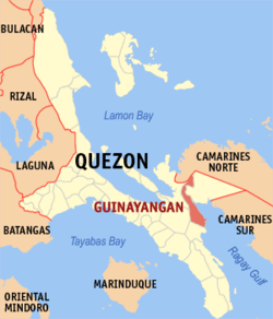 Map of Quezon with Guinayangan highlighted | ||
.svg.png) Guinayangan Location within the Philippines | ||
| Coordinates: 13°54′N 122°27′E / 13.9°N 122.45°ECoordinates: 13°54′N 122°27′E / 13.9°N 122.45°E | ||
| Country |
| |
| Region | Calabarzon (Region IV-A) | |
| Province | Quezon | |
| District | 4th District | |
| Founded | June 21, 1845 | |
| Barangays | 54 (see Barangays) | |
| Government [1] | ||
| • Type | Sangguniang Bayan | |
| • Mayor | Cezar Juarez Isaac III | |
| • Electorate | 24,075 voters (2016) | |
| Area [2] | ||
| • Total | 214.12 km2 (82.67 sq mi) | |
| Population (2015 census)[3] | ||
| • Total | 45,155 | |
| • Density | 210/km2 (550/sq mi) | |
| Time zone | UTC+8 (PST) | |
| ZIP code | 4319 | |
| PSGC | 045618000 | |
| IDD : area code | +63 (0)42 | |
| Climate type | Tropical rainforest climate | |
| Income class | 3rd municipal income class | |
| Revenue (₱) | 113,010,052.08 (2016) | |
| Native languages |
Alabat Island Agta Tagalog | |
| Website |
www | |

Guinayangan, officially the Municipality of Guinayangan, (Tagalog: Bayan ng Guinayangan), is a 3rd class municipality in the province of Quezon, Philippines. According to the 2015 census, it has a population of 45,155 people.[3]
Guinayangan came from a native word for cane "gayang", they "copied"---ginaya and adopted the name to become "ginayangan" or what is now known as "Guinayangan". Its people pronounce it "Ginyangan" omitting the "a" sound.
The municipality is home to the Maulawin Spring Protected Landscape and the critically endangered Inagta Lopez, a dialect of the critically endangered Inagta Alabat language, who has - at most - 30 speakers left in the world.
Barangays
Guinayangan is politically subdivided into 54 barangays.
- A. Mabini
- Aloneros
- Arbismen
- Bagong Silang
- Balinarin
- Bukal Maligaya
- Cabibihan
- Cabong Norte
- Cabong Sur
- Calimpak
- Capuluan Central
- Capuluan Tulon
- Dancalan Caimawan
- Dancalan Central
- Danlagan Batis
- Danlagan Cabayao
- Danlagan Central
- Danlagan Reserva
- Del Rosario
- Dungawan Central
- Dungawan Paalyunan
- Dungawan Pantay
- Ermita
- Gapas
- Himbubulo Este
- Himbubulo Weste
- Hinabaan
- Ligpit Bantayan
- Lubigan
- Magallanes
- Magsaysay
- Manggagawa
- Manggalang
- Manlayo
- Poblacion
- Salacan
- San Antonio
- San Isidro
- San Jose
- San Lorenzo
- San Luis I
- San Luis II
- San Miguel
- San Pedro I
- San Pedro II
- San Roque
- Santa Cruz
- Santa Maria
- Santa Teresita
- Sintones
- Sisi
- Tikay
- Triumpo
- Villa Hiwasayan
Demographics
| Population census of Guinayangan | ||
|---|---|---|
| Year | Pop. | ±% p.a. |
| 1903 | 3,870 | — |
| 1918 | 4,053 | +0.31% |
| 1939 | 15,948 | +6.74% |
| 1948 | 8,390 | −6.89% |
| 1960 | 16,428 | +5.76% |
| 1970 | 26,278 | +4.80% |
| 1975 | 26,860 | +0.44% |
| 1980 | 29,174 | +1.67% |
| 1990 | 32,829 | +1.19% |
| 1995 | 36,775 | +2.15% |
| 2000 | 37,164 | +0.23% |
| 2007 | 39,074 | +0.69% |
| 2010 | 41,669 | +2.37% |
| 2015 | 45,155 | +1.54% |
| Source: Philippine Statistics Authority[3] [4] [5] [6] | ||

Fiesta
When the month of June comes, the people of Guinayangan, Quezon prepare for the annual celebration of Gayang Festival, wherein the coconut tree and the banana is the main attraction of the festivities. The festival is highlighted by a street dancing competition participated by the residents of different barangays, as well as by elementary and high school students.
In the later part of 2000, the very first Seafoods Festival was held in the town. However, it was replaced by Gayang Festival in the succeeding years to give importance to the town's history.
Schools
High schools:
- Dungawan NHS
- Guinayangan Academy
- Guinayangan NHS
- Sta Cruz NHS (GNHS Ext)
- Lamon Bay SOF - Ext. (Aloneros, Guinayangan)
- Nabangka NHS
- Aloneros National High School
- Saint Aloysius Gonzaga Parochial HS
Colleges:
- Guinayangan Institute Of Technology (Permanently Closed)
- G-sisters Learning Institute of Technology (Temporarily Closed)
- Guinayangan College Foundation Inc. GCFI
References
- ↑ "Municipality". Quezon City, Philippines: Department of the Interior and Local Government. Retrieved 31 May 2013.
- ↑ "Province: Quezon". PSGC Interactive. Quezon City, Philippines: Philippine Statistics Authority. Retrieved 12 November 2016.
- 1 2 3 Census of Population (2015). "Region IV-A (Calabarzon)". Total Population by Province, City, Municipality and Barangay. PSA. Retrieved 20 June 2016.
- ↑ Census of Population and Housing (2010). "Region IV-A (Calabarzon)". Total Population by Province, City, Municipality and Barangay. NSO. Retrieved 29 June 2016.
- ↑ Censuses of Population (1903–2007). "Region IV-A (Calabarzon)". Table 1. Population Enumerated in Various Censuses by Province/Highly Urbanized City: 1903 to 2007. NSO.
- ↑ "Province of Quezon". Municipality Population Data. Local Water Utilities Administration Research Division. Retrieved 17 December 2016.
External links
| Wikimedia Commons has media related to Guinayangan. |
- Philippine Standard Geographic Code
- Philippine Census Information
- Local Governance Performance Management System
Places adjacent to Guinayangan | |
|---|---|
Lucena (capital) | |
| Municipalities |
|
| Component city | |
| Highly urbanized city |
|