San Luis, Batangas
| San Luis | ||
|---|---|---|
| Municipality | ||
| Municipality of San Luis | ||
 | ||
| ||
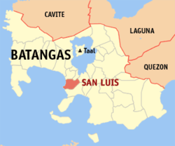 Map of Batangas with San Luis highlighted | ||
.svg.png) San Luis Location within the Philippines | ||
| Coordinates: 13°50′N 120°56′E / 13.83°N 120.93°ECoordinates: 13°50′N 120°56′E / 13.83°N 120.93°E | ||
| Country |
| |
| Region | Calabarzon (Region IV-A) | |
| Province | Batangas | |
| District | 2nd District | |
| Founded | August 25, 1861 [1] | |
| Barangays | 26 (see Barangays) | |
| Government [2] | ||
| • Type | Sangguniang Bayan | |
| • Mayor | Sammy Ocampo | |
| • Electorate | 22,091 voters (2016) | |
| Area [3] | ||
| • Total | 42.56 km2 (16.43 sq mi) | |
| Population (2015 census)[4] | ||
| • Total | 33,149 | |
| • Density | 780/km2 (2,000/sq mi) | |
| Time zone | UTC+8 (PST) | |
| ZIP code | 4210 | |
| PSGC | 041024000 | |
| IDD : area code | +63 (0)43 | |
| Climate type | Tropical monsoon climate | |
| Income class | 4th municipal income class | |
| Revenue (₱) | 78,657,779.86 (2016) | |
| Native languages | Tagalog | |

San Luis, officially the Municipality of San Luis, (Tagalog: Bayan ng San Luis), is a 4th class municipality in the province of Batangas, Philippines. According to the 2015 census, it has a population of 33,149 people.[4]
Geography
According to the Philippine Statistics Authority, the municipality has a land area of 42.56 square kilometres (16.43 sq mi) [3] constituting 1.36% of the 3,119.75-square-kilometre- (1,204.54 sq mi) total area of Batangas.
Barangays
San Luis is politically subdivided into 26 barangays.[5]
| PSGC | Barangay | Population | ±% p.a. | |||
|---|---|---|---|---|---|---|
| 2015[4] | 2010[6] | |||||
| 041024001 | Abiacao | 3.5% | 1,146 | 1,052 | 1.64% | |
| 041024002 | Bagong Tubig | 5.5% | 1,818 | 1,778 | 0.42% | |
| 041024003 | Balagtasin | 1.7% | 561 | 534 | 0.94% | |
| 041024004 | Balite | 3.0% | 997 | 942 | 1.09% | |
| 041024005 | Banoyo | 6.9% | 2,294 | 2,066 | 2.01% | |
| 041024006 | Boboy | 4.5% | 1,502 | 1,480 | 0.28% | |
| 041024007 | Bonliw | 3.5% | 1,145 | 1,002 | 2.57% | |
| 041024008 | Calumpang West | 3.6% | 1,186 | 1,081 | 1.78% | |
| 041024009 | Calumpang East | 4.4% | 1,464 | 1,430 | 0.45% | |
| 041024010 | Dulangan | 8.7% | 2,868 | 2,818 | 0.34% | |
| 041024011 | Durungao | 2.0% | 665 | 621 | 1.31% | |
| 041024012 | Locloc | 1.4% | 458 | 534 | −2.88% | |
| 041024013 | Luya | 3.7% | 1,229 | 1,063 | 2.80% | |
| 041024014 | Mahabang Parang | 2.2% | 734 | 602 | 3.85% | |
| 041024015 | Manggahan | 3.0% | 986 | 924 | 1.24% | |
| 041024016 | Muzon | 6.3% | 2,097 | 2,015 | 0.76% | |
| 041024019 | San Antonio | 2.0% | 656 | 624 | 0.96% | |
| 041024020 | San Isidro | 5.7% | 1,898 | 1,671 | 2.45% | |
| 041024021 | San Jose | 2.1% | 698 | 594 | 3.12% | |
| 041024022 | San Martin | 1.8% | 613 | 542 | 2.37% | |
| 041024023 | Santa Monica | 3.6% | 1,193 | 1,042 | 2.61% | |
| 041024024 | Taliba | 5.0% | 1,657 | 1,484 | 2.12% | |
| 041024025 | Talon | 3.7% | 1,238 | 1,124 | 1.86% | |
| 041024026 | Tejero | 3.8% | 1,258 | 1,068 | 3.17% | |
| 041024027 | Tungal | 1.7% | 558 | 487 | 2.63% | |
| 041024028 | Poblacion | 6.7% | 2,230 | 2,123 | 0.94% | |
| Total | 33,149 | 30,701 | 1.47% | |||
Demographics
| Population census of San Luis | |||||||||||||||||||||||||||||||||||||||||||||||||
|---|---|---|---|---|---|---|---|---|---|---|---|---|---|---|---|---|---|---|---|---|---|---|---|---|---|---|---|---|---|---|---|---|---|---|---|---|---|---|---|---|---|---|---|---|---|---|---|---|---|
|
| ||||||||||||||||||||||||||||||||||||||||||||||||
| Source: Philippine Statistics Authority[4][6][7][8] | |||||||||||||||||||||||||||||||||||||||||||||||||
In the 2015 census, San Luis had a population of 33,149.[4] The population density was 780 inhabitants per square kilometre (2,000/sq mi).
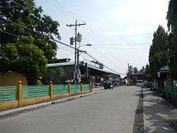
Gallery
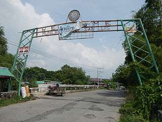 Welcome sign
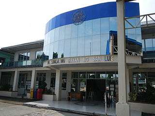 Municipal hall
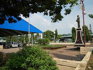 Town plaza
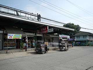 Public market
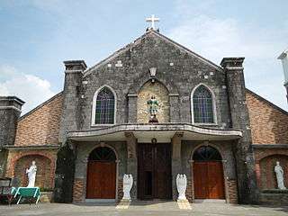 San Isidro Labrador Parish Church
References
- ↑ https://www.sanluisbatangas.gov.ph/index.php/component/content/article?id=34:156th-founding-anniversary-of-san-luis-batangas
- ↑ "Municipality". Quezon City, Philippines: Department of the Interior and Local Government. Retrieved 31 May 2013.
- 1 2 "Province: Batangas". PSGC Interactive. Quezon City, Philippines: Philippine Statistics Authority. Retrieved 12 November 2016.
- 1 2 3 4 5 Census of Population (2015). "Region IV-A (Calabarzon)". Total Population by Province, City, Municipality and Barangay. PSA. Retrieved 20 June 2016.
- ↑ "Municipal: San Luis, Batangas". PSGC Interactive. Quezon City, Philippines: Philippine Statistics Authority. Retrieved 8 January 2016.
- 1 2 Census of Population and Housing (2010). "Region IV-A (Calabarzon)". Total Population by Province, City, Municipality and Barangay. NSO. Retrieved 29 June 2016.
- ↑ Censuses of Population (1903–2007). "Region IV-A (Calabarzon)". Table 1. Population Enumerated in Various Censuses by Province/Highly Urbanized City: 1903 to 2007. NSO.
- ↑ "Province of Batangas". Municipality Population Data. Local Water Utilities Administration Research Division. Retrieved 17 December 2016.
External links
| Wikimedia Commons has media related to San Luis, Batangas. |
Places adjacent to San Luis, Batangas | ||||||||||
|---|---|---|---|---|---|---|---|---|---|---|
| ||||||||||
Batangas (capital) | |
| Municipalities | |
| Component cities | |
This article is issued from
Wikipedia.
The text is licensed under Creative Commons - Attribution - Sharealike.
Additional terms may apply for the media files.