San Pascual, Batangas
| San Pascual | |
|---|---|
| Municipality | |
| Municipality of San Pascual | |
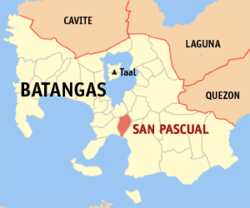 Map of Batangas with San Pascual highlighted | |
.svg.png) San Pascual Location within the Philippines | |
| Coordinates: 13°48′N 121°02′E / 13.8°N 121.03°ECoordinates: 13°48′N 121°02′E / 13.8°N 121.03°E | |
| Country |
|
| Region | Calabarzon (Region IV-A) |
| Province | Batangas |
| District | 2nd District |
| Founded | August 4, 1969 [1] |
| Barangays | 29 (see Barangays) |
| Government [2] | |
| • Type | Sangguniang Bayan |
| • Mayor | Roanna Conti |
| • Vice Mayor | Antonio Dimayuga |
| • Electorate | 38,336 voters (2016) |
| Area [3] | |
| • Total | 50.70 km2 (19.58 sq mi) |
| Population (2015 census)[4] | |
| • Total | 65,424 |
| • Density | 1,300/km2 (3,300/sq mi) |
| Time zone | UTC+8 (PST) |
| ZIP code | 4204 |
| PSGC | 041026000 |
| IDD : area code | +63 (0)43 |
| Climate type | Tropical monsoon climate |
| Income class | 1st municipal income class |
| Revenue (₱) | 197,306,133.70 (2016) |
| Native languages | Tagalog |
San Pascual, officially the Municipality of San Pascual, (Tagalog: Bayan ng San Pascual), is a 1st class municipality in the province of Batangas, Philippines. According to the 2015 census, it has a population of 65,424 people.[4]
It is bordered by the towns of Alitagtag and San Jose to the north, the city of Batangas to the east, Batangas Bay to the south, and the town of Bauan to the west.
History
San Pascual was historically part of Bauan and was known as "Lagnas". In 1954, Caltex inaugurated the Batangas Refinery in the area, the first petroleum refinery in the Philippines. This contributed to the town's continuous growth. Eventually, the Bauan was partitioned once again and San Pascual became an independent municipality in 1969 because of the strong leadership of Mayor Leonardo “Leoning” Mendoza. He is the father and founder of San Pascual, Batangas, his hometown.
Geography
San Pascual is located at 13°48′N 121°02′E / 13.8°N 121.03°E.
According to the Philippine Statistics Authority, the municipality has a land area of 50.70 square kilometres (19.58 sq mi) [3] constituting 1.63% of the 3,119.75-square-kilometre- (1,204.54 sq mi) total area of Batangas.
Barangays
San Pascual is politically subdivided into 29 barangays.[5]
| PSGC | Barangay | Population | ±% p.a. | |||
|---|---|---|---|---|---|---|
| 2015[4] | 2010[6] | |||||
| 041026001 | Alalum | 3.3% | 2,155 | 1,986 | 1.57% | |
| 041026002 | Antipolo | 1.8% | 1,176 | 1,106 | 1.18% | |
| 041026003 | Balimbing | 2.5% | 1,648 | 522 | 24.47% | |
| 041026004 | Banaba | 4.1% | 2,662 | 2,440 | 1.67% | |
| 041026005 | Bayanan | 4.5% | 2,939 | 2,721 | 1.48% | |
| 041026006 | Danglayan | 1.3% | 841 | 580 | 7.33% | |
| 041026007 | Del Pilar | 1.2% | 759 | 667 | 2.49% | |
| 041026008 | Gelerang Kawayan | 2.3% | 1,533 | 1,519 | 0.17% | |
| 041026009 | Ilat North | 2.4% | 1,544 | 1,416 | 1.66% | |
| 041026010 | Ilat South | 2.1% | 1,363 | 1,385 | −0.30% | |
| 041026011 | Kaingin | 1.7% | 1,130 | 1,022 | 1.93% | |
| 041026012 | Laurel | 3.2% | 2,108 | 2,045 | 0.58% | |
| 041026013 | Malaking Pook | 1.2% | 780 | 756 | 0.60% | |
| 041026014 | Mataas na Lupa | 3.2% | 2,092 | 1,938 | 1.47% | |
| 041026015 | Natunuan North | 2.4% | 1,557 | 1,474 | 1.05% | |
| 041026016 | Natunuan South | 1.8% | 1,198 | 1,053 | 2.49% | |
| 041026017 | Padre Castillo | 1.8% | 1,189 | 960 | 4.16% | |
| 041026018 | Palsahingin | 1.6% | 1,065 | 980 | 1.60% | |
| 041026019 | Pila | 1.4% | 928 | 880 | 1.02% | |
| 041026020 | Poblacion | 15.6% | 10,188 | 9,977 | 0.40% | |
| 041026021 | Pook ni Banal | 2.1% | 1,347 | 1,223 | 1.86% | |
| 041026022 | Pook ni Kapitan | 1.4% | 927 | 752 | 4.06% | |
| 041026023 | Resplandor | 1.8% | 1,148 | 1,058 | 1.57% | |
| 041026024 | Sambat | 9.5% | 6,213 | 5,633 | 1.88% | |
| 041026025 | San Antonio | 13.9% | 9,096 | 8,639 | 0.99% | |
| 041026026 | San Mariano | 3.6% | 2,336 | 2,154 | 1.56% | |
| 041026027 | San Mateo | 2.5% | 1,651 | 1,201 | 6.25% | |
| 041026028 | Santa Elena | 1.0% | 650 | 595 | 1.70% | |
| 041026029 | Santo Niño | 4.9% | 3,201 | 2,916 | 1.79% | |
| Total | 65,424 | 59,598 | 1.79% | |||
Economy
As one of the towns adjacent to the province's capital, it is a bustling town full of businesses and establishments.
The town is home to an oil refinery, chemical plants and various subdivisions and housing projects, as well as other industrial and commercial establishments.
Demographics
| Population census of San Pascual | ||
|---|---|---|
| Year | Pop. | ±% p.a. |
| 1970 | 19,377 | — |
| 1975 | 21,761 | +2.35% |
| 1980 | 26,221 | +3.80% |
| 1990 | 34,629 | +2.82% |
| 1995 | 40,849 | +3.14% |
| 2000 | 49,041 | +4.00% |
| 2007 | 57,200 | +2.15% |
| 2010 | 59,598 | +1.51% |
| 2015 | 65,424 | +1.79% |
| Source: Philippine Statistics Authority[4][6][7][8] | ||
In the 2015 census, San Pascual had a population of 65,424.[4] The population density was 1,300 inhabitants per square kilometre (3,400/sq mi).
Gallery
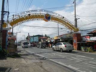 Welcome arch
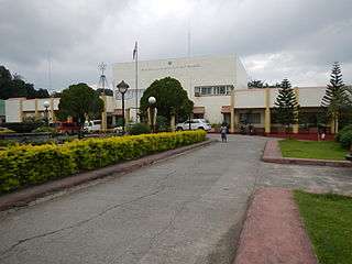 Municipal hall
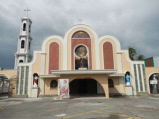 San Pascual Baylon Parish Church
References
- ↑ http://www.chanrobles.com/republicacts/republicactno6116.html
- ↑ "Municipality". Quezon City, Philippines: Department of the Interior and Local Government. Retrieved 31 May 2013.
- 1 2 "Province: Batangas". PSGC Interactive. Quezon City, Philippines: Philippine Statistics Authority. Retrieved 12 November 2016.
- 1 2 3 4 5 Census of Population (2015). "Region IV-A (Calabarzon)". Total Population by Province, City, Municipality and Barangay. PSA. Retrieved 20 June 2016.
- ↑ "Municipal: San Pascual, Batangas". PSGC Interactive. Quezon City, Philippines: Philippine Statistics Authority. Retrieved 8 January 2016.
- 1 2 Census of Population and Housing (2010). "Region IV-A (Calabarzon)". Total Population by Province, City, Municipality and Barangay. NSO. Retrieved 29 June 2016.
- ↑ Censuses of Population (1903–2007). "Region IV-A (Calabarzon)". Table 1. Population Enumerated in Various Censuses by Province/Highly Urbanized City: 1903 to 2007. NSO.
- ↑ "Province of Batangas". Municipality Population Data. Local Water Utilities Administration Research Division. Retrieved 17 December 2016.
External links
| Wikimedia Commons has media related to San Pascual, Batangas. |
Places adjacent to San Pascual, Batangas | ||||||||||
|---|---|---|---|---|---|---|---|---|---|---|
| ||||||||||
Batangas (capital) | |
| Municipalities | |
| Component cities | |