Harapatganj
| Harapatganj हरपतगञ्ज | |
|---|---|
| Village development committee | |
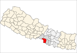
 Harapatganj Location in Nepal | |
| Coordinates: 27°03′N 84°52′E / 27.05°N 84.87°ECoordinates: 27°03′N 84°52′E / 27.05°N 84.87°E | |
| Country |
|
| Zone | Narayani Zone |
| District | Parsa District |
| Population (1991) | |
| • Total | 3,054 |
| Time zone | UTC+5:45 (Nepal Time) |
Harapatganj is a village development committee in Parsa District in the Narayani Zone of southern Nepal. At the time of the 1991 Nepal census it had a population of 3054.[1]
References
- ↑ "Nepal Census 2001". Nepal's Village Development Committees. Digital Himalaya. Retrieved 9 December 2008.
This article is issued from
Wikipedia.
The text is licensed under Creative Commons - Attribution - Sharealike.
Additional terms may apply for the media files.