Mahottari District
| Mahottari District महोत्तरी जिल्ला | |
|---|---|
| District | |
 | |
| Country | Nepal |
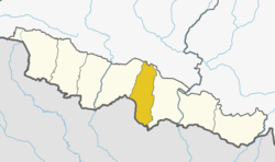
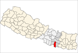
| Province | Province No. 2 |
| Admin HQ. | Jaleshwar |
| Government | |
| • Type | Coordination committee |
| • Body | DCC, Mahottari |
| Area | |
| • Total | 1,002 km2 (387 sq mi) |
| Population (2011) | |
| • Total | 627,580 |
| • Density | 630/km2 (1,600/sq mi) |
| Time zone | UTC+5:45 (NPT) |
| Main Language(s) | Maithili (80%), Nepali (7.2%), other (5.5%) |
Mahottari District (Nepali: महोत्तरी जिल्ला,![]()
Geography and Climate
| Climate Zone[2] | Elevation Range | % of Area |
|---|---|---|
| Lower Tropical | below 300 meters (1,000 ft) | 85.0% |
| Upper Tropical | 300 to 1,000 meters 1,000 to 3,300 ft. |
15.0% |
Village Development Committees (VDCs) and Municipalities
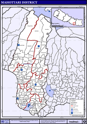
The 2011 National Population and Housing Census by the government of Nepal identifies 77 municipalities and village development committees (VDC) within the Mahottari District.[3]
- Anakar
- Aurahi
- Bagada
- Bagiya Banchauri
- Bairgiya Laksminiya
- Balawa
- Banauli Donauli
- Banauta
- Bardibas Municipality
- Basabitti
- Bathnaha
- Belgachhi
- Bhangaha
- Bharatpur
- Bhatauliya
- Bijayalpura
- Bhramarpura
- Damhi Marai
- Dhamaura
- Dharmapur
- Dhirapur
- Ekadarabela
- Ekarahiya
- Etaharwakatti
- Gaidha Bhetpur
- Gauribas
- Gaushala Municipality
- Gonarpura
- Halkhori
- Hariharpur Harinmari
- Hathilet
- Hatisarwa
- Jaleshwar Municipality
- Khairbanni
- Khaya Mara
- Khopi
- Khuttapipradhi
- Kisan Nagar
- Kolhusa Bagaiya
- Laksminiya
- Loharpatti
- Mahadaiyatapanpur
- Mahottari
- Maisthan
- Majhaura Vishnupur
- Manara
- Matihani
- Meghanath Gorhanna
- Nainhi
- Nigaul
- Padaul
- Parsa Pateli
- Parsadewadh
- Pashupatinagar
- Phulahatta Parikauli
- Phulakaha
- Pigauna
- Pipra
- Pokharibhinda Samgrampur
- Raghunathpur
- Ramgopalpur
- Ramnagar
- Ratauli
- Ratauli 9 Rahmanpur
- Sahasaula
- Sahorawa
- Samdha
- Sarpallo
- Shamsi
- Sripur
- Simardahi
- Singyahi
- Sisawakataiya
- Sonama
- sonamai bhoil
- Sonaum
- Suga Bhawani
- Sundarpur
- Mangalnath , Magarthana
References
- ↑ Household and population by districts, Central Bureau of Statistics (CBS) Nepal Archived 2013-09-27 at the Wayback Machine.
- ↑ The Map of Potential Vegetation of Nepal - a forestry/agroecological/biodiversity classification system (PDF), Forest & Landscape Development and Environment Series 2-2005 and CFC-TIS Document Series No.110., 2005, ISBN 87-7903-210-9, retrieved Nov 22, 2013
- ↑ National Planning Commission Secretariat (November 2012). "National Population and Housing Census 2011" (PDF). Central Bureau of Statistics. Government of Nepal. pp. 27–28. Archived from the original (PDF) on 27 September 2013. Retrieved 3 May 2015.
- "Districts of Nepal". Statoids.
| Wikimedia Commons has media related to Mahottari District. |
| Province No. 1 |  | |
|---|---|---|
| Province No. 2 | ||
| Province No. 3 | ||
| Gandaki Pradesh | ||
| Province No. 5 | ||
| Karnali Pradesh | ||
| Sudurpashchim Pradesh | ||
Coordinates: 26°38′0″N 85°48′0″E / 26.63333°N 85.80000°E