List of state highways in Arkansas
   Highway markers for some of the longest Arkansas state routes | |
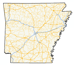 A map of highways in the state of Arkansas | |
| System information | |
|---|---|
| Formed | 1924, renumbered in 1926 |
| Highway names | |
| State | AR nn, Ark. nn, Hwy. nn |
| System links | |
The following is a list of state highways in Arkansas. The state does not use a numbering convention. Generally the two-digit odd numbered highways run north-south with a few exceptions; and even-numbered two-digit state highways run east-west with a few exceptions.
Arkansas has long had a stigma of poor roads. The state has received the designation of "worst roads in America" from several publications.[1] Interstate 30 and Interstate 40 had historically drawn the most ire from truckers nationwide until a large construction plan was completed on I-40.[2] The rationale for this is rooted deep in Arkansas history, primarily sprouting from the state's insistence on using "road districts" rather than a state highway commission, and a lack of comprehensive state highway plan until the formation of the State Highway Commission in 1923.[3]
State highways
- This transport-related list is incomplete; you can help by expanding it.
| Number | Length (mi)[4] | Length (km) | Southern or western terminus | Northern or eastern terminus | Formed | Removed | Notes | |
|---|---|---|---|---|---|---|---|---|
| 159.88 | 257.30 | US 278 in McGehee | Route BB at the Missouri state line | 1926[5] | current | |||
| 195 | 314 | US 67 in Texarkana | Ferry to MS 10 | 1926[5] | 1932 | |||
| 263 | 423 | LA 159 at Louisiana state line | US 64 near West Memphis | 1926[5] | 1940 | |||
| 2.99 | 4.81 | SH-4 at the Oklahoma state line | US 59/US 71 in Cove | 1926[5] | current | |||
| 22.49 | 36.19 | US 65/US 165/US 278 in McGehee | AR 1 at Rohwer | 1926[5] | current | |||
| 42.22 | 67.95 | AR 7 near Hot Springs | US 70 in Little Rock | 1926[5] | current | |||
| 0.38 | 0.61 | AR 100 in Little Rock | AR 107 in North Little Rock | 1926[5] | current | |||
| 118.87 | 191.30 | US 67/US 167 in Cabot | Route 5 at the Missouri state line | 1926[5] | current | |||
| — | — | — | — | 1926[5] | 1935 | |||
| — | — | — | — | 1961 | 1963 | |||
| 296.01 | 476.38 | LA 558 at the Louisiana state line | Diamond City | 1926[5] | current | |||
| 229.83 | 369.88 | SH-63 at the Oklahoma state line | US 65 near Eudora | 1926[5] | current | |||
| 174.17 | 280.30 | AR 5 at Crows | US 63 in Mammoth Spring | 1926[5] | current | |||
| 51.44 | 82.78 | US 79 at Eagle Mills | US 67/US 270B in Malvern | 1926[5] | current | |||
| 135.41 | 217.92 | SH-16 at the Oklahoma state line | I-30 in Little Rock | 1926[5] | current | |||
| 37.53 | 60.40 | I-40/US 63 in Hazen | AR 367 in Searcy | 1926[5] | current | |||
| 36.23 | 58.31 | US 63 at Pansy | Huff's Island Public Use Area | 1926[5] | current | |||
| 12.83 | 20.65 | AR 88 at Reydell | US 165 at Eldridge Corner | 1926[5] | current | |||
| 56.60 | 91.09 | SH-116 at the Oklahoma state line | AR 23 near Clifty | 1926[5] | current | |||
| 54.58 | 87.84 | US 79 near Humphrey | Campground Road | 1926[5] | current | |||
| 5.03 | 8.10 | AR 367 in McRae | AR 267 | 1926[5] | current | |||
| 6.13 | 9.87 | AR 367 in Judsonia | AR 258 | 1926[5] | current | |||
| 227.35 | 365.88 | Boat Dock Road at Table Rock Lake | Mississippi CR 1020 at Golden Lake | 1926[5] | current | |||
| 34.45 | 55.44 | US 79B near Altheimer | AR 89/AR 294 in Furlow | 1926[5] | current | |||
| 21.10 | 33.96 | LA 161 at the Louisiana state line | US 82 in El Dorado | 1926[5] | current | |||
| 260.77 | 419.67 | US 412 in Siloam Springs | US 67B/AR 36 in Searcy | 1926[5] | current | |||
| 114.28 | 183.92 | U.S. Route 49 in Brinkley, Arkansas | Arkansas Highway 37 in Tuckerman, Arkansas | 1926[5] | current | |||
| 93.43 | 150.36 | AR 69 in Jacksonport | I-55 in Blytheville | 1926[5] | current | |||
| 5 | 8 | AR 68 at Old Alabam | AR 23 at Forum | c. 1927[6] | c. 1928[7] | Renumbered AR 127 | ||
| 18.05 | 29.05 | LA 159 at the Louisiana state line | US 79B, Magnolia | 1926[5] | current | |||
| 24.73 | 39.80 | US 371/AR 24 in Prescott | Narrows Dam at Lake Greeson | 1953 | current | |||
| 31.76 | 51.11 | Phillips CR 622 at Lambrook | US 49/Great River Road in Helena-West Helena | 1963[5] | current | Former Highway 49 | ||
| 31.76 | 51.11 | — | — | 1926 | 1962 | replaced by Highway 6 and Highway 49 | ||
| 99.57 | 160.24 | US 64 near Clarksville | Route 13 at the Missouri state line | 1926[5] | current | |||
| 75.60 | 121.67 | US 64/US 71B in Fort Smith | AR 7 in Dardanelle | 1926[5] | current | |||
| 132.67 | 213.51 | US 71 at Elm Park | Route P at the Missouri state line | 1926[5] | current | |||
| 18.6 | 29.9 | McCurtain CR E2100 at the Oklahoma state line | US 71 in Lockesburg | 1926[5] | current | |||
| 38.2 | 61.5 | US 371 in Prescott | US 278 in Camden | 1926[5] | current | |||
| 85.66 | 137.86 | US 64 in Conway | US 63/US 412 in Black Rock | 1926[5] | current | |||
| 56.03 | 90.17 | US 371 | AR 8/AR 51 in Arkadelphia | 1926[5] | current | |||
| 1.8 | 2.9 | I-30 | US 67 in Gum Springs | 1926[5] | current | |||
| 193.70 | 311.73 | US 59/US 71 near Ben Lomond | AR 14, Harriet | 1926[5] | current | |||
| 84.23 | 135.56 | SH-128 at the Oklahoma state line | AR 7/AR 155/AR 247, Dardanelle | 1926[5] | current | |||
| 76.84 | 123.66 | LA 3 at the Louisiana state line | AR 301 in Antoine | 1926[5] | current | |||
| — | — | — | — | 1926[5] | 1958 | decommissioned due to creation of I-30; renumbered Highway 130 | ||
| 75.34 | 121.25 | US 79B near Altheimer | AR 5 near Romance | 1926[5] | current | |||
| 63.10 | 101.55 | SH-3 at the Oklahoma state line | US 371/AR 19 in Willisville | 1926[5] | current | |||
| 85.92 | 138.27 | AR 130 north of DeWitt | AR 37 | 1926[5] | current | |||
| 40.19 | 64.68 | US 412/AR 25 in Walnut Ridge | AR 139 at Fritz | 1926[5] | current | |||
| 115.83 | 186.41 | Macon Lake Road near Dewey | AR 5 in Benton | 1926[5] | current | |||
| 68.01 | 109.45 | U.S. Route 64 in Conway, Arkansas | Arkansas Highway 367 in Searcy, Arkansas | 1926[5] | current | |||
| 52.40 | 84.33 | AR 17 near McCrory | AR 112 at Cord | 1926[5] | current | |||
| 0.61 | 0.98 | US 62 in Gateway | Route 37 at the Missouri state line | 1926[5] | current | |||
| 71.11 | 114.44 | AR 367 in Austin | US 49 near Hunter | 1926[5] | current | |||
| 8.89 | 14.31 | AR 1/AR 316 near Turner | US 49 | 1926[5] | current | |||
| 9.98 | 16.06 | US 49 at Blackton | US 49/AR 241 | 1926[5] | current | |||
| — | — | — | — | 1926[5] | 1958 | decommissioned due to creation of I-40; renumbered Highway 140 | ||
| 18.62 | 29.97 | Franklin CR 40 | AR 23 near Chismville | 1926[5] | current | |||
| 38.38 | 61.77 | US 70B/AR 329 in De Queen | SH 8 at the Texas state line | 1926[5] | current | |||
| 53.69 | 86.41 | Arkansas Highway 37 in McCrory, Arkansas | Arkansas Highway 77 in Turrell, Arkansas | 1926[5] | current | |||
| 27.1 | 43.6 | AR 59 in Siloam Springs | Route 43 at the Missouri state line (concurrent with Oklahoma SH-20) | — | — | |||
| 30.0 | 48.3 | AR 21 at Boxley | AR 7 in Harrison | — | — | |||
| 1.8 | 2.9 | US 65 in Harrison | AR 7 in Harrison | — | — | |||
| 66.14 | 106.44 | Arkansas Highway 85 in Crumrod, Arkansas | Arkansas Highway 20 in Helena, Arkansas | 1926[5] | current | |||
| 26.97 | 43.40 | AR 96 in Hartford | I-540/US 71 in Fort Smith | 1926[5] | current | |||
| 10.64 | 17.12 | AR 59 at Dutch Mills | US 62 | 1926[5] | current | |||
| 25.42 | 40.91 | US 71B in Fayetteville | AR 12 near Clifty | 1926[5] | current | |||
| 39.07 | 62.88 | AR 9 | White Bluff Road near Redfield | 1926[5] | current | |||
| 0.61 | 0.98 | US 62 in Gateway | Route 37 at the Missouri state line | 1926[5] | 1976 | Changed to AR 37 to match Missouri | ||
| 14.53 | 23.38 | AR 9 | US 62 at Ferindale | 1926[5] | current | |||
| — | — | — | — | 1926[5] | 1963 | Decommissioned due to extension of US 49 into Arkansas; renumbered Highway 20 | ||
| 27.96 | 45.00 | St. Francis CR 415 | AR 147 near Anthonyville | 1926[5] | current | |||
| 15.84 | 25.49 | US 70 | AR 77 in Clarkedale | — | — | |||
| 57.37 | 92.33 | AR 53 near Whelen Springs | US 67 in Donaldson | 1926[5] | current | |||
| 7.92 | 12.75 | US 270 in Rockport | US 270 at Magnet Cove | 1926[5] | current | |||
| 7.49 | 12.05 | AR 133 at North Crossett | US 82/US 425 | 1926[5] | current | |||
| 1.83 | 2.95 | US 82/US 425 | Ashley CR 25/Ashley CR 26 | 1926[5] | current | |||
| 16.59 | 26.70 | US 165 in Wilmot | AR 159 at Indian | 1926[5] | current | |||
| 53.31 | 85.79 | Bradley Rd, Louisiana state line | US 371 | — | — | |||
| 32.55 | 52.38 | AR 24 | AR 8 | 1926[5] | current | |||
| 28.80 | 46.35 | US 65/US 165 in Dumas | US 425/AR 11 | 1926[5] | current | |||
| 52.65 | 84.73 | AR 114 | Grant CR 18 | 1963[8] | current | |||
| 22.4 | 36.0 | US 67 in Fulton | AR 27 at Mineral Springs | 1926[5] | 1958 | decommissioned due to creation of I-55; renumbered Highway 355 | ||
| 42.44 | 68.30 | AR 5 in Calico Rock | AR 58 at Poughkeepsie | 1926[5] | current | |||
| 39.38 | 63.38 | US 82 at Marysville | AR 24 in Chidester | 1926[5] | current | |||
| 54.89 | 88.34 | AR 14 | US 62/US 63/US 412 at Ozark Acres | 1926 | current | |||
| — | — | — | — | 1926[5] | 1935 | |||
| 93.24 | 150.06 | AR 22 in Barling | Route 59 at the Missouri state line | 1935 | current | |||
| 71.31 | 114.76 | — | — | 1926[5] | current | |||
| — | — | — | — | 1926[5] | 1930 | Decommissioned due to creation of US 62 | ||
| 30.16 | 48.54 | AR 9 in Mountain View | US 65 in Leslie | 1926[5] | current | |||
| — | — | — | — | 1926[5] | 1988 | decommissioned due to creation of US 412 | ||
| — | — | — | — | 1926[5] | current | |||
| 26.32 | 42.36 | AR 43 at Maysville | US 71B in Bentonville | 1926[5] | current | |||
| 12.67 | 20.39 | I-49/US 71 in Bentonville | US 62 near Avoca | — | — | |||
| 18.59 | 29.92 | AR 355 | US 278 | 1926[5] | current | |||
| 12.37 | 19.91 | US 67 in Hope | AR 53 | 1926[5] | current | |||
| 13.06 | 21.02 | AR 170 in Devil's Den State Park | US 71 in Winslow | — | — | |||
| 2.45 | 3.94 | US 71 near Brentwood | Washington CR 43 | 1926[5] | current | |||
| 19.18 | 30.87 | AR 16 in Elkins | US 412B in Huntsville | — | — | |||
| 13.98 | 22.50 | AR 23 | AR 21 at Kingston | — | — | |||
| 33.92 | 54.59 | AR 21 near Ponca | Newton CR 37/Newton CR 38 near Bass | — | — | |||
| 7.13 | 11.47 | AR 377 at Snowball | US 65 near Marshall | — | — | |||
| 18.18 | 29.26 | AR 27 in Marshall | AR 66 | — | — | |||
| 42.62 | 68.59 | AR 50 | Future I-555/US 63/US 63B/AR 14 in Marked Tree | 1926[5] | current | |||
| — | — | — | — | 1926[5] | 1937 | Replaced by Highway 60 | ||
| — | — | — | — | 1941 | current | |||
| 66.70 | 107.34 | US 70 in West Memphis | Route 108 at the Missouri state line | 1926[5] | current | |||
| 24.03 | 38.67 | AR 306 near Hunter | US 79 | 1926[5] | current | |||
| 4.30 | 6.92 | AR 121 in Aubrey | Lee CR 132/CR 173 | 1973[9] | current | |||
| — | — | — | — | 1926[5] | 1935 | decommissioned due to creation of US 79; renumbered Highway 115 | ||
| 10.3 | 16.6 | Oklahoma state line | AR 45 | 1926[5] | 1930 | |||
| 49.87 | 80.26 | AR 28 at Hon | AR 27 in Danville | 1945 | current | |||
| 12 | 19 | AR 4 in Hon | AR 1 | 1926[5] | c. 1928[7] | |||
| — | — | — | — | 1945 | current | |||
| — | — | — | — | 1926[5] | 1932 | decommissioned due to extension of US 82 in Arkansas; renumbered Highway 152 | ||
| — | — | — | — | 1926[5] | current | |||
| — | — | Polk CR 14 in Bogg Springs | US 71 | 1926[5] | current | |||
| — | — | US 278 in Umpire | Haltom Road in Malvern | 1926[5] | current | |||
| 9.73 | 15.66 | AR 44 in Lake View | US 49/AR 1 at Walnut Corner | 1926[5] | current | |||
| 7 | 11 | Oklahoma state line | US 71 near Gillham | 1926[5] | c. 1928[7] | |||
| 13.27 | 21.36 | AR 38 at Hayley | Prairie CR 251/CR 522 | 1965[10] | current | |||
| 25.33 | 40.76 | US 70 at Screeton | AR 33 | 1953 | current | |||
| 20.17 | 32.46 | Pine Tree Road/Lumber Lane near Clarendon | US 49 | 1940[lower-alpha 1] | current | |||
| 14.0 | 22.5 | Fulton CR 2 in Elizabeth | Route AR at the Missouri state line | 1926[5] | current | |||
| 71.2 | 114.6 | AR 14 near Fifty-six | US 67 in Bradford | 1926[5] | current | |||
| — | — | — | — | 1926[5] | current | |||
| — | — | — | — | 1926[5] | current | |||
| 81.93 | 131.85 | Main Street in Ravenden | Route 84 at the Missouri state line | 1926[5] | current | |||
| 31.91 | 51.35 | US 49/AR 1 in Jonesboro | US 412 in Walnut Ridge | 1926[5] | current | |||
| 63.4 | 102.0 | US 64 in Plumerville | AR 5/AR 25 at Drasco | 1926[5] | current | |||
| 14.66 | 23.59 | AR 90 | Route BB at the Missouri state line | 1926[5] | current | |||
| 22.07 | 35.52 | Horseshoe Bend Park | Route E at the Missouri state line | 1926[5] | current | |||
| 50.5 | 81.3 | US 64 in Morrilton | AR 330 | 1926[5] | current | |||
| 38.2 | 61.5 | AR 10 in Greenwood | AR 23 | 1926[5] | current | |||
| 1.84 | 2.96 | AR 23 in Ozark | AR 219 in Ozark | 1991 | current | |||
| 2 | 3 | US 63 | AR 91 | 1926[5] | c. 1928[7] | |||
| 6.45 | 10.38 | AR 8 | US 79 in Kingsland | c. 1940 | current | |||
| — | — | — | — | 1926[5] | c. 1928[7] | |||
| 47.15 | 75.88 | US 82 | AR 19 at Walkerville | 1940 | current | |||
| — | — | — | — | 1926[5] | 1971 | |||
| 11 | 18 | US 71 in Bentonville | Route 88 at the Missouri state line | 1926[5] | 1960[12] | Supplanted by US 71 | ||
| 8.72 | 14.03 | I-40 in North Little Rock | AR 365 | 1987[13] | current | |||
| 1.61 | 2.59 | AR 365 in North Little Rock | US 70 in North Little Rock | 1987[14] | current | |||
| 11.17 | 17.98 | US 62/US 412 | Route 101 at the Missouri state line | 1926[5] | current | |||
| 7.13 | 11.47 | Marion CR 664 at Hand Valley | US 62/US 412 | c. 1928[7] | current | |||
| 26.27 | 42.28 | AR 43 near Maysville | I-49/US 71 in Bentonville | 1926[5] | current | |||
| 20.43 | 32.88 | Marina Road/Lakeview Drive in Clarksville | AR 215 | — | — | |||
| 31.31 | 50.39 | AR 43 at the Buffalo National River | AR 21 at Oak Grove | 1926[5] | current | |||
| 4.66 | 7.50 | US 270 | AR 365 | 1926[5] | current | |||
| 24.90 | 40.07 | Galla Creek Wildlife Management Area | AR 27 near Hector | 1926[5] | current | |||
| — | — | — | — | 1926[5] | 1929 | |||
| 12.42 | 19.99 | AR 69 near Cushman | AR 69B in Batesville | 1941 | current | |||
| — | — | — | — | 1926[5] | 1937 | |||
| 28.32 | 45.58 | I-40 in North Little Rock | US 64B in Vilonia | — | — | |||
| 23.78 | 38.27 | AR 36 | AR 110 in Heber Springs | 1945 | current | |||
| — | — | — | — | 1926[5] | c. 1928[7] | |||
| 26.09 | 41.99 | SH-87 at the Oklahoma state line | US 59/US 71 in Ashdown | 1945 | current | |||
| 6.96 | 11.20 | US 59/US 71 | US 67 | 1945 | current | |||
| 32.26 | 51.92 | AR 217 | US 64 in Clarksville | 1926[5] | current | |||
| 16.71 | 26.89 | US 65 at Botkinburg | AR 9/AR 16 near Shirley | — | — | |||
| 3.15 | 5.07 | Greers Ferry Lake | AR 16/AR 92 in Greers Ferry | — | — | |||
| 20.09 | 32.33 | Eden Isle, Greers Ferry Lake | AR 124 in Pangburn | — | — | |||
| 2.30 | 3.70 | Alexander | I-30/US 67/US 70 | — | — | |||
| 23.35 | 37.58 | AR 265 in Fayetteville | AR 12 in Bentonville | 1926[5] | current | |||
| — | — | — | — | 1926[5] | 1959 | |||
| 29.27 | 47.11 | AR 10 | US 64 at Blackwell | — | — | |||
| 28.66 | 46.12 | AR 35 | US 65 in Gould | 1926[5] | current | |||
| 44.3 | 71.3 | US 167 in El Dorado | US 167 in Thornton | 1926[5] | 1935 | Supplanted by US 167 | ||
| 50.08 | 80.60 | US 62/US 63/US 412/AR 166 in Imboden | Route 21 at Missouri state line | 1935 | current | Former Highway 79 | ||
| — | — | — | — | c. 1927[6] | c. 1928[7] | |||
| 3.40 | 5.47 | AR 23 | AR 10 | c. 1928[7] | current | |||
| 1.02 | 1.64 | AR 23 | Booneville Human Development Center | — | — | |||
| 16.54 | 26.62 | AR 25/AR 230 in Strawberry | AR 25 in Black Rock | — | — | |||
| 45.72 | 73.58 | US 70/US 79 in West Memphis | CR 495 | — | — | |||
| 9.60 | 15.45 | AR 14 in Marie | Butler | — | — | |||
| 7.22 | 11.62 | US 61 in Osceola | AR 158 in Victoria | — | — | |||
| 3.36 | 5.41 | AR 18 in Leachville | AR 77 in Leachville | — | — | |||
| 5.57 | 8.96 | AR 77 at Poplar Corner | Route K/Route Y at Missouri state line | — | — | |||
| 3.03 | 4.88 | AR 139 | US 49 in Rector | — | — | |||
| 8.03 | 12.92 | US 61 | O'Donnell Bend | — | — | |||
| 39.53 | 63.62 | Lee CR 153 | Lee CR 210/Lee CR 215/Lee CR 233 in La Grange | — | — | |||
| 16.27 | 26.18 | AR 14 | AR 25 | — | — | |||
| 1.62 | 2.61 | Salmon Lane | US 65B in Harrison | 1975[15] | current | |||
| 67.74 | 109.02 | AR 103 in Clarksville | US 65/US 65B in Western Grove | c. 1927[6] | current | |||
| 72.72 | 117.03 | AR 7 in Russellville | AR 36 in Rose Bud | c. 1927[6] | current | |||
| 9.08 | 14.61 | AR 110 in Pangburn | AR 157 at Sunnydale | 1953 | current | |||
| 29.39 | 47.30 | AR 235 near Bruno | Route 125 at the Missouri state line | — | — | |||
| 11.66 | 18.76 | Buffalo City | US 62/US 412 | — | — | |||
| 7.03 | 11.31 | US 62/US 412 in Gassville | AR 5/AR 178 at Midway | — | — | |||
| 4.13 | 6.65 | Madison CR 3345 | AR 23 at Aurora | 1973 | current | |||
| 4.86 | 7.82 | US 412 at Old Alabam | AR 23 at Forum | c. 1928[7] | current | |||
| 8.58 | 13.81 | AR 12 at Lookout | AR 12 | 1965 | current | |||
| 5.82 | 9.37 | Buckhorn Cir at Lost Bridge Village | US 62 in Garfield | 1966 | current | |||
| 31.7 | 51.0 | AR 24 | AR 27 | 1928[7] | 1937 | Renumbered AR 26 | ||
| 11.99 | 19.30 | AR 7 in Sparkman | AR 9 at Holly Springs | — | — | |||
| 6.23 | 10.03 | AR 7/AR 8 | AR 51 at Joan | — | — | |||
| 20.04 | 32.25 | AR 7 | US 270B in Hot Springs | — | — | |||
| 8.78 | 14.13 | AR 5 in Fountain Lake | US 70 | — | — | |||
| 15.02 | 24.17 | LA 33 at the Louisiana state line | US 82 in Strong | 1928[7] | current | |||
| 4.30 | 6.92 | US 63 at Old Union | Union CR 185 at Lawson | 1956 | current | |||
| — | — | — | — | 1928[7] | 1928 | |||
| — | — | — | — | 1937 | 1958 | Renumbered Highway 330; was numbered 134 until 1930 | ||
| 25.31 | 40.73 | US 79B in Stuttgart | AR 1 in DeWitt | 1958 | current | Former Highway 30 | ||
| 5.27 | 8.48 | AR 1 in Haynes | Lee CR 719/Lee CR 722 | — | — | |||
| 9.57 | 15.40 | US 79 | Lee CR 533/Lee CR 632 | — | — | |||
| 8.80 | 14.16 | AR 147 at Bruins | AR 147 at Thompson Grove | — | — | |||
| 3.01 | 4.84 | Proctor Road | AR 147 in Edmondson | — | — | |||
| 1.29 | 2.08 | Service Road in West Memphis | I-40 in West Memphis | — | — | |||
| 25 | 40 | Louisiana state line | US 82 in Magnolia | c. 1928[7] | 1994 | |||
| 1.24 | 2.00 | AR 95 in Morrilton | AR 9 in Morrilton | 1997 | current | |||
| 15.05 | 24.22 | LA 142 at the Louisiana state line | AR 8 at Long View | — | — | |||
| 6.29 | 10.12 | AR 160 | US 425 at Lacey | — | — | |||
| 12.51 | 20.13 | AR 35 in Rison | AR 54 | — | — | |||
| — | — | — | — | c. 1928[7] | 1930 | number accidentally duplicated; restored as Highway 130 in 1937, and became Highway 330 in 1958 | ||
| 20.27 | 32.62 | US 71 | US 82 in Garland | c. 1928[7] | current | |||
| 69.53 | 111.90 | US 63 near Rivervale | US 62 near Corning | 1929 | current | |||
| 7.87 | 12.67 | AR 135 near Rivervale | AR 77 at Carroll's Corner | — | — | |||
| 8.82 | 14.19 | AR 312 | Route DD at the Missouri state line | 1930 | current | |||
| 37.05 | 59.63 | US 278 | AR 1 in Kelso | 1930 | current | |||
| 17.65 | 28.40 | AR 158 in Caraway | Route F at the Missouri state line | — | — | |||
| 34.86 | 56.10 | US 412 | Route 51 | — | — | |||
| 12 | 19 | US 65 in Dumas | Garrett Bridge | 1931 | 1937 | Replaced by Highway 54 | ||
| 32.70 | 52.63 | US 63B/AR 14 in Marked Tree | US 61/Great River Road in Osceola | 1958 | current | Former Highway 40 | ||
| 1.93 | 3.11 | Pearl Street / Quinn Avenue in Osceola | US 61/Great River Road in Osceola | 1966 | current | |||
| 51.68 | 83.17 | Main Street in Jonesboro | US 62/Crowley's Ridge Parkway in McDougal | 1931 | current | |||
| 2.08 | 3.35 | Culberhouse Street in Jonesboro | Parker Road in Jonesboro | 1973 | current | |||
| 5.14 | 8.27 | Levee Road near Lakeport | US 82/US 278 at Shives | c. 1930 | current | |||
| 10.08 | 16.22 | US 62/AR 980 | Route H at the Missouri state line | 1965[16] | current | |||
| 20.50 | 32.99 | US 165 near Jerome | Mississippi River levee | c. 1932 | current | |||
| 4.16 | 6.69 | Big Bayou Meto Use Area | US 165/AR 1/Great River Road | 1973[17] | current | |||
| — | — | — | — | — | — | |||
| 12.96 | 20.86 | US 79 near Stuttgart | White River at Preston Ferry | 1932 | current | |||
| 17.43 | 28.05 | Resort Road at Lawrenceville | AR 39 at Noy | 1965 | current | |||
| 25.83 | 41.57 | AR 131 at Bruins | US 64 near West Memphis | — | — | |||
| 4.61 | 7.42 | AR 151 | Mississippi River levee | — | — | |||
| 8.81 | 14.18 | AR 181 | US 61 in Burdette | — | — | |||
| 3.53 | 5.68 | AR 135 in Black Oak | AR 139 | — | — | |||
| 41.28 | 66.43 | AR 38 in Hughes | I-555/US 63/US 63B in Marked Tree | — | — | |||
| 14.19 | 22.84 | AR 181 in Gosnell | AR 137 at Huffman | — | — | |||
| — | — | — | — | — | — | |||
| 13.344 | 21.475 | US 79 near Humphrey | US 165 | 1957[18] | current | |||
| 0.714 | 1.149 | US 165 in DeWitt | AR 1B in DeWitt | 1933 | current | |||
| 7.488 | 12.051 | US 165/AR 267 | AR 17 at DeLuce | 1933 | current | Former Highway 82 | ||
| — | — | — | — | 1933 | current | route moved to right in 1956 | ||
| — | — | — | — | — | — | |||
| 7.10 | 11.43 | Mount Nebo State Park | AR 22 in Dardanelle | — | — | |||
| 7.56 | 12.17 | AR 7 north of Datto | AR 154 | — | — | |||
| 11.16 | 17.96 | AR 10 near Casa | AR 154 at Petit Jean State Park | — | — | |||
| 11.16 | 17.96 | AR 60 | Perry CR 14 | — | — | |||
| 0.30 | 0.48 | SH-100 at the Oklahoma state line | AR 59 north of Evansville | — | — | |||
| 37.42 | 60.22 | AR 367 in Judsonia | AR 14 in Oil Trough | — | — | |||
| 44.24 | 71.20 | AR 1 in Greenfield | US 61 in Luxora | 1936 | current | |||
| 0.33 | 0.53 | US 49 | Agriculture facility | 1979 | current | |||
| — | — | — | — | — | — | |||
| 51.55 | 82.96 | FM 249 at the Texas state line | AR 19 in Macedonia | — | — | |||
| 14.73 | 23.71 | AR 57 in Mount Holly | AR 7B in Smackover | — | — | |||
| 38.99 | 62.75 | US 278 | US 425 in Fountain Hill | — | — | |||
| 22.73 | 36.58 | US 82 | US 65 in Chicot Junction | — | — | |||
| 11.28 | 18.15 | US 70 at Prothro Junction | Vandenburg Boulevard at LRAFB | 1960 | current | |||
| 19.71 | 31.72 | US 165/AR 15/AR 256 in England | US 165 in Scott | — | — | |||
| — | — | US 67 | US 64 | — | 1970 | Redesignated as an extension of AR 5 | ||
| 1.5 | 2.4 | AR 120 | End state maintenance | 1937 | 1939 | |||
| 1 | 2 | AR 7 near El Dorado | US 167 near El Dorado | 1945 | 1950 | |||
| 11.29 | 18.17 | US 64/US 71B in Van Buren | I-40/US 71/US 71B in Alma, Arkansas | 1953 | current | |||
| 5.39 | 8.67 | AR 59 in Cedarville | CR 24 at Hobbtown | 1973[19] | current | |||
| 2.2 | 3.5 | Wittsburg | US 64 at Levesque | 1942[lower-alpha 2] | c. 1945[21] | |||
| 42.57 | 68.51 | CR 739 at Wittsburg | AR 1/AR 1/Crowley's Ridge Parkway in Jonesboro | 1957[22] | current | |||
| 13.34 | 21.47 | US 64 in Coal Hill | AR 103 | 1957 | current | |||
| 16.64 | 26.78 | AR 21 in Clarksville | AR 7 | 1945 | current | |||
| 1.79 | 2.88 | AR 27 at Scottsville | FR 1001/Broomfield Road | 1963 | current | |||
| 9.83 | 15.82 | AR 7 in Dover | AR 105 at Oak Grove | 1963 | current | |||
| 7.97 | 12.83 | AR 361 in Old Davidsonville State Park | US 62 in Pocahontas | — | — | |||
| 14.57 | 23.45 | US 62/US 67 in Pocahontas | Route A at the Missouri state line | — | — | |||
| 8.59 | 13.82 | AR 228 in Fontaine | US 412 | — | — | |||
| 4.9 | 7.9 | US 79 in Humphrey | AR 13 | 1973[23] | 1977[24] | Supplanted by AR 13 | ||
| 7.82 | 12.59 | Sulphur Springs | Hancock Road in Crossett | 1985[25] | current | |||
| 2.21 | 3.56 | Arkansas Post National Memorial | US 65/US 165 in McGehee | c. 1936 | current | |||
| 1.27 | 2.04 | AR 4 in McGehee | US 65/US 165 in McGehee | 2000[26] | current | |||
| — | — | — | — | — | — | |||
| 1.2 | 1.9 | Wine Dot Road in Gifford | US 67 in Gifford, AR | 1939 | current | |||
| 12 | 19 | AR 84/Hot Spring CR 846 in Malvern | Lake Catherine State Park | 1939 | current | |||
| 9.1 | 14.6 | US 270 in Price | AR 88 in Lonsdale | 1939 | current | |||
| — | — | — | — | 1939 | 1941 | |||
| — | — | — | — | 1965 | current | |||
| — | — | — | — | 1940 | 1979 | |||
| 6.66 | 10.72 | Overflow National Wildlife Refuge | US 165 in Wilmot | 1985[27] | current | |||
| — | — | — | — | — | — | |||
| 21.80 | 35.08 | AR 289 in Cherokee Village | Wirth | 1940[lower-alpha 3] | current | |||
| 2.1 | 3.4 | I-40 at North Little Rock (via Exit 152A Westbound) | Remount Road (CR 67) in North Little Rock | — | — | |||
| 3.0 | 4.8 | AR 107 in Sherwood | US 67 US 167 in Sherwood (via Exit 5) | — | — | |||
| 16.20 | 26.07 | Shield Lane in Herron | AR 223 in Pineville | — | — | |||
| — | — | — | — | 1945 | 1951 | |||
| — | — | — | — | 1953 | current | |||
| — | — | — | — | 1945 | 1968 | |||
| 2.95 | 4.75 | Greenwood | US 64 | 1998 | current | Former Highway 924 | ||
| 1.65 | 2.66 | I-540/US 62/US 71/AR 16 in Fayetteville | US 71B in Fayetteville | 1945 | current | |||
| — | — | — | — | — | — | |||
| — | — | — | — | — | — | |||
| — | — | — | — | — | — | |||
| — | — | — | — | — | — | |||
| — | — | — | — | — | — | |||
| — | — | — | — | — | — | |||
| — | — | — | — | 1945 | 1952 | |||
| — | — | — | — | 1965 | current | |||
| 8.11 | 13.05 | AR 27 | Little Fir Use Area, Montgomery County | 1965 | current | |||
| — | — | — | — | — | — | |||
| — | — | — | — | — | — | |||
| — | — | — | — | — | — | |||
| — | — | — | — | — | — | |||
| — | — | — | — | — | — | |||
| — | — | — | — | 1965 | 1992 | |||
| — | — | — | — | — | — | |||
| — | — | — | — | — | — | |||
| — | — | — | — | — | — | |||
| — | — | — | — | — | — | |||
| 6.79 | 10.93 | US 425 at Terry | US 65 at Linwood | 1965[29] | current | |||
| — | — | — | — | — | — | |||
| 24.05 | 38.70 | AR 341 in Salesville | Route J at the Missouri state line | 1957 | current | |||
| 7.38 | 11.88 | US 62/US 412 in Yelleville | AR 178 in Flippin | 1957[30] | current | |||
| 3.00 | 4.83 | AR 14 at Lakeway | End state maintenance | 1973[31] | 1975[32] | |||
| 9.63 | 15.50 | Marion CR 141, Oakland Use Area | AR 5 | 1975[32] | current | |||
| — | — | — | — | — | — | |||
| 2.50 | 4.02 | AR 12 in Gentry | AR 59 in Gentry | 1980[33] | 1994[34] | Supplanted by AR 59S | ||
| — | — | AR 43 in Siloam Springs | AR 59 in Siloam Springs | 1957[31] | 1996[35] | Supplanted by AR 43 | ||
| 0.35 | 0.56 | Airport Road | US 71B | 1975[36] | 2015[37] | |||
| — | — | — | — | — | — | |||
| 20.07 | 32.30 | AR 43 south of Capps | Boone CR 419 | — | — | |||
| 3.00 | 4.83 | AR 14 in Ralph | Marion CR 6022 | — | — | |||
| — | — | — | — | — | — | |||
| — | — | — | — | — | — | |||
| 1.02 | 1.64 | AR 8 in Parkdale | US 165 in Parkdale | 1975 | current | |||
| 0.59 | 0.95 | US 65 | AR 8 in Readland | 1957 | current | |||
| 0.82 | 1.32 | Greers Ferry Lake | AR 25B in Heber Springs | c. 1970 | current | |||
| 2.25 | 3.62 | AR 110 | Cow Shoals Lane | 1957 | current | |||
| — | — | — | — | — | — | |||
| — | — | — | — | — | — | |||
| — | — | — | — | — | — | |||
| — | — | — | — | — | — | |||
| — | — | — | — | — | — | |||
| — | — | — | — | — | — | |||
| — | — | — | — | — | — | |||
| — | — | — | — | — | — | |||
| 10.88 | 17.51 | US 64, Ozark | Franklin CR 312 | 1957 | current | |||
| — | — | — | — | — | — | |||
| 18.25 | 29.37 | McIlroy WMA | Route 39, Missouri state line | 1957[38] | current | |||
| — | — | — | — | — | — | |||
| — | — | — | — | — | — | |||
| — | — | — | — | — | — | |||
| — | — | — | — | — | — | |||
| 25.28 | 40.68 | AR 367 | I-555/US 63/AR 18, Jonesboro | 1957 | current | |||
| 2.38 | 3.83 | Jackson CR 278 | AR 37 | 1996 | current | |||
| — | — | — | — | — | — | |||
| — | — | — | — | — | — | |||
| 57.61 | 92.71 | AR 8 in Fordyce | South Drive in Benton | 1957[39] | current | |||
| 8.15 | 13.12 | AR 14/AR 25 at Locust Grove | US 167 in Independence | 1978[40] | current | |||
| 13.80 | 22.21 | US 167 in Cave City | AR 25/AR 117 in Strawberry | 1957[41] | current | |||
| 16.25 | 26.15 | AR 367 in Alicia | US 63B in Bono | 1965[42] | current | |||
| 7.04 | 11.33 | US 49B in Brookland | AR 135 at Dixie | 1966[43] | current | |||
| 1.6 | 2.6 | Craighead CR 762/CR 763 | AR 1 | 1973[44] | 1979[45] | |||
| 2.28 | 3.67 | Jackson CR 70 | US 67 | 1975[46] | 1979[47] | |||
| 5.79 | 9.32 | AR 34 | US 412 | — | — | |||
| 3.02 | 4.86 | AR 90 near O'Kean | AR 304 at Sharum | — | — | |||
| 6.12 | 9.85 | AR 251 | AR 93 | 1980 | current | |||
| 7.5 | 12.1 | AR 115 | AR 251 at Warm Springs | 1973 | 1980 | |||
| 1.02 | 1.64 | US 67 | Walnut Ridge Industrial Park | 1980 | — | |||
| — | — | — | — | — | — | |||
| — | — | — | — | — | — | |||
| — | — | — | — | — | — | |||
| 19.73 | 31.75 | US 65 in Pindall | AR 14 in Yellville | — | — | |||
| 12.51 | 20.13 | AR 89 in Pindall | AR 13 in Yellville | — | — | |||
| 25.91 | 41.70 | AR 160 | US 67 in Texarkana | — | — | |||
| — | — | — | — | — | — | |||
| 1.47 | 2.37 | AR 325 | CR 718 in Osceola | — | — | |||
| 10.30 | 16.58 | AR 148 | AR 188 | — | — | |||
| — | — | — | — | — | — | |||
| 7.08 | 11.39 | US 67/AR 39 | AR 302 | 1957 | current | |||
| — | — | — | — | — | — | |||
| — | — | — | — | — | — | |||
| — | — | — | — | — | — | |||
| 8.75 | 14.08 | I-30 | I-30 | 1957 | 2013 | |||
| 26.16 | 42.10 | US 59/US 59 near Vandervoort | AR 84 at Athens | 1957[48] | current | |||
| 5.99 | 9.64 | CR 260 at the Oklahoma state line | US 59/US 59 in Hatfield | 1963[49] | current | |||
| — | — | — | — | — | — | |||
| — | — | — | — | — | — | |||
| — | — | — | — | — | — | |||
| — | — | — | — | — | — | |||
| 15.28 | 24.59 | AR 115 north of Pocahontas | Route P at the Missouri state line | — | — | |||
| — | — | — | — | — | — | |||
| — | — | — | — | — | — | |||
| 20.68 | 33.28 | AR 27 | US 65 at Dennard | 1957 | current | |||
| — | — | — | — | — | — | |||
| — | — | — | — | — | — | |||
| — | — | — | — | — | — | |||
| — | — | — | — | — | — | |||
| — | — | — | — | — | — | |||
| — | — | — | — | — | — | |||
| — | — | — | — | — | — | |||
| — | — | — | — | — | — | |||
| — | — | — | — | — | — | |||
| — | — | — | — | — | — | |||
| 19.70 | 31.70 | AR 170 near Strickler | I-540/US 71/AR 112, Fayetteville | 1957 | current | |||
| 12.07 | 19.42 | AR 16 in Fayetteville | AR 264 in Springdale | c. 1973 | current | |||
| 3.33 | 5.36 | AR 94, Pea Ridge | Route KK at the Missouri state line | 1973 | current | |||
| 0.87 | 1.40 | US 64/US 65B in Conway | Siebenmorgen Road in Conway | — | — | |||
| 15.47 | 24.90 | AR 31 | AR 367 in Searcy | — | — | |||
| 2.25 | 3.62 | AR 31 | AR 13 | — | — | |||
| 3.00 | 4.83 | AR 14 | CR 227/CR 259 | 1973 | current | |||
| 2.78 | 4.47 | AR 14 near Mull | Buffalo National River | — | — | |||
| 16.94 | 27.26 | US 49 | AR 37 | 1957 | current | |||
| 2.06 | 3.32 | US 71B in Waldron | Waldron Municipal Airport | 1973 | current | |||
| 1.58 | 2.54 | AR 88 in Queen Wilhelmina State Park | US 59/US 270 | 1958 | current | |||
| — | — | — | — | — | — | |||
| — | — | — | — | — | — | |||
| — | — | — | — | — | — | |||
| — | — | — | — | — | — | |||
| 16.17 | 26.02 | US 165 at Lodge Corner | US 165/AR 1/Great River Road at Indiana | 1963[50] | current | |||
| 1.62 | 2.61 | Gregory Fisher Road / Lennox Road in Stuttgart | US 79B in Stuttgart | 1974[51] | current | |||
| — | — | — | — | — | — | |||
| 22.73 | 36.58 | US 82 at Thebes | US 65/US 278 at Chicot Junction | 1963[52] | 1998[53] | Supplanted by AR 160 due to US 278 extension into Arkansas | ||
| 0.94 | 1.51 | US 82 in Hamburg | Ashley CR 73 | 1973[54] | 1998[55] | Supplanted by AR 189 due to US 278 extension into Arkansas | ||
| 6.79 | 10.93 | US 82 in Crossett | Sulphur Springs | 1973[56] | 1998[57] | Supplanted by AR 169 due to US 278 extension into Arkansas | ||
| — | — | — | — | — | — | |||
| 5.85 | 9.41 | AR 90 near Delaplaine | AR 90 in Peach Orchard | 1963 | current | |||
| 12.33 | 19.84 | AR 7 near Bergman | Bull Shoals Lake | 1963[58] | current | |||
| 19.48 | 31.35 | US 64 near Van Buren | Brown Street in Chester | — | — | |||
| 3.14 | 5.05 | AR 7 | AR 128 at Caney | 1963 | current | |||
| 1.14 | 1.83 | US 67 in Friendship | Post Oak Road | 1968 | current | |||
| 34.83 | 56.05 | US 49 at Penrose | AR 1B in Forrest City | 1963[59] | current | |||
| — | — | — | — | — | — | |||
| — | — | — | — | — | — | |||
| — | — | — | — | — | — | |||
| — | — | — | — | — | — | |||
| — | — | — | — | — | — | |||
| — | — | AR 7 in Lake Hamilton | AR 171 in Diamondhead | — | — | |||
| 15.71 | 25.28 | AR 46 in Dogwood | AR 190 in Tull | — | — | |||
| 3.78 | 6.08 | AR 21 in Ludwig | AR 123/AR 164 in Tull | — | — | |||
| — | — | — | — | — | — | |||
| — | — | — | — | — | — | |||
| — | — | — | — | — | — | |||
| 25.68 | 41.33 | US 59/US 71 in Texarkana | US 82 | 1963[60] | current | |||
| — | — | — | — | — | — | |||
| — | — | — | — | — | — | |||
| — | — | — | — | — | — | |||
| 34.11 | 54.89 | AR 9/AR 10 near Perryville | AR 10 in Little Rock | — | — | |||
| 1.45 | 2.33 | I-430 in Little Rock | AR 5 in Little Rock | — | — | |||
| 23.49 | 37.80 | AR 26/AR 27 in Murfreesboro | AR 29 in Antoine | 1963 | current | |||
| — | — | — | — | — | — | |||
| 1.86 | 2.99 | Madison CR 192 | AR 74 | — | — | |||
| 9.62 | 15.48 | AR 45 at Mayfield | Benton County line | 1963 | current | |||
| 2.27 | 3.65 | AR 12 | Madison CR 99 | — | — | |||
| 2.27 | 3.65 | US 67/AR 90 in Pocahontas | AR 34/AR 90 in Delaplaine | 1963 | current | |||
| — | — | — | — | — | — | |||
| — | — | — | — | — | — | |||
| — | — | — | — | — | — | |||
| — | — | — | — | — | — | |||
| 5.11 | 8.22 | Yell CR 28 | AR 10 at Waveland | — | — | |||
| 42.90 | 69.04 | AR 10 in Havana | AR 23 at Webb City | — | — | |||
| 1.84 | 2.96 | AR 23 in Ozark | AR 219 in Ozark | 1975 | 1991 | Redesignated AR 96 | ||
| 12.6 | 20.3 | AR 5 near Romance | Clinton Mountain Road | — | — | |||
| 13.4 | 21.6 | AR 16 near Letona | AR 36 near Rose Bud | — | — | |||
| — | — | — | — | — | — | |||
| — | — | — | — | — | — | |||
| — | — | — | — | — | — | |||
| 17.45 | 28.08 | AR 27 in Onyx | AR 7 in Hollis | 1963 | current | |||
| 5.10 | 8.21 | AR 359 | Lutherville | — | — | |||
| 0.60 | 0.97 | US 64 at Knoxville | I-40 | — | — | |||
| — | — | — | — | — | — | |||
| — | — | — | — | — | — | |||
| 2.60 | 4.18 | AR 242 | AR 20 in Helena | 1965[61] | 1970[62] | Partially supplanted by US 49 | ||
| 4.39 | 7.07 | AR 85 at Oneida | AR 44 | 1966[63] | current | |||
| 15.12 | 24.33 | AR 1 | AR 20/GRR | 1973[64] | current | |||
| 18.01 | 28.98 | AR 38 in Ward | AR 107 | 1965 | current | |||
| 1.65 | 2.66 | Cadron Settlement Park | US 64 in Conway | 1975 | current | |||
| 0.77 | 1.24 | AR 36 | Center Hill School | — | — | |||
| 11.20 | 18.02 | AR 5/AR 367 in Cabot | AR 38 | — | — | |||
| 3.79 | 6.10 | AR 31 | AR 267 | — | — | |||
| — | — | — | — | — | — | |||
| — | — | — | — | — | — | |||
| 0.76 | 1.22 | US 64 in Russellville | Tyler Road in Russellville | 1986 | current | |||
| 6.85 | 11.02 | AR 105 at Gold Hill | AR 105 in Atkins | 1965 | current | |||
| 4.01 | 6.45 | AR 155 | AR 10 | 1973 | current | |||
| 3.73 | 6.00 | Lake Sylvia Recreational Area | AR 9 | 1973 | current | |||
| 5.00 | 8.05 | US 61 in Osceola | AR 158 | — | — | |||
| 9.96 | 16.03 | AR 7/AR 7T in Russellville | AR 7 in Russellville | 1965[65] | current | |||
| 1.50 | 2.41 | US 64 in Russellville | AR 124 in Russellville | 1965[66] | current | |||
| 6.52 | 10.49 | AR 124 at Gum Log | AR 105 | 1973[67] | current | |||
| 10.97 | 17.65 | Ozark National Forest boundary at Wayton | AR 74 near Jasper | 1965 | current | |||
| 18.37 | 29.56 | AR 251 | US 62/US 67 in Reyno | 1965 | current | |||
| 7.81 | 12.57 | AR 211 in Success | US 67 | 1973 | current | |||
| — | — | — | — | — | — | |||
| 3.74 | 6.02 | US 65/AR 9 | Choctaw Recreation Area | — | — | Former Highway 130 | ||
| 4.27 | 6.87 | Van Buren Recreation Area | AR 16 | — | — | |||
| 5.28 | 8.50 | AR 274, Pottsville | Bradley Cove Road | 1971 | current | |||
| — | — | — | — | — | — | |||
| — | — | — | — | — | — | |||
| — | — | — | — | — | — | |||
| — | — | — | — | — | — | |||
| — | — | — | — | — | — | |||
| — | — | — | — | — | — | |||
| 8.1 | 13.0 | AR 365 in Sweet Home | AR 5 in Little Rock | — | — | |||
| — | — | — | — | — | — | |||
| — | — | — | — | — | — | |||
| — | — | — | — | — | — | |||
| 3.48 | 5.60 | AR 5 | Norfork Lake | — | — | |||
| 0.76 | 1.22 | US 63 | Mammoth Spring State Park | — | — | |||
| 1.55 | 2.49 | Boat launch site on Spring River | US 63/US 412/AR 175 | — | — | |||
| 9.56 | 15.39 | AR 152 | US 63/US 79 | 1965[68] | current | |||
| 8.59 | 13.82 | US 165 | AR 86 near Slovak | 1966[69] | current | |||
| 4.04 | 6.50 | Wheeler Lake Road | AR 11 | 1966[70] | current | |||
| 8.08 | 13.00 | US 82 | US 371 near Magnolia | 1966[71] | current | |||
| 8.00 | 12.87 | AR 98 at Atlanta | Columbia/Union county line | 1973[72] | 1978[73] | |||
| 3.36 | 5.41 | US 62B in Cotter | US 62/US 412 in Gassville | 1973 | current | |||
| 0.63 | 1.01 | US 62/US 412 in Gassville | AR 126 in Gassville | 1969 | current | |||
| — | — | — | — | — | — | |||
| 6.72 | 10.81 | AR 84 | rural Hot Spring County | — | — | |||
| 5.56 | 8.95 | AR 59 at Figure Five | AR 60 | 1966[74] | current | |||
| 3.61 | 5.81 | US 71 at Cain | Forest Service Road 1117 | 1973[19] | current | |||
| 4.45 | 7.16 | AR 226 | AR 18/AR 91 near Herman | 1966[75] | current | |||
| 2.44 | 3.93 | AR 230 | AR 228 | 1973[76] | current | |||
| 8.21 | 13.21 | US 64 | AR 1 at Wilkins | 1966[77] | current | |||
| 0.92 | 1.48 | Access Road in Jonesboro | AR 18 in Jonesboro | 1966[78] | current | |||
| 13.87 | 22.32 | Airport Road in Jonesboro | AR 358 | 1966[79] | current | |||
| 1.11 | 1.79 | Franklin CR 441 | US 64 | 1973[80] | current | |||
| 21.43 | 34.49 | US 64 in Clarksville | AR 23 | 1966[81] | current | |||
| 1.09 | 1.75 | US 67 | Hempstead CR 2/CR 15 at Guernsey | 1966[82] | current | |||
| 9.70 | 15.61 | AR 9 in Oxford | AR 289 in Horseshoe Bend | — | — | |||
| 12.65 | 20.36 | US 167 in Ash Flat | AR 58 | — | — | |||
| — | — | — | — | — | — | Former Highway 55 | ||
| — | — | — | — | — | — | |||
| 9.20 | 14.81 | AR 50 | US 70 | — | — | |||
| 13.89 | 22.35 | AR 141 | AR 69 in Paragould | 1967 | current | |||
| — | — | — | — | — | — | |||
| — | — | — | — | — | — | |||
| — | — | — | — | — | — | |||
| 1.72 | 2.77 | US 49 | Louisiana Purchase State Park | 1969 | current | |||
| — | — | — | — | — | — | |||
| — | — | — | — | — | — | |||
| 69.31 | 111.54 | US 65B/US 79B, Pine Bluff | US 65B/AR 60, Conway | — | — | |||
| — | — | — | — | — | — | |||
| — | — | — | — | — | — | |||
| — | — | — | — | — | — | |||
| — | — | — | — | — | — | |||
| 2.00 | 3.22 | AR 8 | Opal | — | — | |||
| — | — | — | — | 1970 | 1994 | cancelled due to creation of U.S. Route 371 | ||
| — | — | — | — | — | — | |||
| — | — | — | — | — | — | |||
| — | — | — | — | — | — | |||
| — | — | — | — | — | — | |||
| — | — | — | — | — | — | |||
| — | — | — | — | — | — | |||
| — | — | — | — | — | — | |||
| — | — | — | — | — | — | |||
| — | — | — | — | 1966 | 1979 | |||
| 4.42 | 7.11 | Oklahoma state line | AR 41 | 1997 | current | |||
| 0.20 | 0.32 | Ogden | US 71 | 1997 | current | |||
| — | — | — | — | — | — | |||
| 1.03 | 1.66 | Ozark Folk Center | AR 5/AR 9/AR 14 | 1970 | current | |||
| — | — | — | — | 1966 | 1971 | |||
| — | — | — | — | — | — | |||
| — | — | — | — | — | — | |||
| 1.35 | 2.17 | AR 365 in Wrightsville | Wrightsville Unit | — | — | |||
| 1.25 | 2.01 | Toltec Mounds Archeological State Park | US 165 | — | — | |||
| 1.35 | 2.17 | AR 365 | Lake Kuykendall | — | — | |||
| — | — | — | — | — | — | |||
| 2.39 | 3.85 | US 65 | Arkansas State Penitentiary | 1956 | current | numbered 1968 | ||
| — | — | — | — | 1966 | 1993 | |||
| 1.86 | 2.99 | DeGray Lake | AR 7 | 1968 | current | |||
| 4.51 | 7.24 | I-40 in Galloway (via Exit 161) | US 165 near North Little Rock | — | — | |||
| — | — | — | — | 1968 | 1977 | |||
| — | — | US 62 east of Alpena | AR 7 in Harrison | 1990 | current | |||
| 2.57 | 4.14 | near Six Mile Park | AR 109 | 1994 | current | |||
| 1.86 | 2.99 | AR 22 | Delaware Park, Lake Dardanelle | 1970 | current | |||
| 0.67 | 1.08 | AR 197 | Pleasant Hill | 1990 | current | |||
| — | — | — | — | — | — | |||
| — | — | — | — | — | — | |||
| 2.56 | 4.12 | Ursey Road | US 65 southwest of Omaha | 1973 | current | |||
| 2.08 | 3.35 | AR 43 | Harrison | 1973 | current | |||
| — | — | — | — | — | — | |||
| — | — | — | — | — | — | |||
| — | — | — | — | — | — | |||
| — | — | — | — | — | — | |||
| 20.59 | 33.14 | AR 14 | Future I-555/US 63/US 63B, Jonesboro | — | — | |||
| — | — | US 71 in Fayetteville | US 62/US 71, Rogers | 1984 | 1987 | |||
| — | — | — | — | — | — | |||
| — | — | — | — | 1969 | 1979 | |||
| — | — | — | — | 1995 | 1998 | |||
| 29.49 | 47.46 | Future I-49 | AR 245, Texarkana | 2004 | current | |||
| — | — | AR 112 | I-49 | 2018 | current | Opened on April 30th, 2018. | ||
| 1.31 | 2.11 | Vine Prairie Park | US 64/AR 215 in Mulberry | — | — | |||
| 2.91 | 4.68 | Oil Trough | AR 122 | 1971 | 2004 | |||
| 0.11 | 0.18 | US 79B | Lake Pine Bluff | — | — | |||
| 0.57 | 0.92 | AR 11 | Bayou Des Arc Wildlife Management Area | — | — | |||
| ||||||||
Institutional routes
| Number | Length (mi)[4] | Length (km) | Southern or western terminus | Northern or eastern terminus | Formed | Removed | Notes | |
|---|---|---|---|---|---|---|---|---|
| AR 600 | 73.17 | 117.76 | State Park roads | — | — | |||
| AR 801 | — | — | Arkansas Forestry Commission & Arkansas Geological Survey, Pulaski; former Arkansas State Police, Little Rock | — | — | |||
| AR 802 | — | — | Arkansas State Police | — | — | |||
| AR 803 | — | — | Arkansas State Police, Clarksville | — | 1998 | |||
| AR 804 | — | — | Arkansas State Police, Hope | — | 1981 | |||
| AR 805 | — | — | Arkansas State Police, Warren, North Arkansas College | — | — | |||
| AR 806 | — | — | Arkansas State Police, Forrest City | — | — | section around old facility removed 1998 | ||
| AR 807 | — | — | Arkansas State Police | — | — | |||
| AR 808 | — | — | Arkansas State Police, Madison | — | 1998 | |||
| AR 809 | — | — | Arkansas State Capital, Pulaski | — | — | |||
| AR 810 | 1.22 | 1.96 | McClellan Drive & Arkansas Services Center entry, Jonesboro | — | — | |||
| AR 811 | 0.60 | 0.97 | UA Soil Testing and Research Laboratory roads, Lee Co. | — | — | |||
| AR 812 | 1.86 | 2.99 | Washington Co. Fairgrounds/UA–F Ag Station roads | 1972 | current | |||
| AR 813 | 0.88 | 1.42 | UA Livestock and Forestry Research Station road, Independence Co. | — | — | |||
| AR 814 | 0.50 | 0.80 | Southwest Research and Extension Center roads, Hempstead Co. | — | — | |||
| AR 815 | 1.22 | 1.96 | UA Rice Research and Extension Center roads, Arkansas Co. | 1975 | current | |||
| AR 816 | 0.32 | 0.51 | UA Delta Branch Experiment Station road, Crittenden Co. | 1980 | current | |||
| AR 817 | 0.87 | 1.40 | UA Northeast Research and Extension Center road, Mississippi Co. | 1965 | current | |||
| AR 818 | 3.92 | 6.31 | UA Fruit Research Station roads, Johnson Co. | 1987 | current | |||
| AR 819 | — | — | Joe Hogan State Fish Hatchery, Lonoke Co. | 1957 | 1982 | |||
| AR 819 | 3.50 | 5.63 | UA Vegetable Research Station road, Crawford Co. | 1987 | current | |||
| AR 820 | — | — | Newport Extension Center, Jackson Co. | — | 1992 | |||
| AR 821 | — | — | Phillips Community College | — | — | |||
| AR 822 | — | — | — | — | — | — | ||
| AR 823 | — | — | Southeast Research and Extension Center | — | — | |||
| AR 824 | — | — | Pine Tree Research Experiment Station | — | — | |||
| AR 825 | — | — | Arkansas Governor's Mansion | — | — | |||
| AR 830 | — | — | Arkansas State Highway and Transportation Department | — | — | |||
| AR 831 | — | — | Cummins Unit | — | — | |||
| AR 832 | — | — | Tucker Unit | — | — | |||
| AR 833 | — | — | Southeast Arkansas Community Correction Center, Pine Bluff Unit, Diagnostic Unit | — | — | |||
| AR 834 | — | — | Wrightsville Unit, Delta Regional Unit, North Central Unit | — | — | |||
| AR 835 | — | — | Arkansas Juvenile Assessment and Treatment Center | — | — | |||
| AR 836 | — | — | Fargo Agricultural School | — | 1980 | |||
| AR 840 | — | — | Fargo Agricultural School | — | 1980 | |||
| AR 841 | — | — | University of Arkansas for Medical Sciences, Arkansas State Hospital, War Memorial Stadium | — | — | |||
| AR 842 | — | — | Arkansas Health Center | — | — | |||
| AR 843 | — | — | Booneville Human Development Center | — | — | |||
| AR 844 | — | — | — | — | — | — | ||
| AR 845 | — | — | Alexander Human Development Center | — | 2011 | |||
| AR 846 | — | — | Arkansas Department of Health | 1972 | current | |||
| AR 846 | — | — | Arkansas Department of Health | 1976 | — | |||
| AR 846 | — | — | Hope Migrant Farm Labor Center | 1999 | — | |||
| AR 851 | — | — | Lake Catherine State Park | 1999 | — | |||
| AR 852 | — | — | Arkansas Post State Park | — | — | |||
| AR 853 | — | — | Crowley's Ridge State Park | — | — | |||
| AR 854 | — | — | Buffalo River State Park | — | — | |||
| AR 855 | — | — | Petit Jean State Park | — | — | |||
| AR 856 | — | — | Mount Nebo State Park | — | — | |||
| AR 857 | — | — | — | — | — | — | ||
| AR 858 | — | — | Daisy State Park | — | — | |||
| AR 859 | — | — | — | — | — | — | ||
| AR 860 | — | — | — | — | — | — | ||
| AR 861 | — | — | — | — | — | — | ||
| AR 862 | — | — | Devil's Den State Park | — | — | |||
| AR 871 | 5.33 | 8.58 | University of Arkansas at Monticello campus roads | — | — | |||
| AR 872 | 3.66 | 5.89 | Arkansas Tech University campus roads | — | — | |||
| AR 873 | 5.34 | 8.59 | University of Arkansas campus roads | — | — | |||
| AR 873 | 0.27 | 0.43 | University of Arkansas at Little Rock campus roads | — | — | |||
| AR 874 | 1.42 | 2.29 | Henderson State University campus roads | — | — | |||
| AR 875 | 2.33 | 3.75 | Southern Arkansas University campus roads | — | — | |||
| AR 876 | 2.04 | 3.28 | University of Central Arkansas campus roads | — | — | |||
| AR 877 | 8.56 | 13.78 | Arkansas State University campus roads | — | — | |||
| AR 878 | 1.27 | 2.04 | University of Arkansas at Pine Bluff campus roads | — | — | |||
| AR 879 | — | — | Arkansas School for the Deaf | — | — | |||
| AR 880 | — | — | Arkansas School for the Blind | — | — | |||
| AR 881 | — | — | State Vocational School (Huntsville, Arkansas) | — | 1998 | |||
| AR 882 | — | — | State Vocational School (Clinton, Arkansas) | — | 2007 | |||
| AR 883 | — | — | Arkansas State University-Beebe | — | — | |||
| AR 884 | — | — | Southeast Arkansas College | — | — | |||
| AR 885 | — | — | Arkansas State Veterans Home | — | — | decommissioned from closure of old location to opening of new location | ||
| AR 886 | — | — | Conway Human Development Center, Jonesboro Human Development Center | — | — | |||
| AR 887 | — | — | Arkansas Career Training Institute, National Park Community College | — | — | |||
| AR 888 | — | — | University of Arkansas Community College at Morrilton | — | — | |||
| AR 889 | — | — | Arkansas State University-Searcy | — | — | |||
| AR 890 | — | — | Various buildings | — | — | |||
| AR 902 | — | — | Wilson Brake | — | — | |||
| AR 904 | — | — | C. B. "Charlie" Craig State Hatchery | — | 2004 | |||
| AR 912 | — | — | Lobo Landing | — | 1980 | became part of Arkansas 337 | ||
| AR 915 | — | — | Lakeview Landing (Lake Overcup), Overcup Landing | — | 1980 | |||
| AR 917 | — | — | Vine Prairie Access Area | — | — | |||
| AR 922 | — | — | Lake Wallace | — | — | |||
| AR 924 | — | — | West Creek Public Use Area | — | 1998 | Renumbered Highway 179 | ||
| AR 926 | — | — | Brady Mountain | — | — | |||
| AR 932 | — | — | White River access near Oil Trough, Black River access near Cord | — | 2004 | Former portions of Highway 37 and Highway 122 | ||
| AR 933 | — | — | White River access north of Mountain View, Sylamore Creek Access | — | — | Former portion of Highway 9 | ||
| AR 934 | — | — | Black River access near Elgin | — | 1985 | Former portion of Highway 37 | ||
| AR 935 | — | — | Lake Pine Bluff access | — | — | |||
| AR 943 | — | — | Joe Hogan State Fish Hatchery | 1982 | current | Renumbered from Highway 819 | ||
| AR 946 | — | — | Red River access at Doddridge | 1995 | current | Former portion of Highway 160 | ||
| AR 947 | — | — | Mississippi River levee access at Luxora | — | — | |||
| AR 949 | — | — | Lake Ouachita | — | — | |||
| AR 956 | — | — | Lake Hogue Access Area | — | — | |||
| AR 959 | — | — | Lake Des Arc | — | — | |||
| AR 980 | 35.41 | 56.99 | Airport Roads | — | — | |||
| ||||||||
See also
Notes
References
- ↑ "The Best, Worst, and Deadliest Roads in America: The Rankings." Reader's Digest. Article. Archived 2010-03-25 at the Wayback Machine.. Retrieved October 4, 2010.
- ↑ Lewis, Edward. "Roads In America — The Worst And The Best." American Chronicle. Article.. Retrieved October 4, 2010.
- ↑ McLaren, Christie. "Arkansas Highway History and Architecture, 1910–1965." Article. Archived 2011-06-02 at the Wayback Machine. Page 13. Retrieved October 4, 2010.
- 1 2 "[Arkansas] State Highways 2009 (Database)." April 2010. AHTD: Planning and Research Division. Database. Archived 2011-07-07 at the Wayback Machine. Retrieved April 3, 2011.
- 1 2 3 4 5 6 7 8 9 10 11 12 13 14 15 16 17 18 19 20 21 22 23 24 25 26 27 28 29 30 31 32 33 34 35 36 37 38 39 40 41 42 43 44 45 46 47 48 49 50 51 52 53 54 55 56 57 58 59 60 61 62 63 64 65 66 67 68 69 70 71 72 73 74 75 76 77 78 79 80 81 82 83 84 85 86 87 88 89 90 91 92 93 94 95 96 97 98 99 100 101 102 103 104 105 106 107 108 109 110 111 112 113 114 115 116 117 118 119 120 121 122 123 124 125 126 Arkansas State Highway Department (April 1, 1926). State of Arkansas Showing System of State Highways (TIF) (Map). 1:500,000. Little Rock: Arkansas State Highway Commission. Retrieved December 23, 2017 – via Arkansas GIS Office.
- 1 2 3 4 Arkansas State Highway Department (1927). State of Arkansas Showing System of State Highways (TIF) (Map). 1:500,000. Little Rock: Arkansas State Highway Commission. Retrieved December 23, 2017 – via Arkansas GIS Office.
- 1 2 3 4 5 6 7 8 9 10 11 12 13 14 15 16 Arkansas State Highway Department (1928). State of Arkansas Showing System of State Highways (TIF) (Map). Scale not given. Little Rock: Arkansas State Highway Commission. Retrieved December 23, 2017 – via Arkansas GIS Office.
- ↑ "Minutes" & 1953–69, pp. 914-919.
- ↑ "Minutes" & 1970–79, p. 1119.
- ↑ "Minutes" & 1970–79, p. 671.
- ↑ Arkansas State Highway Commission (1936). General Highway and Transportation Map, Monroe County, Arkansas (TIFF) (Map). 1:62,500. Little Rock: Arkansas State Highway Commission. Retrieved March 13, 2017.
- ↑ "Minutes" & 1953–69, p. 1318.
- ↑ "Minutes" & 1980–89, p. 822.
- ↑ "Minutes" & 1980–89, pp. 900-901.
- ↑ "Minutes" & 1953–69, p. 555.
- ↑ "Minutes" & 1953–69, p. 674.
- ↑ "Minutes" & 1970–79, p. 1117.
- ↑ "Minutes" & 1953–69, p. 1777.
- 1 2 "Minutes" & 1970–79, p. 1190.
- ↑ Arkansas State Highway Commission (1936). General Highway and Transportation Map, Cross County, Arkansas (TIFF) (Map). 1:62,500. Little Rock: Arkansas State Highway Commission. Retrieved December 11, 2017.
- ↑ Arkansas State Highway Commission (1945). Map of the State Highway System of Arkansas (TIFF) (Map). Little Rock: Arkansas State Highway Commission. Retrieved December 11, 2017.
- ↑ "Minutes" & 1953–69, p. 1782.
- ↑ "Minutes" & 1970–79, p. 1117.
- ↑ "Minutes" & 1970–79, p. 492.
- ↑ "Minutes" & 1980–89, p. 610.
- ↑ "Minutes" & 2000–09, p. 130.
- ↑ "Minutes" & 1980–89, p. 610.
- ↑ Arkansas State Highway Commission (1936). General Highway and Transportation Map, Sharp County, Arkansas (TIFF) (Map). 1:62,500. Little Rock: Arkansas State Highway Commission. Retrieved November 26, 2017.
- ↑ "Minutes" & 1953–69, p. 666.
- ↑ "Minutes" & 1953–69, pp. 1778, 1789.
- 1 2 "Minutes" & 1953–69, p. 1778.
- 1 2 "Minutes" & 1970–79, p. 875.
- ↑ "Minutes" & 1980–89, p. 5.
- ↑ "Minutes" & 1990–99, p. 473-474.
- ↑ "Minutes" & 1990–99, p. 799-800.
- ↑ "Minutes" & 1970–79, p. 788.
- ↑ "Minute Order 2015-033" (PDF). Administrative Circular 2015-18. Little Rock: AHTD. April 22, 2015. pp. 2–3. Retrieved December 6, 2016.
- ↑ "Minutes" & 1953–69, p. 1779.
- ↑ "Minutes" & 1953–69, p. 1647.
- ↑ "Minutes" & 1970–79, p. 269.
- ↑ "Minutes" & 1953–69, pp. 1787, 1795.
- ↑ "Minutes" & 1953–69, pp. 675-676.
- ↑ "Minutes" & 1953–69, p. 407.
- ↑ "Minutes" & 1970–79, pp. 1163-1164.
- ↑ "Minutes" & 1970–79, pp. 66-67.
- ↑ "Minutes" & 1970–79, p. 810.
- ↑ "Minutes" & 1970–79, p. 31.
- ↑ "Minutes" & 1953–69, p. 1792.
- ↑ "Minutes" & 1953–69, pp. 913-919.
- ↑ "Minutes" & 1953–69, p. 913.
- ↑ "Minutes" & 1970–79, p. 1054.
- ↑ "Minutes" & 1953–69, p. 913.
- ↑ "Minutes" & 1990–99, p. 1052.
- ↑ "Minutes" & 1970–79, p. 1188.
- ↑ "Minutes" & 1990–99, p. 1052.
- ↑ "Minutes" & 1970–79, p. 1188.
- ↑ "Minutes" & 1990–99, p. 1052.
- ↑ "Minutes" & 1953–69, p. 913.
- ↑ "Minutes" & 1953–69, p. 914.
- ↑ "Minutes" & 1953–69, p. 916.
- ↑ "Minutes" & 1953–69, p. 663.
- ↑ "Minutes" & 1970–79, p. 1636.
- ↑ "Minutes" & 1953–69, p. 565.
- ↑ "Minutes" & 1970–79, p. 1195.
- ↑ "Minutes" & 1953–69, p. 673.
- ↑ "Minutes" & 1953–69, p. 739.
- ↑ "Minutes" & 1970–79, p. 1170.
- ↑ "Minutes" & 1953–69, p. 738.
- ↑ "Minutes" & 1953–69, p. 739.
- ↑ "Minutes" & 1953–69, p. 555.
- ↑ "Minutes" & 1953–69, p. 1557.
- ↑ "Minutes" & 1970–79, p. 1163.
- ↑ "Minutes" & 1970–79, p. 313.
- ↑ "Minutes" & 1953–69, p. 558.
- ↑ "Minutes" & 1953–69, p. 558.
- ↑ "Minutes" & 1970–79, p. 1167.
- ↑ "Minutes" & 1953–69, p. 558.
- ↑ "Minutes" & 1953–69, p. 558.
- ↑ "Minutes" & 1953–69, p. 558.
- ↑ "Minutes" & 1970–79, p. 1166-1167.
- ↑ "Minutes" & 1953–69, p. 559.
- ↑ "Minutes" & 1953–69, p. 559.
- "Minutes of the Meeting" (PDF). Arkansas State Highway Commission. 1953–69. Retrieved December 4, 2016.
- "Minutes of the Meeting" (PDF). Arkansas State Highway Commission. 1970–79. Retrieved December 4, 2016.
- "Minutes of the Meeting" (PDF). Arkansas State Highway Commission. 1980–89. Retrieved December 4, 2016.
- "Minutes of the Meeting" (PDF). Arkansas State Highway Commission. 1990–99. Retrieved December 4, 2016.
- "Minutes of the Meeting" (PDF). Arkansas State Highway Commission. 2000–09. Retrieved December 4, 2016. Check date values in:
|date=(help)