Crumrod, Arkansas
| Crumrod, Arkansas | |
|---|---|
| Unincorporated community | |
 Crumrod, Arkansas  Crumrod, Arkansas | |
| Coordinates: 34°08′55″N 90°58′54″W / 34.14861°N 90.98167°WCoordinates: 34°08′55″N 90°58′54″W / 34.14861°N 90.98167°W | |
| Country | United States |
| State | Arkansas |
| County | Phillips |
| Elevation | 161 ft (49 m) |
| Time zone | UTC-6 (Central (CST)) |
| • Summer (DST) | UTC-5 (CDT) |
| ZIP code | 72328 |
| Area code(s) | 870 |
| GNIS feature ID | 57615[1] |
Crumrod is an unincorporated community in Phillips County, Arkansas, United States. Crumrod is located on Arkansas Highway 44, 13 miles (21 km) south-southwest of Elaine. Crumrod has a post office with ZIP code 72328.[2]
References
Municipalities and communities of Phillips County, Arkansas, United States | ||
|---|---|---|
| Cities | 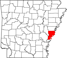 | |
| Town | ||
| Townships |
| |
| Unincorporated communities | ||
This article is issued from
Wikipedia.
The text is licensed under Creative Commons - Attribution - Sharealike.
Additional terms may apply for the media files.