Magnet Cove, Arkansas
| Magnet Cove, Arkansas | |
|---|---|
| Census-designated place | |
 Magnet Cove  Magnet Cove | |
| Coordinates: 34°27′3″N 92°50′18″W / 34.45083°N 92.83833°WCoordinates: 34°27′3″N 92°50′18″W / 34.45083°N 92.83833°W | |
| Country | United States |
| State | Arkansas |
| County | Hot Spring |
| Area[1] | |
| • Total | 2.07 sq mi (5.35 km2) |
| • Land | 2.06 sq mi (5.34 km2) |
| • Water | 0.00 sq mi (0.01 km2) |
| Elevation | 514 ft (157 m) |
| Population (2010) | |
| • Total | 5 |
| • Estimate (2016)[2] | N/A |
| Time zone | UTC-6 (Central (CST)) |
| • Summer (DST) | UTC-5 (CDT) |
| ZIP code | 72104 |
| Area code(s) | 501 |
| FIPS code | 05-43430 |
| GNIS feature ID | 2747298 |
Magnet Cove is a census-designated place (CDP)[3] and former town in Hot Spring County, Arkansas, United States.[4] It is located in the Ouachita Mountains southeast of Hot Springs, on Arkansas Highway 51 north of U.S. Highway 270. As of the 2010 census, the town of Magnet Cove had a population of 5.[5] Population figures for the new CDP have not yet been tabulated.
Geography
The boundaries of the former town, with a population of 5, represented only a very small portion of the overall Magnet Cove community.[6] The community suspended its incorporation in 2006.[7] As of 2015, the U.S. Census Bureau recognized an area along Highway 51 extending from Harver Hills Road in the southeast to Gourdneck Valley Road in the northwest as the Magnet Cove Census Designated Place. The CDP occupies the topographic Magnet Cove, a broad valley along Stone Quarry Creek surrounded by hills, and includes the Magnet Cove High School and Elementary School, as well as Magnet Cove United Methodist Church.[8]
Geology
The Magnet Cove igneous complex lies to the west of the town. The area is known for its abundance of odd minerals, including magnetite usually in the form of lodestone,[9] as well as many other species such as rutile, anatase, brookite, perovskite, and some rare-earth-bearing minerals.
| Historical population | |||
|---|---|---|---|
| Census | Pop. | %± | |
| 2000 | 467 | — | |
| 2010 | 5 | −98.9% | |
| U.S. Decennial Census[10] | |||
References
- ↑ "2016 U.S. Gazetteer Files". United States Census Bureau. Retrieved Jul 18, 2017.
- ↑ "Population and Housing Unit Estimates". Retrieved June 9, 2017.
- ↑ "Geographic Identifiers: 2011-2015 American Community Survey 5-Year Estimates (G001): Magnet Cove CDP, Arkansas". American Factfinder. U.S. Census Bureau. Retrieved April 21, 2017.
- ↑ "Town of Magnet Cove". Geographic Names Information System. United States Geological Survey.
- ↑ "American FactFinder". U.S. Census Bureau. Retrieved 10 June 2012.
- ↑ "Map of Magnet Cove, AR (March 2008)" (PDF). Arkansas State Highway and Transportation Department. Retrieved 10 June 2012. (Note: The purple rectangle in the lower center of the map is the entire incorporated town.)
- ↑ Pennington, Helen (September 17, 2014). "Magnet Cove (Hot Spring County)". Encyclopedia of Arkansas History and Culture. Butler Center for Arkansas Studies at the Central Arkansas Library System. Retrieved February 14, 2016.
- ↑ "TIGERweb mapping system". U.S. Census Bureau Geography Division. Retrieved April 21, 2017.
- ↑ Rivero, Nicolas (25 August 2017). "The Smallest Town in Each of the 50 States". Mental Floss. Retrieved 25 June 2018.
- ↑ "Census of Population and Housing". Census.gov. Retrieved June 4, 2015.
Municipalities and communities of Hot Spring County, Arkansas, United States | ||
|---|---|---|
| Cities | 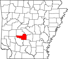 | |
| Towns | ||
| Census-designated place | ||
| Unincorporated communities |
| |
| Townships |
| |
| Ghost towns |
| |