List of state highway spurs in Arkansas
   Highway markers for AR 7S, AR 23S, and AR 137S | |
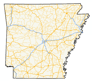 A map of highways in the state of Arkansas | |
| System information | |
|---|---|
| Formed | 1924 |
| Highway names | |
| State | Arkansas nnS, Highway nnS (AR nnS, Hwy. nnS) |
| System links | |
This is a list of state highway spur routes (spurs) in the U.S. state of Arkansas. The spurs are named after their parent highways, which leads to multiple designations of the same name in some cases. All spur routes are maintained by the Arkansas State Highway and Transportation Department.
Shields


Arkansas state highway spur routes are signed using standard state highway shield backgrounds. The number remains the same size and a "S" (for spur) is added in an almost-exponential format. Shield sizes remain, one-digit routes keep the 24-by-24-inch (61 cm × 61 cm) shields, while two-digit routes become 24-by-36-inch (61 cm × 91 cm). Three-digit routes are the same as the parent route with the "S" placed in the available corner space. The "Spur" banners are usually not used by the Arkansas State Highway and Transportation Department, which instead prefers to use only a direction banner.
State highway spurs
| Number | Length (mi) | Length (km) | Southern or western terminus | Northern or eastern terminus | Formed | Removed | Notes | |
|---|---|---|---|---|---|---|---|---|
| 0.49 | 0.79 | AR 1 in St. Charles | White River | — | — | |||
| 1.01 | 1.63 | AR 4 in Arkansas City | Mississippi River levee | 1963 | current | |||
| — | — | AR 4 in Camden | — | 1955 | 1976 | Supplanted by US 79 and AR 4 | ||
| 0.07 | 0.11 | AR 5 in Mountain Home | US 62 in Mountain Home | 1993[1] | current | |||
| 0.29 | 0.47 | AR 7 in Marble Falls | Dogpatch USA | 1974[2] | current | |||
| 2.39 | 3.85 | AR 7 in El Dorado | US 167B in El Dorado | 1971[3] | current | |||
| 1.62 | 2.61 | AR 7 in Hot Springs | US 70B in Hot Springs | 2004[4] | current | Former US 70 | ||
| 1.40 | 2.25 | AR 7 in Russellville | International Paper factory in Russellville | 1974[5] | current | |||
| 0.20 | 0.32 | AR 8 in Glenwood | Lumber yard in Glenwood | 1987[6] | current | |||
| 0.86[7] | 1.38 | AR 8 in Hamburg | Ashley CR 73 | 1993[8] | 2001[9] | Supplanted by AR 189 | ||
| 0.47 | 0.76 | AR 9 in Morrilton | End state maintenance in Morrilton Industrial Park | 1986[10] | current | |||
| 0.90 | 1.45 | AR 9 in Melbourne | AR 9 in Melbourne | 1974[11] | current | |||
| 3.07 | 4.94 | AR 10 in Greenwood | US 71 | 1970[12] | current | Former US 71 | ||
| 0.90 | 1.45 | AR 11 in Hazen | — | 1953 | 2008 | Supplanted by US 63 Spur | ||
| 7.19 | 11.57 | AR 11 | US 425 in Star City | 2013[13] | current | |||
| 1.34 | 2.16 | AR 14 at Salado | US 167/AR 230 at Southside | 1978 | current | |||
| — | — | AR 15 | Moro Bay State Park | 1992[14] | 2000[15] | Supplanted by AR 600 | ||
| 0.43 | 0.69 | AR 16 in Siloam Springs | US 412/AR 59 in Siloam Springs | — | — | |||
| 1.00 | 1.61 | AR 18 | AR 980 in Newport | — | — | |||
| 1.21 | 1.95 | AR 18 in Jonesboro | I-555/US 63 in Jonesboro | — | — | |||
| 1.21 | 1.95 | AR 18 | AR 18 in Manila | 1948 | 1957 | |||
| 1.92 | 3.09 | AR 20 | Mississippi River levee | 1963 | current | Supplanted AR 49S | ||
| 2.65 | 4.26 | AR 23 at Forum | AR 23 | — | — | Former AR 23W | ||
| 0.6 | 1.0 | AR 25 in Heber Springs | — | — | — | |||
| 0.74 | 1.19 | AR 25 in Charlotte | Weaver Lane in Charlotte | 1961[16] | current | |||
| 3.01 | 4.84 | AR 5/AR 25 in Tumbling Shoals | Old Highway 25 Park in Tumbling Shoals | 1962[17] | current | |||
| 1.29 | 2.08 | AR 26 in Gum Springs | — | 1985[18] | current | |||
| — | — | 6th Street in Lewisville | 2nd Street in Lewisville | — | 1969[19] | |||
| 1.75 | 2.82 | AR 33 in Casscoe | Daisy Lane | 1973[20] | current | |||
| 0.55 | 0.89 | AR 39 | US 49 | 1965[21] | current | |||
| 0.38 | 0.61 | AR 39 | Phillips CR 643 at Postelle | — | — | |||
| 1.01 | 1.63 | AR 43 in Siloam Springs | AR 59 in Siloam Springs | 1988[22] | 1996[23] | Supplanted AR 68C | ||
| — | — | AR 20/AR 49 | Mississippi River | 1962[24] | 1963[25] | Supplanted by AR 20S | ||
| — | — | AR 58 in Williford | AR 58E in Williford | 1979[26] | 1980[27] | |||
| 0.71 | 1.14 | AR 59 in Gentry | AR 59B in Gentry | 1994[28] | current | Former AR 204 | ||
| 1.79 | 2.88 | AR 60 in Conway | Donaghey Avenue/Pinnacle Ridge Road in Conway | 1997[29] | current | |||
| 2.53 | 4.07 | AR 69 in Melbourne | Melbourne Municipal Airport in Melbourne | 1990[30] | current | |||
| 0.70 | 1.13 | AR 69 | Jacksonport State Park in Jacksonport | 1985[31] | current | |||
| 0.31 | 0.50 | AR 69 in Batesville | US 167/AR 25 in Batesville | 2004[32] | current | Supplanted AR 69A | ||
| 1.54 | 2.48 | AR 69 in Batesville | AR 463 in Batesville | 1970[33] | current | Supplanted US 63C | ||
| 1 | 2 | AR 72 in Bentonville | US 71B in Bentonville | 1991[34] | 1999[35] | |||
| 0.89 | 1.43 | AR 75 in Parkin | US 64B/AR 75 in Parkin | 1976[36] | current | |||
| 0.08 | 0.13 | AR 78 in Moro | AR 238 in Moro | 2001[37] | current | |||
| 0.42 | 0.68 | AR 81 | Fairfield Road/Paper Mill Road | 2005[38] | current | |||
| 1.95[39] | 3.14 | AR 81 in Monticello | University of Arkansas at Monticello in Monticello | 1974[40] | 1989[41] | Supplanted by AR 83S | ||
| 2.36 | 3.80 | AR 83 in Monticello | University of Arkansas at Monticello in Monticello | 1989[42] | current | Supplanted AR 81S | ||
| 0.29 | 0.47 | — | — | — | 2014 | |||
| 0.98 | 1.58 | AR 94 in Rogers | Monte Ne | — | — | |||
| 0.32 | 0.51 | AR 95 in Morrilton | — | 1972[43] | current | |||
| 1.62 | 2.61 | AR 106 | Bethesda Lane at Bethesda | 1963[44] | current | |||
| 0.77 | 1.24 | AR 108 at Rocky Comfort | AR 41 | 1973[45] | current | |||
| 1.46 | 2.35 | AR 112 in Fayetteville | I-49/US 71/US 62/AR 16 in Fayetteville | 1971 | current | Former alignment of AR 16 | ||
| 0.80 | 1.29 | AR 113 in Bigelow | Fourche La Fave River | 1973[46] | c. 1992 | |||
| 1.26 | 2.03 | AR 117 | AR 25 in Powhatan | 1965[47] | current | |||
| 0.25 | 0.40 | AR 127 at Lost Bridge Village | Lost Bridge Public Use Area | 1969[48] | current | |||
| 0.72 | 1.16 | AR 130 in Almyra | 14th Street in Almyra | 1968[49] | current | |||
| 0.53 | 0.85 | AR 133 near Crossett | North Crossett Wastewater Treatment Plant | 1979[50] | current | |||
| 2.0 | 3.2 | — | — | 1963[51] | 1968[52] | |||
| 2.43 | 3.91 | AR 137 | AR 18 at Armorel | 1996[53] | 2014[54] | |||
| 1.35 | 2.17 | AR 146 | US 165 in Stuttgart | 1966[55] | current | Former US 79 | ||
| 0.45 | 0.72 | AR 150 | US 61 | 1966[56] | current | Former US 61 | ||
| 0.40 | 0.64 | AR 163/Crowley's Ridge Parkway in Jonesboro | AR 1 in Jonesboro | 1976[57] | current | Former AR 1 | ||
| 0.15 | 0.24 | AR 164 in Clarksville | Industrial area | 1980[58] | current | Unsigned | ||
| 3.96 | 6.37 | AR 175 in Cherokee Village | US 62/US 412 in Cherokee Village | 1980[59] | current | |||
| 3.96 | 6.37 | AR 191 in West Memphis | Industrial area | 1970[60] | 1987[61] | |||
| 1.0 | 1.6 | AR 194 | Horsehead Use Area | 1973[62] | 1992[63] | |||
| ||||||||
| Route | Location | Length (mi)[64] | Length (km) | Notes |
|---|---|---|---|---|
| Mountain Home | 0.25 | 0.40 | ||
| Jonesboro | 1.03 | 1.66 | Collins Road | |
| Bruno | 0.31 | 0.50 | ||
| Brinkley | 0.65 | 1.05 | ||
| Blytheville | 1.73 | 2.78 | Locust Street | |
| St. Francis National Forest | 0.11 | 0.18 | ||
| Turkey Scratch | 0.67 | 1.08 | ||
| White County | 0.90 | 1.45 | ||
| Bayou Meto | 1.06 | 1.71 | ||
| Brookings | 0.47 | 0.76 | ||
| Crawford County | 0.97 | 1.56 | ||
| Hindsville | 2.2 | 3.5 | Former part of AR 68 | |
| Little Italy | 1.1 | 1.8 | No longer marked; Ross Hollow Rd. | |
| Marked Tree | 0.13 | 0.21 | ||
| Lonoke County | 3.15 | 5.07 | ||
| White County | 0.35 | 0.56 | ||
| Pine Bluff | 2.14 | 3.44 | ||
| Beebe | 0.49 | 0.79 | ||
| Ozark Folk Center State Park | 0.8 | 1.3 | ||
| Newport | 1.40 | 2.25 | ||
See also


References
- ↑ "Minutes" & 1970–79, p. 451.
- ↑ "Minutes" & 1970–79, p. 983.
- ↑ "Minutes" & 1970–79, p. 1525.
- ↑ "Minutes" & 2000–09, p. 708-709.
- ↑ "Minutes" & 1970–79, p. 1055.
- ↑ "Minutes" & 1980–89, p. 782.
- ↑ "Minutes" & 2000–09, p. 279.
- ↑ "Minutes" & 1990–99, p. 335-336.
- ↑ "Minutes" & 2000–09, p. 279-280.
- ↑ "Minutes" & 1980–89, p. 671.
- ↑ "Minutes" & 1970–79, p. 913.
- ↑ "Minutes" & 1970–79, p. 1623.
- ↑ "Minutes" & 2010–19, p. 421.
- ↑ "Minutes" & 1990–99, p. 298.
- ↑ "Minutes" & 2000–09, p. 10.
- ↑ "Minutes" & 1953–69, p. 1244.
- ↑ "Minutes" & 1953–69, p. 1097.
- ↑ "Minutes" & 1980–89, p. 637.
- ↑ "Minutes" & 1953–69, p. 79-80.
- ↑ "Minutes" & 1970–79, p. 1117.
- ↑ "Minutes" & 1953–69, p. 663.
- ↑ "Minutes" & 1980–89, p. 968.
- ↑ "Minutes" & 1990–99, p. 799.
- ↑ "Minutes" & 1953–69, p. 1112.
- ↑ "Minutes" & 1953–69, p. 903-904.
- ↑ "Minutes" & 1970–79, p. 179.
- ↑ "Minutes" & 1980–89, p. 15.
- ↑ "Minutes" & 1990–99, p. 473-474.
- ↑ "Minutes" & 1990–99, p. 961.
- ↑ "Minutes" & 1990–99, p. 7.
- ↑ "Minutes" & 1980–89, p. 597.
- ↑ "Minutes" & 2000–09, p. 710.
- ↑ "Minutes" & 1970–79, p. 1684-1685.
- ↑ "Minutes" & 1990–99, p. 173.
- ↑ "Minutes" & 1990–99, p. 1399.
- ↑ "Minutes" & 1970–79, p. 605.
- ↑ "Minutes" & 2000–09, p. 197.
- ↑ "Minutes" & 2000–09, p. 821-822.
- ↑ "Minutes" & 1970–79, p. 982.
- ↑ "Minutes" & 1970–79, p. 982.
- ↑ "Minutes" & 1980–89, p. 1168.
- ↑ "Minutes" & 1980–89, p. 1168.
- ↑ "Minutes" & 1970–79, p. 1380.
- ↑ "Minutes" & 1953–69, pp. 913-915.
- ↑ "Minutes" & 1970–79, p. 1192.
- ↑ "Minutes" & 1970–79, p. 1169.
- ↑ "Minutes" & 1953–69, pp. 674-676.
- ↑ "Minutes" & 1953–69, p. 79.
- ↑ "Minutes" & 1953–69, p. 235.
- ↑ "Minutes" & 1970–79, p. 140.
- ↑ "Minutes" & 1953–69, pp. 933-934.
- ↑ "Minutes" & 1953–69, p. 166.
- ↑ "Minutes" & 1990–99, pp. 728.
- ↑ Bennett, Scott E. (November 14, 2014). "Administrative Circular No. 2014-17" (PDF). Arkansas State Highway and Transportation Department. Retrieved December 15, 2017.
- ↑ "Minutes" & 1953–69, p. 555.
- ↑ "Minutes" & 1953–69, pp. 563-564.
- ↑ "Minutes" & 1970–79, p. 684.
- ↑ "Minutes" & 1980–89, p. 94.
- ↑ "Minutes" & 1980–89, pp. 33-34.
- ↑ "Minutes" & 1970–79, pp. 1677-1678.
- ↑ "Minutes" & 1980–89, pp. 899-900.
- ↑ "Minutes" & 1970–79, p. 1166.
- ↑ "Minutes" & 1990–99, p. 227.
- ↑ Planning and Research Division (2010). "Arkansas Road Log Database" (Database). Arkansas State Highway and Transportation Department. Retrieved June 9, 2011.
- "Minutes of the Meeting" (PDF). Arkansas State Highway Commission. 1953–69. Retrieved December 2, 2016.
- "Minutes of the Meeting" (PDF). Arkansas State Highway Commission. 1970–79. Retrieved December 2, 2016.
- "Minutes of the Meeting" (PDF). Arkansas State Highway Commission. 1980–89. Retrieved December 2, 2016.
- "Minutes of the Meeting" (PDF). Arkansas State Highway Commission. 1990–99. Retrieved December 2, 2016.
- "Minutes of the Meeting" (PDF). Arkansas State Highway Commission. 2000–09. Retrieved December 2, 2016. Check date values in:
|date=(help) - "Minutes of the Meeting" (PDF). Arkansas State Highway Commission. 2010–13. Retrieved December 2, 2016.