Crows, Arkansas
| Crows, Arkansas | |
|---|---|
| Unincorporated community | |
 Crows, Arkansas Crows's position in Arkansas. | |
| Coordinates: 34°36′51″N 92°46′10″W / 34.61417°N 92.76944°WCoordinates: 34°36′51″N 92°46′10″W / 34.61417°N 92.76944°W[1] | |
| Country | United States |
| State | Arkansas |
| County | Saline |
| Township | Dyer |
| Elevation[1] | 410 ft (120 m) |
| Time zone | UTC-6 (Central (CST)) |
| • Summer (DST) | UTC-5 (CDT) |
| Area code(s) | 870 |
Crows is an unincorporated community in Dyer Township, Saline County, Arkansas.[1] It is located in the valley of the Middle Fork Saline River at the intersection of Arkansas highways 5 and 9.[2][3]
References
Municipalities and communities of Saline County, Arkansas, United States | ||
|---|---|---|
| Cities | 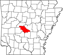 | |
| Towns | ||
| CDPs | ||
| Unincorporated communities | ||
| Footnotes | ‡This populated place also has portions in an adjacent county or counties | |
This article is issued from
Wikipedia.
The text is licensed under Creative Commons - Attribution - Sharealike.
Additional terms may apply for the media files.