Pindall, Arkansas
| Pindall, Arkansas | |
|---|---|
| Town | |
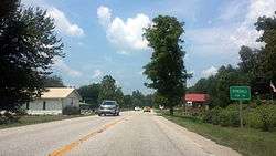 Entrance to Pindall | |
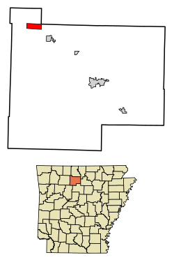 Location of Pindall in Searcy County, Arkansas. | |
| Coordinates: 36°3′34″N 92°52′16″W / 36.05944°N 92.87111°WCoordinates: 36°3′34″N 92°52′16″W / 36.05944°N 92.87111°W | |
| Country | United States |
| State | Arkansas |
| County | Searcy |
| Area[1] | |
| • Total | 2.87 sq mi (7.44 km2) |
| • Land | 2.87 sq mi (7.44 km2) |
| • Water | 0.00 sq mi (0.00 km2) |
| Elevation | 1,060 ft (323 m) |
| Population (2010) | |
| • Total | 112 |
| • Estimate (2017)[2] | 106 |
| • Density | 36.92/sq mi (14.26/km2) |
| Time zone | UTC-6 (Central (CST)) |
| • Summer (DST) | UTC-5 (CDT) |
| ZIP code | 72669 |
| Area code(s) | 870 |
| FIPS code | 05-55280 |
| GNIS feature ID | 0078005 |
Pindall is a town in Searcy County, Arkansas, United States. The population was 112 at the 2010 census. The town is said to be named for Governor Xenophon Overton Pindall.
Geography
Pindall is located at 36°3′34″N 92°52′16″W / 36.05944°N 92.87111°W (36.059369, -92.871042).[3]
According to the United States Census Bureau, the town has a total area of 2.9 square miles (7.5 km2), all land.
Major highway
School District
Pindall is in the Ozark Mountain School District,[4] with a K-12 campus in nearby St. Joe.[5]
Demographics
| Historical population | |||
|---|---|---|---|
| Census | Pop. | %± | |
| 1990 | 135 | — | |
| 2000 | 95 | −29.6% | |
| 2010 | 112 | 17.9% | |
| Est. 2017 | 106 | [2] | −5.4% |
| U.S. Decennial Census[6] | |||
As of the census[7] of 2000, there were 95 people, 36 households, and 30 families residing in the town. The population density was 33.1 inhabitants per square mile (12.8/km²). There were 54 housing units at an average density of 18.8 per square mile (7.3/km²). The racial makeup of the town was 97.89% White and 2.11% Native American.
There were 36 households out of which 41.7% had children under the age of 18 living with them, 69.4% were married couples living together, 8.3% had a female householder with no husband present, and 13.9% were non-families. 13.9% of all households were made up of individuals and 8.3% had someone living alone who was 65 years of age or older. The average household size was 2.64 and the average family size was 2.87.
In the town, the population was spread out with 25.3% under the age of 18, 5.3% from 18 to 24, 32.6% from 25 to 44, 20.0% from 45 to 64, and 16.8% who were 65 years of age or older. The median age was 38 years. For every 100 females, there were 106.5 males. For every 100 females age 18 and over, there were 102.9 males.
The median income for a household in the town was $32,500, and the median income for a family was $32,750. Males had a median income of $28,750 versus $18,750 for females. The per capita income for the town was $12,550. There were 16.0% of families and 21.6% of the population living below the poverty line, including 38.9% of under eighteens and 22.2% of those over 64.
References
- ↑ "2017 U.S. Gazetteer Files". United States Census Bureau. Retrieved Aug 22, 2018.
- 1 2 "Population and Housing Unit Estimates". Retrieved March 24, 2018.
- ↑ "US Gazetteer files: 2010, 2000, and 1990". United States Census Bureau. 2011-02-12. Retrieved 2011-04-23.
- ↑ School District Reference Map (2010 Census) Searcy County, AR (PDF) (Map). US Census Bureau. Retrieved 2011-07-12.
- ↑ "Ozark Mountain School District". Ozark Mountain School District. Retrieved 2011-07-12.
- ↑ "Census of Population and Housing". Census.gov. Archived from the original on May 12, 2015. Retrieved June 4, 2015.
- ↑ "American FactFinder". United States Census Bureau. Retrieved 2008-01-31.
External links
- Map of Pindall (US Census Bureau)
- Map of Searcy County (US Census Bureau)
- Ozark Mountain School District
- Searcy County Historical Society
Municipalities and communities of Searcy County, Arkansas, United States | ||
|---|---|---|
| Cities | 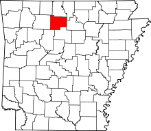 | |
| Towns | ||
| Townships | ||
| Unincorporated communities |
| |
| Footnotes | ‡This populated place also has portions in an adjacent county or counties | |