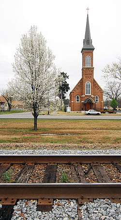
Atkins, Arkansas
| Atkins | |
|---|---|
| City | |
 Atkins | |
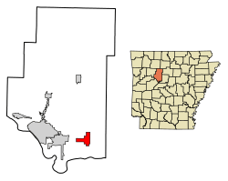 Location of Atkins in Pope County, Arkansas. | |
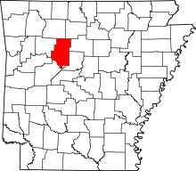
 Atkins Location in Arkansas. | |
| Coordinates: 35°14′37″N 92°56′18″W / 35.24361°N 92.93833°WCoordinates: 35°14′37″N 92°56′18″W / 35.24361°N 92.93833°W | |
| Country | United States |
| State | Arkansas |
| County | Pope |
| Area[1] | |
| • Total | 6.14 sq mi (15.89 km2) |
| • Land | 6.13 sq mi (15.88 km2) |
| • Water | 0.01 sq mi (0.01 km2) |
| Elevation | 371 ft (113 m) |
| Population (2010) | |
| • Total | 3,016 |
| • Estimate (2017)[2] | 3,038 |
| • Density | 495.60/sq mi (191.36/km2) |
| Time zone | UTC-6 (Central (CST)) |
| • Summer (DST) | UTC-5 (CDT) |
| ZIP code | 72823 |
| Area code(s) | 479 |
| FIPS code | 05-02590 |
| GNIS feature ID | 0045966 |
Atkins is a city in Pope County, Arkansas, United States. The population was 3,016 at the 2010 census. It is part of the Russellville Micropolitan Statistical Area.
Geography
Atkins is located at 35°14′37″N 92°56′18″W / 35.24361°N 92.93833°W (35.243485, -92.938212).[3]
According to the United States Census Bureau, the city has a total area of 6.1 square miles (16 km2), all land. Many Atkins residents commute to nearby Russellville for work, school, and recreation.
Demographics
| Historical population | |||
|---|---|---|---|
| Census | Pop. | %± | |
| 1880 | 519 | — | |
| 1890 | 660 | 27.2% | |
| 1900 | 745 | 12.9% | |
| 1910 | 1,258 | 68.9% | |
| 1920 | 1,529 | 21.5% | |
| 1930 | 1,364 | −10.8% | |
| 1940 | 1,322 | −3.1% | |
| 1950 | 1,291 | −2.3% | |
| 1960 | 1,391 | 7.7% | |
| 1970 | 2,015 | 44.9% | |
| 1980 | 3,002 | 49.0% | |
| 1990 | 2,834 | −5.6% | |
| 2000 | 2,878 | 1.6% | |
| 2010 | 3,016 | 4.8% | |
| Est. 2017 | 3,038 | [2] | 0.7% |
| U.S. Decennial Census[4] 2014 Estimate[5] | |||
As of the census[6] of 2010, there were 3,016 people, 1,118 households, and 849 families residing in the city. The population density was 471.8 people per square mile (181/km²). There were 1,288 housing units at an average density of 211.1 per square mile (81/km²). The racial makeup of the city was 95.6% White, 0.9% Black or African American, 0.8% Native American, 0.1% Asian, 1.2% from other races, and 1.2% from two or more races. 2.3% of the population were Hispanic or Latino of any race.
There were 1,118 households out of which 30.4% had children under the age of 18 living with them, 53% were married couples living together, 12.1% had a female householder with no husband present, and 28.4% were non-families. 25.3% of all households were made up of individuals and 11.2% had someone living alone who was 65 years of age or older. The average household size was 2.50 and the average family size was 2.95.
In the city, the population was spread out with 23.4% under the age of 18, 9.4% from 18 to 24, 25% from 25 to 44, 24.5% from 45 to 64, and 17.7% who were 65 years of age or older. The median age was 38.8 years. For every 100 females, there were 90.4 males. For every 100 females age 18 and over, there were 90.7 males.
The median income for a household in the city was $40,112, and the median income for a family was $49,754. Males had a median income of $33,191 versus $38,833 for females. The per capita income for the city was $18,605. About 6.4% of families and 8.8% of the population were below the poverty line, including 6.3% of those under age 18 and 7.9% of those age 65 or over.
Notable people
- Ellis Kinder, major league baseball pitcher; Atkins native[7]
- Johnny Carl Fields, started at linebacker for the University of Arkansas Razorbacks; Atkins native.
- Wilson Matthews, former University of Arkansas assistant football coach; Atkins native
- Norris Church Mailer, writer, wife of Norman Mailer.
References
- ↑ "2017 U.S. Gazetteer Files". United States Census Bureau. Retrieved Aug 22, 2018.
- 1 2 "Population and Housing Unit Estimates". Retrieved March 24, 2018.
- ↑ "US Gazetteer files: 2010, 2000, and 1990". United States Census Bureau. 2011-02-12. Retrieved 2011-04-23.
- ↑ "Census of Population and Housing". Census.gov. Archived from the original on May 12, 2015. Retrieved June 4, 2015.
- ↑ "Annual Estimates of the Resident Population for Incorporated Places: April 1, 2010 to July 1, 2014". Retrieved June 4, 2015.
- ↑ "American FactFinder". United States Census Bureau. Retrieved 2017-01-10.
- ↑ Reichler, Joseph L., ed. (1979) [1969]. The Baseball Encyclopedia (4th ed.). New York: Macmillan Publishing. ISBN 0-02-578970-8.
External links
| Wikimedia Commons has media related to Atkins, Arkansas. |