Evansville, Arkansas
| Evansville, Arkansas | |
|---|---|
| Unincorporated community | |
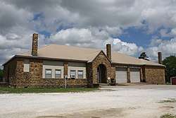 Community Center | |
 Evansville, Arkansas Evansville's position in Arkansas. | |
| Coordinates: 35°47′43.3″N 94°29′48.8″W / 35.795361°N 94.496889°WCoordinates: 35°47′43.3″N 94°29′48.8″W / 35.795361°N 94.496889°W | |
| Country | United States |
| State | Arkansas |
| County | Washington |
| Township | Vineyard |
| Elevation[1] | 1,122 ft (342 m) |
| Time zone | UTC-6 (Central (CST)) |
| • Summer (DST) | UTC-5 (CDT) |
| Area code(s) | 479 |
| GNIS feature ID | 76889 |
| U.S. Geological Survey Geographic Names Information System: Evansville, Arkansas | |
Evansville is an unincorporated community in southwest Washington County, Arkansas, United States.[1] It is located on Arkansas Highway 59 near the Oklahoma state line.[2]
History
A post office called Evansville has been in operation since 1838.[3] The community was named after Captain Lewis Evans, a local merchant.[4]
References
- 1 2 "Feature Detail Report for: Evansville, Arkansas." USGS. U.S. Geological Survey Geographic Names Information System: Evansville, Arkansas Retrieved April 12, 2011.
- ↑ Arkansas Atlas and Gazetteer (Map) (Second ed.). DeLorme. 2002. p. 30. ISBN 0-89933-345-1.
- ↑ "Post Offices". Jim Forte Postal History. Retrieved 4 February 2018.
- ↑ History of Benton, Washington, Carroll, Madison, Crawford, Franklin, and Sebastian Counties, Arkansas. Higginson Book Company. 1889. p. 268.

This article is issued from
Wikipedia.
The text is licensed under Creative Commons - Attribution - Sharealike.
Additional terms may apply for the media files.