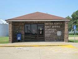
Clarkedale, Arkansas
| Clarkedale, Arkansas | |
|---|---|
| City | |
 | |
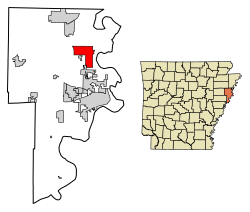 Location of Clarkedale in Crittenden County, Arkansas. | |
 Clarkedale, Arkansas Location of Clarkedale in Crittenden County, Arkansas. | |
| Coordinates: 35°18′33″N 90°14′10″W / 35.30917°N 90.23611°WCoordinates: 35°18′33″N 90°14′10″W / 35.30917°N 90.23611°W | |
| Country | United States |
| State | Arkansas |
| County | Crittenden |
| Area[1] | |
| • Total | 11.44 sq mi (29.62 km2) |
| • Land | 11.44 sq mi (29.62 km2) |
| • Water | 0.00 sq mi (0.00 km2) |
| Elevation | 226 ft (69 m) |
| Population (2010)[2] | |
| • Total | 371 |
| • Estimate (2017)[3] | 362 |
| • Density | 31.65/sq mi (12.22/km2) |
| Time zone | UTC-6 (Central (CST)) |
| • Summer (DST) | UTC-5 (CDT) |
| ZIP code | 72325 |
| Area code(s) | 870 |
| FIPS code | 05-14050 |
| GNIS feature ID | 76622[4] |
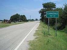
Clarkedale is a town[5] in Crittenden County, Arkansas, United States. Its population was 371 as of the 2010 census.[2] Clarkedale incorporated on November 15, 2000.[6]
The L&Q International Demonstration and Training Center is located in Clarkedale.
Demographics
| Historical population | |||
|---|---|---|---|
| Census | Pop. | %± | |
| 2010 | 371 | — | |
| Est. 2017 | 362 | [3] | −2.4% |
| U.S. Decennial Census[7] | |||
References
- ↑ "2017 U.S. Gazetteer Files". United States Census Bureau. Retrieved Aug 22, 2018.
- 1 2 "American FactFinder". United States Census Bureau. Archived from the original on 2013-09-11. Retrieved 2011-05-14.
- 1 2 "Population and Housing Unit Estimates". Retrieved March 24, 2018.
- ↑ U.S. Geological Survey Geographic Names Information System: Clarkedale, Arkansas
- ↑ Local.Arkansas.gov - Clarkedale, retrieved September 3, 2012
- ↑ "Boundary Changes". Geographic Change Notes: Arkansas. Population Division, United States Census Bureau. 2010-01-01. Retrieved 2011-06-13.
- ↑ "Census of Population and Housing". Census.gov. Archived from the original on May 12, 2015. Retrieved June 4, 2016.
Municipalities and communities of Crittenden County, Arkansas, United States | ||
|---|---|---|
| Cities | 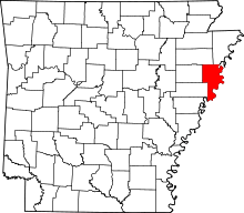 | |
| Towns | ||
| Unincorporated communities | ||
This article is issued from
Wikipedia.
The text is licensed under Creative Commons - Attribution - Sharealike.
Additional terms may apply for the media files.