Onyx, Arkansas
| Onyx, Arkansas | |
|---|---|
| Unincorporated community | |
 Onyx, Arkansas Onyx's position in Arkansas. | |
| Coordinates: 34°51′5.3″N 93°24′28.7″W / 34.851472°N 93.407972°WCoordinates: 34°51′5.3″N 93°24′28.7″W / 34.851472°N 93.407972°W | |
| Country | United States |
| State | Arkansas |
| County | Yell |
| Township | Crawford |
| Elevation[1] | 735 ft (224 m) |
| Time zone | UTC-6 (Central (CST)) |
| • Summer (DST) | UTC-5 (CDT) |
| Area code(s) | 479 |
| GNIS feature ID | 72854 |
| U.S. Geological Survey Geographic Names Information System: Onyx, Arkansas | |
Onyx is an unincorporated community in Yell County, Arkansas, United States.[2] It is located where Arkansas Highway 314 begins at Arkansas Highway 27.[3] The South Fourche La Fave River flows past south of the community.[3]
It was named for valuable deposits of onyx in the vicinity.[4]
References
- ↑ "Onyx, Arkansas." Histopolis Retrieved October 13, 2011.
- ↑ "Feature Detail Report for: Onyx, Arkansas." USGS. U.S. Geological Survey Geographic Names Information System: Onyx, Arkansas Retrieved October 13, 2011.
- 1 2 Arkansas Atlas and Gazetteer (Map) (Second ed.). DeLorme. § 40.
- ↑ "Colorful Names". Arkansas Department of Parks & Tourism. Archived from the original on November 24, 2013. Retrieved 14 July 2014.
Municipalities and communities of Yell County, Arkansas, United States | ||
|---|---|---|
| Cities | 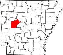 | |
| Town | ||
| Unincorporated communities | ||
This article is issued from
Wikipedia.
The text is licensed under Creative Commons - Attribution - Sharealike.
Additional terms may apply for the media files.