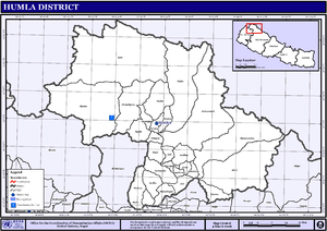
Humla District
| Humla District हुम्ला जिल्ला | |
|---|---|
| District | |
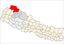 | |
| Country | Nepal |
| Province | Karnali Pradesh |
| Admin HQ. | Simikot |
| Government | |
| • Type | Coordination committee |
| • Body | DCC, Humla |
| Area | |
| • Total | 5,655 km2 (2,183 sq mi) |
| Population (2011) | |
| • Total | 50,858 |
| • Density | 9.0/km2 (23/sq mi) |
| Time zone | UTC+5:45 (NPT) |
| Website | http://www.ddchumla.gov.np/ |
Humla District (Nepali: हुम्ला जिल्ला![]()
Geography and climate
| Climate Zone[2] | Elevation Range | % of Area |
|---|---|---|
| Subtropical | 1,000 to 2,000 meters 3,300 to 6,600 ft. |
2.3% |
| Temperate | 2,000 to 3,000 meters 6,400 to 9,800 ft. |
8.9% |
| Subalpine | 3,000 to 4,000 meters 9,800 to 13,100 ft. |
19.4% |
| Alpine | 4,000 to 5,000 meters 13,100 to 16,400 ft. |
58.7% |
| Nival | above 5,000 meters | 10.7% |
Administration
The district consists of 7 Municipalities, all of which are rural municipalities. These are as follows:[3]
- Simkot Rural Municipality
- Namkha Rural Municipality
- Kharpunath Rural Municipality
- Sarkegad Rural Municipality
- Chankheli Rural Municipality
- Adanchuli Rural Municipality
- Tajakot Rural Municipality
Former Village Development Committees
Prior to the restructuring of the district, Humla District consisted of the following municipalities and Village development committees:
Health care
- Central/regional/zonal hospitals: 0
- District hospitals: 1
- Primary healthcare centres: 0
- Health posts: 10
- Sub-health posts: 16
- Number of doctors: 3
- Number of nurses: 35
Although there is a district hospital as well as primary health care centers, these are not enough for providing health services. The small health centers in many VDCs are often without Auxiliary Health Workers (AHWs), Auxiliary Nurse Midwives (ANMs) and Community Health Workers (CHWs). Many people still believe in Dhami and Jhakri and often resort to local practices before seeking allopathic treatment.
The Nepal Trust, which has been working in Humla since 1996,[4] was one of the first NGOs in the district to address development (especially healthcare) issues at the grass-roots level. PHASE Nepal is a non profit organization which coordinates with the District Health Office in Simikot to provide comprehensive primary health services to the communities of Maila and Melchham, two of the most isolated VDCs of the district; as well as the neighboring villages who also received these services.[5] The Trust was the only organization allowed to continue its development work throughout the district during the Maoist insurgency. The Torpa clinic was built by the trust almost 15 years ago to address the immediate need for health services. To date, the Trust has expanded services throughout the district including improvements made to the district hospital. Currently, Trust initiatives are related to ante/post natal care and infant mortality reduction programs. With its head office in Kathmandu, the Nepal Trust has its own satellite office and guest house in its Simikot office, which acts as a social enterprise (the first built in West Nepal) and along with healthcare works in education, renewable energy, heritage preservation, WASH, food security and agriculture, sustainable tourism development and income generation. Nepal Trust has been managing the Great Himalaya Trail Development Program since 2008.
Tourism
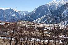
Humla lies in the far west of Nepal, on the border between Nepal and China, and is used as the starting point for trekking and mountaineering, accessible from Simikot Airport. The trekking route to Tibet also starts from Simikot.
Trekking
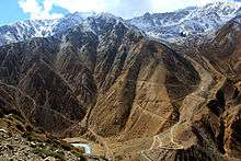
The Nepal section of The Great Himalaya Trail ends in Humla at Hilsa at the border with Tibet. The Humla district is a historic part of the Tibetan Buddhist religious tradition, with several points of interest for the history, culture and values of a typical Buddhist life. It has eleven small villages of Tibetan origin. The Nyin Community and the Limi Valley are inhabited by Buddhist communities.[6]
The border crossing at Hilsa is a main entry point for treks going to and coming from Mount Kailash. The normal route to this point is via a 4-5 day walk to Simikot.
See also
References
- ↑ "National Population and Housing Census 2011 (National Report)" (PDF). Central Bureau of Statistics. Government of Nepal. November 2012. Archived from the original (PDF) on April 18, 2013. Retrieved 3 April 2017.
- ↑ The Map of Potential Vegetation of Nepal - a forestry/agroecological/biodiversity classification system (PDF), Forest & Landscape Development and Environment Series 2-2005 and CFC-TIS Document Series, No. 110, 2005, ISBN 87-7903-210-9, retrieved Nov 22, 2013
- ↑ "स्थानिय तह" (in Nepali). Ministry of Federal Affairs and General Administration. Retrieved 1 September 2018.
- ↑ http://www.nepaltrust.org
- ↑ http://phasenepal.org/project-areas/humla/
- ↑ http://www.thegreathimalayatrail.org/humla
External links
- "Districts of Nepal". Statoids.
- Paudhur
- Countries of Asia
Places adjacent to Humla District | ||||||||||
|---|---|---|---|---|---|---|---|---|---|---|
| ||||||||||
Headquarters: Simikot | ||
| Rural municipalities: 7 | | |
List of municipalities and rural municipalities of Nepal | ||
| Province No. 1 |  | |
|---|---|---|
| Province No. 2 | ||
| Province No. 3 | ||
| Gandaki Pradesh | ||
| Province No. 5 | ||
| Karnali Pradesh | ||
| Sudurpashchim Pradesh | ||
Coordinates: 29°58′N 81°50′E / 29.967°N 81.833°E
| Wikimedia Commons has media related to Humla District. |