Dhankuta District
| Dhankuta District धनकुटा जिल्ला | |
|---|---|
| District | |
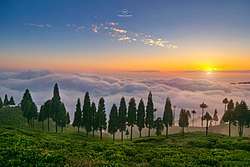 A scene of sunset from a tea garden at Hile, Dhankuta | |
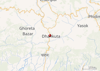
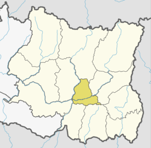 Location of Dhankuta | |
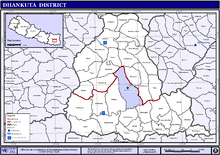
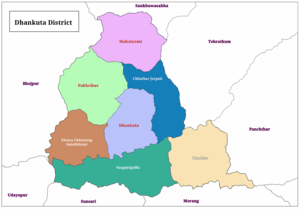 Divisions of Dhankuta District | |
| Country | Nepal |
| Province | Province No. 1 |
| Admin HQ. | Dhankuta |
| Municipality | |
| Government | |
| • Type | Coordination committee |
| • Body | DCC, Dhankuta |
| Area | |
| • Total | 892 km2 (344 sq mi) |
| Population (2011)[1] | |
| • Total | 163,412 |
| • Households | 37,616 |
| Demographics | |
| • Ethnic Groups | Chhetri, Rai, Limbu, Magar |
| • Female ♀ | 53% |
| Human Development Index | |
| • Income per capita (US dollars) | $1257 |
| • Poverty rate | 15.9% |
| • Literacy | 74% |
| • Life Expectancy | 69 |
| Time zone | UTC+5:45 (NPT) |
| Main Language(s) | Nepali, Limbu, Bantawa, Magar |
| Website |
ddcdhankuta |
Dhankuta District (Nepali: धनकुटा जिल्ला) (![]()
History
Dhankuta was a part of Limbuwan and Kirata Kingdom before unification of those parts into Kingdom of Nepal.
After 1816 there were 10 districts in Nepal and Dhankuta-chainpur district was one of them. All land from east of Dudhkosi river to the Mechi river was one district Dhankuta-chainpur. [2]
From 1885 to 1962 Nepal remained divided into 32 districts and there were six districts in eastern-hill region: East No. 1, East No. 2, East No. 3, East No. 4, Ilam and Dhankuta. Dhankuta was center of these districts. That time also dhankuta was a large (by area) district. Current Sankhuwasabha, Tehrathum, Taplejung, Panchthar and Dhankuta districts were Incorporated under one district. The total area of the former Dhankuta district was 3,448 square miles (8,930 km2).[2] [3]
In 1962, Nepal divided into 75 districts and 16 districts of eastern Nepal grouped to form Eastern Development Region and Dhankuta became the headquarter of it. [4] [5]
Geography and Climate
Dhankuta is a mid-hill district of eastern hill region of Nepal. It is situated between 26°53' to 27°19' north latitude and 87°8' to 88°33' east longitude. Total area of the district is 888.7 square kilometres (343.1 sq mi) and it is located at 243 metres (9,600 in) to 629 metres (24,800 in) of elevation above sea level. [6]
Vegetation
The vegetation zones in the district range from sub-tropical Sal forest along the Tamor and Arun rivers, and cooler temperate forests on some of the high ridges that mark the watershed between the two catchments. The altitude ranges from around 300m to 2500m. The majority of the population are involved in agriculture and crops include maize, rice and millet. Important cash crops include citrus fruits, cauliflower, cabbage, ginger, and in recent years, tea. A well-preserved forest (Rani Ban – Queen's Forest) spreads along a ridge line on the northwest side of the village, with well-developed mature stands of rhododendron and sallo (pine) trees.
| Climate Zone[7] | Elevation Range | % of Area |
|---|---|---|
| Lower Tropical | below 300 meters (1,000 ft) | 3.7% |
| Upper Tropical | 300 to 1,000 meters 1,000 to 3,300 ft. |
44.7% |
| Subtropical | 1,000 to 2,000 meters 3,300 to 6,600 ft. |
46.6% |
| Temperate | 2,000 to 3,000 meters 6,400 to 9,800 ft. |
3.2% |
Divisions
Dhankuta is divided into 3 urban municipalities and 4 rural municipalities.
| No. | Type | Name | Nepali | Population (2011) | Area | Website |
|---|---|---|---|---|---|---|
| 1 | Urban | Dhankuta | धनकुटा | 36,619 | 111 | www.dhankutamun.gov.np |
| 2 | Urban | Pakhribas | पाख्रीबास | 22078 | 144.29 | www.pakhribasmun.gov.np |
| 3 | Urban | Mahalaxmi | महालक्ष्मी | 24,800 | 129 | www.mahalaxmimundhankuta.gov.np |
| 4 | Rural | Sangurigadhi | सागुरीगढी | 21,536 | 147.6 | |
| 5 | Rural | Chaubise | चौविसे | 19,283 | 147.6 | |
| 6 | Rural | Khalsa Chhintang Sahidbhumi | खाल्सा छिन्ताङ सहीदभूमि | 18,760 | 99.55 | |
| 7 | Rural | Chhathar Jorpati | छथर जोरपाटी | 18,322 | 102.83 | |
| District | Dhankuta | धनकुटा | 163,412 | 892 | www.ddcdhankuta.gov.np |
Former divisions
Formerly Dhankuta was divided into 2 municipalities and many Village development committees.
- Dhankuta Municipality
- Ahale
- Ankhisalla
- Arkhaule Jitpur
- Basantatar
- Belhara
- Budhabare
- Bhirgaun
- Bodhe
- Budhabare
- Budi Morang
- Chanuwa
- Chhintang
- Chungmang
- Danda Bazar
- Dandagaun
- Ghortikharka (now Pakhribas Municipality)
- Hattikharka
- Jitpur Arkhaule
- Khoku
- Khuwaphok
- Kuruletenupa
- Leguwa
- Mahabharat
- Marek Katahare
- Maunabudhuk
- Mudebas
- Muga (now Pakhribas Municipality)
- Murtidhunga
- Pakhribas (now Pakhribas Municipality)
- Pakhribas Municipality
- Parewadin
- Phaksib
- Phalate (now Pakhribas Municipality)
- Raja Rani
- Sanne (now Pakhribas Municipality)
- Tankhuwa
- Telia
- Vedatar
Constituencies
Dhankuta District has singal Parliamentary constituency and 2 Provincial constituencies:
| Name of cons. | Incorporated areas | Type of cons. | MP/MLA | Party |
|---|---|---|---|---|
| Dhankuta 1 | whole district | parliamentary | Rajendra Kumar Rai | NCP |
| Dhankuta 1(A) | Chaubise, Sangurigadhi, Dhankuta (excluding ward no. 2), Khalsa Chhintang Sahidbhumi (excluding ward no. 4 & 5) | provincial | Niran Rai | NCP |
| Dhankuta 1(B) | Chhathar Jorpati, Pakhribas, Mahalaxmi and ward No. 2 of Dhankuta and ward no. 4 & 5 of Khalsa Chhintang Sahidbhumi | provincial | Indra Mani Parajuli | NCP |
Transportation
 |
| Kosi Highway |
Dhankuta, the headquarter (center) of Dhankuta District is connected with NH-08 (Koshi Highway), which connects Dhankuta with NH-01 (East-west Highway) at Itahari. Itahari is 69 KM at distance from Dhankuta. The NH-08 also connects Dhankuta to northern hill and mountainous area.
Tourist areas
Gallery
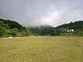 Playground in Basantatar
 Dhankuta in rainy season
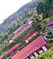 Agricultural Research Station, Pakhribas
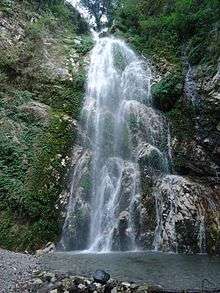 Namaste Fallsat dhankuta
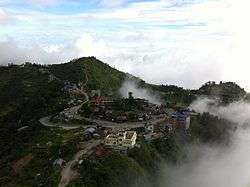 vedatar at dhankuta
 Madhuganga
See also
References
- 1 2 "National Population and Housing Census 2011(National Report)" (PDF). Central Bureau of Statistics. Government of Nepal. November 2012. Archived from the original (PDF) on 2013-04-18. Retrieved November 2012. Check date values in:
|accessdate=(help) - 1 2 "Official website of District coordination committee of Dhankuta". ddcdhankuta.gov.np. Retrieved 4 October 2018.
- ↑ "प्रशासकीय पुनर्गठन समिति (बुच कमिशन) को प्रतिवेदन, २००९" (PDF).
- ↑ "Eastern Development Region". myholidaynepal.com. Retrieved 14 February 2018.
- ↑ "1. Eastern Development Region:". khullakitab.com. Retrieved 14 February 2018.
- ↑ "Official website of District Administration department of Dhankuta district". Retrieved 5 October 2018.
- ↑ The Map of Potential Vegetation of Nepal - a forestry/agroecological/biodiversity classification system (PDF), . Forest & Landscape Development and Environment Series 2-2005 and CFC-TIS Document Series No.110., 2005, ISBN 87-7903-210-9, retrieved Nov 22, 2013
External links
| Wikimedia Commons has media related to Dhankuta District. |
Places adjacent to Dhankuta District | ||||||||||
|---|---|---|---|---|---|---|---|---|---|---|
| ||||||||||
Headquarter: Dhankuta | ||
| Rural Municipalities | | |
| Municipalities | ||
| Province No. 1 |  | |
|---|---|---|
| Province No. 2 | ||
| Province No. 3 | ||
| Gandaki Pradesh | ||
| Province No. 5 | ||
| Karnali Pradesh | ||
| Sudurpashchim Pradesh | ||
Coordinates: 26°58′53″N 87°20′36″E / 26.98139°N 87.34333°E