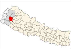
Achham District
| Achham District अछाम | |
|---|---|
| District | |
 | |
| Coordinates: 29°6′40.95″N 81°17′55.78″E / 29.1113750°N 81.2988278°ECoordinates: 29°6′40.95″N 81°17′55.78″E / 29.1113750°N 81.2988278°E | |
| Country | Nepal |
| Admin HQ. | Mangalsen |
| Government | |
| • Type | Coordination committee |
| • Body | DCC, Achham |
| Area | |
| • Total | 1,692 km2 (653 sq mi) |
| Population (2011) | |
| • Total | 257,477[1] |
| Time zone | UTC+5:45 (NPT) |
| Website | Official website |
Achham District (Nepali: अछाम जिल्ला![]()
Mangalsen, the district headquarters, is eight hours walk and two and one-half hour drive from Sanphebagar – a town in Achham sporting a non-functional domestic airport. A bridge crosses the Budhiganga River in Sanphebagar allowing access during high water, a second bridge over the Kailash River. During 2009/2010, the government of Nepal have constructed a paved road connecting Sanphebagar to Mangalsen. The district is served by two hospitals, the government district hospital in Mangalsen and one recently opened in Bayalpata named Bayalpata Hospital that is a collaboration between the government and the non-profit organization Nyaya Health.[3]
Geography and Climate
| Climhiate Zone[4] | Elevation Range | % of Area |
|---|---|---|
| Upper Tropical | 300 to 1,000 meters 1,000 to 3,300 ft. |
27.4% |
| Subtropical | 1,000 to 2,000 meters 3,300 to 6,600 ft. |
58.3% |
| Temperate | 2,000 to 3,000 meters 6,400 to 9,800 fters 9,800 to 13,100 ft. |
1.0% |
Towns and villages
- Mangalsen Municipality
- Kamalbazar Municipality
- Sanphebagar Municipality
- Panchadeval Binayak Municipality
- Chaurpati Rural Municipality
- Mellekh Rural Municipality
- Bannigadi Jayagad Rural Municipality
- Ramaroshan Rural Municipality
- Dhakari Rural Municipality
- Turmakhand Rural Municipality
Mass media and journalist
Newspapers
|
FM Radio
|
References
- 1 2 "National Population and Housing Census 2011(National Report)" (PDF). Central Bureau of Statistics. Government of Nepal. November 2012. Retrieved 10 October 2016.
- ↑ "Accham". Far Western nepal. Archived from the original on 2013-05-21. Retrieved 27 June 2013.
- ↑ "Accham District Nepal". Sudur Sansar. Archived from the original on 2014-11-07. Retrieved 2013-06-27.
- ↑ The Map of Potential Vegetation of Nepal - a forestry/agroecological/biodiversity classification system (PDF), . Forest & Landscape Development and Environment Series 2-2005 and CFC-TIS Document Series No.110., 2005, ISBN 87-7903-210-9, retrieved Nov 22, 2013
External links
| Wikimedia Commons has media related to Achham District. |
Places adjacent to Achham District | |
|---|---|
Headquarters: Mangalsen | ||
| Urban municipalities |
| |
| Rural municipalities |
| |
For former VDCs See here | ||
| Province No. 1 |  | |
|---|---|---|
| Province No. 2 | ||
| Province No. 3 | ||
| Gandaki Pradesh | ||
| Province No. 5 | ||
| Karnali Pradesh | ||
| Sudurpashchim Pradesh | ||
| Authority control |
|---|