Mangalsen
| Mangalsen मंगलसेन | |
|---|---|
| Municipality | |
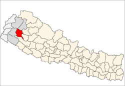
 Mangalsen Location in Nepal | |
| Coordinates: 29°08′N 81°13′E / 29.13°N 81.21°ECoordinates: 29°08′N 81°13′E / 29.13°N 81.21°E | |
| Country |
|
| District | Achham District |
| Area | |
| • Total | 139,9 km2 (540 sq mi) |
| Population (2011) | |
| • Total | 32,507 |
| • Density | 23/km2 (60/sq mi) |
| • Religions | Hindu |
| Time zone | UTC+5:45 (NST) |
Mangalsen Nepali: मंगलसेन is a municipality and the headquarter of Achham District in Province No. 7 of Nepal that was established on 18 May 2014 by merging the former Village development committees Janalibandali, Kuntibandali, Oligau, Jupu into Old-Mangalsen.[1][2] At the time of the 2011 Nepal census it had a population of 32,507 people living in 6,604 individual households.[3]
Mangalsen had been one major scene of fighting between Maoist rebels and government forces during the Civil War.[4]
References
- ↑ "72 new municipalities announced". My Republica.com. Archived from the original on 2014-06-18. Retrieved 2014-06-10.
- ↑ "Government announces 72 new municipalities". The Kathmandu Post. Retrieved 2014-06-10.
- ↑ "National Population and Housing Census 2011" (PDF). Central Bureau of Statistics. November 2017. Retrieved 1 May 2018.
- ↑ Govt forces suffer heavy losses in Achham
Headquarters: Mangalsen | ||
| Urban municipalities |
|  |
| Rural municipalities |
| |
For former VDCs See here | ||
This article is issued from
Wikipedia.
The text is licensed under Creative Commons - Attribution - Sharealike.
Additional terms may apply for the media files.