National Register of Historic Places listings in St. Joseph County, Indiana
This is a list of the National Register of Historic Places listings in St. Joseph County, Indiana.
This is intended to be a complete list of the properties and districts on the National Register of Historic Places in St. Joseph County, Indiana, United States. Latitude and longitude coordinates are provided for many National Register properties and districts; these locations may be seen together in a map.[1]
There are 95 properties and districts listed on the National Register in the county, including 1 National Historic Landmark. Another 4 properties were once listed but have been removed.
Properties and districts located in incorporated areas display the name of the municipality, while properties and districts in unincorporated areas display the name of their civil township. Properties and districts split between multiple jurisdictions display the names of all jurisdictions.
- This National Park Service list is complete through NPS recent listings posted June 19, 2020.[2]
Current listings
| [3] | Name on the Register[4] | Image | Date listed[5] | Location | City or town | Description |
|---|---|---|---|---|---|---|
| 1 | All American Bank Building | 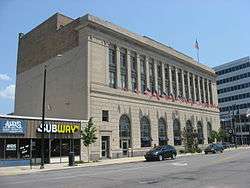 All American Bank Building |
June 5, 1985 (#85001202) |
111 W. Washington 41°40′36″N 86°15′02″W |
South Bend | |
| 2 | Battell Park Historic District | 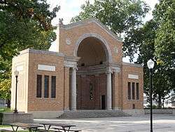 Battell Park Historic District |
January 11, 1996 (#95001541) |
Mishawaka Ave. 41°39′56″N 86°11′14″W |
Mishawaka | |
| 3 | Beiger House |  Beiger House |
August 28, 1973 (#73000042) |
317 E. Lincolnway 41°39′39″N 86°10′38″W |
Mishawaka | |
| 4 | W.N. Bergan-J.C. Lauber Co. Building | 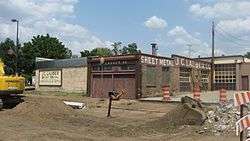 W.N. Bergan-J.C. Lauber Co. Building |
February 18, 1999 (#99000180) |
502-504 E. La Salle St. 41°40′44″N 86°14′39″W |
South Bend | |
| 5 | Berteling Building |  Berteling Building |
June 5, 1985 (#85001203) |
228 W. Colfax Ave. 41°40′39″N 86°15′12″W |
South Bend | |
| 6 | Blackstone-State Theater |  Blackstone-State Theater |
June 5, 1985 (#85001204) |
212 S. Michigan St. 41°40′28″N 86°15′00″W |
South Bend | |
| 7 | Cathedral of St. James and Parish Hall | 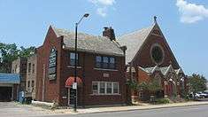 Cathedral of St. James and Parish Hall |
June 5, 1985 (#85001205) |
115 and 117 N. Lafayette Boulevard 41°40′37″N 86°15′14″W |
South Bend | |
| 8 | Central High School & Boys Vocational School | 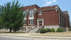 Central High School & Boys Vocational School |
June 5, 1985 (#85001206) |
115 N. St. James Court 41°40′37″N 86°15′17″W |
South Bend | |
| 9 | Chapin Park Historic District |  Chapin Park Historic District |
February 4, 1982 (#82000073) |
Roughly bounded by the St. Joseph River, Main, Madison, Rex, Lindsey, and William Sts., and Leland and Portage Aves. 41°41′06″N 86°15′19″W |
South Bend | |
| 10 | Horatio Chapin House | 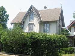 Horatio Chapin House |
August 11, 1980 (#80000064) |
601 Park Ave. 41°41′00″N 86°15′20″W |
South Bend | |
| 11 | Children's Dispensary | 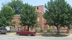 Children's Dispensary |
December 24, 1997 (#97001541) |
1045 W. Washington 41°40′35″N 86°15′58″W |
South Bend | |
| 12 | Citizens Bank | 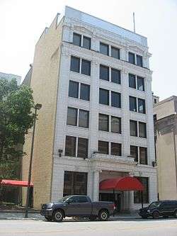 Citizens Bank |
June 5, 1985 (#85001207) |
112 W. Jefferson 41°40′29″N 86°15′04″W |
South Bend | |
| 13 | Colonial Gardens Commercial Historic District |  Colonial Gardens Commercial Historic District |
December 15, 1997 (#97001540) |
2919-3027 Mishawaka Ave. 41°39′57″N 86°12′20″W |
South Bend | |
| 14 | Commercial Building | 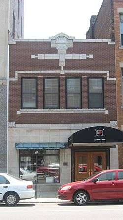 Commercial Building |
June 5, 1985 (#85001209) |
224 W. Colfax Ave. 41°40′39″N 86°15′12″W |
South Bend | |
| 15 | Dille-Probst House | 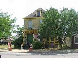 Dille-Probst House |
March 17, 1994 (#94000224) |
520 E. Colfax Ave. 41°40′39″N 86°14′36″W |
South Bend | |
| 16 | Dodge House | 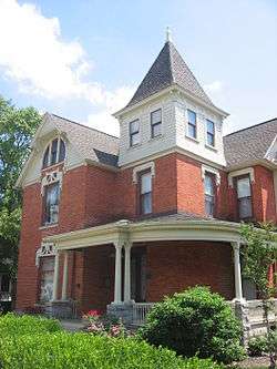 Dodge House |
September 8, 1978 (#78000052) |
415 E. Lincolnway 41°39′39″N 86°10′34″W |
Mishawaka | |
| 17 | East Washington Street Historic District | 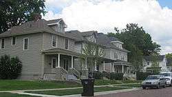 East Washington Street Historic District |
February 18, 1999 (#99000182) |
Roughly between E. Colfax Ave. and E. Washington St., St. Louis Ave., and Eddy St. 41°40′35″N 86°14′21″W |
South Bend | |
| 18 | Maurice Egan House | 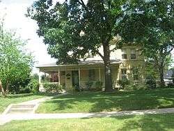 Maurice Egan House |
February 18, 1999 (#99000175) |
1136 N. Notre Dame Ave. 41°41′28″N 86°14′16″W |
South Bend | |
| 19 | Eller-Hosford House | 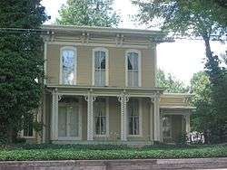 Eller-Hosford House |
January 27, 1983 (#83000101) |
722 E. Lincolnway 41°39′41″N 86°10′14″W |
Mishawaka | |
| 20 | Ellis-Schindler House |  Ellis-Schindler House |
December 18, 1990 (#90001926) |
900 W. Lincolnway 41°39′38″N 86°11′29″W |
Mishawaka | |
| 21 | Evergreen Hill | 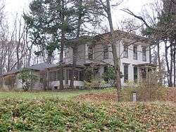 Evergreen Hill |
April 25, 2001 (#01000410) |
59449 Keria Trail, south of South Bend 41°37′52″N 86°16′11″W |
Centre Township | |
| 22 | Farmers Security Bank | 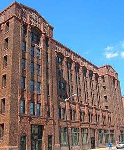 Farmers Security Bank |
June 5, 1985 (#85001210) |
133 S. Main St. 41°40′31″N 86°15′07″W |
South Bend | |
| 23 | Federal Building |  Federal Building |
August 3, 2015 (#15000482) |
204 S. Main St. 41°40′29″N 86°15′06″W |
South Bend | |
| 24 | Fire House No. 3 | 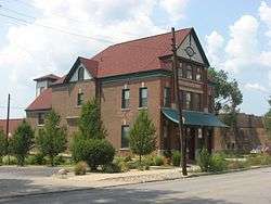 Fire House No. 3 |
February 18, 1999 (#99000177) |
219 N. Hill St. 41°40′43″N 86°14′36″W |
South Bend | |
| 25 | Fire House No. 7 |  Fire House No. 7 |
February 18, 1999 (#99000170) |
803 N. Notre Dame Ave. 41°41′10″N 86°14′18″W |
South Bend | |
| 26 | Former First Presbyterian Church | 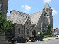 Former First Presbyterian Church |
June 5, 1985 (#85001211) |
101 S. Lafayette Boulevard 41°40′34″N 86°15′14″W |
South Bend | |
| 27 | Hager House | 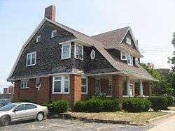 Hager House |
June 5, 1985 (#85001212) |
415 W. Wayne St. 41°40′26″N 86°15′20″W |
South Bend | |
| 28 | Haven Hubbard Home | 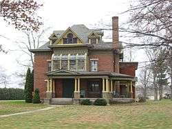 Haven Hubbard Home |
March 20, 2013 (#13000091) |
31895 Chicago Trail, northeast of New Carlisle 41°43′51″N 86°28′56″W |
Olive Township | |
| 29 | W.R. Hinkle and Co. | 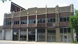 W.R. Hinkle and Co. |
June 5, 1985 (#85001213) |
225 N. Lafayette Boulevard 41°40′43″N 86°15′14″W |
South Bend | |
| 30 | Martin Hoban House | 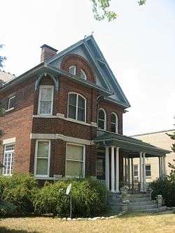 Martin Hoban House |
February 18, 1999 (#99000171) |
205 N. St. Louis Boulevard 41°40′41″N 86°14′30″W |
South Bend | |
| 31 | Hoffman Hotel | 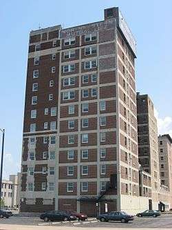 Hoffman Hotel |
June 5, 1985 (#85001214) |
120 W. LaSalle 41°40′44″N 86°15′05″W |
South Bend | |
| 32 | Howard Park Historic District | 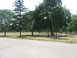 Howard Park Historic District |
February 18, 1999 (#99000169) |
Roughly between E. Jefferson and Wayne Sts., N. Eddy, and the St. Joseph River 41°40′25″N 86°14′32″W |
South Bend | |
| 33 | I&M Building | 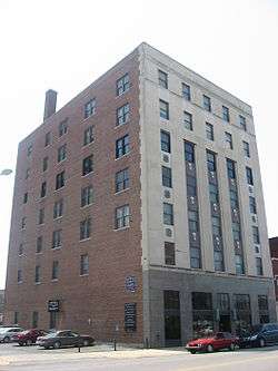 I&M Building |
June 5, 1985 (#85001215) |
220 W. Colfax Ave. 41°40′39″N 86°15′11″W |
South Bend | |
| 34 | I and M Electric Co. Building-Transformer House and Garage | I and M Electric Co. Building-Transformer House and Garage |
February 18, 1999 (#99000173) |
401 E. Colfax Ave. and 312 E. LaSalle St. 41°40′41″N 86°14′46″W |
South Bend | |
| 35 | J.M.S. Building | 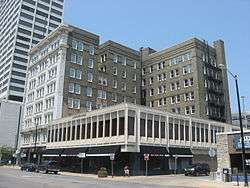 J.M.S. Building |
June 5, 1985 (#85001216) |
108 N. Main St. 41°40′36″N 86°15′06″W |
South Bend | |
| 36 | James A. Judie House | 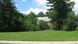 James A. Judie House |
March 24, 1983 (#83000146) |
1515 E. Jefferson Boulevard 41°40′30″N 86°13′28″W |
South Bend | |
| 37 | Kamm and Schellinger Brewery | 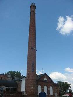 Kamm and Schellinger Brewery |
October 11, 1979 (#79000042) |
100 Center St. 41°39′45″N 86°11′25″W |
Mishawaka | |
| 38 | Kelley-Fredrickson House and Office Building |  Kelley-Fredrickson House and Office Building |
May 24, 1984 (#84001619) |
233 N. Lafayette Boulevard and 314 W. LaSalle St. 41°40′44″N 86°15′14″W |
South Bend | House moved to 702 W. Colfax in 1987.[6] |
| 39 | John G. Kerr Company | 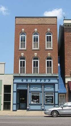 John G. Kerr Company |
June 5, 1985 (#85001217) |
121 W. Colfax Ave. 41°40′41″N 86°15′06″W |
South Bend | |
| 40 | Knights of Columbus-Indiana Club | 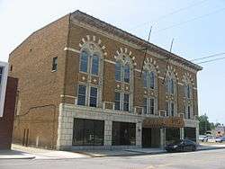 Knights of Columbus-Indiana Club |
June 5, 1985 (#85001218) |
320 W. Jefferson Boulevard 41°40′29″N 86°15′16″W |
South Bend | |
| 41 | Knights of Pythias Lodge | 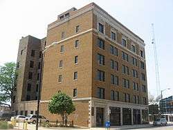 Knights of Pythias Lodge |
June 5, 1985 (#85001219) |
224 W. Jefferson Boulevard 41°40′29″N 86°15′12″W |
South Bend | |
| 42 | La Salle Street Bridge | 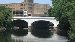 La Salle Street Bridge |
February 18, 1999 (#99000181) |
La Salle St., over the St. Joseph River 41°40′45″N 86°14′56″W |
South Bend | |
| 43 | Lakeville High School | 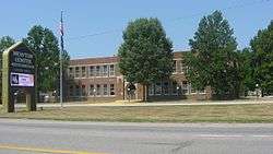 Lakeville High School |
August 29, 1991 (#91001166) |
601 N. Michigan St. 41°31′52″N 86°16′25″W |
Lakeville | |
| 44 | LaSalle Annex | 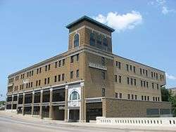 LaSalle Annex |
June 5, 1985 (#85001220) |
306 N. Michigan St. 41°40′46″N 86°15′00″W |
South Bend | |
| 45 | LaSalle Hotel | 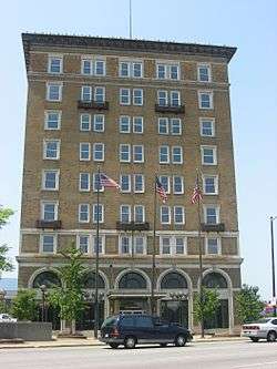 LaSalle Hotel |
June 5, 1985 (#85001221) |
237 N. Michigan St. 41°40′44″N 86°15′03″W |
South Bend | |
| 46 | Chauncey N. Lawton House | 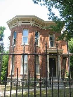 Chauncey N. Lawton House |
June 23, 1983 (#83000116) |
405 W. Wayne St. 41°40′26″N 86°15′18″W |
South Bend | |
| 47 | Leeper Park |  Leeper Park |
June 15, 2000 (#00000679) |
Roughly bounded by the St. Joseph River, Park Ln., and Bartlett St. 41°41′11″N 86°15′07″W |
South Bend | |
| 48 | Samuel Leeper Jr. House | 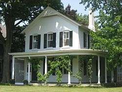 Samuel Leeper Jr. House |
March 21, 1985 (#85000600) |
113 W. North Shore Dr. 41°41′20″N 86°15′05″W |
South Bend | |
| 49 | Marquette School | 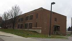 Marquette School |
September 18, 2013 (#13000726) |
1905 College Ave. 41°42′07″N 86°16′38″W |
South Bend | |
| 50 | Charles McCormick Building | 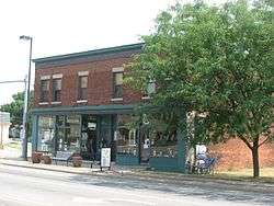 Charles McCormick Building |
February 25, 1999 (#99000178) |
526-532 E. Colfax Ave. 41°40′39″N 86°14′35″W |
South Bend | |
| 51 | Merrifield-Cass House | 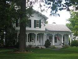 Merrifield-Cass House |
June 16, 1983 (#83000147) |
816 E. Lincolnway 41°39′42″N 86°10′09″W |
Mishawaka | |
| 52 | Mishawaka Carnegie Library | 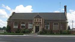 Mishawaka Carnegie Library |
August 14, 1998 (#98001048) |
122 North Hill 41°39′42″N 86°11′04″W |
Mishawaka | |
| 53 | Mishawaka Fire Station No. 4 | September 18, 2017 (#100001614) |
2319 Lincolnway E. 41°39′47″N 86°08′28″W |
Mishawaka | ||
| 54 | Mishawaka Reservoir Caretaker's Residence | Mishawaka Reservoir Caretaker's Residence |
August 14, 1998 (#98001053) |
16581 Chandler Boulevard, south of Mishawaka 41°38′19″N 86°11′04″W |
Penn Township | |
| 55 | Morey House | 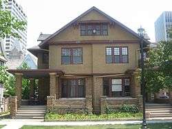 Morey House |
June 5, 1985 (#85001222) |
110-112 Franklin Pl. 41°40′33″N 86°15′17″W |
South Bend | |
| 56 | Morey-Lampert House |  Morey-Lampert House |
June 5, 1985 (#85001223) |
322 W. Washington St. 41°40′34″N 86°15′17″W |
South Bend | |
| 57 | Muessel-Drewry's Brewery |  Muessel-Drewry's Brewery |
December 28, 2000 (#00001543) |
1408 Elwood Ave. 41°41′37″N 86°16′16″W |
South Bend | |
| 58 | New Carlisle Historic District |  New Carlisle Historic District |
December 14, 1992 (#92001653) |
Roughly bounded by Front, Arch, Chestnut, and Bray Sts. 41°42′22″N 86°30′37″W |
New Carlisle | |
| 59 | Normain Heights Historic District |  Normain Heights Historic District |
March 20, 2002 (#02000203) |
Roughly 2300-2900 N. Main, 2300-2800 Normandy, and the 100-200 blocks of E. Ardennes, Palau, Bastogne, Leyte, Saint Lo, and Guam 41°41′03″N 86°10′47″W |
Mishawaka | |
| 60 | North Liberty Historic District |  North Liberty Historic District |
March 26, 2014 (#14000077) |
State Road 23 between Center and Harrison Sts. 41°32′07″N 86°25′37″W |
North Liberty | |
| 61 | North Liberty Park | 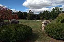 North Liberty Park |
March 29, 2007 (#07000211) |
309 N. Jefferson St. 41°32′16″N 86°25′45″W |
North Liberty | |
| 62 | North Pumping Station |  North Pumping Station |
January 2, 1997 (#96001538) |
830 N. Michigan St. 41°41′10″N 86°15′00″W |
South Bend | |
| 63 | Northside Boulevard Riverwall | 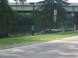 Northside Boulevard Riverwall |
September 27, 2006 (#06000877) |
600-1100 Northside Boulevard 41°40′07″N 86°14′20″W |
South Bend | |
| 64 | O'Brien Electric Priming Company | 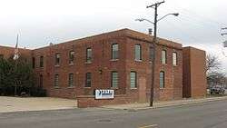 O'Brien Electric Priming Company |
December 28, 1983 (#83003756) |
2001 W. Washington St. 41°40′38″N 86°16′41″W |
South Bend | |
| 65 | Old Courthouse (Second St. Joseph County Courthouse) | 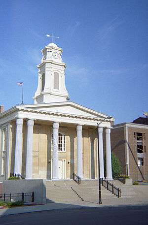 Old Courthouse (Second St. Joseph County Courthouse) |
September 4, 1970 (#70000007) |
112 S. Lafayette Boulevard 41°38′58″N 86°15′00″W |
South Bend | |
| 66 | Joseph D. Oliver House | 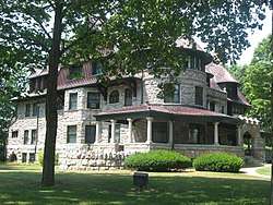 Joseph D. Oliver House |
August 28, 1973 (#73000043) |
808 W. Washington Ave. 41°40′33″N 86°15′44″W |
South Bend | |
| 67 | Palace Theater | 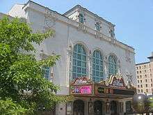 Palace Theater |
June 5, 1985 (#85001226) |
211 N. Michigan St. 41°40′42″N 86°15′03″W |
South Bend | |
| 68 | Palais Royale Building |  Palais Royale Building |
July 21, 1983 (#83000102) |
113-105 W. Colfax Ave. and 201-209 N. Michigan St. 41°40′40″N 86°15′03″W |
South Bend | |
| 69 | St. Casimir Parish Historic District | 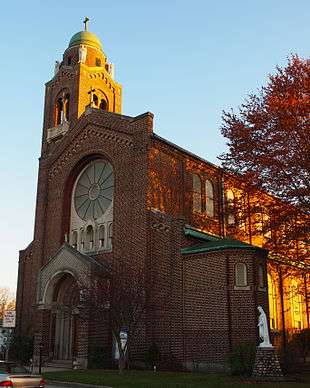 St. Casimir Parish Historic District |
January 16, 1997 (#96001543) |
Roughly bounded by Arnold and W. Sample Sts. and the former Conrail tracks 41°40′01″N 86°16′16″W |
South Bend | |
| 70 | St. Joseph County Infirmary |  St. Joseph County Infirmary |
June 15, 2000 (#00000670) |
3016 Portage Ave. 41°43′07″N 86°16′56″W |
South Bend | |
| 71 | St. Joseph School | 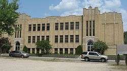 St. Joseph School |
February 18, 1999 (#99000179) |
210 N. Hill St. 41°40′41″N 86°14′33″W |
South Bend | |
| 72 | St. Patrick's Farm |  St. Patrick's Farm |
December 31, 2013 (#13001015) |
50651 Laurel Rd., north of South Bend 41°45′29″N 86°16′03″W |
Clay Township | |
| 73 | Second St. Joseph Hotel |  Second St. Joseph Hotel |
June 5, 1985 (#85001227) |
117-119 W. Colfax Ave. 41°40′40″N 86°15′05″W |
South Bend | |
| 74 | Jeremiah H. Service House |  Jeremiah H. Service House |
March 15, 2000 (#00000216) |
302 E. Michigan St. 41°42′22″N 86°30′18″W |
New Carlisle | |
| 75 | Singer Manufacturing-South Bend Lathe Co. Historic District |  Singer Manufacturing-South Bend Lathe Co. Historic District |
February 18, 1999 (#99000174) |
Madison St. between N. Niles Ave. and the St. Joseph River 41°40′56″N 86°14′46″W |
South Bend | |
| 76 | Sommerer House |  Sommerer House |
February 18, 1999 (#99000172) |
415 Parry St. 41°40′20″N 86°14′09″W |
South Bend | |
| 77 | Sons of Israel Synagogue |  Sons of Israel Synagogue |
June 25, 2013 (#13000427) |
420 S. William St. 41°40′17″N 86°15′21″W |
South Bend | |
| 78 | South Bend Brewing Association |  South Bend Brewing Association |
September 16, 2001 (#01000987) |
1636 W. Lincolnway 41°41′08″N 86°16′32″W |
South Bend | |
| 79 | South Bend City Cemetery | December 4, 2018 (#100003189) |
214 N. Elm St. 41°40′41″N 86°16′04″W |
South Bend | ||
| 80 | South Bend Remedy Company |  South Bend Remedy Company |
June 5, 1985 (#85001228) |
220 W. LaSalle 41°40′44″N 86°15′12″W |
South Bend | Moved to 501 W. Colfax Ave. in 1988, and then to 402 W. Washington St. in 2003.[7] |
| 81 | South Bend Remedy Company Building | South Bend Remedy Company Building |
September 16, 2001 (#01000993) |
501 W. Colfax Ave. 41°40′41″N 86°15′24″W |
South Bend | Moved to 402 W. Washington St. in 2003.[8] |
| 82 | South Michigan Street Historic District |  South Michigan Street Historic District |
December 15, 1997 (#97001556) |
Roughly along the junction of Monroe and Michigan Sts. 41°40′15″N 86°15′02″W |
South Bend | |
| 83 | Stephenson Underwear Mill | 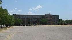 Stephenson Underwear Mill |
September 28, 1995 (#95000197) |
322 E. Colfax Ave. 41°40′39″N 86°14′44″W |
South Bend | |
| 84 | Studebaker Clubhouse and Tree Sign |  Studebaker Clubhouse and Tree Sign |
September 18, 1985 (#85002430) |
32132 State Road 2, south of New Carlisle 41°40′08″N 86°29′25″W |
Olive Township | Located in Bendix Woods County Park |
| 85 | Summers-Longley House-Building | 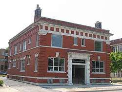 Summers-Longley House-Building |
June 5, 1985 (#85001229) |
312-314 W. Colfax Ave. 41°40′39″N 86°15′15″W |
South Bend | |
| 86 | Third St. Joseph County Courthouse | 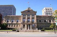 Third St. Joseph County Courthouse |
June 5, 1985 (#85001230) |
105 S. Main St. 41°40′33″N 86°15′08″W |
South Bend | |
| 87 | Tippecanoe Place | 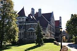 Tippecanoe Place |
July 2, 1973 (#73000044) |
620 W. Washington Ave. 41°40′33″N 86°15′34″W |
South Bend | |
| 88 | Tower Building | 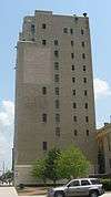 Tower Building |
June 5, 1985 (#85001244) |
216 W. Washington 41°40′34″N 86°15′10″W |
South Bend | |
| 89 | University of Notre Dame: Main and South Quadrangles |  University of Notre Dame: Main and South Quadrangles |
May 23, 1978 (#78000053) |
Off Interstates 80/90 41°42′07″N 86°14′26″W |
Portage Township | Includes the University's historic center, comprising the Basilica, the Golden Dome, and Washington Hall, was built in the early years of the University. |
| 90 | Walker Field Shelterhouse |  Walker Field Shelterhouse |
September 27, 2006 (#06000876) |
1305 Ewing Ave. 41°39′02″N 86°16′10″W |
South Bend | |
| 91 | Water Street/Darden Road Bridge | 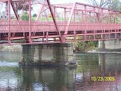 Water Street/Darden Road Bridge |
March 21, 1985 (#85000599) |
Over the St. Joseph River at Darden Rd. 41°43′49″N 86°16′07″W |
South Bend | |
| 92 | Martin Wenger Farmhouse | 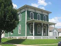 Martin Wenger Farmhouse |
June 22, 2000 (#00000715) |
701 E. Pennsylvania 41°39′41″N 86°14′27″W |
South Bend | |
| 93 | Wertz-Bestle Farm | 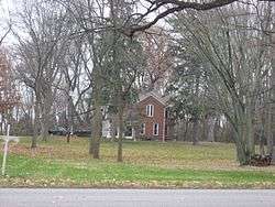 Wertz-Bestle Farm |
April 12, 2001 (#01000356) |
51387 Portage Rd., north of South Bend 41°44′46″N 86°18′00″W |
German Township | |
| 94 | West LaSalle Avenue Historic District | 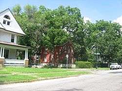 West LaSalle Avenue Historic District |
September 18, 2013 (#13000727) |
W. LaSalle Ave. between William St. and Martin Luther King Dr. 41°40′45″N 86°15′34″W |
South Bend | |
| 95 | West Washington Historic District | 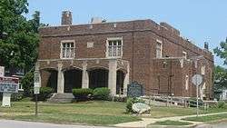 West Washington Historic District |
January 17, 1975 (#75000049) |
Irregular pattern roughly bounded by Main St., Western Ave., W. LaSalle Ave., and McPherson St. 41°40′32″N 86°15′30″W |
South Bend |
Former listings
| [3] | Name on the Register | Image | Date listed | Date removed | Location | City or town | Summary |
|---|---|---|---|---|---|---|---|
| 1 | Colfax Theater | June 5, 1985 (#85001208) | July 7, 1993 | 213 W. Colfax Ave. 41°40′39″N 86°15′08″W |
South Bend | ||
| 2 | Morningside Club Residence | June 5, 1985 (#85001224) | January 24, 1989 | 413 W. Colfax |
South Bend | ||
| 3 | Northern Indiana Gas and Electric Company Building | June 5, 1985 (#85001225) | October 9, 2012 | 221 N. Michigan St. 41°40′43″N 86°15′02″W |
South Bend | ||
| 4 | Tivoli Theater | April 1, 1998 (#98000304) | March 24, 2005 | 208 N. Main St. |
Mishawaka |
See also
| Wikimedia Commons has media related to National Register of Historic Places in St. Joseph County, Indiana. |
References
- The latitude and longitude information provided in this table was derived originally from the National Register Information System, which has been found to be fairly accurate for about 99% of listings. Some locations in this table may have been corrected to current GPS standards.
- "National Register of Historic Places: Weekly List Actions". National Park Service, United States Department of the Interior. Retrieved on June 19, 2020.
- Numbers represent an ordering by significant words. Various colorings, defined here, differentiate National Historic Landmarks and historic districts from other NRHP buildings, structures, sites or objects.
- "National Register Information System". National Register of Historic Places. National Park Service. March 13, 2009.
- The eight-digit number below each date is the number assigned to each location in the National Register Information System database, which can be viewed by clicking the number.
- http://www2.sjcpl.org/historydb/browserecord.php?-action=browse&-recid=188
- http://www.indianalandmarks.org/historicsitestoursevents/officeproperties/Pages/default.aspx
- http://www.indianalandmarks.org/historicsitestoursevents/officeproperties/Pages/default.aspx
| Topics | |
|---|---|
| Lists by state |
|
| Lists by insular areas | |
| Lists by associated state | |
| Other areas | |
| Related | |
| |

Municipalities and communities of St. Joseph County, Indiana, United States | ||
|---|---|---|
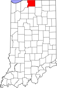
| Cities | Map of Indiana highlighting St. Joseph County | |
| Towns | ||
| Townships | ||
| CDPs | ||
| Unincorporated communities | ||
| Footnotes | ‡This populated place also has portions in an adjacent county or counties | |