National Register of Historic Places listings in Tippecanoe County, Indiana
This is a list of the National Register of Historic Places listings in Tippecanoe County, Indiana.
This is intended to be a complete list of the properties and districts on the National Register of Historic Places in Tippecanoe County, Indiana, United States. Latitude and longitude coordinates are provided for many National Register properties and districts; these locations may be seen together in a map.[1]
There are 48 properties and districts listed on the National Register in the county, including 2 National Historic Landmarks.
Properties and districts located in incorporated areas display the name of the municipality, while properties and districts in unincorporated areas display the name of their civil township. Properties and districts split between multiple jurisdictions display the names of all jurisdictions.
- This National Park Service list is complete through NPS recent listings posted June 19, 2020.[2]
Current listings
| [3] | Name on the Register[4] | Image | Date listed[5] | Location | City or town | Description |
|---|---|---|---|---|---|---|
| 1 | Alpha Tau Omega Fraternity House | 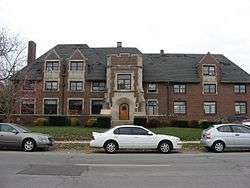 Alpha Tau Omega Fraternity House |
March 20, 2002 (#02000197) |
314 Russell St. 40°25′39″N 86°55′07″W |
West Lafayette | |
| 2 | Jesse Andrew House | 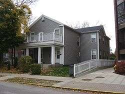 Jesse Andrew House |
August 11, 1983 (#83000103) |
123 Andrew Pl. 40°25′28″N 86°54′34″W |
West Lafayette | |
| 3 | Archeological Sites 12T59 and 12T530 | September 14, 2015 (#15000599) |
Southern side of Indian Mound Dr.[6] 40°31′23″N 86°47′30″W |
Tippecanoe Township | ||
| 4 | Judge Cyrus Ball House | 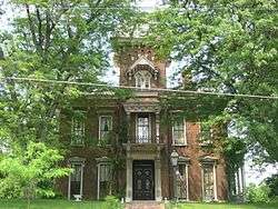 Judge Cyrus Ball House |
May 3, 1984 (#84001649) |
402 S. 9th St. 40°24′49″N 86°53′12″W |
Lafayette | |
| 5 | Battle Ground Historic District | Battle Ground Historic District |
July 23, 1985 (#85001639) |
Roughly bounded by Burnett Creek, Sherman Dr., and an open ridge on the southeast 40°30′35″N 86°50′21″W |
Battle Ground | |
| 6 | Big Four Depot | 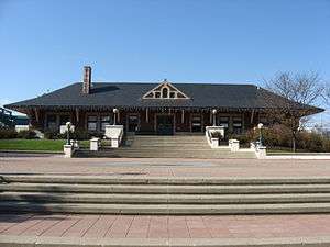 Big Four Depot |
June 22, 2003 (#03000548) |
200 N. 2nd St. 40°25′07″N 86°53′44″W |
Lafayette | |
| 7 | Cairo Skywatch Tower | 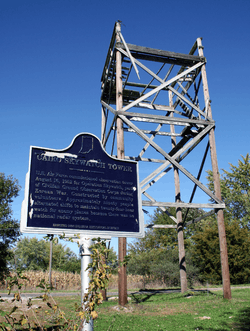 Cairo Skywatch Tower |
March 21, 2002 (#02000202) |
County Road 850N at County Road 100W at Cairo 40°32′26″N 86°55′30″W |
Tippecanoe Township | |
| 8 | Centennial Neighborhood District |  Centennial Neighborhood District |
June 16, 1983 (#83003443) |
Roughly bounded by Union, 3rd, 4th, Ferry, and 9th Sts. 40°25′21″N 86°53′25″W |
Lafayette | |
| 9 | Chauncey-Stadium Avenues Historic District |  Chauncey-Stadium Avenues Historic District |
December 20, 2002 (#02001558) |
Roughly bounded by Meridian, Lincoln, River Rd., Fowler, Quincy, Northwestern, and Allen Sts. 40°25′52″N 86°54′22″W |
West Lafayette | |
| 10 | John E. and Catherine E. Christian House | _Entrance.jpg) John E. and Catherine E. Christian House |
June 16, 1992 (#92000679) |
1301 Woodland Ave. 40°26′18″N 86°54′59″W |
West Lafayette | |
| 11 | Curtis-Grace House |  Curtis-Grace House |
April 10, 2012 (#12000190) |
2175 Tecumseh Park Ln. 40°26′50″N 86°54′27″W |
West Lafayette | |
| 12 | Dayton Historic District | 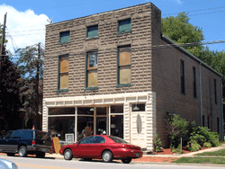 Dayton Historic District |
March 26, 2003 (#03000142) |
Roughly bounded by Walnut, Harrison, and Pennsylvania Sts. 40°22′35″N 86°46′03″W |
Dayton | |
| 13 | Downtown Lafayette Historic District | 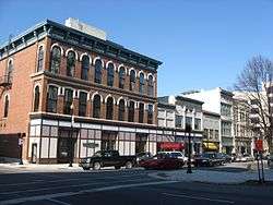 Downtown Lafayette Historic District |
November 28, 1980 (#80000067) |
Roughly bounded by 2nd, Ferry, 6th, and South Sts. 40°25′08″N 86°53′33″W |
Lafayette | |
| 14 | Ellsworth Historic District | 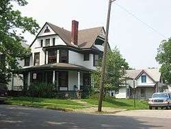 Ellsworth Historic District |
December 30, 1986 (#86003501) |
Roughly bounded by Columbia, the Norfolk Southern railroad tracks, Alabama, 7th, South, and 6th Sts. 40°24′55″N 86°53′20″W |
Lafayette | |
| 15 | Ely Homestead | 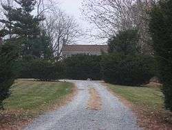 Ely Homestead |
October 8, 1976 (#76000036) |
4106 E. 200N, northeast of Lafayette 40°26′53″N 86°49′37″W |
Fairfield Township | |
| 16 | Enterprise Hotel |  Enterprise Hotel |
June 21, 1984 (#84001650) |
1015 Main St. 40°25′08″N 86°53′06″W |
Lafayette | |
| 17 | Falley Home | 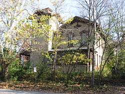 Falley Home |
July 15, 1982 (#82000078) |
601 New York St. 40°24′52″N 86°53′24″W |
Lafayette | |
| 18 | Farmers Institute |  Farmers Institute |
March 27, 1986 (#86000609) |
4626 W. County Road 660S; also 4636 West 660 South 40°19′18″N 86°59′29″W |
Shadeland | Second address represents a boundary increase approved March 6, 2020 |
| 19 | Fort Ouiatenon |  Fort Ouiatenon |
February 16, 1970 (#70000008) |
Along River Rd. and the Wabash River, west of the Purdue University Airport[7] 40°24′23″N 86°57′50″W |
Wabash Township | |
| 20 | Moses Fowler House | 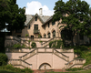 Moses Fowler House |
August 5, 1971 (#71000009) |
Corner of 10th and South Sts. 40°25′00″N 86°53′10″W |
Lafayette | |
| 21 | Happy Hollow Heights Historic District |  Happy Hollow Heights Historic District |
December 15, 2015 (#15000891) |
1821 and 1809 Happy Hollow Rd. and all houses on Laurel, Hollowood, Fearnleaf, and Sumac Drs. 40°26′33″N 86°54′00″W |
West Lafayette | |
| 22 | Hershey House |  Hershey House |
November 28, 1978 (#78000054) |
East of Lafayette on East Rd. 40°26′42″N 86°45′59″W |
Perry Township | |
| 23 | Highland Park Neighborhood Historic District |  Highland Park Neighborhood Historic District |
March 14, 1996 (#96000270) |
Roughly bounded by Kossuth St., S. 9th St., Cherokee Ave., and 4th St. 40°24′22″N 86°53′21″W |
Lafayette | |
| 24 | Hills and Dales Historic District |  Hills and Dales Historic District |
June 27, 2002 (#02000689) |
Roughly bounded by Northwestern Ave., Meridian St., Hillcrest Rd., and Grant St. 40°26′07″N 86°54′49″W |
West Lafayette | |
| 25 | Indian Trail Road-Belle River Bridge | Indian Trail Road-Belle River Bridge |
January 28, 2000 (#00000012) |
Steel Bridge Research, Inspection, Training and Engineering Center, S. Sharon Chapel Rd. 40°24′31″N 86°57′02″W |
Wabash Township | Replaced in 2008, this bridge was moved from its original location and as of 2015 resides at Purdue University's Steel Bridge Research, Inspection, Training and Engineering Center.[8] |
| 26 | Indiana State Soldiers Home Historic District |  Indiana State Soldiers Home Historic District |
January 2, 1974 (#74000034) |
North of Lafayette off State Road 43 40°28′08″N 86°53′15″W |
Tippecanoe and Wabash Townships | |
| 27 | Jefferson Historic District |  Jefferson Historic District |
September 16, 2001 (#01000976) |
Roughly bounded by 9th, Erie, Elizabeth, and Ferry Sts. 40°25′19″N 86°53′04″W |
Lafayette | |
| 28 | Marian Apartments | 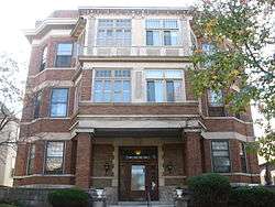 Marian Apartments |
June 30, 1983 (#83000150) |
615 North St. 40°25′15″N 86°53′23″W |
Lafayette | |
| 29 | Mars Theatre |  Mars Theatre |
January 26, 1981 (#81000030) |
11 N. 6th St. 40°25′06″N 86°53′25″W |
Lafayette | |
| 30 | Levi and Lucy Morehouse Farm | 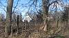 Levi and Lucy Morehouse Farm |
December 19, 2012 (#12001065) |
5038 Morehouse Rd., northwest of West Lafayette 40°29′27″N 86°57′26″W |
Wabash Township | |
| 31 | Morton School |  Morton School |
September 9, 1999 (#99001113) |
222 N. Chauncey Ave. 40°25′31″N 86°54′23″W |
West Lafayette | |
| 32 | Ninth Street Hill Neighborhood Historic District |  Ninth Street Hill Neighborhood Historic District |
April 14, 1997 (#97000303) |
Roughly 9th St. from South to Kossuth Sts. and State St. from 9th to Kossuth Sts. 40°24′48″N 86°53′09″W |
Lafayette | |
| 33 | Park Mary Historic District | 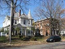 Park Mary Historic District |
June 15, 2001 (#01000617) |
Roughly bounded by Union, Hartford, N. 6th, and N. 14th Sts. 40°25′33″N 86°53′01″W |
Lafayette | |
| 34 | Oliver Webster Jr. and Catherine Peirce House | December 3, 2018 (#100003190) |
538 S. 7th St. 40°24′38″N 86°53′18″W |
Lafayette | ||
| 35 | Perrin Historic District |  Perrin Historic District |
September 10, 1979 (#79000045) |
Roughly bounded by Murdock Park, Sheridan Rd., Columbia, Main, and Union Sts. 40°25′14″N 86°52′47″W |
Lafayette | |
| 36 | James Pierce Jr. House | 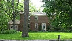 James Pierce Jr. House |
June 17, 1982 (#82000079) |
4624 N. 140W, north of West Lafayette 40°29′06″N 86°55′56″W |
Wabash Township | |
| 37 | William Potter House | 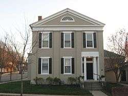 William Potter House |
January 6, 1983 (#83000104) |
915 Columbia St. 40°25′05″N 86°53′08″W |
Lafayette | |
| 38 | St. John's Episcopal Church |  St. John's Episcopal Church |
September 20, 1978 (#78000055) |
315 N. 6th St. 40°25′13″N 86°53′25″W |
Lafayette | |
| 39 | St. Mary Historic District | 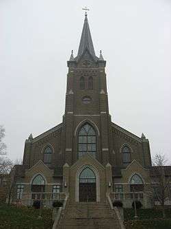 St. Mary Historic District |
June 14, 2001 (#01000622) |
Roughly bounded by Main, South, 10th, and 14th Sts. 40°25′01″N 86°52′51″W |
Lafayette | |
| 40 | Scott Street Pavilion | 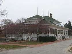 Scott Street Pavilion |
September 27, 1984 (#84001656) |
Columbian Park 40°24′54″N 86°52′18″W |
Lafayette | |
| 41 | Stidham United Methodist Church | 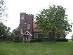 Stidham United Methodist Church |
November 27, 1992 (#92001651) |
5300 S. 175W 40°20′30″N 86°56′17″W |
Shadeland | |
| 42 | Temple Israel |  Temple Israel |
February 19, 1982 (#82000080) |
17 S. 7th St. 40°25′00″N 86°53′16″W |
Lafayette | |
| 43 | Tippecanoe Battlefield |  Tippecanoe Battlefield |
October 15, 1966 (#66000013) |
7 miles northeast of Lafayette on State Road 25 40°28′08″N 86°50′43″W |
Battle Ground and Tippecanoe Township | |
| 44 | Tippecanoe County Courthouse |  Tippecanoe County Courthouse |
October 31, 1972 (#72000013) |
Public Square 40°25′05″N 86°53′20″W |
Lafayette | |
| 45 | Upper Main Street Historic District | 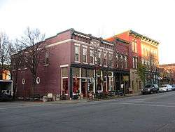 Upper Main Street Historic District |
May 24, 1990 (#90000814) |
Roughly bounded by Ferry St., 6th St., Columbia St., and the Norfolk Southern railroad tracks 40°25′09″N 86°53′14″W |
Lafayette | |
| 46 | The Varsity | 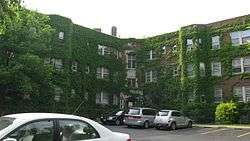 The Varsity |
December 7, 2001 (#01001342) |
101 Andrew Place 40°25′27″N 86°54′33″W |
West Lafayette | |
| 47 | Waldron-Beck House and Carriage House |  Waldron-Beck House and Carriage House |
February 9, 1984 (#84001661) |
829 N. 21st St. 40°25′33″N 86°52′21″W |
Lafayette | |
| 48 | James H. Ward House |  James H. Ward House |
April 7, 1988 (#88000385) |
1116 Columbia St. 40°25′06″N 86°53′02″W |
Lafayette |
Former listings
| [3] | Name on the Register | Image | Date listed | Date removed | Location | City or town | Summary |
|---|---|---|---|---|---|---|---|
| 1 | West Lafayette Baptist Church | September 6, 1979 (#79000046) | September 29, 1984 | 123 N. Chauncey St. |
West Lafayette |
See also
| Wikimedia Commons has media related to National Register of Historic Places in Tippecanoe County, Indiana. |
References
- The latitude and longitude information provided in this table was derived originally from the National Register Information System, which has been found to be fairly accurate for about 99% of listings. Some locations in this table may have been corrected to current GPS standards.
- "National Register of Historic Places: Weekly List Actions". National Park Service, United States Department of the Interior. Retrieved on June 19, 2020.
- Numbers represent an ordering by significant words. Various colorings, defined here, differentiate National Historic Landmarks and historic districts from other NRHP buildings, structures, sites or objects.
- "National Register Information System". National Register of Historic Places. National Park Service. March 13, 2009.
- The eight-digit number below each date is the number assigned to each location in the National Register Information System database, which can be viewed by clicking the number.
- Strezewski, Michael, et al. Archaeological Investigations at Site 12-T-59 and Two Other Locations in Prophetstown State Park, Tippecanoe County, Indiana. Digital ed. Fort Wayne: Indiana University-Purdue University at Fort Wayne, June 2006, 196.
- Location derived from its GNIS feature record; the NRIS lists the site as "Address Restricted"
- Bob Gross (April 11, 2015). "Old China Township bridge is going to Purdue". The Times Herald.
| Topics | |
|---|---|
| Lists by state |
|
| Lists by insular areas | |
| Lists by associated state | |
| Other areas | |
| Related | |
| |

Municipalities and communities of Tippecanoe County, Indiana, United States | ||
|---|---|---|
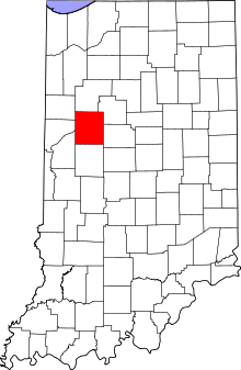
| Cities | Map of Indiana highlighting Tippecanoe County | |
| Towns | ||
| Townships | ||
| CDPs | ||
| Other unincorporated communities |
| |
| Ghost towns | ||
| Footnotes | ‡This populated place also has portions in an adjacent county or counties | |