National Register of Historic Places listings in Huntington County, Indiana
This is a list of the National Register of Historic Places listings in Huntington County, Indiana.
This is intended to be a complete list of the properties and districts on the National Register of Historic Places in Huntington County, Indiana, United States. Latitude and longitude coordinates are provided for many National Register properties and districts; these locations may be seen together in a map.[1]
There are 20 properties and districts listed on the National Register in the county. Another 2 properties were once listed but have been removed.
Properties and districts located in incorporated areas display the name of the municipality, while properties and districts in unincorporated areas display the name of their civil township. Properties and districts split between multiple jurisdictions display the names of all jurisdictions.
- This National Park Service list is complete through NPS recent listings posted June 19, 2020.[2]
Current listings
| [3] | Name on the Register[4] | Image | Date listed[5] | Location | City or town | Description |
|---|---|---|---|---|---|---|
| 1 | Chenoweth-Coulter Farm |  Chenoweth-Coulter Farm |
June 17, 2009 (#09000426) |
7067 S. Etna Rd., northeast of La Fontaine 40°43′29″N 85°34′04″W |
Wayne Township | |
| 2 | Chief Richardville House and Miami Treaty Grounds |  Chief Richardville House and Miami Treaty Grounds |
September 16, 1985 (#85002446) |
2 miles (3.2 km) west of downtown Huntington, southwest of the junction of U.S. Route 24 and State Roads 9/37 40°52′37″N 85°31′58″W |
Huntington and Huntington Township | |
| 3 | Drover Town Historic District | 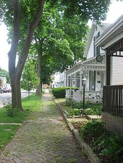 Drover Town Historic District |
September 20, 2006 (#06000852) |
Roughly bounded by the Little River, S. LaFontaine St., Olinger and Elm Sts., Ogan and Salamonie Ave., and Whitelock St. 40°52′39″N 85°29′38″W |
Huntington | |
| 4 | German Reformed Church | 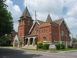 German Reformed Church |
April 11, 1985 (#85000724) |
202 Etna Ave. 40°52′40″N 85°29′38″W |
Huntington | |
| 5 | Hawley Heights Historic District | 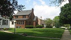 Hawley Heights Historic District |
September 28, 2003 (#03000983) |
Generally bounded by Oak, MacGahan, Cherry, and Collins Sts. 40°53′22″N 85°30′19″W |
Huntington | |
| 6 | Hotel LaFontaine |  Hotel LaFontaine |
February 9, 1984 (#84001056) |
200 W. State St. 40°52′52″N 85°29′42″W |
Huntington | |
| 7 | Huntington Courthouse Square Historic District |  Huntington Courthouse Square Historic District |
September 4, 1992 (#92001163) |
Roughly bounded by State, Court, and Cherry Sts., Park Dr., and the alley between Warren and Guilford Sts. 40°52′52″N 85°29′37″W |
Huntington | |
| 8 | John and Minerva Kline Farm |  John and Minerva Kline Farm |
December 22, 1988 (#88003038) |
2715 E. 400N, east of Huntington 40°53′19″N 85°23′59″W |
Union Township | |
| 9 | Memorial Park | 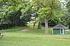 Memorial Park |
March 7, 2017 (#100000714) |
1200 W. Park Dr. 40°52′44″N 85°30′32″W |
Huntington | |
| 10 | Moore/Carlew Building | 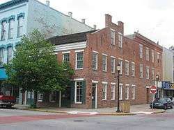 Moore/Carlew Building |
September 1, 1983 (#83000036) |
400 and 410-418 N. Jefferson St. 40°52′55″N 85°29′42″W |
Huntington | |
| 11 | North Jefferson Street Historic District | 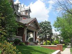 North Jefferson Street Historic District |
March 31, 2010 (#10000123) |
Roughly bounded by W. Park Dr. and College, Madison, Collins, Oak, Stephen, and Buchanan Sts. 40°53′11″N 85°29′57″W |
Huntington | |
| 12 | Old Plat Historic District |  Old Plat Historic District |
March 15, 2000 (#00000196) |
Roughly bounded by Warren, John, Wilkerson, Lincoln, Washington, 2nd, and Court Sts. 40°53′01″N 85°29′32″W |
Huntington | |
| 13 | David Alonzo and Elizabeth Purviance House |  David Alonzo and Elizabeth Purviance House |
March 17, 1994 (#94000225) |
809 N. Jefferson St. 40°53′06″N 85°29′50″W |
Huntington | |
| 14 | Samuel Purviance House |  Samuel Purviance House |
June 13, 1986 (#86001266) |
326 S. Jefferson 40°52′40″N 85°29′32″W |
Huntington | |
| 15 | Rangeline Road Bridge |  Rangeline Road Bridge |
April 3, 1998 (#98000306) |
County Road 475W over the Wabash River, west of Huntington 40°52′45″N 85°32′34″W |
Huntington Township | |
| 16 | Sunken Gardens | 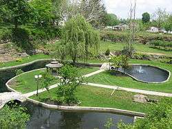 Sunken Gardens |
June 26, 1997 (#97000596) |
West Park Dr., southwest of the junction of U.S. Route 24 and La Fontaine St. 40°52′44″N 85°30′22″W |
Huntington | |
| 17 | Taylor-Zent House | 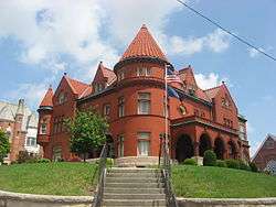 Taylor-Zent House |
February 11, 1982 (#82000041) |
715 N. Jefferson St. 40°53′04″N 85°29′50″W |
Huntington | |
| 18 | Victory Noll-St. Felix Friary Historic District |  Victory Noll-St. Felix Friary Historic District |
December 6, 2004 (#04001311) |
1900 W. Park Dr.-1280 Hitzfield St. 40°53′12″N 85°30′55″W |
Huntington | |
| 19 | William Street School | 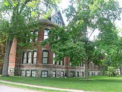 William Street School |
June 26, 1986 (#86001390) |
521 William St. 40°52′36″N 85°29′50″W |
Huntington | |
| 20 | Young-Yentes-Mattern Farm | 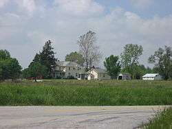 Young-Yentes-Mattern Farm |
April 12, 2001 (#01000361) |
Junction of Roads 900W and 400N, west of Huntington 40°53′20″N 85°37′30″W |
Dallas Township |
Former listings
| [3] | Name on the Register | Image | Date listed | Date removed | Location | City or town | Summary |
|---|---|---|---|---|---|---|---|
| 1 | Madame Margaret LaFolier House | February 19, 1982 (#82000040) | December 18, 1990 | West of Huntington on U.S. Route 24 |
Huntington | ||
| 2 | S.C. Snider and George McFeeley Polygonal Barn | April 2, 1993 (#93000185) | February 21, 2012 | State Roads 9/37, 0.5 miles (0.80 km) south of their junction with Division Rd. 40°49′27″N 85°32′05″W |
Huntington |
See also
| Wikimedia Commons has media related to National Register of Historic Places in Huntington County, Indiana. |
References
- The latitude and longitude information provided in this table was derived originally from the National Register Information System, which has been found to be fairly accurate for about 99% of listings. Some locations in this table may have been corrected to current GPS standards.
- "National Register of Historic Places: Weekly List Actions". National Park Service, United States Department of the Interior. Retrieved on June 19, 2020.
- Numbers represent an ordering by significant words. Various colorings, defined here, differentiate National Historic Landmarks and historic districts from other NRHP buildings, structures, sites or objects.
- "National Register Information System". National Register of Historic Places. National Park Service. March 13, 2009.
- The eight-digit number below each date is the number assigned to each location in the National Register Information System database, which can be viewed by clicking the number.
| Topics | |
|---|---|
| Lists by state |
|
| Lists by insular areas | |
| Lists by associated state | |
| Other areas | |
| Related | |
| |

Municipalities and communities of Huntington County, Indiana, United States | ||
|---|---|---|
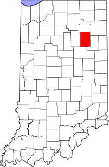
| City | Map of Indiana highlighting Huntington County | |
| Towns | ||
| Townships | ||
| Unincorporated communities | ||
| Footnotes | ‡This populated place also has portions in an adjacent county or counties | |