Walkerton, Indiana
Walkerton is a town in Lincoln Township, St. Joseph County, in the U.S. state of Indiana.[6] The population was 2,144 at the 2010 Census. It is part of the South Bend–Mishawaka, IN-MI, Metropolitan Statistical Area.
Walkerton, Indiana | |
|---|---|
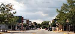 Downtown Walkerton | |
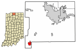 Location of Walkerton in St. Joseph County, Indiana. | |
| Coordinates: 41°27′50″N 86°29′4″W | |
| Country | United States |
| State | Indiana |
| County | St. Joseph |
| Township | Lincoln |
| Area | |
| • Total | 1.96 sq mi (5.08 km2) |
| • Land | 1.96 sq mi (5.08 km2) |
| • Water | 0.00 sq mi (0.00 km2) |
| Elevation | 722 ft (220 m) |
| Population | |
| • Total | 2,144 |
| • Estimate (2018)[4] | 2,259 |
| • Density | 1,153.49/sq mi (445.43/km2) |
| Time zone | UTC-5 (Eastern (EST)) |
| • Summer (DST) | UTC-4 (EDT) |
| ZIP code | 46574 |
| Area code(s) | 574 Exchange: 586 |
| FIPS code | 18-79694[5] |
| GNIS feature ID | 452831 |
| Website | http://www.walkerton.org/ |
History
Walkerton was platted in 1856.[7] It was named for John Walker, a railroad promoter.[7] The town was laid out by the railroad surveyors and the first lot was taken by C.W.N. Stephens, Walkerton's first postmaster. Stephens relocated his general store from nearby West York.[8] The Walkerton post office has been in operation since 1860.[9]
During World War II Walkerton housed some of the workers for the nearby Kingsbury Ordnance Plant.[10] The plant initially sought 10,000 workers, and the entire population of LaPorte numbered only 16,000 in 1940.[11] In August 1941 Kingsbury's first shells were loaded and en route to the front lines.[12]
In July 2006, Walkerton celebrated its sesquicentennial (150-year anniversary).
In April, 2015, Walkerton gained national attention after the owners of the town's local pizza parlor, Memories Pizza, became the first known Indiana business to advertise that it would not cater to a gay wedding after the passing of Indiana's Religious Freedom Restoration Act.[13]
Geography
According to the 2010 census, Walkerton has a total area of 1.96 square miles (5.08 km2), all land.[14]
Demographics
| Historical population | |||
|---|---|---|---|
| Census | Pop. | %± | |
| 1880 | 754 | — | |
| 1890 | 885 | 17.4% | |
| 1900 | 1,037 | 17.2% | |
| 1910 | 1,003 | −3.3% | |
| 1920 | 1,031 | 2.8% | |
| 1930 | 1,137 | 10.3% | |
| 1940 | 1,178 | 3.6% | |
| 1950 | 2,102 | 78.4% | |
| 1960 | 2,044 | −2.8% | |
| 1970 | 2,006 | −1.9% | |
| 1980 | 2,051 | 2.2% | |
| 1990 | 2,061 | 0.5% | |
| 2000 | 2,274 | 10.3% | |
| 2010 | 2,144 | −5.7% | |
| Est. 2018 | 2,259 | [4] | 5.4% |
| U.S. Decennial Census[15] | |||
2010 census
As of the census[3] of 2010, there were 2,144 people, 763 households, and 546 families living in the town. The population density was 1,093.9 inhabitants per square mile (422.4/km2). There were 850 housing units at an average density of 433.7 per square mile (167.5/km2). The racial makeup of the town was 95.0% White, 0.4% African American, 0.7% Native American, 0.3% Asian, 2.1% from other races, and 1.5% from two or more races. Hispanic or Latino of any race were 5.0% of the population.
There were 763 households of which 38.9% had children under the age of 18 living with them, 51.1% were married couples living together, 15.7% had a female householder with no husband present, 4.7% had a male householder with no wife present, and 28.4% were non-families. 24.2% of all households were made up of individuals and 10.7% had someone living alone who was 65 years of age or older. The average household size was 2.70 and the average family size was 3.18.
The median age in the town was 37.2 years. 26.5% of residents were under the age of 18; 8.9% were between the ages of 18 and 24; 24.7% were from 25 to 44; 25.4% were from 45 to 64; and 14.4% were 65 years of age or older. The gender makeup of the town was 46.9% male and 53.1% female.
2000 census
As of the census[5] of 2000, there were 2,274 people, 810 households, and 562 families living in the town. The population density was 1,310.6 people per square mile (504.6/km²). There were 860 housing units at an average density of 495.7 per square mile (190.8/km²). The racial makeup of the town was 94.24% White, 0.48% African American, 0.44% Native American, 0.35% Asian, 3.65% from other races, and 0.84% from two or more races. Hispanic or Latino of any race were 5.85% of the population.
There were 810 households out of which 37.0% had children under the age of 18 living with them, 49.4% were married couples living together, 14.7% had a female householder with no husband present, and 30.5% were non-families. 26.7% of all households were made up of individuals and 12.5% had someone living alone who was 65 years of age or older. The average household size was 2.67 and the average family size was 3.23.
In the town, the population was spread out with 29.2% under the age of 18, 9.1% from 18 to 24, 27.7% from 25 to 44, 18.0% from 45 to 64, and 15.9% who were 65 years of age or older. The median age was 34 years. For every 100 females, there were 90.6 males. For every 100 females age 18 and over, there were 86.0 males.
The median income for a household in the town was $36,481, and the median income for a family was $42,407. Males had a median income of $31,895 versus $24,583 for females. The per capita income for the town was $15,122. About 11.3% of families and 14.5% of the population were below the poverty line, including 19.9% of those under age 18 and 14.4% of those age 65 or over.
Education
The town has a lending library, the Walkerton-Lincoln Township Public Library.[16] The La Porte County Public Library also operates the Fish Lake Branch library within Walkerton town limits.[17] The Starke County Public Library System likewise operates a library with a Walkerton address, the Koontz Lake Branch.[18]
Notable people
- Harold C. Urey (1893–1981), winner of the 1934 Nobel Prize in Chemistry for the discovery of deuterium, was born in Walkerton.
- Walter LaFeber (b. 1933), noted historian of American foreign relations, was born in Walkerton.
- Chad Blount, NASCAR Nationwide Series driver
References
- "2016 U.S. Gazetteer Files". United States Census Bureau. Retrieved Jul 28, 2017.
- "US Board on Geographic Names". United States Geological Survey. 2007-10-25. Retrieved 2008-01-31.
- "U.S. Census website". United States Census Bureau. Retrieved 2012-12-11.
- "Population and Housing Unit Estimates". Retrieved December 20, 2019.
- "U.S. Census website". United States Census Bureau. Retrieved 2008-01-31.
- "Walkerton, Indiana". Geographic Names Information System. United States Geological Survey. Retrieved 2016-11-06.
- Howard, Timothy Edward (1907). A History of St. Joseph County, Indiana. Lewis publishing Company. pp. 316–317.
- "History". Town of Walkerton, Indiana. 2012-10-20. Retrieved 2017-12-26.
- "Saint Joseph County". Jim Forte Postal History. Retrieved 1 April 2015.
- "Kingsbury Ordnance Plant's history won't fade with time | What's New LaPorte?". whatsnewlaporte.com. Retrieved 2017-12-26.
- "The Kingsbury Ordnance Plant". Moment of Indiana History - Indiana Public Media. Retrieved 2017-12-26.
- "Kingsbury Ordnance Works: History and Images". SUBSTREET. 2015-11-08. Retrieved 2017-12-26.
- "Walkerton pizzeria once at center of national controversy has now closed". Retrieved 2019-06-15.
- "G001 - Geographic Identifiers - 2010 Census Summary File 1". United States Census Bureau. Archived from the original on 2020-02-13. Retrieved 2015-07-25.
- "Census of Population and Housing". Census.gov. Retrieved June 4, 2015.
- "Indiana public library directory" (PDF). Indiana State Library. Retrieved 15 March 2018.
- "Library Hours & Information". La Porte County Public Library. Retrieved 8 March 2018.
- "Hours & Locations". Starke County Public Library System. Retrieved 15 March 2018.
External links
Municipalities and communities of St. Joseph County, Indiana, United States | ||
|---|---|---|
| Cities | Map of Indiana highlighting St. Joseph County | |
| Towns | ||
| Townships | ||
| CDPs | ||
| Unincorporated communities | ||
| Footnotes | ‡This populated place also has portions in an adjacent county or counties | |