National Register of Historic Places listings in Lake County, Indiana
This is a list of the National Register of Historic Places listings in Lake County, Indiana.
This is intended to be a complete list of the properties and districts on the National Register of Historic Places in Lake County, Indiana, United States. Latitude and longitude coordinates are provided for many National Register properties and districts; these locations may be seen together in a map.[1]
There are 79 properties and districts listed on the National Register in the county. Another 2 properties were once listed but have been removed.
Properties and districts located in incorporated areas display the name of the municipality, while properties and districts in unincorporated areas display the name of their civil township. Properties and districts split between multiple jurisdictions display the names of all jurisdictions.
- This National Park Service list is complete through NPS recent listings posted June 19, 2020.[2]
Current listings
| [3] | Name on the Register[4] | Image | Date listed[5] | Location | City or town | Description |
|---|---|---|---|---|---|---|
| 1 | Walter Allman House |  Walter Allman House |
December 27, 2010 (#10001077) |
102 S. East St. 41°25′04″N 87°21′43″W |
Crown Point | |
| 2 | American Sheet and Tin Mill Apartment Building | 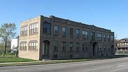 American Sheet and Tin Mill Apartment Building |
June 17, 2009 (#09000427) |
633 W. 4th Ave. 41°36′13″N 87°20′44″W |
Gary | |
| 3 | Louis J. Bailey Branch Library-Gary International Institute |  Louis J. Bailey Branch Library-Gary International Institute |
September 29, 2004 (#04001102) |
1501 S. Madison St. 41°35′16″N 87°20′29″W |
Gary | |
| 4 | James Brannon House |  James Brannon House |
March 21, 2011 (#11000120) |
260 Burnham St. 41°17′42″N 87°24′53″W |
Lowell | |
| 5 | Buckley Homestead | 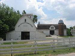 Buckley Homestead |
December 6, 1984 (#84000503) |
3606 Belshaw Rd., southeast of Lowell 41°16′53″N 87°22′43″W |
Cedar Creek Township | |
| 6 | Wellington A. Clark House | 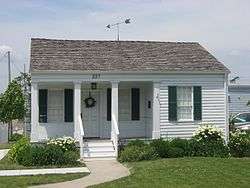 Wellington A. Clark House |
June 6, 2001 (#01000619) |
227 S. Court St. 41°24′57″N 87°21′57″W |
Crown Point | |
| 7 | Combs Addition Historic District | 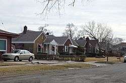 Combs Addition Historic District |
September 30, 2014 (#14000805) |
400 and 500 blocks of Rutledge and Ellsworth Sts., and the 500 block of Marshall St. between 4th and 6th Aves. 41°36′10″N 87°22′10″W |
Gary | |
| 8 | Crawford-Winslow House |  Crawford-Winslow House |
June 25, 2013 (#13000422) |
357 S. Main St. 41°24′47″N 87°21′53″W |
Crown Point | |
| 9 | Crown Point Courthouse Square Historic District | 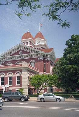 Crown Point Courthouse Square Historic District |
March 22, 2004 (#04000203) |
Roughly bounded by Clark St., the alley east of Main St., Hack Ct., and Court St.; also roughly bounded by Robinson, East, Walnut, and Court Sts.; also 208 Main St. 41°25′02″N 87°21′56″W |
Crown Point | Second set of boundaries represents a boundary adjustment of December 8, 2005; 208 Main represents a boundary increase of March 29, 2007 |
| 10 | Morse Dell Plain House and Garden | 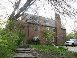 Morse Dell Plain House and Garden |
April 1, 1998 (#98000298) |
7109 Knickerbocker Parkway 41°35′03″N 87°28′39″W |
Hammond | |
| 11 | Ralph Waldo Emerson School | 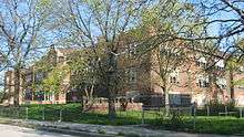 Ralph Waldo Emerson School |
June 9, 1995 (#95000702) |
716 E. 7th Ave. 41°35′57″N 87°19′39″W |
Gary | |
| 12 | Eskilson Historic District | 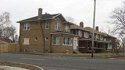 Eskilson Historic District |
March 26, 2014 (#14000073) |
Roughly bounded by W. 3rd Ave. and the alleys between Garfield and Hayes Sts., W. 4th Pl., and W. 5th Ave., Cleveland St., and McKinley St. 41°36′13″N 87°21′37″W |
Gary | |
| 13 | First Unitarian Church of Hobart |  First Unitarian Church of Hobart |
September 9, 1999 (#99001112) |
497 Main St. 41°31′48″N 87°15′11″W |
Hobart | |
| 14 | Forest-Ivanhoe Residential Historic District |  Forest-Ivanhoe Residential Historic District |
March 31, 2010 (#10000124) |
Roughly bounded by 172nd Pl., the eastern side of Forest Ave. south to its end, and the Little Calumet River 41°34′51″N 87°31′25″W |
Hammond | |
| 15 | Forest-Moraine Residential Historic District |  Forest-Moraine Residential Historic District |
September 23, 2010 (#10000777) |
Roughly bounded by Wildwood Rd., 165th St., Hohman Ave. and State Line Ave. 41°35′53″N 87°31′24″W |
Hammond | |
| 16 | Forest-Southview Residential Historic District |  Forest-Southview Residential Historic District |
September 23, 2010 (#10000778) |
Roughly bounded by 165th St., Hohman Ave., Locust St. and State Line Ave. 41°35′37″N 87°31′25″W |
Hammond | |
| 17 | Gary Bathing Beach Aquatorium | 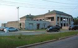 Gary Bathing Beach Aquatorium |
November 25, 1994 (#94001354) |
One Marquette Dr., Marquette Park 41°37′11″N 87°15′24″W |
Gary | |
| 18 | Gary City Center Historic District | 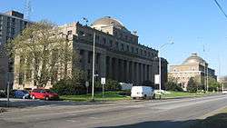 Gary City Center Historic District |
November 25, 1994 (#94001352) |
Roughly Broadway from the Chicago SouthShore and South Bend railroad tracks to 9th Ave. 41°36′01″N 87°20′13″W |
Gary | |
| 19 | Gary Land Company Building |  Gary Land Company Building |
May 8, 1979 (#79000021) |
4th Ave. and Massachusetts St. 41°36′15″N 87°20′09″W |
Gary | |
| 20 | Gary Public Schools Memorial Auditorium | 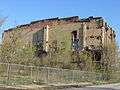 Gary Public Schools Memorial Auditorium |
November 25, 1994 (#94001353) |
700-734 Massachusetts St. 41°35′53″N 87°20′10″W |
Gary | |
| 21 | Gary Union Station | .jpg) Gary Union Station |
June 6, 2019 (#100004040) |
251 N. Broadway 41°36′20″N 87°20′13″W |
Gary | |
| 22 | Glendale Park Historic District | 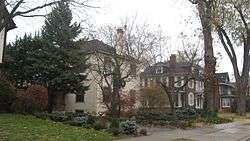 Glendale Park Historic District |
June 25, 2013 (#13000423) |
17-64 Glendale Parkway 41°36′07″N 87°31′24″W |
Hammond | |
| 23 | E.J. and E. Griffith Interlocking Tower | 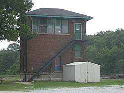 E.J. and E. Griffith Interlocking Tower |
September 28, 2003 (#03000980) |
201 S. Broad St. 41°31′16″N 87°25′39″W |
Griffith | |
| 24 | Griffith Grand Trunk Depot |  Griffith Grand Trunk Depot |
September 28, 2003 (#03000985) |
201 S. Broad St. 41°31′16″N 87°25′39″W |
Griffith | |
| 25 | Griffith State Bank | June 3, 2019 (#100004050) |
101 E. Main St. 41°31′22″N 87°25′39″W |
Griffith | ||
| 26 | Melvin A. Halsted House | 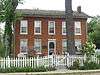 Melvin A. Halsted House |
December 8, 1978 (#78000037) |
201 E. Main St. 41°17′36″N 87°25′21″W |
Lowell | |
| 27 | Hansen Branch-Hammond Public Library | November 29, 2019 (#100004719) |
2823 Martha St., 6736 Alabama Ave. 41°35′26″N 87°27′38″W |
Hammond | ||
| 28 | Hobart Carnegie Library | 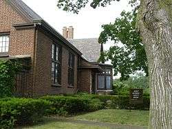 Hobart Carnegie Library |
July 15, 1982 (#82000047) |
706 E. 4th St. 41°31′55″N 87°15′07″W |
Hobart | |
| 29 | Hobart Commercial District |  Hobart Commercial District |
December 16, 2014 (#14001037) |
Roughly bounded by Lake George, the Norfolk Southern rail line, and Center and 2nd Sts.. 41°31′55″N 87°15′17″W |
Hobart | |
| 30 | Hobart First Methodist Episcopal Church | 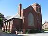 Hobart First Methodist Episcopal Church |
December 7, 2017 (#100001880) |
650 and 654 E. 4th St. 41°31′55″N 87°15′08″W |
Hobart | |
| 31 | Hohman Avenue Commercial Historic District |  Hohman Avenue Commercial Historic District |
March 21, 2011 (#11000118) |
Approximately three blocks lining Hohman Ave. between Clinton St. and Rimbach St. 41°37′02″N 87°31′19″W |
Hammond | |
| 32 | Hoosier Theater Building |  Hoosier Theater Building |
February 18, 1987 (#87000069) |
1329-1335 119th St. 41°40′46″N 87°29′47″W |
Whiting | |
| 33 | Ibach House | 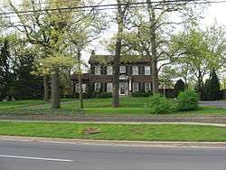 Ibach House |
December 27, 2010 (#10001078) |
1908 Ridge Rd. 41°33′26″N 87°28′56″W |
Munster | |
| 34 | Indi-Illi Park Historic District | 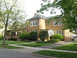 Indi-Illi Park Historic District |
June 15, 2012 (#12000335) |
Roughly bounded by Locust and 169th Sts., and Hohman and State Line Aves. 41°35′24″N 87°31′28″W |
Hammond | |
| 35 | Indiana Harbor Public Library | 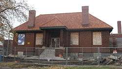 Indiana Harbor Public Library |
September 15, 2005 (#05001014) |
3605 Grand Ave. 41°38′51″N 87°26′58″W |
East Chicago | |
| 36 | Jackson-Monroe Terraces Historic District | 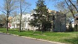 Jackson-Monroe Terraces Historic District |
June 17, 2009 (#09000428) |
404-423 Jackson St. and 408-426 Monroe St. 41°36′12″N 87°20′39″W |
Gary | |
| 37 | Jefferson Street Historic District | 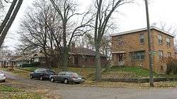 Jefferson Street Historic District |
September 18, 2013 (#13000723) |
Roughly bounded by Washington St. and 37th, 35th, Jefferson, and Madison Aves. 41°33′10″N 87°20′21″W |
Gary | |
| 38 | Francis P. Keilman House | 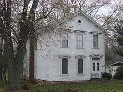 Francis P. Keilman House |
March 20, 2013 (#13000084) |
9260 Patterson St. 41°27′03″N 87°28′17″W |
St. John | |
| 39 | Kingsbury-Doak Farmhouse |  Kingsbury-Doak Farmhouse |
September 15, 2005 (#05001013) |
4411 E. 153rd Ave., west of Hebron 41°20′20″N 87°17′11″W |
Eagle Creek Township | |
| 40 | Knights of Columbus Building | 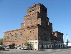 Knights of Columbus Building |
March 1, 1984 (#84001065) |
333 W. 5th Ave. 41°36′06″N 87°20′30″W |
Gary | |
| 41 | Lake County Courthouse |  Lake County Courthouse |
May 17, 1973 (#73000073) |
Public Sq. 41°25′02″N 87°21′57″W |
Crown Point | |
| 42 | Lake County Tuberculosis Sanatorium, Nurses Home and Superintendent's House |  Lake County Tuberculosis Sanatorium, Nurses Home and Superintendent's House |
June 17, 2005 (#05000608) |
2323 N. Main St. and 425 W. 93rd Ave. 41°27′04″N 87°21′55″W |
Crown Point | 427 W. 93rd represents a boundary increase of January 9, 2013 |
| 43 | Lake County Sheriff's House and Jail | 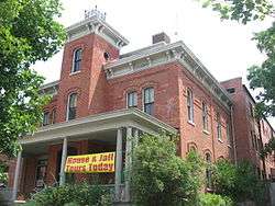 Lake County Sheriff's House and Jail |
January 4, 1989 (#88003039) |
232 S. Main St. 41°24′56″N 87°21′51″W |
Crown Point | |
| 44 | Lassen Hotel | 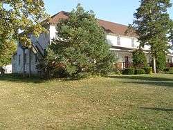 Lassen Hotel |
July 7, 1981 (#81000019) |
7808 W. 138th Pl. 41°22′06″N 87°25′30″W |
Cedar Lake | |
| 45 | Lincoln Street Historic District | 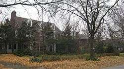 Lincoln Street Historic District |
December 31, 2013 (#13001012) |
Roughly bounded by Fillmore and Hayes Sts. and 6th and 8th Aves. 41°35′57″N 87°21′17″W |
Gary | |
| 46 | Lowell Commercial Historic District |  Lowell Commercial Historic District |
March 26, 2003 (#03000144) |
305-519 Commercial Ave. and 108-110 Clark St. 41°17′30″N 87°25′23″W |
Lowell | |
| 47 | Albert Maack House | 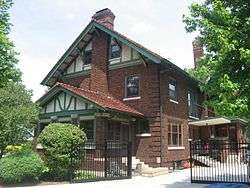 Albert Maack House |
June 23, 2011 (#11000383) |
498 S. Court St. 41°24′34″N 87°21′58″W |
Crown Point | |
| 48 | Horace Mann Historic District | 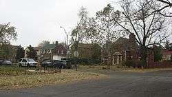 Horace Mann Historic District |
September 18, 2013 (#13000722) |
Roughly bounded by W. 5th, 8th, and 7th Aves., and Cleveland and Roosevelt Sts. 41°36′00″N 87°21′47″W |
Gary | |
| 49 | Marktown Historic District | 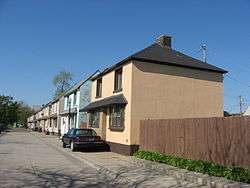 Marktown Historic District |
February 20, 1975 (#75000025) |
Bounded by Pine, Riley, Dickey, and 129th Sts. 41°39′31″N 87°28′04″W |
East Chicago | |
| 50 | MATERIAL SERVICE (shipwreck) |  MATERIAL SERVICE (shipwreck) |
March 25, 2014 (#14000074) |
Lake Michigan, northeast of Calumet Harbor[6] 41°44′33″N 87°30′23″W |
North Township | |
| 51 | Joseph Ernest Meyer House |  Joseph Ernest Meyer House |
March 1, 1984 (#84001068) |
1370 Joliet St. 41°29′26″N 87°29′48″W |
Dyer | |
| 52 | Miller Town Hall | 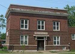 Miller Town Hall |
July 7, 1978 (#78000038) |
Junction of Miller Ave., Old Hobart Rd., and Grand Boulevard 41°36′02″N 87°15′41″W |
Gary | |
| 53 | Monon Park Dancing Pavilion | 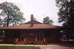 Monon Park Dancing Pavilion |
January 3, 2001 (#00001540) |
13701 Lauerman St. 41°22′07″N 87°26′22″W |
Cedar Lake | |
| 54 | Monroe Terrace Historic District | 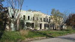 Monroe Terrace Historic District |
June 17, 2009 (#09000429) |
304-318 Monroe St. 41°36′19″N 87°20′37″W |
Gary | |
| 55 | Morgan-Skinner-Boyd Homestead | 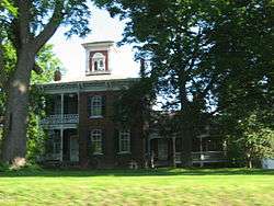 Morgan-Skinner-Boyd Homestead |
December 27, 2010 (#10001079) |
111 E. 73rd Ave. 41°29′08″N 87°20′02″W |
Merrillville | |
| 56 | Morningside Historic District |  Morningside Historic District |
September 24, 2009 (#09000758) |
Roughly bounded by the eastern side of Washington, the western side of Jefferson, and 45th and 47th Sts. 41°32′05″N 87°20′22″W |
Gary | |
| 57 | Charles E. Nichols House | 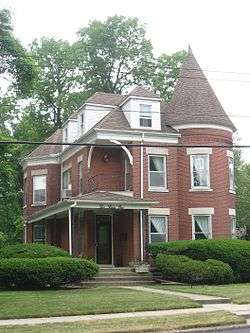 Charles E. Nichols House |
June 24, 2010 (#10000375) |
231 W. Commercial Ave. 41°17′23″N 87°25′39″W |
Lowell | |
| 58 | Northern States Life Insurance Company | 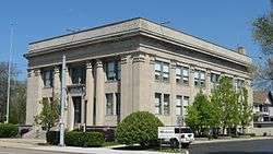 Northern States Life Insurance Company |
June 24, 2010 (#10000376) |
5935 Hohman Ave. 41°36′20″N 87°31′18″W |
Hammond | |
| 59 | Pennsylvania Railroad Station |  Pennsylvania Railroad Station |
March 1, 1984 (#84001070) |
1001 Lillian St. 41°32′04″N 87°14′50″W |
Hobart | |
| 60 | Polk Street Concrete Cottage Historic District | 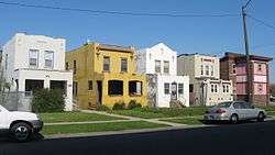 Polk Street Concrete Cottage Historic District |
September 15, 2011 (#11000657) |
604-614 Polk St. 41°35′59″N 87°21′00″W |
Gary | |
| 61 | Polk Street Terraces Historic District | 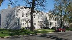 Polk Street Terraces Historic District |
June 17, 2009 (#09000430) |
404-422 and 437-455 Polk St. 41°36′13″N 87°20′59″W |
Gary | |
| 62 | Pullman-Standard Historic District | 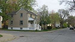 Pullman-Standard Historic District |
April 10, 2012 (#12000186) |
Roughly bounded by Columbia, Field, Porter, and Willard Aves. 41°36′17″N 87°29′53″W |
Hammond | |
| 63 | Theodore Roosevelt High School | 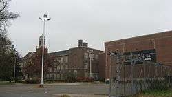 Theodore Roosevelt High School |
December 19, 2012 (#12001059) |
730 W. 25th St. 41°34′28″N 87°20′42″W |
Gary | |
| 64 | Roselawn-Forest Heights Historic District | 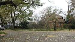 Roselawn-Forest Heights Historic District |
December 19, 2012 (#12001060) |
Roughly bounded by Lawndale, 172nd Pl., and Hohman and State Line Aves. 41°35′12″N 87°31′26″W |
Hammond | |
| 65 | John Ross Farm | 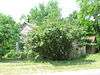 John Ross Farm |
March 27, 1996 (#96000283) |
3815 E. U.S. Route 231, northwest of Leroy 41°22′14″N 87°17′21″W |
Winfield Township | |
| 66 | J. Claude Rumsey House |  J. Claude Rumsey House |
December 22, 2008 (#08001211) |
709 Michigan Ave. 41°17′44″N 87°25′00″W |
Lowell | |
| 67 | Barney Sablotny House | 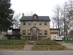 Barney Sablotny House |
December 19, 2012 (#12001061) |
501 W. 47th St. 41°31′59″N 87°20′33″W |
Gary | |
| 68 | St. Augustine's Episcopal Church | 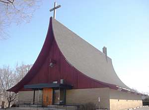 St. Augustine's Episcopal Church |
September 18, 2013 (#13000758) |
2425 W. 19th Ave. 41°35′03″N 87°22′05″W |
Gary | |
| 69 | St. John's Lutheran Church and School |  St. John's Lutheran Church and School |
December 3, 2019 (#100004723) |
2271 West 10th Ave. 41°35′35″N 87°21′57″W |
Gary | |
| 70 | Southmoor Apartment Hotel | 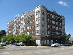 Southmoor Apartment Hotel |
March 21, 2011 (#11000125) |
5946 Hohman Ave. 41°36′19″N 87°31′20″W |
Hammond | |
| 71 | Stallbohm Barn-Kaske House | 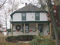 Stallbohm Barn-Kaske House |
April 1, 1998 (#98000303) |
1154 Ridge Rd. 41°33′35″N 87°30′01″W |
Munster | |
| 72 | State Bank of Hammond Building | 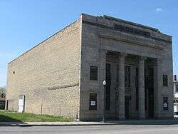 State Bank of Hammond Building |
September 27, 1984 (#84001072) |
5444-5446 Calumet Ave. 41°36′51″N 87°30′33″W |
Hammond | |
| 73 | State Street Commercial Historic District | 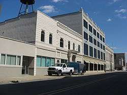 State Street Commercial Historic District |
September 17, 1999 (#99001157) |
Roughly State St. between Sohl and Bulletin Ave. 41°37′07″N 87°31′00″W |
Hammond | |
| 74 | Van Buren Terrace Historic District | 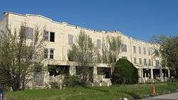 Van Buren Terrace Historic District |
June 22, 2007 (#07000565) |
336-354 Van Buren St. 41°36′17″N 87°20′47″W |
Gary | |
| 75 | West Fifth Avenue Apartments Historic District |  West Fifth Avenue Apartments Historic District |
May 17, 1984 (#84001076) |
Roughly 5th Ave. from Taft to Pierce St. 41°36′06″N 87°21′29″W |
Gary | |
| 76 | William Whitaker Landscape and House | 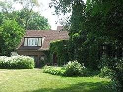 William Whitaker Landscape and House |
September 9, 1999 (#99001107) |
472 S. Main St. 41°24′37″N 87°21′50″W |
Crown Point | |
| 77 | Whiting Memorial Community House |  Whiting Memorial Community House |
February 8, 1980 (#80000044) |
1938 Clark St. 41°40′41″N 87°29′47″W |
Whiting | |
| 78 | George John Wolf House | 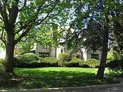 George John Wolf House |
June 21, 2007 (#07000563) |
7220 Forest Ave. 41°34′57″N 87°31′27″W |
Hammond | |
| 79 | John Wood Old Mill | 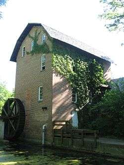 John Wood Old Mill |
October 10, 1975 (#75000026) |
East of central Merrillville on State Road 330 41°28′36″N 87°13′18″W |
Merrillville |
Former listings
| [3] | Name on the Register | Image | Date listed | Date removed | Location | City or town | Summary |
|---|---|---|---|---|---|---|---|
| 1 | John Stewart Settlement House | June 7, 1978 (#78000039) | November 4, 1992 | 1501 Massachusetts St. |
Gary | ||
| 2 | Wilbur Wynant House | 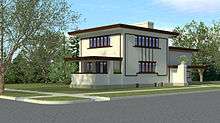 Wilbur Wynant House |
October 18, 2002 (#02001168) | December 15, 2011 | 600 Fillmore St. 41°36′00″N 87°21′05″W |
Gary | A house discovered in 1995 to have been designed by Frank Lloyd Wright. Largely burned in 2006. |
See also
| Wikimedia Commons has media related to National Register of Historic Places in Lake County, Indiana. |
References
- The latitude and longitude information provided in this table was derived originally from the National Register Information System, which has been found to be fairly accurate for about 99% of listings. Some locations in this table may have been corrected to current GPS standards.
- "National Register of Historic Places: Weekly List Actions". National Park Service, United States Department of the Interior. Retrieved on June 19, 2020.
- Numbers represent an ordering by significant words. Various colorings, defined here, differentiate National Historic Landmarks and historic districts from other NRHP buildings, structures, sites or objects.
- "National Register Information System". National Register of Historic Places. National Park Service. March 13, 2009.
- The eight-digit number below each date is the number assigned to each location in the National Register Information System database, which can be viewed by clicking the number.
- Screening Level Risk Assessment Package: Material Service. Office of Response and Restoration, National Oceanic and Atmospheric Administration, 2013-03, 1. Accessed 2014-04-10.
| Topics | |
|---|---|
| Lists by state |
|
| Lists by insular areas | |
| Lists by associated state | |
| Other areas | |
| Related | |
| |

Municipalities and communities of Lake County, Indiana, United States | ||
|---|---|---|
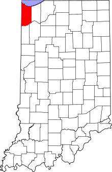
| Cities | Map of Indiana highlighting Lake County | |
| Towns | ||
| Townships | ||
| CDPs | ||
| Other unincorporated communities | ||
| Ghost town | ||
| Footnotes | ‡This populated place also has portions in an adjacent county or counties. | |