National Register of Historic Places listings in Pulaski County, Indiana
This is a list of the National Register of Historic Places listings in Pulaski County, Indiana.
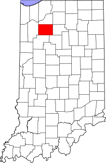
Location of Pulaski County in Indiana
This is intended to be a complete list of the properties on the National Register of Historic Places in Pulaski County, Indiana, United States. Latitude and longitude coordinates are provided for many National Register properties; these locations may be seen together in a map.[1]
There are 7 properties listed on the National Register in the county.
Properties and districts located in incorporated areas display the name of the municipality, while properties and districts in unincorporated areas display the name of their civil township. Properties and districts split between multiple jurisdictions display the names of all jurisdictions.
- This National Park Service list is complete through NPS recent listings posted June 19, 2020.[2]
Current listings
| [3] | Name on the Register[4] | Image | Date listed[5] | Location | City or town | Description |
|---|---|---|---|---|---|---|
| 1 | Mallon Building | 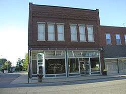 Mallon Building |
September 17, 1999 (#99001151) |
102 E. Montgomery St. 40°59′07″N 86°52′53″W |
Francesville | |
| 2 | Monterey Bandstand | 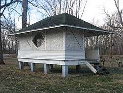 Monterey Bandstand |
June 15, 2012 (#12000339) |
Walnut St. 41°09′35″N 86°28′50″W |
Monterey | |
| 3 | Pulaski County Courthouse | 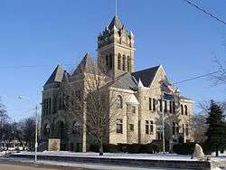 Pulaski County Courthouse |
December 19, 2007 (#07001282) |
112 E. Main St. 41°03′03″N 86°36′14″W |
Winamac | |
| 4 | Pulaski County Home | 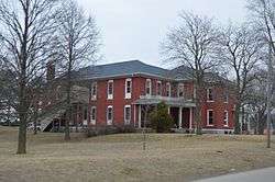 Pulaski County Home |
March 17, 2015 (#15000079) |
700 W. 60 S. 41°02′46″N 86°37′00″W |
Monroe Township | |
| 5 | Tepicon Hall | 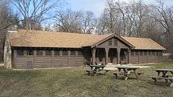 Tepicon Hall |
April 3, 1992 (#92000189) |
Tippecanoe River State Park, north of Winamac 41°08′58″N 86°35′38″W |
Franklin Township | |
| 6 | Dr. George W. Thompson House | 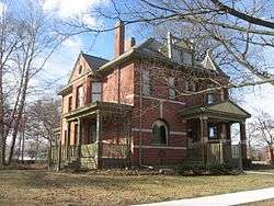 Dr. George W. Thompson House |
September 27, 1984 (#84001233) |
407 N. Market St. 41°03′13″N 86°36′22″W |
Winamac | |
| 7 | Vurpillat's Opera House | 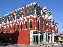 Vurpillat's Opera House |
March 20, 2002 (#02000201) |
Junction of Market and Main Sts. 41°03′04″N 86°36′15″W |
Winamac |
See also
| Wikimedia Commons has media related to National Register of Historic Places in Pulaski County, Indiana. |
References
- The latitude and longitude information provided in this table was derived originally from the National Register Information System, which has been found to be fairly accurate for about 99% of listings. Some locations in this table may have been corrected to current GPS standards.
- "National Register of Historic Places: Weekly List Actions". National Park Service, United States Department of the Interior. Retrieved on June 19, 2020.
- Numbers represent an ordering by significant words. Various colorings, defined here, differentiate National Historic Landmarks and historic districts from other NRHP buildings, structures, sites or objects.
- "National Register Information System". National Register of Historic Places. National Park Service. March 13, 2009.
- The eight-digit number below each date is the number assigned to each location in the National Register Information System database, which can be viewed by clicking the number.
| Topics | |
|---|---|
| Lists by state |
|
| Lists by insular areas | |
| Lists by associated state | |
| Other areas | |
| Related | |
| |

Municipalities and communities of Pulaski County, Indiana, United States | ||
|---|---|---|
| Towns | Map of Indiana highlighting Pulaski County | |
| Townships | ||
| CDP | ||
| Other unincorporated communities | ||
This article is issued from Wikipedia. The text is licensed under Creative Commons - Attribution - Sharealike. Additional terms may apply for the media files.