National Register of Historic Places listings in Union County, Indiana
This is a list of the National Register of Historic Places listings in Union County, Indiana.
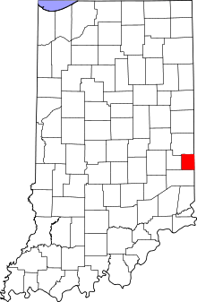
This is intended to be a complete list of the properties and districts on National Register of Historic Places in Union County, Indiana, United States. Latitude and longitude coordinates are provided for many National Register properties and districts; these locations may be seen together in a map.[1]
There are 3 properties and districts listed on the National Register in the county. Another 2 properties were once listed but have been removed. Properties and districts located in incorporated areas display the name of the municipality, while properties and districts in unincorporated areas display the name of their civil township. Properties and districts split between multiple jurisdictions display the names of all jurisdictions.
- This National Park Service list is complete through NPS recent listings posted June 19, 2020.[2]
Current listings
| [3] | Name on the Register[4] | Image | Date listed[5] | Location | City or town | Description |
|---|---|---|---|---|---|---|
| 1 | Liberty Courthouse Square Historic District | .jpg) Liberty Courthouse Square Historic District |
December 31, 2013 (#13001018) |
Courthouse Square and adjacent blocks along Union and Market Sts. 39°38′08″N 84°55′48″W |
Liberty | |
| 2 | Liberty Residential Historic District | .jpg) Liberty Residential Historic District |
December 31, 2013 (#13001017) |
28 and 103-403 E. Union, 4-8 W. Seminary, 2-124 E. Seminary, and 1-7 S. Fairground Sts., and 2 and 102 College Corner Ave. 39°38′08″N 84°55′39″W |
Liberty | |
| 3 | Union County Courthouse | .jpg) Union County Courthouse |
July 21, 1987 (#87000103) |
Courthouse Sq. 39°38′05″N 84°55′50″W |
Liberty |
Former listings
| [3] | Name on the Register | Image | Date listed | Date removed | Location | City or town | Summary |
|---|---|---|---|---|---|---|---|
| 1 | Brownsville Covered Bridge | October 15, 1973 (#73002283) | October 16, 1974 | Off State Road 14 |
Brownsville | ||
| 2 | Dr. John Grove House and Office | February 11, 1982 (#82000081) | July 19, 1985 | 23-27 S. Market St |
Liberty |
See also
| Wikimedia Commons has media related to National Register of Historic Places in Union County, Indiana. |
References
- The latitude and longitude information provided in this table was derived originally from the National Register Information System, which has been found to be fairly accurate for about 99% of listings. Some locations in this table may have been corrected to current GPS standards.
- "National Register of Historic Places: Weekly List Actions". National Park Service, United States Department of the Interior. Retrieved on June 19, 2020.
- Numbers represent an ordering by significant words. Various colorings, defined here, differentiate National Historic Landmarks and historic districts from other NRHP buildings, structures, sites or objects.
- "National Register Information System". National Register of Historic Places. National Park Service. March 13, 2009.
- The eight-digit number below each date is the number assigned to each location in the National Register Information System database, which can be viewed by clicking the number.
| Topics | |
|---|---|
| Lists by state |
|
| Lists by insular areas | |
| Lists by associated state | |
| Other areas | |
| Related | |
| |

Municipalities and communities of Union County, Indiana, United States | ||
|---|---|---|
| Towns | Map of Indiana highlighting Union County | |
| Townships | ||
| Unincorporated communities | ||