Wilmington, New York
Wilmington is a town in Essex County, New York, United States. The population was 1,253 at the 2010 census.[4] The town is named after Wilmington, Vermont.
Wilmington, New York | |
|---|---|
Town | |
.JPG) Whiteface Mountain as seen from the Esther Mountain | |
 Location in Essex County and the state of New York | |
| Coordinates: 44°23′30″N 73°48′13″W | |
| Country | United States |
| State | New York |
| County | Essex |
| Government | |
| • Type | Town Council |
| • Town Supervisor | Roy Holzer |
| • Town Council | Members' List
|
| Area | |
| • Total | 65.47 sq mi (169.57 km2) |
| • Land | 65.22 sq mi (168.93 km2) |
| • Water | 0.25 sq mi (0.64 km2) |
| Elevation | 1,093 ft (333 m) |
| Population (2010) | |
| • Total | 1,253 |
| • Estimate (2016)[2] | 1,264 |
| • Density | 19.38/sq mi (7.48/km2) |
| Time zone | UTC-5 (Eastern (EST)) |
| • Summer (DST) | UTC-4 (EDT) |
| ZIP code | 12997 |
| Area code(s) | 518 |
| FIPS code | 36-031-82315 |
| GNIS feature ID | 0979644[3] |
| Website | www |
Wilmington is on the county's northern border and is southwest of Plattsburgh. It is in the Whiteface region of the Adirondack Park.
History
The town was first settled circa 1812.
The town was formed in 1821 from the town of Jay. At that time, the town was called "Dansville". In 1822, the name was changed, as suggested by a settler from Vermont, to "Wilmington" due to confusion with another "Dansville" in New York. In 1848, part of the town was partitioned off to form the town of St. Armand.
At the beginning of the 20th century, the tourist industry began to develop in the town.
"Santa's Workshop", one of the first American theme parks for children, is located near the community of North Pole. Whiteface Mountain (4,870 feet) was the site of alpine events for the 1932 and 1980 Winter Olympics.
Geography
According to the United States Census Bureau, the town has a total area of 65.3 square miles (169.0 km2), of which 65.3 square miles (169.0 km2) is land and 0.2 square miles (0.6 km2), or 0.36%, is water.[4]
The north town line is the border of Clinton County. At the northwest corner is the corresponding corner of Franklin County.
The West Branch of the Ausable River flows northeastward through the center of the town.
New York State Route 431, an east–west highway known as Whiteface Mountain Memorial Highway, intersects New York State Route 86, a north–south highway in Wilmington village.
Demographics
| Historical population | |||
|---|---|---|---|
| Census | Pop. | %± | |
| 1830 | 695 | — | |
| 1840 | 928 | 33.5% | |
| 1850 | 1,218 | 31.3% | |
| 1860 | 861 | −29.3% | |
| 1870 | 794 | −7.8% | |
| 1880 | 899 | 13.2% | |
| 1890 | 678 | −24.6% | |
| 1900 | 634 | −6.5% | |
| 1910 | 573 | −9.6% | |
| 1920 | 545 | −4.9% | |
| 1930 | 567 | 4.0% | |
| 1940 | 737 | 30.0% | |
| 1950 | 574 | −22.1% | |
| 1960 | 683 | 19.0% | |
| 1970 | 777 | 13.8% | |
| 1980 | 1,051 | 35.3% | |
| 1990 | 1,020 | −2.9% | |
| 2000 | 1,131 | 10.9% | |
| 2010 | 1,253 | 10.8% | |
| Est. 2016 | 1,264 | [2] | 0.9% |
| U.S. Decennial Census[5] | |||
At the 2000 census,[6] there were 1,131 people, 460 households and 304 families residing in the town. The population density was 17.4 people per square mile (6.7/km²). There were 734 housing units at an average density of 11.3 per square mile (4.3/km²). The racial makeup of the town was 98.59% White, 0.09% African American, 0.35% Native American, 0.09% Asian, 0.18% from other races, and 0.71% from two or more races. Hispanic or Latino of any race were 0.62% of the population.
There were 460 households of which 35.0% had children under the age of 18 living with them, 53.0% were married couples living together, 8.7% had a female householder with no husband present, and 33.7% were non-families. 27.4% of all households were made up of individuals and 10.9% had someone living alone who was 65 years of age or older. The average household size was 2.46 and the average family size was 3.01.
27.7% of the population were under the age of 18, 5.9% from 18 to 24, 29.2% from 25 to 44, 23.7% from 45 to 64, and 13.5% who were 65 years of age or older. The median age was 36 years. For every 100 females, there were 97.0 males. For every 100 females age 18 and over, there were 96.6 males.
The median household income was $34,432 and the median family income was $43,077. Males had a median income of $27,604 and females $21,328. The per capita income was $18,052. About 6.6% of families and 10.0% of the population were below the poverty line, including 11.3% of those under age 18 and 4.7% of those age 65 or over.
Communities and locations in Wilmington
- Haselton – A hamlet in the northeast part of the town on County Road 12 and the Ausable River.
- High Falls Gorge – A location on NY 86, south of Wilmington village.
- North Pole – A community and theme park (Santa's Workshop) northwest of Wilmington village on NY 431.
- Wilmington – The hamlet of Wilmington is at the junction of Routes NY-86 and NY-431 and the Au Sable River, near the town's center. The community is a resort and skiing center.
See also
References
- "2016 U.S. Gazetteer Files". United States Census Bureau. Retrieved Jul 4, 2017.
- "Population and Housing Unit Estimates". Retrieved June 9, 2017.
- "US Board on Geographic Names". United States Geological Survey. 2007-10-25. Retrieved 2008-01-31.
- "Geographic Identifiers: 2010 Demographic Profile Data (G001): Wilmington town, Essex County, New York". U.S. Census Bureau, American Factfinder. Retrieved March 8, 2016.
- "Census of Population and Housing". Census.gov. Retrieved June 4, 2015.
- "U.S. Census website". United States Census Bureau. Retrieved 2008-01-31.
External links
| Wikimedia Commons has media related to Wilmington, New York. |
- Town of Wilmington official website
- Early Wilmington history
- Wilmington tourism information
- Historical summary of Wilmington, NY
- Wilmington Historical Society
Municipalities and communities of Essex County, New York, United States | ||
|---|---|---|
| Towns | 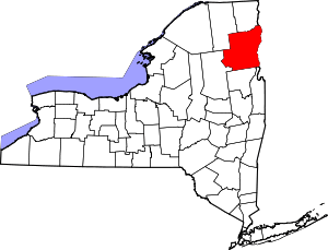 Map of New York highlighting Essex County | |
| Villages | ||
| CDPs | ||
| Other hamlets | ||
| Footnotes | ‡This populated place also has portions in an adjacent county or counties | |
| Authority control |
|
|---|