Clinton County, New York
Clinton County is a county in the north-easternmost corner of the state of New York, in the United States and bordered by Canada. As of the 2010 United States Census, the population was 82,128.[1] Its county seat is the city of Plattsburgh.[2] The county lies just south of the border with the Canadian province of Quebec and to the west of the State of Vermont.
Clinton County | |
|---|---|
 | |
 Flag  Seal | |
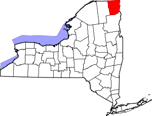 Location within the U.S. state of New York | |
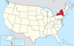 New York's location within the U.S. | |
| Coordinates: 44°44′N 73°41′W | |
| Country | |
| State | |
| Founded | 1788 |
| Named for | George Clinton |
| Seat | Plattsburgh |
| Largest city | Plattsburgh |
| Area | |
| • Total | 1,117.53 sq mi (2,894.4 km2) |
| • Land | 1,037.85 sq mi (2,688.0 km2) |
| • Water | 80 sq mi (200 km2) 7.1% |
| Population (2010) | |
| • Total | 82,128 |
| • Density | 79.1/sq mi (30.5/km2) |
| Time zone | UTC−5 (Eastern) |
| • Summer (DST) | UTC−4 (EDT) |
| Congressional district | 21st |
| Website | www |
The county is named for George Clinton, the first Governor of New York, who later was elected as Vice President. He had been a Founding Father who represented New York in the Continental Congress.
Clinton County comprises the Plattsburgh, New York Micropolitan statistical area.
History
.png)
When counties were established in New York State in 1683, the present Clinton County was part of Albany County. This was an enormous county, including the northern part of New York State as well as all of the present state of Vermont and, in theory, extending westward to the Pacific Ocean. This county was reduced in size on July 3, 1766, by the creation of Cumberland County, and further on March 16, 1770, by the creation of Gloucester County, both containing territory now in Vermont. On March 12, 1772, what was left of Albany County was split into three parts, one remaining under the name Albany County. One of the other pieces, Charlotte County, contained the eastern portion.
In 1784, the name "Charlotte County" was changed to Washington County to honor George Washington, the American Revolutionary War General and later the first President of the United States of America.
In 1788, Clinton County split off from Washington County.
In 1799, Essex County split from Clinton County.
In 1802, parts of Clinton, Herkimer, and Montgomery counties formed the new St. Lawrence County.
In 1808, Franklin County split from Clinton County.
Geography
Clinton County lies at the northeast corner of New York state. Its northern border abuts the Canadian province of Quebec. Its eastern border abuts the state of Vermont (across Lake Champlain). The encompassing region is referred to as the Adirondack Coast.[3]
The Saranac River flows easterly through the central part of the county, discharging into Lake Champlain at Plattsburgh, and the Great Chazy River flows northeastward through the upper part of the county, discharging into Lake Champlain at Coopersville. The Ausable River forms a large part of the southern county line.[4] The county's highest point is Lyon Mountain, in the town of Dannemora, at 3,830' (1167m) ASL.[5] According to the US Census Bureau, the county has a total area of 1,117.53 square miles (2,894.4 km2), of which 1,037.85 square miles (2,688.0 km2) is land and 79.67 square miles (206.3 km2) (7.1%) is water.[6]
Adjacent counties and municipalities
- Grand Isle County, Vermont — east
- Chittenden County, Vermont — southeast
- Essex County — south
- Franklin County — west
- Le Haut-Richelieu Regional County Municipality, Quebec — north
- Le Haut-Saint-Laurent Regional County Municipality, Quebec — north
- Les Jardins-de-Napierville Regional County Municipality, Quebec — north
Protected areas
- Adirondack Park (part)
- Ausable Marsh Wildlife Management Area
- Cadyville State Forest
- Chazy Fossil Reef National Natural Landmark (part)
- Dannemora State Forest
- Dunkin's Reserve State Forest
- Flat Rock State Forest
- Kings Bay Wildlife Management Area
- Macomb State Forest
- Miner Lake State Park[7]
- Monty's Bay Wildlife Management Area
- Point au Roche State Park
- Valcour Island
Lakes
- Chazy Lake[4]
- Fern Lake
- Lake Champlain (along east border)
- Mead Reservoir
- Military Pond
- Miner Lake
- Mud Pond
- Newberry Pond
- Patterson Reservoir
- Silver Lake
- Slush Pond
- Taylor Pond
- Union Falls Pond (part)
- Upper Chateaugay Lake
Government and politics
| Year | Republican | Democratic | Third parties |
|---|---|---|---|
| 2016 | 45.0% 14,449 | 46.9% 15,059 | 8.1% 2,597 |
| 2012 | 36.3% 11,115 | 61.9% 18,961 | 1.9% 580 |
| 2008 | 37.7% 12,579 | 60.6% 20,216 | 1.6% 542 |
| 2004 | 45.4% 15,330 | 52.2% 17,624 | 2.3% 782 |
| 2000 | 43.4% 13,274 | 50.9% 15,542 | 5.7% 1,743 |
| 1996 | 33.6% 9,759 | 53.0% 15,386 | 13.5% 3,915 |
| 1992 | 42.1% 13,455 | 40.3% 12,881 | 17.7% 5,652 |
| 1988 | 55.0% 15,702 | 44.4% 12,670 | 0.7% 191 |
| 1984 | 64.2% 19,549 | 35.5% 10,804 | 0.3% 90 |
| 1980 | 48.8% 13,120 | 42.8% 11,498 | 8.5% 2,272 |
| 1976 | 56.9% 15,433 | 42.6% 11,555 | 0.4% 115 |
| 1972 | 63.6% 17,048 | 36.2% 9,703 | 0.2% 53 |
| 1968 | 51.6% 11,951 | 43.8% 10,153 | 4.6% 1,064 |
| 1964 | 24.8% 6,078 | 75.1% 18,398 | 0.1% 16 |
| 1960 | 44.7% 11,154 | 55.2% 13,782 | 0.1% 15 |
| 1956 | 70.5% 16,295 | 29.5% 6,833 | 0.0% 0 |
| 1952 | 64.5% 14,535 | 35.3% 7,963 | 0.2% 37 |
| 1948 | 49.1% 9,694 | 47.4% 9,357 | 3.6% 704 |
| 1944 | 46.7% 8,775 | 53.2% 9,996 | 0.2% 35 |
| 1940 | 47.6% 10,369 | 52.2% 11,378 | 0.2% 53 |
| 1936 | 48.9% 10,521 | 50.6% 10,898 | 0.6% 119 |
| 1932 | 42.7% 8,263 | 56.9% 11,027 | 0.4% 75 |
| 1928 | 41.7% 7,824 | 58.0% 10,888 | 0.3% 59 |
| 1924 | 57.8% 7,918 | 37.5% 5,138 | 4.7% 642 |
| 1920 | 67.7% 9,062 | 30.7% 4,110 | 1.6% 213 |
| 1916 | 53.7% 4,986 | 44.5% 4,130 | 1.9% 172 |
| 1912 | 44.7% 3,903 | 38.1% 3,323 | 17.2% 1,497 |
| 1908 | 55.5% 5,474 | 39.2% 3,866 | 5.2% 516 |
| 1904 | 59.1% 6,327 | 37.2% 3,988 | 3.7% 397 |
| 1900 | 58.8% 6,326 | 39.9% 4,287 | 1.3% 143 |
| 1896 | 65.4% 6,005 | 33.5% 3,074 | 1.2% 110 |
| 1892 | 50.6% 5,135 | 47.0% 4,773 | 2.4% 241 |
| 1888 | 56.7% 6,271 | 42.7% 4,724 | 0.6% 61 |
| 1884 | 53.4% 5,973 | 46.1% 5,151 | 0.5% 54 |
Like much of the North Country region, Clinton County has historically been a Republican county. However, it has voted for Democratic candidates at the state and national level in recent times. Since 1996, it has voted for the Democratic candidate for president in every election. In the 2008 U.S. Presidential election, Barack Obama carried the county by a 22.9% margin over John McCain (Obama won every municipality in the county), and won by a 26.9% margin over McCain statewide.[9] In 2006, both Eliot Spitzer and Hillary Clinton carried the county, winning 63% and 64% of vote, respectively. In 2010, Governor Andrew Cuomo, and Senators Chuck Schumer and Kirsten Gillibrand won the county, each receiving more than 60% of the vote.
Republicans still win most local races. The county's Congressional district did not elect a Democrat to Congress until 2009 when Bill Owens defeated Doug Hoffman in the special election to replace John McHugh, who resigned to serve as the Obama Administration's Secretary of the Army. The special election received nationwide attention due to Hoffman, a third-party candidate and Tea Party favorite, polling higher than the Republican nominee, Dede Scozzafava, which ultimately led to her dropping out of the race and supporting Owens. It had not elected a Democrat to the State Senate or State Assembly in over a half-century until Billy Jones was elected to the State Assembly.
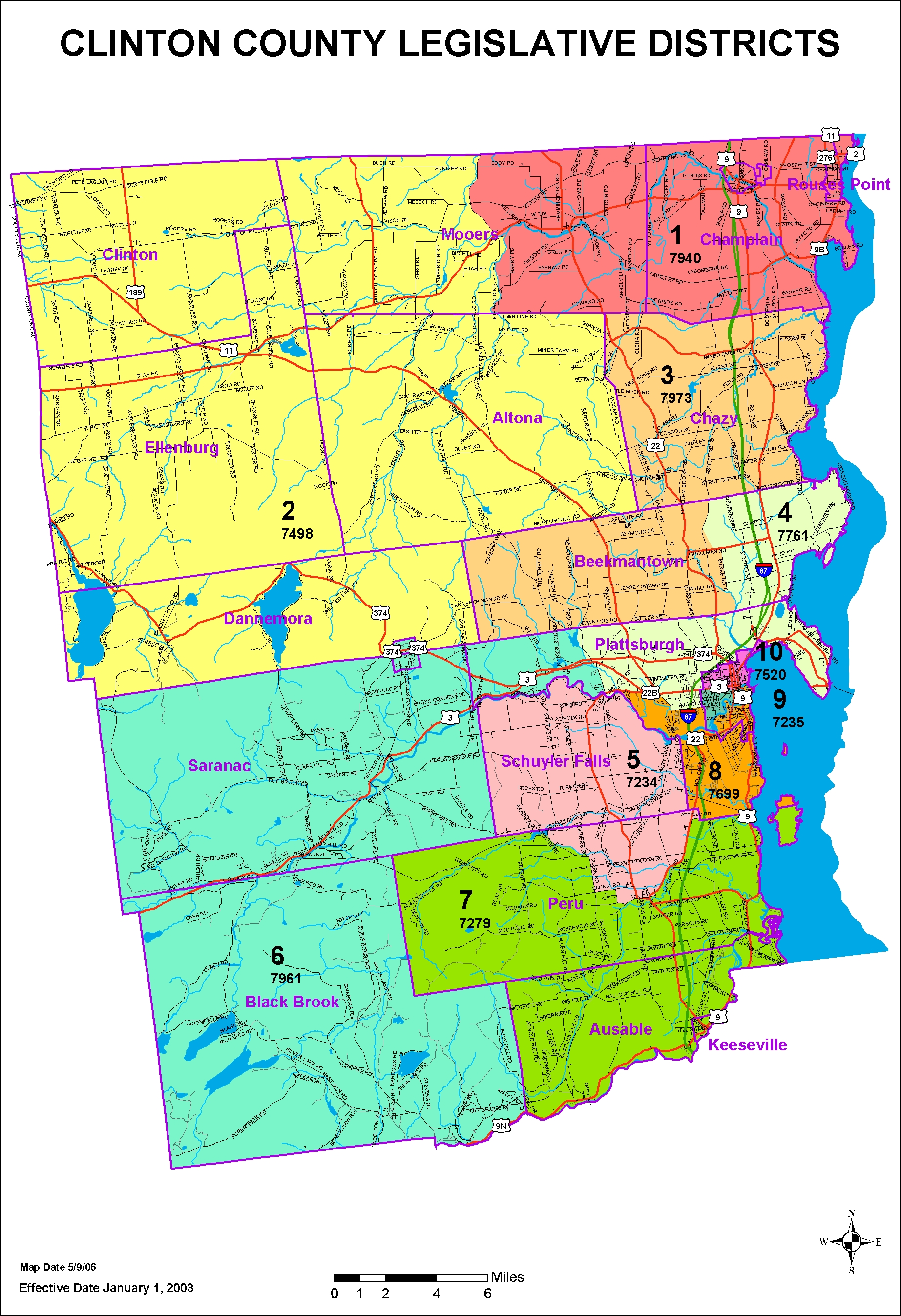
The Clinton County Legislature is the lawmaking body of the county. It consists of 10 members, each elected from single member districts.[10] As of 2019, the County Legislature consists of four Republicans and six Democrats.[11]
Demographics
| Historical population | |||
|---|---|---|---|
| Census | Pop. | %± | |
| 1790 | 1,615 | — | |
| 1800 | 8,514 | 427.2% | |
| 1810 | 8,002 | −6.0% | |
| 1820 | 12,070 | 50.8% | |
| 1830 | 19,344 | 60.3% | |
| 1840 | 28,157 | 45.6% | |
| 1850 | 40,047 | 42.2% | |
| 1860 | 45,735 | 14.2% | |
| 1870 | 47,947 | 4.8% | |
| 1880 | 50,897 | 6.2% | |
| 1890 | 46,437 | −8.8% | |
| 1900 | 47,430 | 2.1% | |
| 1910 | 48,230 | 1.7% | |
| 1920 | 43,898 | −9.0% | |
| 1930 | 46,687 | 6.4% | |
| 1940 | 54,006 | 15.7% | |
| 1950 | 53,622 | −0.7% | |
| 1960 | 72,722 | 35.6% | |
| 1970 | 72,934 | 0.3% | |
| 1980 | 80,750 | 10.7% | |
| 1990 | 85,969 | 6.5% | |
| 2000 | 79,894 | −7.1% | |
| 2010 | 82,128 | 2.8% | |
| Est. 2018 | 80,695 | [12] | −1.7% |
| US Decennial Census[13] 1790-1960[14] 1900-1990[15] 1990-2000[16] 2010-2013[1] | |||
2000 census
As of the 2000 United States Census,[17] there were 79,894 people, 29,423 households, and 19,272 families in the county. The population density was 77.0/sqmi (29.7/km²). There were 33,091 housing units at an average density of 31.9/sqmi (12.3/km²). The racial makeup of the county was 93.33% White, 3.58% Black or African American, 0.36% Native American, 0.67% Asian, 0.02% Pacific Islander, 1.10% from other races, and 0.93% from two or more races. 2.46% of the population were Hispanic or Latino of any race. 23.7% were of French, 15.0% French Canadian, 12.5% American, 11.8% Irish, 7.6% English and 5.5% German ancestry according to Census 2000. 94.1% spoke English, 2.8% French and 1.7% Spanish as their first language.
There were 29,423 households out of which 32.00% had children under the age of 18 living with them, 51.00% were married couples living together, 10.20% had a female householder with no husband present, and 34.50% were non-families. 26.30% of all households were made up of individuals and 10.00% had someone living alone who was 65 years of age or older. The average household size was 2.47 and the average family size was 2.98.
The county population contained 23.00% under the age of 18, 12.40% from 18 to 24, 30.60% from 25 to 44, 22.10% from 45 to 64, and 11.90% who were 65 years of age or older. The median age was 36 years. For every 100 females there were 104.90 males. For every 100 females age 18 and over, there were 104.60 males.
The median household income was $37,028, and the median income for a family was $45,732. Males had a median income of $33,788 versus $25,520 for females. The per capita income for the county was $17,946. About 9.40% of families and 13.90% of the population were below the poverty line, including 15.30% of those under age 18 and 11.40% of those age 65 or over.
Education
The State University of New York at Plattsburgh is located in the City of Plattsburgh. The county is also served by Clinton Community College, which is located in the Town of Plattsburgh.
Infrastructure
Clinton Correctional Facility, a maximum-security prison is located in the village of Dannemora. Altona Correctional Facility is a medium-security prison in the town of Altona.
Transportation
Highways
Airports
- Plattsburgh International Airport (PBG) – Plattsburgh
- Clinton County Airport (PLB) – Plattsburgh
- Rouses Point Seaplane Base (K21) – Rouses Point[19]
Rail
Amtrak's Adirondack Train travels through the county, connecting Montreal to New York City. Two trains a day (one north and one south) stop in the county in Plattsburgh and Rouses Point.[20]
Mass-Transit
The Clinton County Public Transit runs bus routes that branch from Plattsburgh to towns in the county.[21]
See also
References
- "State & County QuickFacts". United States Census Bureau. Retrieved October 11, 2013.
- "Find a County". National Association of Counties. Archived from the original on 31 May 2011. Retrieved 7 June 2011.
- "GoAdirondack.com-About The Adirondack Coast". goadirondack.com. Archived from the original on 21 July 2018. Retrieved 6 July 2019.
- Clinton County NY - Google Maps (accessed 6 July 2019)
- Lyon Mountain, New York. PeakBagger.com (accessed 6 July 2019)
- "2010 Census Gazetteer Files". US Census Bureau. Archived from the original on May 19, 2014. Retrieved 6 July 2010.
- Miner Lake State Park. stateparks.com (accessed 6 July 2019)
- Leip, David. "Atlas of US Presidential Elections". uselectionatlas.org. Retrieved 22 October 2018.
- US Election Atlas
- Legislative District Maps
- Clinton County Government (accessed 6 July 2019)
- "Population and Housing Unit Estimates (accessed 6 July 2019)". Retrieved 6 July 2019.
- "US Decennial Census". US Census Bureau. Retrieved January 3, 2015.
- "Historical Census Browser". University of Virginia Library. Retrieved January 3, 2015.
- "Population of Counties by Decennial Census: 1900 to 1990". US Census Bureau. Retrieved January 3, 2015.
- "Census 2000 PHC-T-4. Ranking Tables for Counties: 1990 and 2000" (PDF). US Census Bureau. Retrieved January 3, 2015.
- "U.S. Census website". US Census Bureau. Retrieved 31 January 2008.
- I-87 Multimodal Corridor Study Archived 8 September 2015 at the Wayback Machine, New York State Department of Transportation, Retrieved June 13, 2016.
- Clinton County Public and Private Airports, New York. Retrieved June 13, 2013.
- AMTRAK/Plattsburgh, New York station (accessed 6 July 2019)
- Welcome to Clinton County Public Transit (accessed 6 July 2019)
External links
| Wikimedia Commons has media related to Clinton County, New York. |
- Clinton County, NY webpage
- Clinton County at Curlie
- Summary early history of Clinton County and its towns
- Clinton County Historical Association Museum
Places adjacent to Clinton County, New York | ||||||||||
|---|---|---|---|---|---|---|---|---|---|---|
| ||||||||||
Municipalities and communities of Clinton County, New York, United States | ||
|---|---|---|
| City | Map of New York highlighting Clinton County | |
| Towns | ||
| Villages | ||
| CDPs | ||
| Other hamlets | ||
| Footnotes | ‡This populated place also has portions in an adjacent county or counties | |
| Authority control |
|
|---|