Presidency division
Presidency Division is an administrative division within the Indian state of West Bengal. The headquarters and the largest city of the Presidency division is Kolkata, the state capital. Presidency division is bounded by Medinipur division to South-West, Burdwan division to North-West and Malda division to North. The whole east side of the division is covered by Bangladesh–India border. Shri A. R. Bardhan, IAS is the current Secretary and Divisional Commissioner of the division.[1]
Presidency division | |
|---|---|
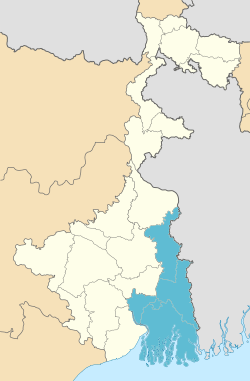 Divisions of West Bengal (Presidency division in orange color) | |
| Country | India |
| State | West Bengal |
| Districts | 1. Howrah, 2. Kolkata, 3. Nadia, 4. North 24 Paraganas, 5. South 24 Parganas, 6. Hooghly |
| Area | |
| • Total | 24,957 km2 (9,636 sq mi) |
| Population (2001 census) | |
| • Total | 32,741,224 |
| Main crops | Paddy, Jute, Pulses, Wheat, Mustard, Sesame, Sugarcane, Soybean, Onion, vegetables, Turmeric |
Districts
It consists of 6 districts:[2]
List of districts
| Code[3] | District | Headquarters[4] | Established[5] | Subdivisions[2] | Area[4] | Population 2011[4] | Population Density | Map |
|---|---|---|---|---|---|---|---|---|
| HR | Howrah | Howrah | 1947 | 1,467 km2 (566 sq mi) | 4,850,029 | 3,306/km2 (8,560/sq mi) | 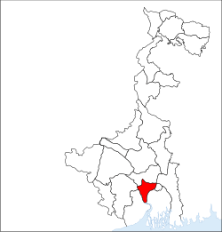 | |
| KO | Kolkata | Kolkata | 1947 | — | 185 km2 (71 sq mi) | 4,486,679 | 24,252/km2 (62,810/sq mi) |  |
| NA | Nadia | Krishnanagar | 1947 | 3,927 km2 (1,516 sq mi) | 5,168,488 | 1,316/km2 (3,410/sq mi) |  | |
| PN | North 24 Parganas | Barasat | 1986[6] | 4,094 km2 (1,581 sq mi) | 10,082,852 | 2,463/km2 (6,380/sq mi) | 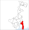 | |
| PS | South 24 Parganas | Alipore | 1986[6] | 9,960 km2 (3,850 sq mi) | 8,153,176 | 819/km2 (2,120/sq mi) | 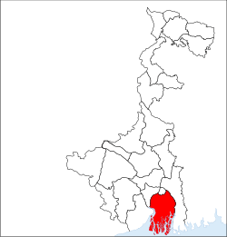 | |
| Total | — | — | — | 23 | 24,957 km2 (9,636 sq mi) | 32,741,224 | 1,312/km2 (3,400/sq mi) | 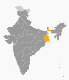 |
References
- "Divisional Commissioners/ West Bengal". Office of the Resident Commissioner- Govt. of WB. 4 June 2019.
- "Directory of District, Sub division, Panchayat Samiti/ Block and Gram Panchayats in West Bengal, March 2008". West Bengal. National Informatics Centre, India. 19 March 2008. p. 1. Archived from the original on 25 February 2009. Retrieved 28 February 2009.
- "NIC Policy on format of e-mail Address: Appendix (2): Districts Abbreviations as per ISO 3166–2" (PDF). Ministry Of Communications and Information Technology, Government of India. 18 August 2004. pp. 5–10. Archived from the original (PDF) on 11 September 2008. Retrieved 24 November 2008.
- "Districts : West Bengal". Government of India portal. Retrieved 24 November 2008.
- Here 'Established' means year of establishment as a district of West Bengal. The state of West Bengal was established in 1947 with 14 districts of erstwhile Bengal province of British India.
- Mandal, Asim Kumar (2003). The Sundarbans of India: A Development Analysis. Indus Publishing. pp. 168–169. ISBN 81-7387-143-4. Retrieved 4 September 2008.
This article is issued from Wikipedia. The text is licensed under Creative Commons - Attribution - Sharealike. Additional terms may apply for the media files.