Punarbhaba River
The Punarbhaba (Poonorvoba Bengali: পুনর্ভবা নদী) is a river of Bangladesh and West Bengal, of total length about 160 kilometres (99 mi) and a width of 3 to 8 kilometres (1.9 to 5.0 mi) and a mean depth of 1.96 metres (6.4 ft) It originates from the lowlands of Thakurgaon District of Bangladesh. The river's upper part is a few kilometres west of Atrai. Dinajpur town of Bangladesh is situated on the east bank of the river. It flows through Gangarampur and Tapan community development blocks of Dakshin Dinajpur district of West Bengal.[1] After flowing to the south, this river meets with the Dhepa River. Ultimately it flows into the Ganges[2]
| Punarbhaba River | |
|---|---|
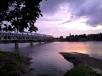 The Punarbhaba River view from near Gangarampur Railway Station. | |
| Location | |
| Country | India, Bangladesh |
| State | West Bengal |
| Physical characteristics | |
| Source | Dhepa River |
| • location | Dinajpur, Dinajpur District, Bangladesh, Rangpur Division, Bangladesh |
| Mouth | Mahananda River |
• location | Gomostapur Upazila, Nawabganj District, Rajshahi Division, Bangladesh |
• coordinates | 24°49′42″N 88°18′18″E |
| Length | 160 km (99 mi) |
| Discharge | |
| • location | Padma River |
References
- "Dakshin Dinajpur". Rivers. District administration. Retrieved 30 May 2009.
- Chowdhury, Masud Hasan (2012). "Punarbhaba River". In Islam, Sirajul; Jamal, Ahmed A. (eds.). Banglapedia: National Encyclopedia of Bangladesh (Second ed.). Asiatic Society of Bangladesh.
This article is issued from Wikipedia. The text is licensed under Creative Commons - Attribution - Sharealike. Additional terms may apply for the media files.