Gopalpur, Dakshin Dinajpur
Gopalpur is a census town in Gangarampur CD Block in Gangarampur subdivision of Dakshin Dinajpur district in the state of West Bengal, India.
Gopalpur | |
|---|---|
Census Town | |
 Gopalpur Location in West Bengal, India  Gopalpur Gopalpur (India) | |
| Coordinates: 25.3636°N 88.5251°E | |
| Country | |
| State | West Bengal |
| District | Dakshin Dinajpur |
| Population (2011) | |
| • Total | 7,016 |
| Languages | |
| • Official | Bengali, English |
| Time zone | UTC+5:30 (IST) |
| Telephone code | 03524 |
| Vehicle registration | WB |
| Lok Sabha constituency | Balurghat |
| Vidhan Sabha constituency | Gangrampur |
| Website | ddinajpur |
Geography
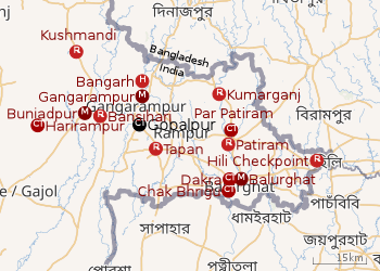 |
| Cities and towns in the Dakshin Dinajpur district M: municipal city/ town, CT: census town, R: rural/ urban centre, H: historical site Owing to space constraints in the small map, the actual locations in a larger map may vary slightly |
Location
Gopalpur is located at 25.3636°N 88.5251°E.
In the map alongside, all places marked on the map are linked in the full screen version.
Demographics
As per the 2011 Census of India, Gopalpur had a total population of 7,016, of which 3,883 (51%) were males and 3,433 (49%) were females. Population below 6 years was 615. The total number of literates in Gopalpur was 4,964 (77.55% of the population over 6 years).[1]
Transport
Gopalpur is on Gangarampur-Tapan main road.[2]
References
- "2011 Census – Primary Census Abstract Data Tables". West Bengal – District-wise. Registrar General and Census Commissioner, India. Retrieved 16 January 2019.
- Google maps
Cities, towns and locations in Dakshin Dinajpur district | |||||
|---|---|---|---|---|---|
| Cities, municipal and census towns |
| ||||
| Locations other than cities and towns |
| ||||
| Related topics |
| ||||
This article is issued from Wikipedia. The text is licensed under Creative Commons - Attribution - Sharealike. Additional terms may apply for the media files.