Dr. Phillips, Florida
| Dr. Phillips, Florida | |
|---|---|
| Census-designated place | |
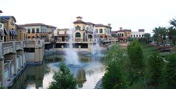 Sand Lake Road on Restaurant Row. | |
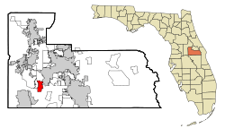 Location in Orange County and the state of Florida | |
| Coordinates: 28°27′22″N 81°29′35″W / 28.45611°N 81.49306°WCoordinates: 28°27′22″N 81°29′35″W / 28.45611°N 81.49306°W | |
| Country |
|
| State |
|
| County | Orange |
| Area | |
| • Total | 4.9 sq mi (12.6 km2) |
| • Land | 3.4 sq mi (8.8 km2) |
| • Water | 1.5 sq mi (3.8 km2) |
| Elevation | 121 ft (37 m) |
| Population (2010) | |
| • Total | 10,981 |
| • Density | 2,200/sq mi (870/km2) |
| Time zone | UTC-5 (Eastern (EST)) |
| • Summer (DST) | UTC-4 (EDT) |
| FIPS code | 12-17725[1] |
| GNIS feature ID | 1867136[2] |
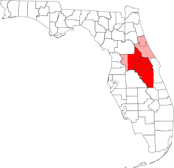
Dr. Phillips is a census-designated place and an unincorporated area in Orange County, Florida, United States. It is a suburb of Orlando and is part of the Orlando–Kissimmee–Sanford, Florida Metropolitan Statistical Area. The population was 10,981 at the 2010 census.[3]
The area of Dr. Phillips is named after Dr. Phillip Phillips, a Central Florida citrus magnate.[4] He was responsible for several key innovations in the processing and packaging of orange juice. By the early 1920s, he owned thousands of acres of groves, stretching across nine Central Florida counties and extending from Conroy Road on the north to the south end of the Sand Lake Chain, encompassing all of what is now Bay Hill, Orange Tree, Sand Lake Hills, Clubhouse Estates and Turkey Lake Park.[5]
Geography
According to the United States Census Bureau, the CDP has a total area of 12.6 km² (4.8 mi²), of which 8.8 km² (3.4 mi²) is land and 3.8 km² (1.5 mi²) (29.90%) is water.[6]
Demographics
| Historical population | |||
|---|---|---|---|
| Census | Pop. | %± | |
| 1990 | 7,963 | — | |
| 2000 | 9,548 | 19.9% | |
| 2010 | 10,981 | 15.0% | |
| source:[3][7] | |||
As of the census[1] of 2000, there were 9,548 people; 3,451 households; and 2,691 families residing in the CDP. The population density was 1,084.3/km² (2,808.4/mi²). There were 3,769 housing units at an average density of 428.0/km² (1,108.6/mi²). The racial makeup of the CDP was 84.14% White; 3.05% African American; 0.06% Native American; 4.46% Asian; 0.03% Pacific Islander; 1.94% from other races; and 2.31% from two or more races. Hispanic or Latino of any race were 8.36% of the population.
There were 3,451 households out of which 39.4% had children under the age of 18 living with them, 65.7% were married couples living together, 9.1% had a female householder with no husband present, and 22.0% were non-families. 17.5% of all households were made up of individuals and 4.6% had someone living alone who was 65 years of age or older. The average household size was 2.77 and the average family size was 3.14.
In the CDP, the population was spread out with 26.5% under the age of 18, 6.7% from 18 to 24, 28.5% from 25 to 44, 28.5% from 45 to 64, and 9.8% who were 65 years of age or older. The median age was 39 years. For every 100 females, there were 95.2 males. For every 100 females age 18 and over, there were 94.7 males.
The median income for a household in the CDP was $70,754, and the median income for a family was $76,992. Males had a median income of $51,616 versus $30,696 for females. The per capita income for the CDP was $31,197. About 3.4% of families and 4.4% of the population were below the poverty line, including 3.4% of those under age 18 and 4.8% of those age 65 or over.
As of the 2010 census, the CDP had a population of 10,981; 65.9% of which was non-Hispanic White, 4.1% African American, 0.2% Native American, 9.9% Asian, and 3.7 from two or more races. Hispanic or Latino of any race were 12.9% of the population.[8]
Education
Orange County Public Schools (OCPS) serves the Dr. Phillips area.[9]
Three elementary schools serve sections of Dr. Phillips: Dr. Phillips Elementary,[10] Bay Meadows,[11] and Sand Lake.[12] Southwest Middle School is the designated middle school for the Dr. Phillips CDP.[13] Dr. Phillips High School is the designated high school for the entire Dr. Phillips CDP.[14]
References
- 1 2 "American FactFinder". United States Census Bureau. Archived from the original on 2013-09-11. Retrieved 2008-01-31.
- ↑ "US Board on Geographic Names". United States Geological Survey. 2007-10-25. Retrieved 2008-01-31.
- 1 2 "Profile of General Population and Housing Characteristics: 2010 Demographic Profile Data (DP-1): Doctor Phillips CDP, Florida". U.S. Census Bureau, American Factfinder. Archived from the original on September 11, 2013. Retrieved September 21, 2012.
- ↑ Moyer, Armond; Moyer, Winifred (1958). The origins of unusual place-names. Keystone Pub. Associates. p. 37.
- ↑ The Dr. Phillips History
- ↑ "US Gazetteer files: 2010, 2000, and 1990". United States Census Bureau. 2011-02-12. Retrieved 2011-04-23.
- ↑ "CENSUS OF POPULATION AND HOUSING (1790-2000)". U.S. Census Bureau. Retrieved 2010-07-17.
- ↑ Doctor Phillips CDP QuickFacts from the US Census Bureau Archived 2012-07-08 at WebCite
- ↑ "2010 CENSUS - CENSUS BLOCK MAP: Doctor Phillips CDP, FL." U.S. Census Bureau. Retrieved on April 19, 2017.
- ↑ "Dr. Phillips Elementary School Zone." Orange County Public Schools Department of Student Enrollment. April 17, 2017. Retrieved on April 21, 2017.
- ↑ "Bay Meadows Elementary School Zone." Orange County Public Schools Department of Student Enrollment. April 17, 2017. Retrieved on April 21, 2017.
- ↑ "Sand Lake Attendance Zone." Orange County Public Schools Department of Student Enrollment. February 20, 2015. Retrieved on April 21, 2017.
- ↑ "Southwest Middle School Zone Archived 2017-04-21 at the Wayback Machine.."Orange County Public Schools Office of Pupil Assignment. Retrieved on April 21, 2017.
- ↑ "Dr Phillips High School Zone" Orange County Public Schools Office of Pupil Assignment. July 31, 2008. Retrieved on April 21, 2017.
| Wikimedia Commons has media related to Dr. Phillips. |
Municipalities and communities of Orange County, Florida, United States | ||
|---|---|---|
| Cities | 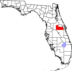 | |
| Towns | ||
| CDPs |
| |
| Unincorporated communities | ||
| Footnotes | ‡This populated place also has portions in an adjacent county or counties | |