Kakani
| Kakani ककनी | |
|---|---|
| Gaupalika | |
 | |
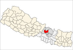
 Kakani Location in Nepal | |
| Coordinates: 27°49′N 85°16′E / 27.817°N 85.267°ECoordinates: 27°49′N 85°16′E / 27.817°N 85.267°E | |
| Country |
|
| Zone | Province No. 3 |
| District | Nuwakot District |
| Elevation | 2,030 m (6,660 ft) |
| Population (1991) | |
| • Total | 7,816 |
| Time zone | UTC+5:45 (Nepal Time) |

Kakaniis a Gaunpalika and former village development committee in Nuwakot District in Province No. 3 of central Nepal. At the time of the 1991 Nepal census, the Kakani village development committee administered a population of 7816 living in 1343 individual households.[1]
As one of the most accessible settlements from Kathmandu over 2000 meters, this hill station hosts a British Gurkhas welfare bungalow[2] and a number of hotels. The village is also home to a memorial park to the victims of Thai Airways International Flight 311.
A notable local industry is strawberry farming. With the assistance of a United Nations Development Programme project, a local farmers' cooperative now produces close to 250 000 kg of the fruit per year.[3]
References
- ↑ "Nepal Census 2001", Nepal's Village Development Committees, Digital Himalaya, archived from the original on 12 October 2008, retrieved 15 November 2009 .
- ↑ British Gurkhas Nepal Guide to Preparation and Arrival British Army 1 Feb 2010
- ↑ New morning in Kakani! UNDP Micro-Enterprise Development Programme 05-01-2010
External links
Headquarters: Bidur | ||
| Municipalities |
|  |
| Rural municipalities |
| |
| Former VDCs |
| |
This article is issued from
Wikipedia.
The text is licensed under Creative Commons - Attribution - Sharealike.
Additional terms may apply for the media files.