List of Canada–United States border crossings
This is a list of border crossings along the International Boundary between Canada and the United States. They are ordered from west to east (crossings with Alaska from north to south). Each port of entry in the table below links to an article about that crossing.
The Land ports of entry list is limited to places where CBSA and/or CBP currently provide border inspection services. Crossings where border inspection services were once provided, but have since been barricaded are listed in the Closed Land Ports of Entry section. Unstaffed crossings are listed in the Unstaffed Road Crossings section. Separate sections are also provided for Rail Crossings and point-to-point Ferry Crossings.
_from_U.S._(Blaine%2C_WA).jpg)
Land ports of entry
Port of entry hours of service for road crossings, except where noted, are open year-round during the day.
| The yellow background indicates a border crossing where travel is permitted in only one direction. |
| The green background indicates a border crossing that is located at a bridge or a tunnel. |
Closed land ports of entry
This list includes only those crossings known to have had Customs or Immigration services at the border. They are listed in order from west to east. Other unattended roads are listed in the Unstaffed Road Crossings section.
| Canada Port of Entry | Canada Road/ Highway | United States Port of Entry | United States Road/ Highway | Notes | Photo | Coordinates |
|---|---|---|---|---|---|---|
| Boundary Bay | 67 Street | Point Roberts | Meadow Lane | A former border crossing used to be located on the eastern side of the peninsula. The crossing was permanently closed in 1975 when the Tyee Road border crossing was expanded.[5] The former Canada border station remains and has been refurbished. | 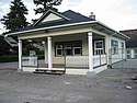 |
49°0′7.20″N 123°2′16.80″W / 49.0020000°N 123.0380000°W |
| Chopaka West | Chopaka Road | Nighthawk West | Chopaka Road | Canada periodically provided border services at the crossing on Chopaka Road until the US barricaded the road in 1964. It still owns the property at the border. The US never had border inspection services at this crossing.[6] A branch of the Great Northern Railway also once crossed the border at this location, but was abandoned in the late 1930s. | 49°0′0″N 119°43′33.4″W / 49.00000°N 119.725944°W | |
| Bridesville | Old Molson Road | Molson | Old Railroad Road | Molson died a slow death as its mining and farming businesses dried up in the 1920s.[7] Molson's designation as a port of entry was revoked in 1941,[8] and the Customs and Immigration station in the town closed. This building still stands as part of the Molson Museums, showing elements of what is now a ghost town. | 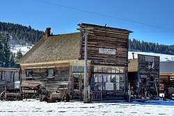 |
49°0′0.72″N 119°10′45.84″W / 49.0002000°N 119.1794000°W |
| Myncaster | Myncaster Road | Chesaw | Bolster Road | Canada port of entry was maintained to support both road and rail traffic, however, traffic on Bolster Road was light and the railroad ceased operations in 1937. The port of entry closed around 1955, but opened again for one day on June 9, 1990.[9] | 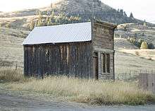 |
49°0′0.00″N 119°1′18.12″W / 49.0000000°N 119.0217000°W |
| Gateway | Dorr Road | Gateway | The border crossing at Gateway, Montana was located on the eastern banks of the Kootenay River approximately 5 miles west of the Roosville border crossing. Customs operations began around 1902 to inspect both vessel traffic on the lake and rail traffic on the adjacent Great Northern Railway branch. The crossing closed in 1933 when rail service ended, with Customs officers being relocated to the busier Roosville crossing. The railroad tracks were removed in 1936, and the US Post Office closed in 1950. What was left of the town was innundated by water in 1975 with the completion of the Libby Dam which created Lake Koocanusa. [10] | 49°0′3.96″N 114°28′42.24″W / 49.0011000°N 114.4784000°W | ||
| Flathead | Flathead Rd | Trailcreek | North Fork Rd | Border crossing adjacent to the Flathead River closed in 1996 due to flooding of the road just north of the border.[11] The road is gated at the border. Both the US and Canada border stations remain but are falling into disrepair. |  |
49°0′3.96″N 114°28′42.24″W / 49.0011000°N 114.4784000°W |
| Whiskey Gap | Emigrant Gap Road | Emigrant Gap | Emigrant Gap Road | Opened in 1934 and closed in 1939 when the Del Bonita Road opened. It was once a favorite place to bring alcohol into the US during prohibition.[12] | 48°59′54.60″N 113°5′46.68″W / 48.9985000°N 113.0963000°W | |
| Pinhorn | Township Road 12 | Laird | Laird Road | Canadian port of entry closed in 1929 and moved to Aden.[12] | 48°59′52.44″N 110°59′25.08″W / 48.9979000°N 110.9903000°W | |
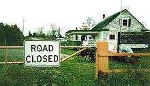
| Big Beaver | Hwy 34 | Whitetail | MT 511 | Canadian port of entry permanently closed on April 1, 2011, and the U.S. port of entry closed on January 26, 2013.[13] | 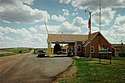 |
48°59′57.84″N 105°9′44.64″W / 48.9994000°N 105.1624000°W |
| Beaubier | Saskatchewan Highway 707 | Westby | North Westby Road | The port of Westby, Montana was established in 1919, and was revoked by Executive Order 9382 on September 23, 1943. Shortly before being designated a port of entry, the town of Westby moved a short distance from North Dakota into Montana to be closer to a new rail spur, and to be in a state that permitted the sale of alcohol.[14] | 48°59′59.9″N 104°04′41.4″W / 48.999972°N 104.078167°W | |
| Northgate | Hwy 9 | Northgate | ND 8 | US and Canadian Ports of Entry were abandoned when the highway was rebuilt about a half mile west of town in the early 1980s. Both buildings remain, and the border community is a virtual ghost town.[15] | 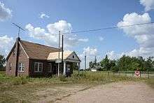 |
48°59′55.68″N 102°15′58.32″W / 48.9988000°N 102.2662000°W |
| West Lynne (Emerson) | 5th Street | Pembina | US 81 | This crossing on the Meridian Highway, whose other end was at the Mexico–United States border in Laredo, Texas, was moderately trafficked through the 1950s, but it was closed in the mid-1960s a few years after Interstate 29 and Manitoba Highway 29 were built immediately to the west. The Canadian and US border stations were demolished, but the concrete slabs on which they stood remain.[16] | 49°0′1.44″N 97°14′6.36″W / 49.0004000°N 97.2351000°W | |
| Emerson East | PTH 75 | Noyes | US 75 | Throughout the early 20th century, this was among the busiest U.S.-Canada border crossings. It was the point at which the Jefferson Highway intersected the international boundary and for a few years was adorned with an elaborate archway. Traffic waned with the 1957 opening of Interstate 29 two miles to the west. The crossing was closed by Canada in 2003 (where traffic was permitted southbound only) and then by the U.S. in 2006. All road traffic must now use the Pembina–Emerson Border Crossing. | .jpg) |
49°0′0.00″N 97°12′26.28″W / 49.0000000°N 97.2073000°W |
| Pigeon River | Old Border Rd (formerly Ontario Highway 61) | Pigeon River | County Route 89 (formerly MN 1 and US 61) | Formerly called Sextus City. The Outlaw Bridge as it was known, was built in 1917. It was closed in 1961 when a new bridge and border station were built in Grand Portage, Minnesota about 6 miles to the east. The old bridge, store, hotel and both border stations have all been destroyed. | 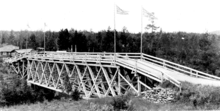 |
48°0′37.44″N 89°42′29.88″W / 48.0104000°N 89.7083000°W |
| Niagara Falls | River Road | Niagara Falls | Niagara Street | The Honeymoon Bridge collapsed on January 27, 1938 after an ice jam undermined the structure. A new bridge called the Rainbow Bridge was built just to the north and new border inspection facilities were built on both sides. | 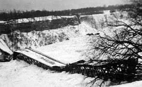 |
43°5′20.4″N 79°4′8.4″W / 43.089000°N 79.069000°W |
| Queenston | Niagara Regional Road 81 | Lewiston | Robert Moses State Parkway | The Queenston-Lewiston suspension bridge was replaced by the transverse-named Lewiston–Queenston Bridge in 1962, which was built about 0.7 miles (1.1 km) to the south. The bridge had a single line trolley track of the Niagara Gorge Railroad in the center of 3 lanes. The US inspection area has been transformed into the Earl W. Brydges Artpark State Park. | 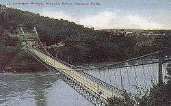 |
|
| Cornwall | Highway 138 | Massena | NY 37 | The Canadian port of entry on Cornwall Island was closed June 1, 2009, due to a disagreement between the Mohawk Nation of Akwesasne and the Canada Border Services Agency regarding the arming of border services officers. A temporary port of entry was opened July 13, 2009, at the north end of the Seaway International Bridge north (high) span; it was used until the current "interim" port of entry was opened January 24, 2014. The old border station on Cornwall Island was demolished in July 2015. |  |
44°59′26.37″N 74°44′22.26″W / 44.9906583°N 74.7395167°W |
| Jamieson's Line | Chemin Jamieson | Jamieson Line | County Road 29 | The Canadian port of entry was permanently closed on April 1, 2011. For three years, this was a one-way crossing, with travelers able to enter the U.S. but not Canada at this location. Finally, the U.S. port of entry closed August 21, 2014. |  |
44°59′30.26″N 74°10′28.78″W / 44.9917389°N 74.1746611°W |
| Saint-Bernard-de-Lacolle, Quebec | Rang Roxham | Mooers | Roxham Road | The Canadian port of entry operated until the late 1950s and the building is now a private residence. The US never had a border station at this location. This crossing has been barricaded since the 1970s. |  |
45°0′25.56″N 73°31′1.92″W / 45.0071000°N 73.5172000°W |
| Blackpool | Chemin Ridge | Champlain | US 9 | The border crossing on US Route 9 closed in 1967 when Interstate 87 was completed immediately to the west. | 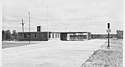 |
45°0′32.76″N 73°26′30.84″W / 45.0091000°N 73.4419000°W |
| Saint-Bernard-de-Lacolle | Route 217 | Champlain | Meridian Road | Port of entry on Meridian Road was closed around 1950. The Canada border station was demolished. The USDA has since used the old US border station as an office.,[17] and it is currently for sale.[18] | 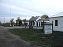 |
45°0′32.76″N 73°26′30.48″W / 45.0091000°N 73.4418000°W |
| Highwater | Chemin Lafond | North Troy | Space Research Corporation Road | In the 1960s and 1970s, Space Research Corporation founder Gerald Bull built his company on property his family owned on both sides of the border. As the company began building military weapons, the US established a border inspection station outside the company's south gate to inspect southbound traffic. This station also enabled US workers to legally return home after work without having to go through the North Troy border crossing, and it was not for use by the general public. Canada did not have a border station on the company's north gate. The SRC facility (and the Customs station) closed in 1980 when Bull was convicted of violating an arms embargo against South Africa.[19] | 45°0′30.60″N 72°26′58.20″W / 45.0085000°N 72.4495000°W | |
| Mansonville | Chemin du Pont-Couvert | North Troy | Douglas Road | Also known as "Province Hill", Canada Customs closed this office around 1972. The building is now purple and privately owned, but in the 1980s it was rented as a vacation home.[20] Prior to its construction in the 1960s, Canada Customs operated out of a line house across the street. This building was separated, moved about a half mile North and used as cottages.[21] The US did not have a border station at this crossing; persons entering were expected to travel to the North Troy border station for inspection. | 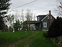 |
45°0′22.68″N 72°22′28.92″W / 45.0063000°N 72.3747000°W |
| Leadville | Chemin des Parulines | Newport | Leadville Road | Canadian Customs had a station from the mid-1930s to 1939, then reopened in 1948. It was replaced with a new border station in the mid-1950s, which permanently closed on March 31, 1969.[22] The Canada border station was converted into a private home that has been updated substantially. There was no US border station at this location; persons entering the US here were expected to travel to the US Customs office at 70 Main Street, Newport, VT to report for inspection. That office closed in 1972, and the road was barricaded. Today the former US Customs office is home to Northeast Kingdom Community Action. | 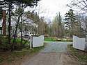 |
45°0′15.12″N 72°16′28.56″W / 45.0042000°N 72.2746000°W |
| Leadville | Chemin de Leadville | Newport | Lake Road | Although this was a busy road with many lakeside homes, neither the US or Canada had a border station here. Persons entering the US here were expected to travel to the US Customs office at 70 Main Street, Newport, VT to report for inspection. That office closed in 1972, and the road was barricaded at the border at that time. | 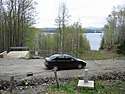 |
45°0′15.84″N 72°15′30.60″W / 45.0044000°N 72.2585000°W |
| Lineboro | Chemin de Nord Derby | North Derby | North Derby Road | Canada provided Customs service at this road and rail crossing 1932-1937 and 1949-1953. The U.S. never had Customs services here. Persons entering the US at this location were expected to travel to the US Customs office at 70 Main Street, Newport, VT to report for inspection. That office closed in 1972, and the road was barricaded at the border at that time. Today the Canada border station is a private home.[23] | 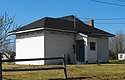 |
45°0′21.10″N 72°10′19.20″W / 45.0058611°N 72.1720000°W |
| Stanhope | Rue Principale | Norton | Nelson Road | Historically, signs directed traffic to report directly to the staffed Stanhope-Norton border station. It has been barricaded since 2015. This crossing is site of an international general store and post office, which closed around 2002. |  |
45°0′38.16″N 71°47′55.32″W / 45.0106000°N 71.7987000°W |
| Daaquam | Rang Sainte-Marie | Daaquam | American Realty Road | Crossing which mostly served the logging industry closed in 2004 when regular customs service was moved to St. Juste. The road is now barricaded. | 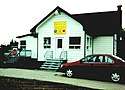 |
46°35′53.16″N 70°1′4.80″W / 46.5981000°N 70.0180000°W |
| Grand Falls | Caswell Road | Caswell | (unnamed road) | The US operated a border inspection station between 1936 and 1953. The General Services Administration purchased approximately a half acre of land in 1931, and constructed a red brick border station. The property was sold by the US government on October 13, 1954,[24] and although the sale included the brick building, it has since been demolished. The parcel, and the road leading to the border from Route 1A are now private property. It is not known if Canada had a border station on Caswell Road. | 47°02′29.7″N 67°47′24.2″W / 47.041583°N 67.790056°W | |
| Four Falls | Brown Road | East Road | Russell Road | Canada still provides Customs services seasonally, but US-bound traffic is prohibited, and has been since the US border station closed in the 1960s. However until 2008, US-bound traffic was permitted to use the road to the Aroostook Valley Country Club, which is in both countries. Several Canadian properties can only be accessed via the US part of the road, which pre-dates the establishment of the border; several residents have experienced harassment from U.S. Border Patrol officers since 9/11.[25][26] | 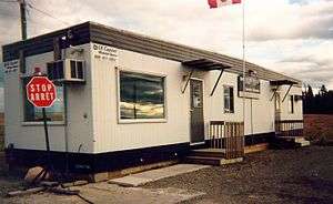 |
46°49′24.21″N 67°47′22.65″W / 46.8233917°N 67.7896250°W |
| Tinker | Tinker Road | Fort Fairfield | Aroostook Falls Road | The US operated a border station at this crossing from 1941 to 1953. The border station was located about 500 feet west of the Canada–US border. The General Services Administration purchased the property for the border station on May 20, 1940, and sold it on October 21, 1955.[27] In 1970, The Canadian Magazine declared this crossing "The best place to sneak across the border".[28] The road was barricaded around 1976. The Aroostook River flood of 1994 killed 2 Canadian Customs officers whose vehicle was swept into a ditch by rising flood waters at this crossing.[29] | 46°47′36.24″N 67°47′22.56″W / 46.7934000°N 67.7896000°W | |
| Hillandale | Reid Road | Monson Hill | Dorsey Road | This crossing closed in the 1940s. Aside from some light fixtures, no signs of the border crossing remains. | 46°42′7.20″N 67°47′20.04″W / 46.7020000°N 67.7889000°W | |
| Beaconsfield | Nicholson Road | Easton | Curtis Road | Canada stopped providing Customs services in the late 1950s and erected a sign directing travelers to the nearest open crossing. The US moved its border services to the Rivière de Chute crossing from a more central location on Ladner Road. The crossing was barricaded in the 1980s. | 46°39′9.36″N 67°47′18.96″W / 46.6526000°N 67.7886000°W | |
| Listerville | Mars Hill Road | Mars Hill | Knoxford Line Road | Border inspection services were established in 1939, and closed in 1976. The US crossing was also known as Knoxford Line and was housed in a temporary trailer. The General Services Administration deemed the US border station property to be excess on November 3, 1977, and it was subsequently sold.[30] The Canada border station has been renovated and today it serves as a private home. | 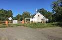 |
46°34′9.12″N 67°47′15.00″W / 46.5692000°N 67.7875000°W |
| Upper Royalton | Brown Road | Blaine | Mountain Road | This crossing was generally known as "Brown Road" on both sides of the border. The US border station was housed in a temporary trailer. It existed for only a few years, from 1941 to 1952. The US sold the 1 acre border station site on May 22, 1953.[31] |  |
46°30′13.6″N 67°47′09.6″W / 46.503778°N 67.786000°W |
| Jackson Falls | Foxcroft Road | Littleton | Foxcroft Road | This crossing, known as "Starkey Corners" opened in 1936, and was permanently closed on May 19, 1962. The General Services Administration purchased the US border station property on May 20, 1932, and sold it (building included) on January 26, 1966.[32] The US border station is now a private home. The Canadian station was demolished in the late 1960s. |  |
46°13′3.00″N 67°46′54.12″W / 46.2175000°N 67.7817000°W |
| Woodstock | Old Houlton Road | Houlton | US 2 | This border crossing was closed in the early 1970s when Interstate 95 was completed immediately to the north. The Canada border station, which was sometimes called Richmond Road, was demolished. The US border station remains in disrepair. |  |
46°8′0.00″N 67°46′52.32″W / 46.1333333°N 67.7812000°W |
| Union Corner | Green Road | East Hodgdon | Boundary Line Road | This border crossing, known as "Union Corner", was permanently closed on May 19, 1962. The General Services Administration sold the US border station on August 16, 1965,[33] and it has since been used as a private home. The Canadian station was torn down in the late 1960s. |  |
46°3′14.40″N 67°46′51.60″W / 46.0540000°N 67.7810000°W |
| Monument | Amity Road | North Amity | Monument Road | The US purchased 12,580 square feet of land on the south side of Monument Road on May 25, 1932 and spent $5,625 to erect a red brick border station, which saw little traffic. This crossing was about 2000 feet north of Monument #1, which marks the beginning of the land border between the US and Canada. On February 19, 1949, the US sold the property and the border station. The building has since been demolished. | 45°56′56.1″N 67°46′52.5″W / 45.948917°N 67.781250°W | |
| Upper Mills | Route 170 | Baring | Front Street | This crossing closed in 1948 when the bridge was deemed unsafe. It was dismantled soon thereafter. The US did not have a Customs station at this crossing. | 45°8′12.48″N 67°19′5.88″W / 45.1368000°N 67.3183000°W | |
| St. Stephen | Route 170 | Calais | Todd Street | This crossing, also known as "Union Bridge", closed in 1961 when the bridge was deemed unsafe. It was dismantled in April, 1963, and two men drowned in the process.[34] The US border station property was sold on May 14, 1962, and still stands as a private residence. |  |
45°8′12.48″N 67°19′5.88″W / 45.1368000°N 67.3183000°W |
Unstaffed road crossings
This is a list of roads that cross the U.S.-Canada border that do not have border inspection services, but where you are legally allowed to cross the border in one or both directions. In prior years, there were dozens of such roads where one could legally cross the border and then proceed to an open Customs office to report for inspection, but most have since been barricaded. Requirements for reporting to CBSA or CBP for inspection are noted.
| Canada City/Town | Canada Road Name | United States City/Town | United States Road Name | Notes | Structure or Notable Feature | Coordinates |
|---|---|---|---|---|---|---|
| Stewart | Road to Salmon Glacier [Premier] | Hyder | NF-88, Tongass National Forest | Unstaffed and open. Canadian road ends at former Granduc mine; U.S. road connects only to Canada. | 56°2′46.32″N 130°2′12.48″W / 56.0462000°N 130.0368000°W | |
| Skagit Valley Provincial Park | Silver Skagit Road | North Cascades National Park | Silver Skagit Road | Unstaffed and open. Canadian road with access to Hozomeen Campground on Ross Lake ends about 2 miles inside the US . Persons found on the U.S. side by the U.S. Border Patrol should be prepared to provide passport identification. | 49°0′0.72″N 121°3′46.80″W / 49.0002000°N 121.0630000°W | |
| Northwest Angle Provincial Forest | PR 525 | Angle Inlet | Winter Road | The border for both Canada and the U.S. is staffed remotely. Travellers are directed to video telephones, 12.5 km / 7.8 mi from the border in Angle Inlet, to contact the Canadian or United States border agencies to make their declarations. | Northwest Angle | 49°17′17.59″N 95°9′12.21″W / 49.2882194°N 95.1533917°W |
| Kanatakon (St. Regis), Akwesasne 15 Réserve | Andrew Johnson Road & Saint Regis Street | Akwesasne, St. Regis Mohawk Reservation | Johnson & St. Regis Roads | Unstaffed crossings to/from Québec accessible by road only through New York. No requirement to report. | 44°59′58.02″N 74°39′0.14″W / 44.9994500°N 74.6500389°W | |
| Tsi Snaihne (Snye), Akwesasne 15 Réserve | River, Phillips, Snye, McDonald & Chapman Roads | Akwesasne, St. Regis Mohawk Reservation | River, Phillips, Snye, McDonald & Chapman Roads | Unstaffed crossings to/from Québec accessible by road only through New York. No requirement to report. | 44°59′57.70″N 74°36′51.30″W / 44.9993611°N 74.6142500°W | |
| Dundee | Chemin de la Pointe Hopkins | Fort Covington | Hopkins Point Road | Unstaffed crossing to/from Québec accessible by road only through New York. Signs direct travellers to report to nearby staffed border post. | 44°59′53.16″N 74°30′32.94″W / 44.9981000°N 74.5091500°W | |
Rail crossings
- This transport-related list is incomplete; you can help by expanding it.
| The green background indicates a crossing that is located at a bridge or a tunnel. |
| The blue background indicates a crossing where passenger rail service is available. |
| The red background indicates a closed railroad crossing. |
| Canada Nearest Community | Canada Rail Company | United States Nearest Community | United States Rail Company | Notes | Structure or Notable Feature | Coordinates |
|---|---|---|---|---|---|---|
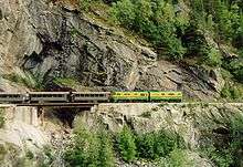
| Fraser | WPY | Skagway | WPY | 3 ft (914 mm) narrow gauge route, isolated line not connected to any others in North America. Former northern terminus Whitehorse, now ends at Carcross. | 59°37′27.99″N 135°8′20.58″W / 59.6244417°N 135.1390500°W | |
| White Rock | BNSF | Blaine | BNSF | Used by Amtrak Cascades passenger trains. | 49°0′7.56″N 122°45′27.00″W / 49.0021000°N 122.7575000°W | |
| Huntingdon | CP & SRY | Sumas | BNSF | 49°0′8.64″N 122°16′0.84″W / 49.0024000°N 122.2669000°W | ||
| Grand Forks | KFR | Danville | KFR | Abandoned by the KFR south of the border. | 49°0′0.36″N 118°29′33.36″W / 49.0001000°N 118.4926000°W | |
| Billings | KFR | Laurier | KFR | Canada section isolated from Canadian rail network following CP's 1991 abandonment of their Boundary Sub, accessible only through the U.S. | 49°0′0.36″N 118°13′28.56″W / 49.0001000°N 118.2246000°W | |
| Waneta | KFR | Boundary | KFR | Canada section isolated from Canadian rail network following abandonment of Burlington Northern's Nelson Sub in 1989, only accessible through the U.S. | 49°0′2.52″N 117°37′36.84″W / 49.0007000°N 117.6269000°W | |
| Kingsgate | CP | Eastport | UP | 49°0′1.80″N 116°10′55.92″W / 49.0005000°N 116.1822000°W | ||
| Coutts | CP | Sweetgrass | BNSF | 48°59′54.24″N 111°57′32.40″W / 48.9984000°N 111.9590000°W | ||
| North Portal | CP | Portal | CP (SOO) | 48°59′56.04″N 102°32′56.40″W / 48.9989000°N 102.5490000°W | ||
| Northgate | CN | Northgate | BNSF | CN abandoned north of the border in 2001. | 48°59′55.68″N 102°15′51.48″W / 48.9988000°N 102.2643000°W | |
| Gretna | CP | Neche | BNSF | The line was abandoned by both railways during the early 1990s. The tracks have been removed on both sides. | 49°0′1.80″N 97°33′38.16″W / 49.0005000°N 97.5606000°W | |
| West Lynne (Emerson) | CN | Pembina | BNSF | The tracks were removed after BNSF abandoned its rail line from Joliette to the border in 1980; the CN line maintains its connection with the BNSF line at the nearby Emerson-Noyes crossing. | 49°0′1.44″N 97°14′6.36″W / 49.0004000°N 97.2351000°W | |
| Emerson | CN (west track) / CP (east track) | Noyes | BNSF (west track) / CP (east track) | Since closure of the adjacent road border crossing, this rail crossing has been managed by the nearby Emerson (Canada) and Pembina (U.S.) ports of entry. | 49°0′1.44″N 97°12′13.32″W / 49.0004000°N 97.2037000°W | |
| Middlebro (Sprague) | CN | Longworth (Warroad) | CN | The U.S. stretch between Warroad & Baudette connects only through Canada. It was isolated from the U.S. rail network when Minnesota Northern Railroad abandoned the Warroad subdivision in 2009. | 48°59′56.40″N 95°22′32.16″W / 48.9990000°N 95.3756000°W | |
| Rainy River | CN | Baudette | CN | The U.S. stretch between Warroad & Baudette connects only through Canada. | 48°43′10.56″N 94°35′29.04″W / 48.7196000°N 94.5914000°W | |
| Fort Frances | MDW | International Falls | Minnesota, Dakota & Western Railway | Once connecting to CN's nearby mainline, the Fort Frances stretch is now isolated from the Canadian rail network. Trains must cross this bridge to the U.S. to get back into Canada. | Fort Frances – International Falls International Bridge | 48°36′26.69″N 93°24′6.42″W / 48.6074139°N 93.4017833°W |
| Fort Frances | CN | Ranier | CN | Ranier International Rail Bridge | 48°36′53.64″N 93°24′6.42″W / 48.6149000°N 93.4017833°W | |
| Sault Ste. Marie | CN (ACR) | Sault Ste. Marie | CN (WC) | International Rail Bridge | 46°30′30.60″N 84°21′41.76″W / 46.5085000°N 84.3616000°W | |
| Sarnia | CN | Port Huron | CN | Paul M. Tellier Tunnel | 42°57′34.20″N 82°25′21.36″W / 42.9595000°N 82.4226000°W | |
| Windsor | CP | Detroit | CP | Michigan Central Railway Tunnel | 42°19′9.12″N 83°3′30.24″W / 42.3192000°N 83.0584000°W | |
| Fort Erie | CN | Buffalo | CN | International Railway Bridge | 42°55′46.20″N 78°54′28.80″W / 42.9295000°N 78.9080000°W | |
| Niagara Falls | CP | Niagara Falls | CP | Closed to rail traffic in 2000. Presently mothballed. | Michigan Central Railway Bridge | 43°6′30.60″N 79°3′29.52″W / 43.1085000°N 79.0582000°W |
| Niagara Falls | CN | Niagara Falls | CSX | Used by Amtrak/Via Maple Leaf passenger trains. Cars may use the bridge if all passengers have a Nexus Card. | Whirlpool Rapids Bridge | 43°6′33.27″N 79°3′30.00″W / 43.1092417°N 79.0583333°W |
| Sainte-Agnès-de-Dundee | CSX | Fort Covington | CSX | 44°59′51.36″N 74°29′8.88″W / 44.9976000°N 74.4858000°W | ||
| Elgin | NYC | Trout River | NYC | Abandoned, but ROW intact. | 44°59′31.92″N 74°14′32.28″W / 44.9922000°N 74.2423000°W | |
| Cantic | CP (west track) & CN (east track) | Rouses Point | CP (DH) | Used by Amtrak Adirondack passenger trains, using CN track in Canada. Cantic port of entry next to Lacolle 223. | 45°0′36.72″N 73°22′18.12″W / 45.0102000°N 73.3717000°W | |
| Clarenceville | CN | Alburg Springs | CN | 45°0′45.00″N 73°14′28.32″W / 45.0125000°N 73.2412000°W | ||
| Abercorn | CMQ | Richford | CMQ | U.S. section isolated from the U.S. rail network following 1990 abandonment of Central Vermont Railway's Richford Branch. Trains in the U.S. must pass through Canada. Part of the Farnham-Richford-North Troy line. | 45°0′54.36″N 72°39′49.32″W / 45.0151000°N 72.6637000°W | |
| Glen Sutton | CMQ | East Richford | CMQ | Canadian section has always been isolated from the Canadian rail network. Trains must pass through the U.S. to connect with the rest of Canada. Part of the Farnham-Richford-North Troy line. | 45°0′41.76″N 72°35′9.24″W / 45.0116000°N 72.5859000°W | |
| Highwater | CMQ | North Troy | CMQ | Trains in Canada must pass back through the U.S. from this isolated section. Part of the Farnham-Richford-North Troy line. | 45°0′25.56″N 72°24′43.92″W / 45.0071000°N 72.4122000°W | |
| Lineboro | Quebec Central Railway (QC) | North Derby | Quebec Central Railway (QC) | Tracks were removed in the 1990s. Now Piste cyclable de Stanstead (Canada) and Newport Bikepath (U.S.). Signs urge cyclists not to cross here. | 45°0′20.88″N 72°10′17.40″W / 45.0058000°N 72.1715000°W | |
| Stanhope | SLR | Norton | SLQ | 45°0′38.16″N 71°47′42.36″W / 45.0106000°N 71.7951000°W | ||
| Trudel (Lac-Mégantic) | CMQ | Beattie (Jackman) | CMQ | 45°32′48.12″N 70°41′21.48″W / 45.5467000°N 70.6893000°W | ||
| St. Leonard | MNRY | Van Buren | MNRY | Unnamed rail bridge | 47°10′29.64″N 67°56′32.28″W / 47.1749000°N 67.9423000°W | |
| Tinker | CP | Fort Fairfield | CP | Tracks removed. | 46°47′36.60″N 67°47′22.56″W / 46.7935000°N 67.7896000°W | |
| Green Road | CAR | Houlton | CAR | Abandoned June 1989. | 46°5′42.72″N 67°46′52.32″W / 46.0952000°N 67.7812000°W | |
| St. Croix | NBSR | Vanceboro | EMRY | Only Canada-U.S. border crossing to be attacked by a foreign force. See Vanceboro international bridge bombing. | Saint Croix-Vanceboro Railway Bridge | 45°33′50.40″N 67°25′39.00″W / 45.5640000°N 67.4275000°W |
| Mohannes | NBSR | Woodland | NBSR | The American stretch is isolated from the rest of the U.S. rail network, and trains must cross this bridge to a small portion through Canada to the U.S. at Baring. Part of NBSR’s St. Stephen-Calais-Woodland branch; leased from Woodland Rail. | Sprague Falls Railroad Bridge | 45°10′0.84″N 67°24′15.48″W / 45.1669000°N 67.4043000°W |
| Upper Mills | NBSR | Baring Plantation | NBSR | The Canadian stretch between Mohannes and Upper Mills is isolated from the Canadian rail network, and trains must cross this bridge into the U.S. to connect to the rest of Canada. Sold to Woodland Rail by Pan-Am Railways after a short period out of service. Part of the St. Stephen-Calais-Woodland branch; leased from Woodland Rail. | Baring Railroad Bridge | 45°8′3.84″N 67°24′15.48″W / 45.1344000°N 67.4043000°W |
| St. Stephen (Milltown) | NBSR | Calais | NBSR | The American stretch between Baring and Calais is isolated from the U.S. rail network, and trains in the U.S. must switch direction and cross this bridge into Canada to connect with the rest of the U.S. rail network. The line was disconnected from the U.S. network when Guilford Rail (Pan-Am Railways) abandoned the connecting line to Bangor in 1989; those rails were intact until torn up in the late 2000s. Part of the St. Stephen-Calais-Woodland branch; leased from Woodland Rail on the U.S. side. | Salmon Falls Railroad Bridge | 45°10′29.28″N 67°17′29.40″W / 45.1748000°N 67.2915000°W |
Ferry crossings
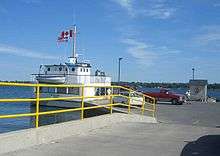
This list is of point-to-point international ferry services, including those for road vehicles, passengers and rail. Other marine ports of entry are not included.
Recent and proposed changes
- Canada Border Services Agency implemented changes on April 1, 2011. The result was the closure of Big Beaver, Franklin Centre and Jamieson's Line. Also, hours were reduced at East Pinnacle, Glen Sutton, Morses Line to 8 am-4 pm. Note that southbound traffic from Franklin Centre toward Churubusco, New York may proceed.
- On December 21, 2012, US Customs and Border Protection announced the permanent closure of the port of Whitetail, Montana.[38]
- On August 21, 2014, U.S. Customs and Border Protection permanently closed the Jamieson Line Border Crossing.
- U.S. Customs and Border Protection has proposed the permanent closure of Morses Line, Vermont.[39] The review process is still ongoing.
- The Gordie Howe International Bridge is a planned additional bridge between Windsor, Ontario and Detroit, Michigan aimed at relieving traffic congestion between the two cities.
See also
References
- 1 2 "CBP finalizes hours for Lancaster and Roseau Ports of Entry". U.S. Border Customs and Protection. 12 December 2017.
- ↑ "Buffalo and Fort Erie Public Bridge Authority". peacebridge.com.
- ↑ (accessed 2016-12-30)
- ↑ http://www.cbsa-asfc.gc.ca/travel-voyage/pptraq-ppvreq-eng.html
- ↑ Saba, Anne, "Point Roberts, WA - Then and Now", US Customs Today, October 1999
- ↑ Ann Briley (April 12, 2011). "Chopaka: The early days". BC Local News. Retrieved December 30, 2014.
- ↑ David G. Jones, "Molson is Becoming Smaller: A Canadian-American Community After the First War", BC Studies, no. 49, Spring 1981, p.54
- ↑ Federal Register 6 FR 705, February 1, 1941
- ↑ Camp, Al, "Border Crossing Diplomacy Opens Way for Canadians", The Omak-Okanogan County Chronicle, June 20, 1990
- ↑ S, Gary. "Gateway, Montana". Flickr. Retrieved 8 October 2018.
- ↑ Michael Jamison of the Missoulian (April 11, 2002). "Bust near Glacier nets 120 pounds of pot". Missoulian.com. Retrieved March 2, 2011.
- 1 2 Legg, Herbert (1962). Customs services in western Canada, 1867-1925; a History, The Creston Review Ltd., Creston, BC
- ↑ "Obtain information about the Whitetail Port of Entry". Help.cbp.gov. Retrieved March 2, 2011.
- ↑ Wick, Douglas A. "Westby (Divide County)". North Dakota Place Names. Retrieved 19 August 2018.
- ↑ Northgate, ND. GhostsofNorthDakota.com. Retrieved on April 12, 2014.
- ↑ Larson, Troy. "History Appreciation In Pembina". Ghosts of North Dakota. Retrieved January 19, 2016.
- ↑ Maisel, Albert Q. Aliens Are Swarming Over Our Unguarded Northern Border, Look Magazine, New York, November 17, 1953, p. 75.
- ↑ Former Agricultural Inspection Border Station. "193 Meridian Road, Champlain, NY, 12919 - Agricultural Property - Off-Market on". Loopnet.com. Retrieved March 2, 2011.
- ↑ Fried, Joseph P. (March 25, 1990). "Gerald Bull, 62, Shot in Belgium; Scientist Who Violated Arms Law". New York Times. Retrieved June 12, 2016.
- ↑ O'Neill, Thomas and Yamashita, Michael (Photographer) (1984). Lakes, Peaks and Prairies - Discovering the United States-Canada Border, p. 53. National Geographic Society, ISBN 0-87044-478-6.
- ↑ Bailey, Merton (1982). Border Crossings of Potton Township, p.A5.
- ↑ "Granby Leader-Mail - Google News Archive Search". Google News. Retrieved June 9, 2014.
- ↑ Farfan, Matthew (2009). The Vermont-Quebec Border - Life on the Line, p. 82. Arcadia Publishing
- ↑ General Services Administration, Record Group 121 (October 13, 1954). US Border Station - former - Mars Hill, ME. Waltham, MA: National Archives Identifier: 1271926.
|access-date=requires|url=(help) - ↑ "Orange alert on the Pedersen farm". CBC News. April 1, 2003.
- ↑ "Golfers' drive out of bounds, say U.S. officials". CBC News. June 27, 2008.
- ↑ General Services Administration, Record Group 269 (October 21, 1955). Aroostook Falls Road Border Station - Fort Fairfield, ME. Waltham, MA: National Archives Identifier: 659904.
|access-date=requires|url=(help) - ↑ "All About the Border". The Canadian Magazine: 16. September 5, 1970.
- ↑ Hon. David Anderson (Minister of National Revenue) as recorded in the House of Commons transcript, April 18, 1994, Ottawa, Canada.
- ↑ General Services Administration, Record Group 269 (Nov 3, 1977). US Border Station - former - Mars Hill, ME. Waltham, MA: National Archives Identifier: 4723630.
|access-date=requires|url=(help) - ↑ General Services Administration, Record Group 121 (May 22, 1941). Brown Road Border Station, Blaine, ME. Waltham, MA: National Archives Identifier: 1271888.
|access-date=requires|url=(help) - ↑ General Services Administration, Record Group 291 (January 26, 1966). Border Station - Littleton, ME - [Project #] T-Maine-524. Waltham, MA: National Archives Identifier: 1143714.
|access-date=requires|url=(help) - ↑ General Services Administration, Record Group 269 (August 16, 1965). Border Station (former) - Hodgdon, ME. Waltham, MA: National Archives Identifier: 660339.
|access-date=requires|url=(help) - ↑ "2 Men Drown, 3 Rescued in St. Croix River Tragedy". Calais Advertiser. April 11, 1963.
- ↑ "Your Shipping Solution to Alaska". CN. Archived from the original on 2014-07-14. Retrieved 2018-03-21.
- ↑ "Seattle-Victoria Ferry". Clipper Vacations. Retrieved 2018-03-21.
- ↑ "Welcome to the MV Jiimaan". Ontarioferries.com. Archived from the original on December 19, 2010. Retrieved March 2, 2011.
- ↑ "CBP Announces Closure of Port of Whitetail, Montana". www.cbp.gov. January 25, 2013. Archived from the original on June 26, 2013. Retrieved April 4, 2013.
- ↑ "Obtain information about the Morses Line Border Crossing". Help.cbp.gov. Retrieved March 2, 2011.
External links
- Canada Border Services Agency - Highway-Land Border Offices
- U.S. Customs and Border Protection - Locate a Port of Entry
- This transport-related list is incomplete; you can help by expanding it.