Saskatchewan Highway 37
| ||||
|---|---|---|---|---|
| Route information | ||||
| Length | 186.2 km[1] (115.7 mi) | |||
| Major junctions | ||||
| South end |
| |||
| North end |
| |||
| Location | ||||
| Rural municipalities | Lone Tree, Frontier, Grassy Creek, Bone Creek, Carmichael, Gull Lake, Pittville, Riverside | |||
| Highway system | ||||
|
Provincial highways in Saskatchewan
| ||||
.svg.png)
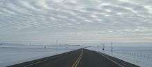
Highway 37 is a highway in the Canadian province of Saskatchewan. It runs from Montana Secondary Highway 241 at the US border near Port of Climax to Highway 32 at Cabri. Highway 37 is about 186 km (116 mi) long.[1] This north south route connects with the horseshoe tourism route at Shaunavon. Going west on the Red Coat Trail Highway 13 one can tour the town of Eastend, which has Saskatchewan's best dinosaur museum, which has a Tyrannosaurus rex fossil as their premier display. Going further west and north one can visit the charming town of Maple Creek, a cowboy town of the current era.
Highway 37 passes near the communities of Climax, Shaunavon, and Gull Lake, as well as Port of Climax and Cabri. Highway 37 connects with Highways 18, 722, 13, 631, 1, 322, and 738.
History
Saskatchewan Highways and Transportation (SHT), now the Ministry of Highways and Infrastructure undertook a landslide risk management system program to monitor risk sites, apply technological innovations to prevent any further erosion of the riverbank and plan responses to future landslide movement detected by monitors. Highway 37 south of Shaunavon along the Frenchman River has experienced land slides.[2]
Major intersections
From south to north:[3]
| Rural municipality | Location | km[1] | mi | Destinations | Notes | |||
|---|---|---|---|---|---|---|---|---|
| Lone Tree No. 18 | Port of Climax | 0.0 | 0.0 | Continuation into Montana | ||||
| Canada–United States border at Turner–Climax Border Crossing | ||||||||
| Climax | 23.0 | 14.3 | Hwy 37 branches west; south end of Hwy 18 concurrency | |||||
| 31.9 | 19.8 | Hwy 37 turns north; north end of Hwy 18 concurrency | ||||||
| Frontier No. 19 |
No major junctions | |||||||
| Grassy Creek No. 78 | Shaunavon | 74.1 | 46.0 | |||||
| 74.5 | 46.3 | South end of Hwy 13 concurrency | ||||||
| Bone Creek No. 108 | | 83.9 | 52.1 | North end of Hwy 13 concurrency | ||||
| Carmichael No. 109 |
No major junctions | |||||||
| Gull Lake No. 139 | Gull Lake | 126.7 | 78.7 | |||||
| 127.1 | 79.0 | |||||||
| ↑ / ↓ | | 150.3 | 93.4 | |||||
| Pittville No. 169[lower-alpha 1] Riverside No. 168[lower-alpha 2] | | 160.1 | 99.5 | Hwy 37 branches east; south end of Hwy 322 concurrency | ||||
| Riverside No. 168 | | 161.7 | 100.5 | Hwy 37 branches north; north end of Hwy 322 concurrency | ||||
| | 184.4 | 114.6 | South end of Hwy 738 concurrency | |||||
| Cabri | 186.2 | 115.7 | North end of Hwy 738 concurrency | |||||
1.000 mi = 1.609 km; 1.000 km = 0.621 mi
| ||||||||
Footnotes
References
- 1 2 3 Google (February 5, 2018). "Highway 37 in Saskatchewan" (Map). Google Maps. Google. Retrieved February 5, 2018.
- ↑ Antunes, P. Jorge; Allen J. Kelly (May 17, 2006). "LANDSLIDE RISK MANAGEMENT AND REMOTE MONITORING SYSTEMS" (PDF). Canada-Northern Ireland Transportation Systems Technology Initiative (CNITSTI). Retrieved 2009-02-07.
- ↑ MapArt (2007). Saskatchewan Road Atlas (Map) (2007 ed.). 1:540,000. Oshawa, ON: Peter Heiler Ltd. pp. 39, 47. ISBN 1-55368-020-0.