Warroad–Sprague Border Crossing
| Warroad–Sprague Border Crossing | |
|---|---|
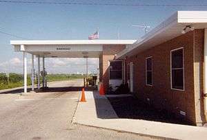 US Border Inspection Station at Warroad, MN as seen in 1998 | |
| Location | |
| Country | United States; Canada |
| Location |
US Port: 41059 Minnesota State Highway 313, Warroad, MN 56763-9411 Canadian Port: Manitoba Highway 12, Sprague, Manitoba R0A 1Z0 |
| Coordinates | 48°59′56″N 95°22′34″W / 48.998994°N 95.376154°W |
| Details | |
| Opened | 1901 |
| US Phone | (218) 386-2796 |
| Canadian Phone | (204) 437-2361 |
| Hours | Open 24 hours |
|
Website https://www.cbp.gov/contact/ports/warroad | |
The Warroad–Sprague Border Crossing connects the cities of Warroad, Minnesota and community of Sprague, Manitoba on the Canada–United States border.
This crossing is connected by Minnesota State Highway 313 on the American side and Manitoba Highway 12 on the Canadian side. Both highways form part of MOM's Way, the network of four highways that form a route between Thunder Bay, Ontario and Ste. Anne, Manitoba. This crossing is also frequently used by U.S. residents traveling between the mainland and Northwest Angle, an enclave of Minnesota that can only be reached by road via Manitoba. This crossing is also the first land crossing west of the Great Lakes that is not at a bridge or tunnel.
The U.S. replaced its border crossing in 2010 with an elaborate 40,000 square foot facility that won architectural design awards.[1] The new facility was built more than a half mile south of the previous border inspection station. Canada last replaced the Sprague border station in 1973.
See also
References
- ↑ Mays, Vernon (November 10, 2010). "Warroad Land Port of Entry". ARCHITECT MAGAZINE- THE JOURNAL OF THE AMERICAN INSTITUTE OF ARCHITECTS. Retrieved 16 January 2017.