North Dakota Highway 20
| ||||
|---|---|---|---|---|
| Route information | ||||
| Maintained by NDDOT | ||||
| Length | 171.00 mi[1] (275.20 km) | |||
| Existed | 1939 – present | |||
| Major junctions | ||||
| South end |
| |||
|
| ||||
| North end |
| |||
| Location | ||||
| Counties | Stutsman, Foster, Eddy, Benson, Ramsey, Cavalier | |||
| Highway system | ||||
| ||||
.svg.png)
North Dakota Highway 20 is a north–south highway in North Dakota. It runs from U.S. Route 281/U.S. Route 52 in Jamestown to the Canada–United States border near Sarles. The highway continues into Manitoba as PTH 34.
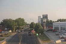
North Dakota 20 in Devils Lake
A portion of ND 20 between mile markers 87 and 90 was closed in April 2010 due to flooding at Devils Lake and Spring Lake.[2][3]
Major intersections
| County | Location | mi[4] | km | Destinations | Notes | |||
|---|---|---|---|---|---|---|---|---|
| Stutsman | Jamestown | 0.000 | 0.000 | |||||
| | 22.620 | 36.403 | Western end of ND 9 concurrency | |||||
| Courtenay | 28.003 | 45.066 | Eastern end of ND 9 concurrency | |||||
| Foster | Glenfield | 44.903 | 72.264 | |||||
| Eddy | | 61.198 | 98.489 | Southern end of ND 15 concurrency | ||||
| | 69.313 | 111.548 | Northern end of ND 15 concurrency | |||||
| Benson |
No major junctions | |||||||
| Ramsey | | 97.709 | 157.247 | Eastern terminus of ND 57 | ||||
| Devils Lake | 102.654 | 165.206 | ||||||
| 103.348 | 166.322 | Eastern terminus of ND 19 | ||||||
| | 124.464 | 200.305 | Southern end of ND 17 concurrency | |||||
| | 129.463 | 208.351 | Northern end of ND 17 concurrency | |||||
| Cavalier | | 141.255 | 227.328 | |||||
| | 150.270 | 241.836 | Eastern end of ND 5 concurrency | |||||
| | 156.034 | 251.112 | Western end of ND 5 concurrency | |||||
| | 170.550 | 274.474 | Continuation into Manitoba | |||||
1.000 mi = 1.609 km; 1.000 km = 0.621 mi
| ||||||||
Notes
- ↑ Mileage retrieved from North Dakota Highways 1 to 30 unless otherwise noted.
- ↑ "Major Road Closed in Devils Lake Region". Retrieved 2010-06-14.
- ↑ "North Dakota Emergencies". North Dakota Department of Transportation. 2010-08-27. Archived from the original on 2010-08-29.
- ↑ "Route and Mileage Map Insets" (PDF). North Dakota Department of Transportation. North Dakota Department of Transportation. Retrieved May 3, 2017.
External links
Route map:
- The North Dakota Highways Page by Chris Geelhart
- North Dakota Signs by Mark O'Neil
This article is issued from
Wikipedia.
The text is licensed under Creative Commons - Attribution - Sharealike.
Additional terms may apply for the media files.