Sweet Grass, Montana
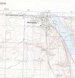
Topographical map of the Sweet Grass area
Sweet Grass (also Sweetgrass[1]) is a census-designated place and unincorporated community in Toole County, Montana, United States, on the Canada–US border. It is the northern terminus of Interstate 15, an important route connecting western Canada, the western United States, and Mexico.
In 2004, a joint border facility opened at the Sweetgrass port of entry and Coutts, Alberta, housing both Canadian and American federal authorities.[2]
Climate
Sweet Grass has a semi-arid climate (Köppen BSk) that closely borders a humid continental climate (Köppen Dwb).
| Climate data for Sweet Grass, Montana | |||||||||||||
|---|---|---|---|---|---|---|---|---|---|---|---|---|---|
| Month | Jan | Feb | Mar | Apr | May | Jun | Jul | Aug | Sep | Oct | Nov | Dec | Year |
| Record high °F (°C) | 64 (18) |
70 (21) |
72 (22) |
84 (29) |
91 (33) |
96 (36) |
105 (41) |
105 (41) |
95 (35) |
88 (31) |
74 (23) |
67 (19) |
105 (41) |
| Average high °F (°C) | 31 (−1) |
35 (2) |
43 (6) |
54 (12) |
65 (18) |
73 (23) |
82 (28) |
81 (27) |
70 (21) |
57 (14) |
40 (4) |
31 (−1) |
55 (13) |
| Average low °F (°C) | 8 (−13) |
12 (−11) |
20 (−7) |
30 (−1) |
39 (4) |
47 (8) |
52 (11) |
50 (10) |
42 (6) |
31 (−1) |
19 (−7) |
10 (−12) |
30 (−1) |
| Record low °F (°C) | −39 (−39) |
−35 (−37) |
−29 (−34) |
−7 (−22) |
16 (−9) |
30 (−1) |
35 (2) |
30 (−1) |
12 (−11) |
−12 (−24) |
−26 (−32) |
−44 (−42) |
−44 (−42) |
| Average precipitation inches (mm) | 0.30 (7.6) |
0.23 (5.8) |
0.58 (14.7) |
1.00 (25.4) |
2.61 (66.3) |
3.13 (79.5) |
1.96 (49.8) |
1.94 (49.3) |
1.45 (36.8) |
0.62 (15.7) |
0.45 (11.4) |
0.30 (7.6) |
14.57 (369.9) |
| Average snowfall inches (cm) | 9.5 (24.1) |
8.3 (21.1) |
8.9 (22.6) |
6.6 (16.8) |
2.3 (5.8) |
0.4 (1) |
0.1 (0.3) |
0.1 (0.3) |
2.6 (6.6) |
4.2 (10.7) |
7.4 (18.8) |
9.1 (23.1) |
59.5 (151.2) |
| Source: [3] | |||||||||||||
Notable people
- Earl W. Bascom (1906-1995), "Father of Modern Rodeo" and Hall of Fame Cowboy, artist, sculptor, actor, inventor, cowboyed in the 1920s on a ranch on Kicking Horse Creek once owned by his cousin C.M. Russell
- Charles M. Russell (1864-1926), cowboy artist and sculptor ranched on Kicking Horse Creek near the Sweetgrass Hills
In popular culture
- The town is referenced in the Marias Pass Approach/Route for TRS2006, via two portals on a BNSF Railway line that goes up to Sweet Grass.
- Referenced to in "Alberta Bound" by Paul Brandt. ("... and so I cranked up the radio cause there’s just a little more to go for I’d cross the border at that Sweet Grass sign.")
Notes
| Wikimedia Commons has media related to Sweet Grass, Montana. |
Coordinates: 48°59′37″N 111°57′04″W / 48.99360°N 111.95118°W
Municipalities and communities of Toole County, Montana, United States | ||
|---|---|---|
| City | 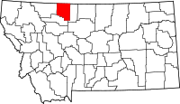 | |
| Towns | ||
| CDP | ||
| Unincorporated communities | ||
This article is issued from
Wikipedia.
The text is licensed under Creative Commons - Attribution - Sharealike.
Additional terms may apply for the media files.