Juneau, Alaska
| Juneau, Alaska Dzánti K'ihéeni | |||
|---|---|---|---|
| State capital of Alaska | |||
| City and Borough of Juneau | |||
 Clockwise from top: Downtown, Shrine of St. Therese, St. Nicholas Russian Orthodox Church, Juneau-Douglas Bridge, Alaska State Capitol | |||
| |||
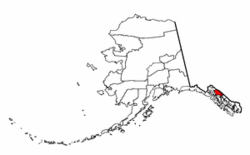 Location of Juneau City and Borough, Alaska | |||
 Juneau, Alaska Location within Alaska 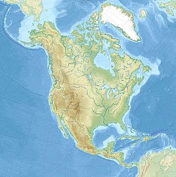 Juneau, Alaska Location within North America | |||
| Coordinates: 58°18′05″N 134°25′18″W / 58.3014485°N 134.4216125°WCoordinates: 58°18′05″N 134°25′18″W / 58.3014485°N 134.4216125°W | |||
| Country |
| ||
| State |
| ||
| Named |
1881 (Juneau City) 1882 (Juneau) | ||
| Incorporated | 1900 | ||
| Home-rule city | October 1960 | ||
| Borough |
September 30, 1963 (Greater Juneau Borough) July 1, 1970 (City and Borough of Juneau) | ||
| Named for | Joe Juneau | ||
| Government | |||
| • Mayor | Ken Koelsch | ||
| • Governing body | Assembly | ||
| • State senator | Dennis Egan (D) | ||
| • State reps. |
Sam Kito III (D) Justin Parish (D) | ||
| Area[1] | |||
| • State capital of Alaska | 3,253.92 sq mi (8,427.63 km2) | ||
| • Land | 2,702.01 sq mi (6,998.16 km2) | ||
| • Water | 551.92 sq mi (1,429.46 km2) | ||
| • Urban | 14.0 sq mi (36 km2) | ||
| Elevation | 56 ft (17 m) | ||
| Population (2010) | |||
| • State capital of Alaska | 31,276 | ||
| • Estimate (2017)[2] | 32,094 | ||
| • Density | 9.98/sq mi (3.85/km2) | ||
| • Urban | 24,537 | ||
| • Urban density | 1,749.5/sq mi (675.5/km2) | ||
| • Demonym | Juneauite | ||
| Time zone | UTC−9 (AKST) | ||
| • Summer (DST) | UTC−8 (AKDT) | ||
| ZIP code | 99801-99803, 99811-99812, 99821, 99824 | ||
| Area code(s) | 907 | ||
| FIPS code | 02-36400 | ||
| GNIS feature ID | 1404263 | ||
| Website |
www | ||
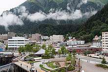
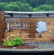
The City and Borough of Juneau (/ˈdʒuːnoʊ/ JOO-noh; Tlingit: Dzánti K'ihéeni [ˈtsántʰì kʼìˈhíːnì]), commonly known as Juneau, is the capital city of Alaska. It is a unified municipality on Gastineau Channel in the Alaskan panhandle, and it is the second largest city in the United States by area. Juneau has been the capital of Alaska since 1906, when the government of what was the District of Alaska was moved from Sitka as dictated by the U.S. Congress in 1900. The municipality unified on July 1, 1970, when the city of Juneau merged with the city of Douglas and the surrounding Greater Juneau Borough to form the current municipality,[3] which is larger by area than both Rhode Island and Delaware.
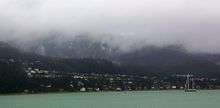
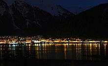
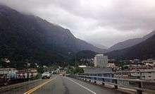
Downtown Juneau (58°18′07″N 134°25′11″W / 58.30194°N 134.41972°W) is nestled at the base of Mount Juneau and across the channel from Douglas Island. As of the 2010 census, the City and Borough had a population of 31,276. In 2014, the population estimate from the United States Census Bureau was 32,406, making it the second most populous city in Alaska after Anchorage.[4] Fairbanks, however, is the state's second most populous metropolitan area, with roughly 100,000 residents. Juneau's daily population can increase by roughly 6,000 people from visiting cruise ships between the months of May and September.
The city is named after a gold prospector from Quebec, Joe Juneau, though the place was for a time called Rockwell and then Harrisburg (after Juneau's co-prospector, Richard Harris). The Tlingit name of the town is Dzántik'i Héeni ("Base of the Flounder’s River," dzánti ‘flounder,’ –kʼi ‘base,’ héen ‘river’), and Auke Bay just north of Juneau proper is called Áak'w ("Little lake," áa ‘lake,’ -kʼ ‘diminutive’) in Tlingit. The Taku River, just south of Juneau, was named after the cold t'aakh wind, which occasionally blows down from the mountains.
Juneau is unusual among U.S. capitals (except Honolulu, Hawaii) in that there are no roads connecting the city to the rest of Alaska or to the rest of North America (although ferry service is available for cars). The absence of a road network is due to the extremely rugged terrain surrounding the city. This in turn makes Juneau a de facto island city in terms of transportation, since all goods coming in and out must go by plane or boat, in spite of the city being on the Alaskan mainland. Downtown Juneau sits at sea level, with tides averaging 16 feet (5 m), below steep mountains about 3,500 feet (1,100 m) to 4,000 feet (1,200 m) high. Atop these mountains is the Juneau Icefield, a large ice mass from which about 30 glaciers flow; two of these, the Mendenhall Glacier and the Lemon Creek Glacier, are visible from the local road system. The Mendenhall glacier has been gradually retreating; its front face is declining in width and height.
The Alaska State Capitol in downtown Juneau was built as the Federal and Territorial Building in 1931. Prior to statehood, it housed federal government offices, the federal courthouse and a post office. It also housed the territorial legislature and many other territorial offices, including that of the governor. Today, Juneau remains the home of the state legislature and the offices of the governor and lieutenant governor. Some other executive branch offices have moved elsewhere in the state. Recent discussion has been focused between relocating the seat of state government outside Juneau and building a new capitol building in Juneau; neither position has led efforts to keep the capital in Juneau.
History
Long before European settlement in the Americas, the Gastineau Channel was a favorite fishing ground for the Auke (A'akw Kwáan) and Taku tribes, who had inhabited the surrounding area for thousands of years. The A'akw Kwáan had a village and burying ground here. In the 21st century it is known as Indian Point. They annually harvested herring during the spawning season, and celebrated this bounty.
Since the late 20th century, the A'akw Kwáan, together with the Sealaska Heritage Institute, have resisted European-American development of Indian Point, including proposals by the National Park Service and the National Oceanic and Atmospheric Administration (NOAA). They consider it sacred territory, both because of the burying ground and the importance of the point in their traditions of gathering sustenance from the sea. They continue to gather clams, gumboots, grass and sea urchins here, as well as tree bark for medicinal uses.[5] The city and state supported Sealaska Heritage Institute in documenting the 78-acre site, and in August 2016 it was listed on the National Register of Historic Places. "It is the first traditional cultural property in Southeast Alaska to be placed on the register."[5][6]
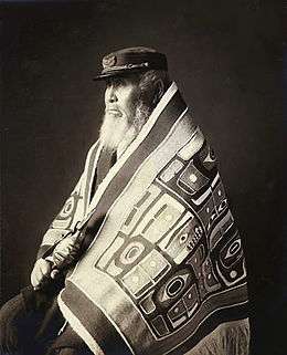
Descendants of these indigenous cultures include the Tlingit people. Native cultures have rich artistic traditions expressed in carving, weaving, orating, singing, and dancing. Juneau has become a major social center for the Tlingit, Haida, and Tsimshian of Southeast Alaska.
European encounters
Although the Russians had a colony in the Alaska territory from 1784 to 1867, they did not settle in Juneau. They conducted extensive fur trading with Alaskan Natives of the Aleutian Islands and Kodiak. Some ships likely explored this area, but did not record it.
The first European to see the Juneau area is recorded as Joseph Whidbey, master of the Discovery during George Vancouver’s 1791–95 expedition. He and his party explored the region in July–August 1794. Early in August he viewed the length of Gastineau Channel from the south, noting a small island in mid-channel. He later recorded seeing the channel again, this time from the west. He said it was unnavigable, being filled with ice.[7]
Mining era
After the California gold rush, miners migrated up the Pacific Coast and explored the West, seeking other gold deposits. In 1880, Sitka mining engineer George Pilz offered a reward to any local chief in Alaska who could lead him to gold-bearing ore. Chief Kowee (Tlingit Kaawa.ée) arrived with some ore, and several prospectors were sent to investigate. On their first trip to Gold Creek, they found deposits of little interest. However, at Chief Kowee's urging, Pilz sent Joe Juneau and Richard Harris back to the Gastineau Channel, directing them to Snow Slide Gulch (the head of Gold Creek). There they found nuggets "as large as peas and beans," in Harris' words.
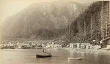
On October 18, 1880, the two men marked a 160-acre (650,000 m2) town site where soon a mining camp sprang up. Within a year, so many miners had arrived that the camp became a village, albeit made up mostly of tents and shacks rather than substantial buildings. It was the first European American settlement founded in this territory after the United States purchased Alaska.
By the autumn of 1881, the village had a population of over 100 and was known as Rockwell, after Lt. Com. Charles Rockwell; later it was known as Harrisburg after prospector Richard Harris. On 14 Dec. 1881, a miners' meeting of 72 persons decided to name the settlement Juneau, after prospector Joe Juneau.[8][9] Perhaps they changed the name to be more distinctive, as another Harrisburg is the capital of Pennsylvania.
Establishment of Russian Orthodox Church
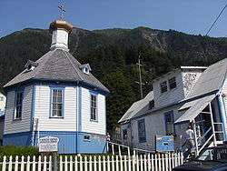
Perhaps because of the pressure of this European encroachment, some Tlingit appealed to the Russian Orthodox Church. It had given services in northern Tlingit settlements in local languages since 1800 and 1824. One of its priests had translated scripture and liturgy into the Tlingit language in the 1830s–1840s. The Tlingit arranged for an Orthodox priest to come to their settlement in Juneau. In 1890, some 700 people converted, following chief Yees Gaanaalx and his wife of Auke Bay. The Orthodox Church Missionary Society supported the Tlingit in furnishing and constructing a church for this large congregation.[10]
St. Nicholas Orthodox Church was completed in 1894 and has maintained a strong presence among the Tlingit, Serbians, and other Europeans who followed this church. The iconostasis has six large panels sent from Russia.[10]
Development of mining
During this period, prospector and placer miner John Lemon operated in what is today the Lemon Creek area. The neighborhood that developed there was named for him by early settlers, as have been several other landmarks in Juneau.
Major mining operations in the Juneau mining district prior to World War II included the Treadwell Mine, The Alaska-Juneau Mine, and Alaska-Gastineau Mine.
In 1906, after the decline of whaling and the fur trade, Sitka, the original capital of Alaska, became less important and the territorial legislature moved the seat of government to Juneau. Juneau was the largest city in Alaska during the inter-war years, passing Fairbanks in the 1920 census. In the post-World War II years, it was displaced by Anchorage in 1950.
20th and 21st centuries
In 1911, the United States Congress authorized funds for construction of a capitol building for the Alaska Territory. World War I delayed construction was and there were difficulties purchasing the necessary land. Citizens of Juneau donated some of the required funds, and construction began on September 8, 1929. Construction of the capitol took less than two years, and the building was dedicated as the Federal and Territorial Building on February 14, 1931. It was designed by Treasury Department architects in the Art Deco architectural style. The building was originally used by the federal government to house the federal courthouse and post office for the territory. Since Alaska gained statehood in 1959, the building has been used by the state government.
The Alaska Governor's Mansion was commissioned under the Public Building Act in 1910. The mansion was designed by James Knox Taylor in the Federal style. Construction was completed in 1912. The territorial governor at that time was the first governor to inhabit the mansion, and he held the first open house for citizens on January 1, 1913. The area of the mansion is 14,400 square feet (1,340 m2). It has ten bathrooms, six bedrooms, and eight fireplaces. The governor resides here when in Juneau on official business. In June 1923, President Warren G. Harding became the first president to visit Alaska. Harding visited the Governor's Mansion while Territorial Governor Scott Bone, who was appointed by Harding, was in office. Harding spoke from the porch of the mansion explaining his policies and met with attendees.
Robert Atwood, then publisher of the Anchorage Times and an Anchorage "booster," was an early leader in efforts to move the capital to Fairbanks, which many in both cities resisted. Some supporters of a move wanted a new capital to be at least 30 miles (48 km) from Anchorage and Fairbanks, to prevent either city from having undue influence. Juneau has continued as the capital. In the 1970s, voters passed a plan to move the capital to Willow, a town 70 miles (110 km) north of Anchorage. But pro-Juneau people there and in Fairbanks persuaded voters also to approve a measure (the FRANK Initiative) requiring voter approval of all bondable construction costs before building could begin. Alaskans later voted against spending the estimated $900 million. A 1984 "ultimate" capital-move vote also failed, as did a 1996 vote.
Juneau remains the capital.[11] Once Alaska was granted statehood in 1959, Juneau's population increased along with the growth of state government. After construction of the Alaska Pipeline in 1977, the state budget was flush with oil revenues, and it expanded programs for the people. That growth slowed considerably in the 1980s.[12]
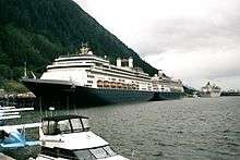
In 2005 the state demographer projected slow growth in the borough for the next twenty years.[13] Cruise ship tourism has expanded rapidly, from approximately 230,000 passengers in 1990 to nearly 1,000,000 in 2006, as cruise lines have built more and larger ships—even 'mega-ships.' They have sailed to Juneau seven days a week instead of six, and over a longer season, but the cruising tourism is still primarily a summer industry. It provides few year-round jobs but stimulates summer employment in the city.
In 2010, the city was recognized as part of the "Playful City USA" initiative by KaBOOM!, created to honor cities that ensure their children have great places to play.[14]
Juneau is larger in area than the state of Delaware and was, for many years, the country's largest city by area. Juneau continues to be the only U.S. state capital on an international border: it is bordered on the east by Canada. It is the U.S. state capital whose namesake was most recently alive: Joe Juneau died in 1899, a year after Otto von Bismarck, the Prussian leader for whom Bismarck, North Dakota was named.
The city was temporarily renamed UNO, after the card game, on April 1, 2016 (April Fool's Day).[15][16] The change was part of a promotion with Mattel to draw "attention to new wild cards in [the] game".[15] For Juneau's cooperation, Mattel donated $15,000 "to the Juneau Community Foundation in honor of late Mayor Greg Fisk."[15]
Juneau hosts a major Zip-line attraction developed by Experience Based Learning.
Geography
According to the United States Census Bureau, the borough has an area of 3,255 square miles (8,430 km2), making it the third-largest municipality in the United States by area (the largest is Yakutat City and Borough, Alaska). 2,716.7 square miles (7,036 km2) of it is land and 538.3 square miles (1,394 km2) of it (16.54%) is water.
Central (downtown) Juneau is at 58°18′07″N 134°25′11″W / 58.30194°N 134.41972°W.[17] The City and Borough of Juneau includes Douglas Island, a tidal island to the west of mainland Juneau. Douglas Island can be reached via the Juneau-Douglas Bridge.
As is the case throughout Southeast Alaska, the Juneau area is susceptible to damage caused by natural disasters. The 2014 Palma Bay earthquake caused widespread outages to telecommunications in the area due to damage to a fiber optic cable serving the area. In April 2008, a series of massive avalanches outside Juneau heavily damaged the electrical lines providing Juneau with power, knocking the hydroelectric system offline and forcing the utility to switch to a much more expensive diesel system.
Adjacent boroughs and census areas
- Haines Borough, Alaska – northwest, west
- Hoonah-Angoon Census Area, Alaska – south, southwest
Border area
Juneau, Alaska, shares its eastern border with the Canadian province of British Columbia. It is the only U.S. state capital to border another country.
- Stikine Region, British Columbia – northeast, east
Places adjacent to Juneau, Alaska | ||||||||||
|---|---|---|---|---|---|---|---|---|---|---|
| ||||||||||
National protected areas
- Tongass National Forest (part)
- Admiralty Island National Monument (part)
- Kootznoowoo Wilderness (part)
- Tracy Arm-Fords Terror Wilderness (part)
- Admiralty Island National Monument (part)
Climate
The Juneau area is in a transition zone between a continental climate (Köppen Dfb/Dfc), and an oceanic climate (Köppen Cfb/Cfc), depending on the isotherm used. The city is milder in winter than its latitude may suggest due to the influence of the Pacific Ocean. Winters are moist and long, but mild by Alaskan standards: the average low temperature is 23 °F (−5 °C) in January, and highs are frequently above freezing. Spring, summer, and fall are warmer than winter, with highs peaking in July at 65 °F (18.3 °C). Snowfall averages 87.4 inches (222 cm) and occurs chiefly from November to March. Precipitation falls on an average 230 days per year, averaging 62.27 inches (1,580 mm) at the airport (1981–2010 normals), but ranging from 55 to 92 inches (1,400 to 2,340 mm), depending on location.[18] The spring months are the driest while September and October are the wettest. The coldest temperature ever recorded in Juneau was −22 °F (−30.0 °C) on February 2, 1968, and January 12, 1972. The hottest temperature was 90 °F (32.2 °C) on July 7, 1975.
Records have been officially kept at downtown Juneau from January 1890 to June 1943, and at Juneau International Airport since July 1943; the normals and record temperatures for both downtown and the airport are provided below.
| Climate data for Juneau, Alaska (Juneau Int'l, 1981–2010 normals,[19] extremes 1890–present) | |||||||||||||
|---|---|---|---|---|---|---|---|---|---|---|---|---|---|
| Month | Jan | Feb | Mar | Apr | May | Jun | Jul | Aug | Sep | Oct | Nov | Dec | Year |
| Record high °F (°C) | 57 (14) |
57 (14) |
61 (16) |
74 (23) |
82 (28) |
87 (31) |
90 (32) |
87 (31) |
85 (29) |
68 (20) |
64 (18) |
59 (15) |
90 (32) |
| Mean maximum °F (°C) | 44.5 (6.9) |
45.3 (7.4) |
48.8 (9.3) |
61.7 (16.5) |
71.1 (21.7) |
77.9 (25.5) |
77.3 (25.2) |
76.1 (24.5) |
65.7 (18.7) |
55.5 (13.1) |
47.1 (8.4) |
45.0 (7.2) |
80.3 (26.8) |
| Average high °F (°C) | 32.8 (0.4) |
35.2 (1.8) |
39.6 (4.2) |
48.4 (9.1) |
56.6 (13.7) |
62.2 (16.8) |
63.9 (17.7) |
62.7 (17.1) |
55.7 (13.2) |
47.0 (8.3) |
37.8 (3.2) |
34.1 (1.2) |
48 (8.9) |
| Daily mean °F (°C) | 28.3 (−2.1) |
30.1 (−1.1) |
33.8 (1) |
40.8 (4.9) |
48.6 (9.2) |
54.6 (12.6) |
56.9 (13.8) |
55.9 (13.3) |
50.0 (10) |
42.4 (5.8) |
33.4 (0.8) |
29.9 (−1.2) |
42.1 (5.6) |
| Average low °F (°C) | 23.7 (−4.6) |
25.0 (−3.9) |
28.0 (−2.2) |
33.3 (0.7) |
40.6 (4.8) |
46.9 (8.3) |
50.0 (10) |
49.0 (9.4) |
44.4 (6.9) |
37.8 (3.2) |
29.1 (−1.6) |
25.6 (−3.6) |
36.1 (2.3) |
| Mean minimum °F (°C) | 6.0 (−14.4) |
9.0 (−12.8) |
13.6 (−10.2) |
23.2 (−4.9) |
31.7 (−0.2) |
38.8 (3.8) |
43.6 (6.4) |
41.0 (5) |
32.8 (0.4) |
24.5 (−4.2) |
14.3 (−9.8) |
7.5 (−13.6) |
−1.4 (−18.6) |
| Record low °F (°C) | −22 (−30) |
−22 (−30) |
−15 (−26) |
6 (−14) |
25 (−4) |
31 (−1) |
36 (2) |
27 (−3) |
23 (−5) |
11 (−12) |
−5 (−21) |
−21 (−29) |
−22 (−30) |
| Average precipitation inches (mm) | 5.35 (135.9) |
4.13 (104.9) |
3.78 (96) |
2.94 (74.7) |
3.40 (86.4) |
3.24 (82.3) |
4.60 (116.8) |
5.73 (145.5) |
8.64 (219.5) |
8.63 (219.2) |
5.99 (152.1) |
5.84 (148.3) |
62.27 (1,581.6) |
| Average snowfall inches (cm) | 27.7 (70.4) |
16.8 (42.7) |
11.6 (29.5) |
1.1 (2.8) |
0.0 (0) |
0.0 (0) |
0.0 (0) |
0.0 (0) |
0.0 (0) |
0.8 (2) |
13.1 (33.3) |
15.6 (39.6) |
86.7 (220.2) |
| Average precipitation days (≥ 0.01 in) | 20.6 | 16.6 | 18.9 | 17.0 | 16.3 | 15.8 | 17.7 | 19.1 | 22.4 | 23.9 | 20.9 | 20.6 | 229.8 |
| Average snowy days (≥ 0.1 in) | 10.6 | 7.9 | 6.8 | 1.3 | 0.0 | 0.0 | 0.0 | 0.0 | 0.0 | 0.6 | 5.9 | 10.0 | 43.1 |
| Average relative humidity (%) | 79.9 | 80.8 | 79.4 | 76.8 | 76.3 | 78.3 | 81.3 | 84.3 | 87.9 | 87.7 | 85.1 | 82.8 | 81.7 |
| Mean monthly sunshine hours | 80.9 | 89.2 | 137.3 | 182.3 | 231.7 | 189.3 | 182.9 | 161.6 | 109.6 | 66.2 | 58.5 | 41.2 | 1,530.7 |
| Percent possible sunshine | 36 | 34 | 37 | 42 | 44 | 35 | 34 | 34 | 28 | 21 | 25 | 20 | 34 |
| Source: NOAA (relative humidity and sun 1961–1990)[20][21][22] | |||||||||||||
| Climate data for Juneau, Alaska (Downtown, 1981–2010 normals, extremes 1890–present) | |||||||||||||
|---|---|---|---|---|---|---|---|---|---|---|---|---|---|
| Month | Jan | Feb | Mar | Apr | May | Jun | Jul | Aug | Sep | Oct | Nov | Dec | Year |
| Record high °F (°C) | 60 (16) |
57 (14) |
61 (16) |
72 (22) |
80 (27) |
87 (31) |
89 (32) |
87 (31) |
85 (29) |
68 (20) |
64 (18) |
59 (15) |
89 (32) |
| Average high °F (°C) | 34.6 (1.4) |
36.7 (2.6) |
40.8 (4.9) |
49.1 (9.5) |
56.9 (13.8) |
62.4 (16.9) |
63.4 (17.4) |
62.6 (17) |
56.6 (13.7) |
48.4 (9.1) |
39.8 (4.3) |
36.7 (2.6) |
49.0 (9.4) |
| Daily mean °F (°C) | 30.4 (−0.9) |
32.1 (0.1) |
35.5 (1.9) |
42.2 (5.7) |
49.6 (9.8) |
55.4 (13) |
57.4 (14.1) |
56.4 (13.6) |
51.2 (10.7) |
43.7 (6.5) |
35.6 (2) |
32.3 (0.2) |
43.5 (6.4) |
| Average low °F (°C) | 26.2 (−3.2) |
27.6 (−2.4) |
30.1 (−1.1) |
35.3 (1.8) |
42.3 (5.7) |
48.4 (9.1) |
51.4 (10.8) |
50.2 (10.1) |
45.8 (7.7) |
39.0 (3.9) |
31.4 (−0.3) |
27.8 (−2.3) |
38.0 (3.3) |
| Record low °F (°C) | −20 (−29) |
−15 (−26) |
−5 (−21) |
12 (−11) |
26 (−3) |
32 (0) |
39 (4) |
32 (0) |
28 (−2) |
13 (−11) |
−7 (−22) |
−10 (−23) |
−20 (−29) |
| Average precipitation inches (mm) | 7.98 (202.7) |
6.71 (170.4) |
6.29 (159.8) |
4.64 (117.9) |
4.96 (126) |
4.42 (112.3) |
5.44 (138.2) |
8.16 (207.3) |
12.72 (323.1) |
13.23 (336) |
8.44 (214.4) |
9.23 (234.4) |
92.22 (2,342.5) |
| Average snowfall inches (cm) | 24.2 (61.5) |
15.9 (40.4) |
5.4 (13.7) |
0.9 (2.3) |
0 (0) |
0 (0) |
0 (0) |
0 (0) |
0 (0) |
0.6 (1.5) |
9.2 (23.4) |
13.6 (34.5) |
69.8 (177.3) |
| Average precipitation days (≥ 0.01 in) | 20.8 | 17.3 | 19.1 | 18.5 | 19.0 | 17.9 | 17.3 | 21.0 | 22.3 | 24.5 | 20.8 | 20.7 | 239.2 |
| Average snowy days (≥ 0.1 in) | 8.3 | 5.3 | 5.0 | 0.7 | 0 | 0 | 0 | 0 | 0 | 0.2 | 4.1 | 5.8 | 29.4 |
| Source: NOAA[20][23] | |||||||||||||
Demographics
| Historical population | |||
|---|---|---|---|
| Census | Pop. | %± | |
| 1890 | 1,253 | — | |
| 1900 | 1,864 | 48.8% | |
| 1910 | 1,644 | −11.8% | |
| 1920 | 3,058 | 86.0% | |
| 1930 | 4,043 | 32.2% | |
| 1940 | 5,729 | 41.7% | |
| 1950 | 5,956 | 4.0% | |
| 1960 | 6,797 | 14.1% | |
| 1970 | 6,050 | −11.0% | |
| 1980 | 19,528 | 222.8% | |
| 1990 | 26,751 | 37.0% | |
| 2000 | 30,711 | 14.8% | |
| 2010 | 31,275 | 1.8% | |
| Est. 2017 | 32,094 | [2] | 2.6% |
| U.S. Decennial Census[24] | |||
Juneau first appeared on the 1890 U.S. Census. It formally incorporated in 1900.
As of the 2010 census, there were 31,275 people, 12,187 households, and 7,742 families residing in the city/borough. The population density was 11.3 per square mile (4.4/km2). There were 13,055 housing units at an average density of 4.0 per square mile (1.5/km2). The racial makeup of the city/borough was 69.4% White (67.4% Non-Hispanic White, down from 83.2% in 1980),[25] 0.9% African American, 11.8% Native American or Alaska Native, 6.1% Asian (4.5% Filipino, 0.3% Other Asian, 0.3% Chinese, 0.3% Korean, 0.2% Japanese, 0.1% Vietnamese), 0.7% Pacific Islander, and 1.2% from other races, and 9.5% from two or more races. 5.1% of the population were Hispanic or Latino of any race.[26] 2.6% reported speaking Tagalog at home, and 2.4% reported speaking Spanish.[27]
There were 11,543 households out of which 36.7% had children under the age of 18 living with them, 51.2% were married couples living together, 10.5% had a female householder with no husband present, and 33.8% were non-families. 24.4% of all households were made up of individuals and 4.3% had someone living alone who was 65 years of age or older. The average household size was 2.60 and the average family size was 3.10.
The age distribution of Juneau was as follows: 27.4% of the population was under the age of 18, 8.1% were from 18 to 24, 32.8% from 25 to 44, 25.7% from 45 to 64, and 6.1% who were 65 years of age or older. The median age was 35 years. For every 100 females, there were 101.5 males. For every 100 females age 18 and over, there were 100.2 males.
The median income for a household in the city/borough was $62,034, and the median income for a family was $70,284. Males had a median income of $46,744 versus $33,168 for females. The per capita income for the city/borough was $26,719. 6.0% of the population and 3.7% of families were below the poverty line, including 6.7% of those under the age of 18 and 3.9% of those 65 and older.
Economy

As the capital of Alaska, the primary employer in Juneau is government. This includes the state government, federal government (which has regional offices here, especially for resource agencies), municipal government (which includes the local airport, hospital, harbors, and school district), and the University of Alaska Southeast. State government offices and their indirect economic impact compose approximately one-quarter of Juneau's economy.[28]
Another large contributor to the local economy is the tourism industry, which generates most income in the summer months. In 2005, the cruise ship industry was estimated to bring nearly one million visitors to Juneau for up to 11 hours at a time, between May and September.[29] While cruise ships provide an economic boost to segments of the economy, not all locals are appreciative. The Juneau Public Library, built atop a parking garage along South Franklin Street near the Red Dog Saloon, was designed to take advantage of the view of and across Gastineau Channel. This view is often blocked by docking cruise ships, which have become so large that they tower over the five-story structure.
Bill Ray, who lived in Juneau from 1938 to 2000 and represented the community in the Alaska Legislature from 1965 to 1987, said when he paid a return visit in 2003: "Juneau doesn't go forward. They've prostituted themselves to tourism. It looks like a poor man's Lahaina".[30]
The fishing industry is still a major part of the Juneau economy, while not as strong as when the halibut schooner fleet generated considerable profits. Juneau was recently the 49th most lucrative U.S. fisheries port by volume and 45th by value. In 2004 it took in 15 million pounds of fish and shellfish, valued at 21.5 million dollars, according to the National Marine Fisheries Service. While the port of Juneau does comparatively little seafood processing compared to other towns of this size in Alaska, the hundreds of commercial fishing boats sell their fish to plants in nearby Sitka, Hoonah, Petersburg and Ketchikan. The largest fleets operating from Juneau are the gillnet and troll salmon fleets.
Juneau is also the home to many of the commercial fishing associations in Alaska, as they want to educate and lobby the state legislature. These associations include the Alaska Trollers Association, United Fishermen of Alaska, United Southeast Alaska Gillnetters Association, and the Southeast Alaska Seiners Association.
Real estate agencies, federally funded highway construction, and mining are still viable non-government local industries. Alaska Seaplanes, an airline, has its headquarters in Juneau.[31] As of Census 2010 there were 1,107 businesses with operations in Juneau borough and thus, with a population of 31,275, a per capita of roughly 28 people per business.
Juneau's only power utility is Alaska Electric Light & Power (AEL&P). Most of the electricity in the borough is generated at the Snettisham Hydroelectric facility in the southern end of the borough, accessible only by boat or plane. In April 2008, an avalanche destroyed three transmission towers, forcing AEL&P to supply almost all of the borough's electricity from diesel-powered generators for one month.[32]
Also headquartered in Juneau is the Marine Exchange of Alaska, a nonprofit organization which operates an extensive vessel tracking network and ensures safe maritime operations for the entire state.[33]
Companies based in Juneau include Sealaska Corporation.
Culture
Juneau hosts the annual Alaska Folk Festival, Juneau Jazz & Classics music festival, and Celebration, a biennial Alaska Native cultural festival.
The city is home to Perseverance Theatre, Alaska's largest professional theater, and the non-profit Theatre in the Rough. The Juneau Symphony performs regularly. The Juneau Lyric Opera and Opera to Go are the two local opera companies. The JUMP Society hosts screenings of locally made short films two times a year.
Downtown Juneau has many art galleries that participate in the monthly First Friday Art Walk and annual Gallery Walk held in the first week of December. The Juneau Arts & Humanities Council coordinates events and operates the Juneau Arts & Culture Center, which features a community center, gallery and lobby shop. The University of Alaska Southeast Campus offers lectures, concerts, and theater performances. Sealaska Heritage, the nonprofit affiliate of the Sealaska Corporation, operates The Walter Soboleff Building which is decorated by carvings and hosts ongoing cultural exhibits.
Notable artists from Juneau include painter Rie Muñoz, printmaker Dale DeArmond, violinists Linda Rosenthal and Paul Rosenthal, Alaska Native carver and painter James Schoppert, playwright and filmmaker Gab Cody, theatre director Molly Smith, filmmaker Chuck D. Keen, writer and photographer Lynn Schooler, who authored The Blue Bear, Ishmael Hope, who wrote the videogame Never Alone and Janet Gardner, Singer of the hard rock band Vixen.
Government

The City and Borough of Juneau operates under a council–manager form of government. The mayor is the titular head of the city, is the presiding officer (or chair) of the Juneau Assembly (council), and is one of three members of that body elected at-large, or areawide. The remaining six members are elected by single-member districts: two districts have been defined by the Assembly, as of its last redistricting in 2003:[34]
|
|
They hire a professional city manager to handle daily affairs.
These districts are nearly aligned with the boundaries of the 31st and 32nd election districts that were established by the state. The main difference is that the 32nd District includes communities outside the CBJ: Gustavus, Kupreanof, Petersburg, Skagway and Tenakee Springs. The Juneau Airport precinct is in the 31st district, which is otherwise identical to the 2nd Assembly District.
Since Juneau was split into two state house districts by the state during redistricting in the early 1990s, the districts comprising downtown Juneau, Douglas Island and surrounding areas have exclusively elected Democrats to the Alaska House of Representatives, while the districts comprising Mendenhall Valley and surrounding areas have mostly elected Republicans. The 31st District is currently represented in the House by Democrat Justin Parish, who has been in office since 2016. The 32nd District is currently represented by Democrat Sam Kito III, who has been in office since the resignation of Beth Kerttula in 2014.
Combined, these two election districts form Alaska Senate District P. That seat is held by Democrat Dennis Egan, a former Juneau mayor who has been in office since 2009. The last Republican to represent Juneau in the state Senate was Elton Engstrom, Jr., the father of Cathy Muñoz. He left office at the end of his term in early 1971, after failing to be re-elected in 1970.
| Year | Democrat | Republican |
|---|---|---|
| 2008 | 64.4% | 32.4% |
| 2004 | 59.2% | 37.3% |
While there are more state jobs based in Anchorage than in Juneau, the state government still maintains a substantial presence in Juneau. A number of executive branch departments, as well as the legislature, are based in Juneau. The legislature, in response to repeated pressure from Southcentral Alaska to move either the capital or the legislature, acquired and renovated several buildings in the vicinity of the Alaska State Capitol, which hold committee meeting rooms and administrative offices for the Legislative Affairs Agency. These buildings were named for former legislators Terry Miller and Thomas Stewart.
Stewart, a Juneau native and son of early Juneau mayor B. D. Stewart, represented Juneau in the Senate during the 1st Alaska State Legislature. He later served in Juneau's Alaska Superior Court judgeship and was noted as an authority on the latter territory/early statehood eras of Alaska's history.
The federal government has a nine-story federal building in Juneau in the area known as "The Flats". Along Gold Creek near its mouth and a short distance east of the Juneau-Douglas Bridge, the building houses numerous federal agencies, the United States District Court for the District of Alaska, and Juneau's main post office. It was designed by Linn A. Forrest and constructed in 1966. Under the Alaska Statehood Act, the Federal and Territorial Building was transferred to the new state for use as its (capitol).
Education
Primary and secondary schools
Juneau is served by the Juneau School District and includes the following schools:[36]
|
|
In addition, the following private schools also serve Juneau:
- (Glacier) Valley Baptist Academy
- Faith Community School
- Thunder Mountain Learning Center (Formerly Thunder Mountain Academy)
- Juneau Seventh-day Adventist Christian School
- Juneau Montessori School
Colleges and universities
The University of Alaska Southeast is within the Auke Bay community along the Auke Lake. Juneau-Douglas Community College, founded in 1956, and Southeastern Senior College, established in 1972, were merged in 1980 forming the University of Alaska Juneau. The university was restructured as the University of Alaska Southeast to include Ketchikan and Sitka campuses. The university offers undergraduate and graduate studies.
Transportation
Juneau is not directly accessible by road, although there are road connections to several areas immediately adjacent to the city. Primary access to the city is by air and sea. Cars and trucks are transported to and from Juneau by barge or the Alaska Marine Highway ferry system.

Sea
The state-owned ferry system is called the Alaska Marine Highway. The Southeast ferries connect Juneau with 13 other cities in Southeast Alaska and other destinations north via Whittier, as well as with the continental road system in Bellingham, Washington, and Prince Rupert, British Columbia. Going north, the ferries dock in Haines and Skagway connecting to the Alaska Highway via Whitehorse Canada.[37] In addition to the traditional Alaska Marine Highway ferries, high-speed catamarans known as "Fast cats" connect Juneau with Haines and Skagway (91 miles (146 km)) in half the time of the traditional ferries, needing around four hours' travel time.[38]
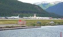
Air
Juneau International Airport serves the city and borough of Juneau. Alaska Airlines services the airport year round, operating upwards of 11 daily departures. Alaska Airlines serves Juneau and other Southeast Alaska villages via "Milk Run" flights which make multiple stops to and from Seattle or Anchorage. Alaska also connects Juneau to other cities in the country through connections in Seattle or Anchorage.
In the summer Delta Air Lines serves Juneau from its major West Coast hub in Seattle, providing global service to and from Southeast Alaska without having to switch air carriers.
In the past, MarkAir and Western Airlines previously serviced Juneau.[39] Alaska Seaplanes and Ward Air offer charter seaplane service from the seaplane floatpond "runway" that runs parallel to the traditional tarmac. They offer service to the smaller villages in the surrounding area as well as flightseeing.
Alaska Seaplanes, Harris Air, and Island Air Express provide FAA Part 135 scheduled commuter service to many communities throughout Southeast Alaska. These trips are the only connections to the outside world for many of these villages. Alaska Seaplanes has recently restored scheduled international service to Juneau with 3 weekly trips to Whitehorse, Canada, while Ward Air provides unscheduled charter flights to Canada.[40]
Roads
Avalanche hazards, steep slopes, cold weather and environmental protection concerns are factors that make road construction and maintenance both difficult and costly.
The Juneau-Douglas Bridge connects Juneau mainland with Douglas Island.
There are no roads connecting Juneau to the rest of North America, although cars can use the ferries to connect to the road network. Juneau is one of only four state capitals not served by an Interstate highway. (The others are Dover, Delaware; Jefferson City, Missouri; and Pierre, South Dakota.)[41]
Juneau Access Project
Juneau's roads remain separate from other roads in Alaska and in the Lower 48. There have been plans to connect Juneau to Haines and Skagway by road since before 1972, with funding for the first feasibility study acquired in 1987.[42] The State of Alaska Department of Transportation and Public Facilities announced in 2005 that the connection was to be provided partly by road, and partly by fast ferry. A 51-mile (82 km) road would be built on the east side of Lynn Canal to a new ferry terminal at the Katzehin River estuary.[43] A ferry would take cars from the terminal to Haines and Skagway, where the cars could then access the rest of North America.[43] In 2006, the project was estimated to cost $258 million, and in 2007, the estimate was increased to $350 million.[43] Annual costs have been estimated from $2.1 million to $12 million, depending on the length of the road.[42] The Western Federal Lands Center estimates the project will cost $491 million.[43] As of 2009, $25 million has been spent on the project.[43]
Local opinions on constructing a road link to the outside world are mixed. Some residents see such a road as a much-needed link between Juneau and the rest of the world which will also provide great economic benefits to the city, while many other residents are concerned about the project's financial costs along with environmental and social impacts.[44]
Citing the state’s multibillion-dollar financial crisis, Governor Bill Walker announced on December 15, 2016, that the state is no longer backing construction of the Juneau Access Improvements Project.[45]
Public transportation
Local government operates a bus service under the name Capital Transit.
Walking, hiking, and biking
Residents walk, hike, or ride bicycles for both recreational purposes and as transportation. The downtown area of Juneau has sidewalks, and the neighborhoods on the hill above downtown are accessible by foot. Some roads in the city also have bike lanes, and there is a bike path parallel to the main highway.
Infrastructure
Healthcare
The city and borough is primarily served by Bartlett Regional Hospital in Juneau's Twin Lakes area. The hospital also serves the nearby remote communities of Hoonah, Haines, and Skagway. Individuals in these communities must be airlifted to the hospital via helicopter or air ambulance (ranging from a 20-minute to a 45-minute flight, depending on location).
Utilities
Juneau is served by the following utilities:
- Electric: Alaska Electric Light and Power Company
- Water and Sewer: City and Borough of Juneau
Media
Juneau's only daily newspaper, the Juneau Empire, is published Sunday through Friday, with no Saturday edition. There is also a regional weekly newspaper, the Capital City Weekly. The University of Alaska Southeast has The Whalesong, a college newspaper.
- Radio
Additionally, the studios of CoastAlaska (a regional public radio station consortium), are in Juneau. AP (the Associated Press), Anchorage news outlets, and other Alaska media entities, send reporters to Juneau during the annual Legislative session.
- Television
Juneau's major television affiliates are: KTOO (PBS), 360 North "Alaska’s public affairs channel" (Operated by KTOO), KATH-LD (NBC), KXLJ-LD (CBS), and KJUD (ABC)/The CW on DT2. Fox and MyNetworkTV are only available on cable via their Anchorage affiliates.
The Juneau-Douglas High School video program also produces a variety of television programming, including a weekly 10-minute TV newscast, JDTV News, during the spring semester.
Mayors
- Ohlin Harrison Adsit (1855–1909) from 1902 to 1904.
- Arthur K. Delaney (1841–1905) from 1900 to 1901.
Sister cities
Juneau has six official sister cities.[46]


See also
- Juneau gold belt
- Adair-Kennedy Memorial Park
- Auke Bay, Alaska
- Capital City Fire/Rescue
- Douglas, Alaska
- Evergreen Cemetery
- Hurff Ackerman Saunders Federal Building and Robert Boochever US Courthouse
- Juneau Mountain Rescue
- National Register of Historic Places listings in Juneau, Alaska
- Alaska Route 7
- Out the road (Juneau), a region of Juneau
- Thane, Alaska
Notes
- ↑ "2016 U.S. Gazetteer Files". United States Census Bureau. Retrieved Jun 22, 2017.
- 1 2 "Population and Housing Unit Estimates". Retrieved June 9, 2017.
- ↑ Miller, Marian (9 June 1997). "An Outline History of Juneau Municipal Government". City and Borough of Juneau. Retrieved 3 May 2012.
- ↑ "Juneau City and Borough QuickFacts from the US Census Bureau". Quickfacts.census.gov. Archived from the original on 2015-07-07. Retrieved 2015-10-14.
- 1 2 ICTMN Staff, "Indian Point Goes on National Register of Historic Places", Indian Country Today, 18 August 2016; accessed 21 August 2016
- ↑ Lisa Phu, "Feds designate Juneau's Indian Point as sacred, worthy of protection", Juneau Empire, 16 August 2016; accessed 21 August 2016
- ↑ Vancouver, George; Vancouver, John (1801). A voyage of discovery to the North Pacific ocean, and round the world. vols. I-VI. London: J. Stockdale.
- ↑ Arthur C. Spencer (1906). The Juneau Gold Belt, Alaska, USGS Bulletin No. 287. United States Government Printing Office. pp. 2–3.
- ↑ Gannett, Henry (1905). The Origin of Certain Place Names in the United States. Govt. Print. Off. p. 171.
- 1 2 Amos Wallace (April 10, 1973). "St. Nicholas Russian Orthodox Church". National Park Service. and accompanying photos from 1961 and 1972
- ↑ "Sean Parnell, 10th Governor of Alaska". Gov.state.ak.us. Archived from the original on 2008-02-25. Retrieved 2011-12-10.
- ↑ "CensusScope − Population Growth". Retrieved November 15, 2005.
- ↑ "Juneau's future demographic: Growing older". JuneauAlaska.com. Retrieved 2005-11-15.
- ↑ Juneau Named ‘Playful’ City, Only Honoree in Alaska. Juneau Empire, September 3, 2010. Retrieved 2010-11-15.
- 1 2 3 "No joke: Alaska city temporarily renamed for card game UNO". Associated Press/CBS News. April 1, 2016. Retrieved April 1, 2016.
- ↑ "Greetings from 'Uno, Alaska.' Capital city teams up with Mattel for April Fools' Day". KTUU-TV/Gray Television. April 1, 2016. Archived from the original on April 2, 2016. Retrieved April 1, 2016.
- ↑ "US Gazetteer files: 2010, 2000, and 1990". United States Census Bureau. 2011-02-12. Retrieved 2011-04-23.
- ↑ "Tongass National Forest – Home". fs.fed.us.
- ↑ Mean monthly maxima and minima (i.e. the highest and lowest temperature readings during an entire month or year) calculated based on data at said location from 1981 to 2010.
- 1 2 "NOWData – NOAA Online Weather Data". National Oceanic and Atmospheric Administration. Retrieved 2017-08-28.
- ↑ "Station Name: AK JUNEAU INTL AP". National Oceanic and Atmospheric Administration. Retrieved 2014-03-13.
- ↑ "WMO Climate Normals for Juneau, AK 1961–1990". National Oceanic and Atmospheric Administration. Retrieved September 10, 2015.
- ↑ "Station Name: AK JUNEAU DWTN". National Oceanic and Atmospheric Administration. Retrieved 2014-03-13.
- ↑ "Census of Population and Housing". Census.gov. Archived from the original on May 12, 2015. Retrieved June 4, 2015.
- ↑ "Alaska - Race and Hispanic Origin for Selected Cities and Other Places: Earliest Census to 1990". U.S. Census Bureau. Archived from the original on 2012-08-06. Retrieved 2013-01-10.
- ↑ "American FactFinder". U.S. Census Bureau. Archived from the original on 10 December 2014. Retrieved 23 May 2014.
- ↑ "Language Map Data Center".
- ↑ The Associated Press. "Alaska capital move would devastate Juneau economy" Archived 2009-04-23 at the Wayback Machine., Fairbanks Daily News-Miner, 19 April 2009; accessed August 2, 2009.
- ↑ "Cruise outlook for 2005 shows growth". Retrieved November 15, 2005.
- ↑ "Memoirs of a longtime lawmaker – Bill Ray comes to Juneau to sign his new book, 'Liquor, Legislation & Laughter'" (PDF). Juneau Empire. Fairbanks: (as hosted by the University of Alaska System). April 25, 2003. Retrieved October 24, 2011.
- ↑ "Contact Us." Alaska Seaplanes. Retrieved on August 12, 2017.
- ↑ "Snettisham Hydroelectric Project outage causes city to run partly on diesel".
- ↑ "Marine Exchange of Alaska – MXAK Overview and Programs". Mxak.org. Archived from the original on 2015-11-21. Retrieved 2015-10-14.
- ↑ "CBJ Assembly Districts" (PDF). juneau.org. Office of the City and Borough of Juneau Clerk. June 30, 2012. Retrieved April 12, 2013.
- ↑ "2008 Presidential Election Results by House District in Alaska". USA Election Atlas http://uselectionatlas.org/FORUM/index.php?topic=88046.0. Retrieved 5 July 2010
- ↑ Schools in the Juneau School District
- ↑ Alaska Marine Highway System (2008). Alaska Marine Highway System; Annual Traffic Volume Report (PDF) (Report). Alaska Department of Transportation and Public Facilities. Archived from the original (PDF) on March 30, 2013.
- ↑ "Vessel Information Table" (PDF). State of Alaska DOT. Retrieved 22 August 2017.
- ↑ Phu, Lisa (April 11, 2016). "Delta to end year-round service in Juneau". JuneauEmprie.com. Juneau Empire. Retrieved August 23, 2017.
- ↑ "Ward Air". Retrieved 2017-08-23.
- ↑ "The Dwight D. Eisenhower System of Interstate and Defense Highways - Part VII - Miscellaneous Interstate Facts". Federal Highway Administration. Retrieved June 3, 2018.
- 1 2 Kleeschulte, Chuck (8 June 1987). "Haines-to-Juneau road to be studied". Juneau Empire. Juneau, United States.
- 1 2 3 4 5 Connelly, Joel (July 10, 2009). "Tab for Alaska road: $445 million". Seattle Post-Intelligencer.
- ↑ Juneau's Road to Ruin Archived 2011-07-23 at the Wayback Machine., Sierra Club Alaska Chapter.
- ↑ "Gov. Walker abandons Juneau access road 15 December 2016". Alaska public media. Retrieved 2 February 2017.
- ↑ "The City and Borough of Juneau Homepage". juneau.org.
References
- Andrews, Clarence Leroy (1944). The Story of Alaska. Caldwell, Id: The Caxton Printers, Ltd. OCLC 5024244.
- Naske, Claus-M; Slotnick, Herman E (1987). Alaska: A History of the 49th State. Norman, Oklahoma: University of Oklahoma Press. ISBN 0-8061-2099-1.
External links
| Wikimedia Commons has media related to Juneau, Alaska. |
| Wikivoyage has a travel guide for Juneau. |
| Wikisource has the text of the 1911 Encyclopædia Britannica article Juneau. |
- Official website
- Juneau Convention & Visitors Bureau
- Juneau, Alaska at Curlie (based on DMOZ)
Neighborhoods of The City and Borough of Juneau, Alaska, United States | ||
|---|---|---|
| Neighborhoods | | |
| Ghost town | ||
Juneau (capital) | ||
| Topics |  | |
| Society | ||
| Regions | ||
| Largest cities pop. over 25,000 | ||
| Smaller cities pop. over 2,000 | ||
| Boroughs | ||
| Census Areas | ||