Jhapa District
| Jhapa District झापा जिल्ला | |
|---|---|
| District | |
 | |
| Country | Nepal |
| Province | Province No. 1 |
| Admin HQ. | Bhadrapur |
| Government | |
| • Type | Coordination committee |
| • Body | DCC, Jhapa |
| • Head | Mr. Somnath Bishwakarma |
| • Deputy-Head | Mrs. Mina Parajuli |
| • Parliamentary constituencies | 5 |
| • Provincial constituencies | 10 |
| Area | |
| • Total | 1,606 km2 (620 sq mi) |
| Elevation(maximum) | 506 m (1,660 ft) |
| Population (2011[1]) | |
| • Total | 812,650 |
| • Density | 510/km2 (1,300/sq mi) |
| Time zone | UTC+5:45 (NPT) |
| Website | www.ddcjhapa.gov.np |
Jhapa (Nepali: झापा जिल्ला![]()
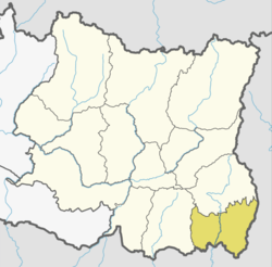
Location
Jhapa is the easternmost district of Nepal and lies in the fertile Terai plains. Rajbanshi are the first settlers about 800 years ago.jhapa is derived from rajbashi word that means canopy means due to the dense forest. It is bound by Ilam in the north, Morang in the west, the Indian state of Bihar in the south and the Indian state of West Bengal to the southeast and east. Geographically, it covers an area of 1,606 km2 (620 sq mi). The main cities of Jhapa district are Birtamod, Damak, and Kakarvitta.
Geography and climate
| Climate Zone[2] | Elevation Range | % of Area |
|---|---|---|
| Lower Tropical | below 300 meters (1,000 ft) | 98.8% |
| Upper Tropical | 300 to 1,000 meters 1,000 to 3,300 ft. |
1.2% |
Education
Among 77 districts, Jhapa with literacy rate of 99.99%, is the district with the highest number of literate people.[3]
People from Jhapa District
- Wilson Bikram Rai, Actor, Singer, and Producer
- Himal Sagar singer
- Juna Prasai ,singer
- Tika Prasai singer
- Suraj Chapagain Comedian, actor, script writer, director
- Ananta Tamang footballer
- Bishal Rai footballer
- Karna Limbu football player
- Sitaram Kattel (Actor ,Social Worker, director, comedian ,writer)
- Aditi Budhathoki Actress, model
- Shovit Basnet (actor and director)
- Jiya K.C. ( Actress, model)
- Prakash Angdembe Film Director, and writer
- Rubina Chhetri, cricketer
- K.P. Oli, politician
- Chandra Prakash Mainali, politician
References
- ↑ Household and population by districts, Central Bureau of Statistics (CBS) Nepal Archived 2013-07-31 at the Wayback Machine.
- ↑ The Map of Potential Vegetation of Nepal - a forestry/agroecological/biodiversity classification system (PDF), Forest & Landscape Development and Environment Series 2-2005 and CFC-TIS Document Series No.110., 2005, ISBN 87-7903-210-9, retrieved Nov 22, 2013
- ↑ "Census 2001". Census. central bureau of statistics, Nepal. 2001. Archived from the original on 2008-09-24. Retrieved 2008-08-24.
Places adjacent to Jhapa District | ||||||||||
|---|---|---|---|---|---|---|---|---|---|---|
| ||||||||||
Headquarter: Damak | ||
| Rural Municipalities | | |
| Municipalities | ||
| Province No. 1 |  | |
|---|---|---|
| Province No. 2 | ||
| Province No. 3 | ||
| Gandaki Pradesh | ||
| Province No. 5 | ||
| Karnali Pradesh | ||
| Sudurpashchim Pradesh | ||
Coordinates: 27°55′03″N 84°11′37″E / 27.917373°N 84.193726°E
External links
- "Districts of Nepal". Statoids.
| Wikimedia Commons has media related to Jhapa District. |