Keystone Heights Airport
| Keystone Airpark Keystone Heights Airport | |||||||||||||||
|---|---|---|---|---|---|---|---|---|---|---|---|---|---|---|---|
 USGS aerial photo, 1999 | |||||||||||||||
| Summary | |||||||||||||||
| Airport type | Public | ||||||||||||||
| Owner | Keystone Airpark Authority | ||||||||||||||
| Serves | Keystone Heights, Florida | ||||||||||||||
| Location | Clay & Bradford Counties | ||||||||||||||
| Elevation AMSL | 196 ft / 60 m | ||||||||||||||
| Coordinates | 29°50′41″N 082°02′51″W / 29.84472°N 82.04750°WCoordinates: 29°50′41″N 082°02′51″W / 29.84472°N 82.04750°W | ||||||||||||||
| Website | KeystoneAirport.com | ||||||||||||||
| Map | |||||||||||||||
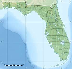 42J Location of airport in Florida | |||||||||||||||
| Runways | |||||||||||||||
| |||||||||||||||
| Statistics (2009) | |||||||||||||||
| |||||||||||||||
Keystone Airpark[1][2] (FAA LID: 42J), also known as Keystone Heights Airport,[3] is a public use airport located three nautical miles (6 km) north of the central business district of Keystone Heights, a town in Clay County, Florida, United States.[1] The airport is situated in Clay County and Bradford County.[4]
Owned by the Keystone Airpark Authority,[1] this airport is included in the National Plan of Integrated Airport Systems for 2011–2015, which categorized it as a general aviation facility.[5]
The airport is adjacent to Camp Blanding, the Florida National Guard Reservation and "Fly through History" Military Museum and Memorial Park. This museum at Camp Blanding is dedicated to the World War II units that trained there during the early 1940s.
History
The airport was constructed in 1942 as Crystal Lake Airfield, and was commissioned in December 1942 as Keystone Army Airfield (AAF) by the United States Army Air Forces. It was used as part of the Air University's Army Air Forces School of Applied Tactics (AAFSAT) tactical combat simulation school in Central and Northern Florida.
After the end of World War II, the facility was turned over to the City of Keystone Heights in 1947.
Facilities and aircraft
The airport covers an area of 2,476 acres (1,002 ha) at an elevation of 196 feet (60 m) above mean sea level. It has two asphalt paved runways: 5/23 is 5,046 by 100 feet (1,538 x 30 m) and 11/29 is 4,899 by 75 feet (1,493 x 23 m).[1]
Keystone employs one full-time clerk and one part-time maintenance workers. The airport is home to Express Air, a fixed wing flight training school, The Florida International Rally and Motorsport Park, RallyPro Performance Driving School, International Security Academy, Wings of Dreams Aviation Museum and Warbird Restoration Center and three FAA certified airframe and power plant mechanics. The businesses located on airport property employ approximately 80 people.
For the 12-month period ending September 8, 2009, the airport had 32,400 aircraft operations, an average of 88 per day: 95.7% general aviation, 2.8% military, and 1.5% air taxi. At that time there were 55 aircraft based at this airport: 85.5% single-engine, 5.5% helicopter, 3.6% multi-engine, 3.6% glider, and 1.8% ultralight.[1]
References
- 1 2 3 4 5 6 FAA Airport Master Record for 42J (Form 5010 PDF). Federal Aviation Administration. Effective November 15, 2012.
- ↑ "Keystone Airpark" (PDF). Florida Department of Transportation CFASPP. Retrieved August 3, 2013. External link in
|publisher=(help) - ↑ "Keystone Hts. Airport (42J)". Official site. Retrieved August 3, 2013.
- ↑ "Map showing airport and Clay/Bradford county border". MapQuest. Retrieved June 14, 2013.
- ↑
"2011–2015 NPIAS Report, Appendix A" (PDF). National Plan of Integrated Airport Systems. Federal Aviation Administration. October 4, 2010. Archived from the original (PDF, 2.03 MB) on September 27, 2012. External link in
|work=(help)
External links
- Keystone Hts. Airport (42J)
- "Keystone Airpark". brochure from CFASPP
- Aerial image as of February 1999 from USGS The National Map
- FAA Terminal Procedures for 42J, effective October 11, 2018
- Resources for this airport:
- FAA airport information for 42J
- AirNav airport information for 42J
- FlightAware airport information and live flight tracker
- SkyVector aeronautical chart for 42J
| Major commercial airports |  | |
|---|---|---|
| Secondary commercial airports | ||
| General aviation airports | ||
| Transportation | ||
| Agency | ||