Bara District
| Bara District बारा जिल्ला | |
|---|---|
| District | |
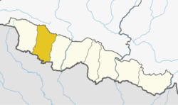 | |
| Country | Nepal |
| Province | Province No. 2 |
| Admin HQ. | Kalaiya |
| Government | |
| • Type | Coordination committee |
| • Body | DCC, Bara |
| Area | |
| • Total | 1,190 km2 (460 sq mi) |
| Population (2011) | |
| • Total | 687,708[1] |
| Time zone | UTC+5:45 (NPT) |
Bara District (Nepali: बारा जिल्ला ![]()
History
Simraungadh is major part of Bara district. It is historical place in Nepal. Simraungarh is famous for agriculture product in Nepal. The people grow wheat, corn, different green vegetables (cauliflower, tomato, banana (raw), beetroot, bitter gourd, bottle gourd, brinjal, cabbage, carrot, cauliflower, chilli (green), chilli (dry red), Arbi coriander leaves, cucumber, potato and so on).
Bara district is famous for the Gadhimai Temple, particularly as every five years it celebrates the Gadhimai Mela. This festival has historically been celebrated every 5 years by sacrificing animals. In the future animal sacrifice will no longer occur, as temple authorities have decided to convert the festival into a "momentous celebration of life."[2][3]
Geography and Climate
| Climate Zone[4] | Elevation Range | % of Area |
|---|---|---|
| Lower Tropical | below 300 meters (1,000 ft) | 86.6% |
| Upper Tropical | 300 to 1,000 meters 1,000 to 3,300 ft. |
13.4% |
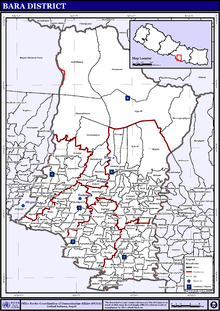
Administration
The district consists of two sub-metropolitan cities five urban municipalities and nine rural municipalities. These are as follows:[5]
- Jeetpur Simara Sub-Metropolitan City
- Kalaiya Sub-Metropolitan City
- Kolhabi Municipality
- Nijgadh Municipality
- Mahagadhimai Municipality
- Simraungadh Municipality
- Pacharauta Municipality
- Pheta Rural Municipality
- Bishrampur Rural Municipality
- Prasauni Rural Municipality
- Adarsh Kotwal Rural Municipality
- Karaiyamai Rural Municipality
- Devtal Rural Municipality
- Parwanipur Rural Municipality
- Baragadhi Rural Municipality
- Suwarna Rural Municipality
Former Municipalities and Village Development Committees
Prior to the restructuring of the district, Dolakha consisted of the following municipalities and Village development committees:
Education
Symbiosis Institute of Management (SIM) is situated in district headquarter, Kalaiya which is committed for quality education in Commerce and Education.
References
- 1 2 "National Population and Housing Census 2011(National Report)" (PDF). Central Bureau of Statistics. Government of Nepal. November 2012. Archived from the original (PDF) on April 18, 2013. Retrieved November 2012. Check date values in:
|accessdate=(help) - ↑ Ram Chandra, Shah. "Gadhimai Temple Trust Chairman, Mr Ram Chandra Shah, on the decision to stop holding animal sacrifices during the Gadhimai festival:" (PDF). Humane Society International. Retrieved 29 July 2015.
- ↑ Meredith, Charlotte (29 July 2015). "Thousands of Animals Have Been Saved in Nepal as Mass Slaughter Is Cancelled". Vice News. Vice Media, Inc. Retrieved 29 July 2015.
- ↑ The Map of Potential Vegetation of Nepal - a forestry/agroecological/biodiversity classification system (PDF), . Forest & Landscape Development and Environment Series 2-2005 and CFC-TIS Document Series No.110., 2005, ISBN 87-7903-210-9, retrieved Nov 22, 2013
- ↑ "स्थानिय तह" (in Nepali). Ministry of Federal Affairs and General Administration. Retrieved 1 September 2018.
External links
| Wikimedia Commons has media related to Bara District. |
- "Districts of Nepal". Statoids.

