Tarcutta Creek
The Tarcutta Creek, part of the Murray Darling basin, is mostly a perennial stream located in the Riverina region of New South Wales, Australia.
| Tarcutta | |
|---|---|
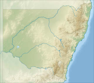 Location of the Tarcutta Creek mouth in New South Wales | |
| Etymology | Tarcutta |
| Location | |
| Country | Australia |
| State | New South Wales |
| Physical characteristics | |
| Source | Great Dividing Range |
| • location | southwest of Batlow |
| • coordinates | 35°08′26″S 147°35′57″E |
| • elevation | 620 m (2,030 ft) |
| Mouth | confluence with the Murrumbidgee River |
• location | southeast of Oura |
• coordinates | 35°37′4″S 148°38′36″E |
• elevation | 185 m (607 ft) |
| Length | 111 km (69 mi) |
| Basin features | |
| River system | Murrumbidgee River, Murray Darling Basin |
| [1] | |
Course and features
The stream rises on the western slopes of the Great Dividing Range and Australian Alps, approximately 13 kilometres (8.1 mi) southwest of Batlow. The stream flows generally north by west towards the town of Tarcutta where the creek is crossed by the Hume Motorway. From this point the river continues generally north by west towards the city of Wagga Wagga and reaches its confluence with the Murrumbidgee River, approximately 6 kilometres (3.7 mi) southeast of Oura.[2] The creek descends 435 metres (1,427 ft) over its 111-kilometre (69 mi) course.[1]
See also
References
- "Map of Tarcutta Creek, NSW". Bonzle Digital Atlas of Australia. 2018. Retrieved 14 February 2018.
- "Tarcutta Creek". Geographical Names Register (GNR) of NSW. Geographical Names Board of New South Wales. Retrieved 13 July 2009.

External links
- "Water sharing plans: Tarcutta Creek". Department of Primary Industries. Government of New South Wales. Retrieved 14 February 2018.
Rivers of the Murrumbidgee River catchment, New South Wales and the Australian Capital Territory, Australia | |||||
|---|---|---|---|---|---|
| |||||
| |||||
| Cities | |
|---|---|
| Local government areas | |
| Towns / Communities |
|
| National parks |
|
| Rivers, Water and irrigation entities Other watercourses |
|
| Landmarks | |
This article is issued from Wikipedia. The text is licensed under Creative Commons - Attribution - Sharealike. Additional terms may apply for the media files.