Kyeamba, New South Wales
Kyeamba is a farming community in the central east part of the Riverina and situated about 16 kilometres (9.9 mi) north west of Humula and 23 kilometres (14 mi) south west of Tarcutta. At the 2016 census, Kyeamba had a population of 54.[1]
| Kyeamba New South Wales | |
|---|---|
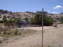 Entering Kyeamba - the property Kyeamba Park is in the background | |
Kyeamba | |
| Coordinates | 35°27′31″S 147°36′56″E |
| Population | 54 (2016 census)[1] |
| Postcode(s) | 2650 |
| Elevation | 309 m (1,014 ft) |
| Location |
|
| County | Wynyard |
| State electorate(s) | Wagga Wagga |
Location and features
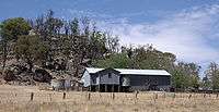
A shearing shed in the area of Kyeamba
The town's name is derived from an aboriginal word for "forehead band".[2]
Kyeamba is situated in the vicinity of the Alfredtown to Kyeamba Road where it meets the Hume Highway. There are no stores or significant public buildings in the area.
Kyamba Telegraph Office opened on 1 September 1861. This later became a Post Office, was renamed Kyeamba in 1917 and closed in 1957.[3]
References
- Australian Bureau of Statistics (25 October 2007). "Kyeamba (State Suburb)". 2006 Census QuickStats. Retrieved 20 December 2019.

- "Kyeamba". Geographical Names Register (GNR) of NSW. Geographical Names Board of New South Wales. Retrieved 4 August 2013.

- "Post Office List". Premier Postal History. Retrieved 11 June 2009.
This article is issued from Wikipedia. The text is licensed under Creative Commons - Attribution - Sharealike. Additional terms may apply for the media files.