Sandy Creek (Mirrool)
The Sandy Creek, a partly–perennial stream[3] that is part of the Lachlan sub-catchment of the Murrumbidgee catchment within the Murray–Darling basin, is located in the Riverina region of New South Wales, Australia. The course of the Sandy Creek becomes indefinite at its mouth.[3]
| Sandy | |
|---|---|
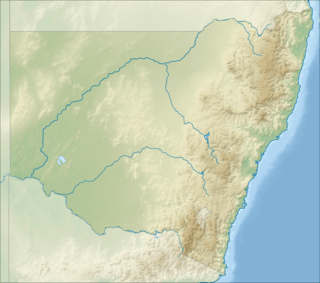 The indefinite location of the Sandy Creek mouth in New South Wales | |
| Location | |
| Country | Australia |
| State | New South Wales |
| Region | Riverina (IBRA) |
| LGA | Bland |
| Physical characteristics | |
| Source | pastoral runoff |
| ⁃ location | northeast of Tallimba |
| ⁃ coordinates | 33°56′22″S 147°4′40″E |
| ⁃ elevation | 312 m (1,024 ft) |
| Mouth | indefinite, generally towards Mirrool Creek |
⁃ location | northeast of Binya |
⁃ coordinates | 34°10′22″S 146°39′42″E |
⁃ elevation | 166 m (545 ft) |
| Length | 72 km (45 mi) |
| Basin features | |
| River system | Lachlan sub–catchment, Murray–Darling basin |
| Tributaries | |
| ⁃ left | Native Dog Creek |
| ⁃ right | Magpie Creek |
| [1][2] | |
Course and features
The Sandy Creek (technically a river[3]) rises approximately 19 kilometres (12 mi) east by north of the locality of Tallimba, west of the town of West Wyalong. The creek flows generally southwest for approximately 70 kilometres (43 mi), joined by two minor tributaries, before becoming indefinite approximately 5 kilometres (3.1 mi) west of the locality of Welcome Tank and northeast of Binya as the creek approaches the Mirrool Creek (itself a tributary of the Lachlan River). The Sandy Creek descends 146 metres (479 ft) over its 72-kilometre (45 mi) course.[1]
References
- "Map of Sandy Creek, NSW". Bonzle Digital Atlas of Australia. Retrieved 5 January 2015.
- "Our partners: local government". Lachlan Catchment Management Authority. Government of New South Wales. 2013. Retrieved 5 January 2015.
- "Sandy Creek". Geographical Names Register (GNR) of NSW. Geographical Names Board of New South Wales. Retrieved 5 January 2015.

External links
- "Lachlan River catchment" (map). Office of Environment and Heritage. Government of New South Wales.
- Trueman, Will (2012). True Tales of the Trout Cod: River Histories of the Murray–Darling Basin (Lachlan River catchment booklet) (PDF). Canberra: Murray–Darling Basin Authority. ISBN 978-1-921914-98-0. Archived from the original (PDF) on 25 February 2014.
Rivers of the Murrumbidgee River catchment, New South Wales and the Australian Capital Territory, Australia | |||||
|---|---|---|---|---|---|
| |||||
| |||||