Mulwala
Mulwala (locally /mʌlˈweɪlə/; possibly also /mʌlˈwɑːlə/[2]) is a town in the Federation Council local government area in the Riverina district of New South Wales, Australia. The town is situated on Lake Mulwala, an artificial lake formed by the damming of the Murray River. At the 2006 census, Mulwala had a population of 1,986 people.[1] The town's name is derived from an aboriginal word for 'rain'.[3]
| Mulwala New South Wales | |
|---|---|
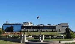
 New residential development on the shore of Lake Mulwala. | |
Mulwala | |
| Coordinates | 35°58′55″S 146°00′04″E |
| Population | 1,986 (2006 census)[1] |
| Established | 1858 |
| Postcode(s) | 2647 |
| Location |
|
| LGA(s) | Federation Council |
| County | Denison |
| State electorate(s) | Albury |
| Federal Division(s) | Farrer |
Overview
Across the border in Victoria is Mulwala's twin town of Yarrawonga.
Mulwala is a popular destination for water sports and fishing, especially for tourists from nearby Melbourne, 300 kilometres (190 mi) to the south. Other popular attractions include three major licensed clubs.
The local Australian rules football club, Mulwala Football Club competes in the Murray Football League.
History
In 1847 James McRae arrived in the district to take charge of "Mulwala" and "Boroge" stations on behalf of the squatter Linbourne. McRae built a punt and a public house at the locality. He obtained a licence for his Travellers' Rest Hotel in 1853.
In 1858 Surveyor Adams marked out a township at the site. In 1866 a new hotel was opened at Mulwala and a school established at the township. Mulwala Post Office opened in 1864 for about six weeks, closed due to a large fire, and was reopened on 1 June 1866.[4] The pioneer, James McRae, died in 1866.
In 1872 Mulwala was described as a small township of about 100 inhabitants, possessing a church, a school, a post-office and a public house.
In 1887 it was reported that Mulwala had two hotels and two stores; a court-house had been erected and a sawmill started.[5]
In 1972, Mulwala was the site for a large outdoor pop music festival,[6] which despite boasting big Australian names (Chain, Doug Parkinson, Billy Thorpe and the Aztecs) and some overseas artists (Canned Heat, Stephen Stills & Manassas), was considered a flop, after rain had washed out the site by the third day.
On 21 March 2013, Mulwala was one of the areas affected by a tornado, injuring over 20 people and damaging several buildings and houses. A caravan park approximately 5 km east of Mulwala was severely affected with most of the park's caravans damaged beyond repair.
Heritage listings
Mulwala contains a number of heritage-listed sites, including:
- North Road: Mulwala Homestead[7]
Transport
Mulwala Railway Station is a station with a silo on the Oaklands railway line.
References
- Australian Bureau of Statistics (25 October 2007). "Mulwala (State Suburb)". 2006 Census QuickStats. Retrieved 4 November 2009.
- Macquarie Dictionary, Fourth Edition (2005). Melbourne, The Macquarie Library Pty Ltd. ISBN 1-876429-14-3
- "Mulwala". Geographical Names Register (GNR) of NSW. Geographical Names Board of New South Wales. Retrieved 4 November 2009.

- Premier Postal History. "Post Office List". Retrieved 11 April 2008.
- Jervis, James, 'The Western Riverina: A History of Its Development', Royal Australian Historical Society Journal and Proceedings, Vol. XXXVIII 1952, pp. 240.
- MILESAGO - Performance - Music Festivals - Rock Isle (Mulwala) Festival 1972
- "Mulwala Homestead Precinct (Place ID 105659)". Australian Heritage Database. Department of the Environment. Retrieved 23 September 2018.
External links
![]()
- Corowa Shire Council website at the Library of Congress Web Archives (archived 2009-05-18)
- Mulwala Rail Platform