Mayrung, New South Wales
Mayrung is a community in the central part of the Riverina about 45 kilometres east of Pretty Pine and 35 kilometres north-east of Deniliquin.
| Mayrung New South Wales | |
|---|---|
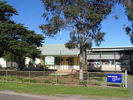 Mayrung Public School | |
| Postcode(s) | 2710 |
| Location |
|
| LGA(s) | Edward River Council |
| County | Townsend |
| State electorate(s) | Murray |
| Federal Division(s) | Farrer |
The Wiradjuri Aborigines, who inhabited the district prior to white settlement, called it 'Carawatha', which is thought to mean 'place of pines'. Mayrung is situated within the Berriquin Irrigation Area which supplies wool, wheat, fat lambs, rice, dairy products, vegetables, cereals, cattle and pigs.[1]
References
This article is issued from Wikipedia. The text is licensed under Creative Commons - Attribution - Sharealike. Additional terms may apply for the media files.