Jugiong Creek
The Jugiong Creek, a mostly–perennial river[2] that is part of the Murrumbidgee catchment within the Murray–Darling basin, is located in the South West Slopes region of New South Wales, Australia.
| Jugiong Cumbamurra, Connors, Barbers, Talmo | |
|---|---|
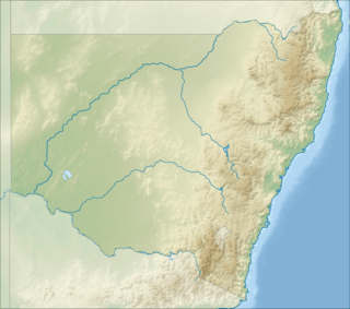 Location of the Jugiong Creek mouth in New South Wales | |
| Location | |
| Country | Australia |
| State | New South Wales |
| Region | South Eastern Highlands (IBRA), South West Slopes |
| LGAs | Yass Valley, Hilltops |
| Physical characteristics | |
| Source | Great Dividing Range |
| Source confluence | Illalong Creek and Bogolong Creek |
| ⁃ location | near Illalong Creek |
| ⁃ coordinates | 34°36′23″S 148°43′29″E |
| ⁃ elevation | 422 m (1,385 ft) |
| Mouth | confluence with the Murrumbidgee River |
⁃ location | east of Jugiong |
⁃ coordinates | 34°49′36″S 148°22′14″E |
⁃ elevation | 247 m (810 ft) |
| Length | 58 km (36 mi) |
| Basin features | |
| River system | Murrumbidgee catchment, Murray–Darling basin |
| Tributaries | |
| ⁃ right | Balgalal Creek, Rocky Ponds Creek, Cunningham Creek (Harden Shire) |
| [1] | |
Course and features
Formed by the confluence of the Illalong and Bogolong Creeks, the Jugiong Creek (technically a river[2]) rises in the Burrinjuck State Forest near the locality of llalong Creek, on the south western slopes of the Great Dividing Range. The creek flows generally north, west northwest and then southwest, joined by four minor tributaries, before reaching its confluence with the Murrumbidgee River east of the town of Jugiong. The creek descends 175 metres (574 ft) over its 58-kilometre (36 mi) course.[1]
The creek is crossed by the Hume Highway near the river mouth.
References
- "Map of Jugiong Creek, NSW". Bonzle Digital Atlas of Australia. Retrieved 8 December 2014.
- "Jugiong Creek". Geographical Names Register (GNR) of NSW. Geographical Names Board of New South Wales. Retrieved 8 December 2014.

External links
- Trueman, Will (2012). True Tales of the Trout Cod: River Histories of the Murray–Darling Basin (Lachlan River catchment booklet) (PDF). Canberra: Murray–Darling Basin Authority. ISBN 978-1-921914-98-0. Archived from the original (PDF) on 25 February 2014.
- Murrumbidgee Catchment Management Authority website
- "Murrumbidgee and Lake George catchments" (map). Office of Environment and Heritage. Government of New South Wales.
Rivers of the Murrumbidgee River catchment, New South Wales and the Australian Capital Territory, Australia | |||||
|---|---|---|---|---|---|
| |||||
| |||||