Abercrombie River
Abercrombie River, a perennial river that is part of the Murray–Darling basin, is located in the central west of New South Wales, Australia.
| Abercrombie River | |
|---|---|
 | |
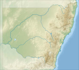 Location in New South Wales  Abercrombie River (Australia) | |
| Etymology | named by John Thomas Bigge[1] |
| Location | |
| Country | Australia |
| State | New South Wales |
| IBRA | South Eastern Highlands |
| District | Central West |
| Municipalities | Upper Lachlan, Oberon Shire |
| Physical characteristics | |
| Source | |
| ⁃ location | near Mount Werong village |
| ⁃ elevation | 1,130 m (3,710 ft) |
| 2nd source | Lachlan River |
| ⁃ location | Wyangala Dam |
| ⁃ coordinates | 33.919976°S 149.025285°E |
| ⁃ elevation | 375 m (1,230 ft) |
| Length | 130 km (81 mi) |
| Basin features | |
| River system | Murray–Darling basin |
| Tributaries | |
| ⁃ left | Burra Burra Creek, Bolong River, Copperhannia Creek |
| ⁃ right | Isabella River, Tuena Creek, Meglo Creek, Piesleys Creek |
| [2] | |
Course
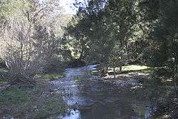
The river rises to the east of the village of Mount Werong and generally flows westward towards its confluence with the Lachlan River at Wyangala Dam near Cowra.[1] The river flows through freehold land as well as the Abercrombie River National Park, and provides habitat for platypus and rakali,[3] dropping 758 metres (2,487 ft) over its course of 130 kilometres (81 mi).[2]
The Abercrombie River is the furthest east of the inland flowing rivers.
History
The original inhabitants of the land alongside the river were Australian Aborigines of the Wiradjuri or Gundungara clans, which may have used the river as a trading route.[4]
The first European to discover the watercourse was explorer Charles Throsby on 5 May 1819, during an expedition from Sydney to the central west of New South Wales. The river was named by Commissioner John Thomas Bigge on 22 October 1820.[1]
Alluvial gold was discovered in and along the river in 1851, inspiring a minor gold rush hampered by the ruggedness of the terrain and the periodic depths of the waterway.[5] Early miners recovered up to 3 oz (85 g) of gold a day along the river,[6] and by 1862 between forty and fifty mining parties were at work at Milburne Creek, a minor tributary of the Abercrombie.[7]
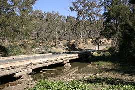
The Goulburn-Oberon Road crosses the Abercrombie River in the steep-sided Abercrombie Gorge.
See also
- List of rivers of Australia
- List of rivers of New South Wales (A-K)
- Rivers of New South Wales
References
- "Abercrombie River". Geographical Names Register (GNR) of NSW. Geographical Names Board of New South Wales. Retrieved 11 January 2013.

- "Map of Abercrombie River, NSW". Bonzle.com. Retrieved 13 January 2013.
- "Abercrombie River National Park". NSW National Parks and Wildlife Service. Government of New South Wales. July 2009. Retrieved 18 September 2007.
- "Abercrombie River National Park: Culture and History". NSW Department of Environment and Climate Change. Government of New South Wales. 2009. Retrieved 13 July 2009.
- "The Wentworth Diggings". The Argus. Melbourne, Victoria: Argus Office. 24 September 1851. p. 4. Retrieved 13 July 2009.
- "The Gold Fields". The Maitland Mercury & Hunter River General Advertiser. Maitland NSW: Thomas William Tucker and Richard Jones. 1 December 1852. p. 4. Retrieved 13 July 2009.
- "New South Wales: The Lachlan". The Argus. Melbourne, Victoria: Argus Office. 1 February 1862. p. 7. Retrieved 13 July 2009.
External links
- "Lachlan River catchment" (map). Office of Environment and Heritage. Government of New South Wales.
Rivers of the Murrumbidgee River catchment, New South Wales and the Australian Capital Territory, Australia | |||||
|---|---|---|---|---|---|
| |||||
| |||||