Pulletop, New South Wales
Pulletop is a rural locality in the south eastern part of the Riverina - it used to be called Pullitop. It is situated by road, about 5 kilometres east south-east of Burrandana [1] and 9 kilometres north of Westby.
| Pulletop New South Wales | |
|---|---|
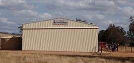 Pulletop Fire Brigade Shed | |
Pulletop Location in New South Wales | |
| Coordinates | 35°27′03″S 147°23′24″E |
| Postcode(s) | 2650 |
| Location |
|
| LGA(s) | City of Wagga Wagga |
| County | Mitchell |
| State electorate(s) | Wagga Wagga |
See also
Notes and references
- "Pulletop". Geographical Names Register (GNR) of NSW. Geographical Names Board of New South Wales.

| Wikimedia Commons has media related to Pulletop, New South Wales. |
This article is issued from Wikipedia. The text is licensed under Creative Commons - Attribution - Sharealike. Additional terms may apply for the media files.